GREAT WESTERN HIGHWAY
Sydney to Bathurst

Great Western Highway heading west from Bells Line of Road (Main St) at Lithgow. Oct 2005.
Length: 203km
Eastern Terminus: George St & Pitt St & Broadway & Lee St, Railway Square
Western Terminus: Mid Western Hwy & Mitchell Hwy & Gt Western Hwy, Bathurst
Route taken: Broadway, Parramatta Rd, Church St, Parramatta to Penrith via Prospect, High St, Henry St, North St, Belmore St, Jane St, then to Emu Plains via Victoria Bridge then Russell St to the M4 Motorway. Then from the end of the M4 Motorway at Governors Drive via Katoomba and Lithgow to Bathurst.
RTA Internal Classification: State Highway No. 5
Proclaimed a State Highway: 7 August 1928
Named: 7 August 1928
The Great Western Highway from Sydney across the Blue Mountains to Bathurst is Australia ’s most historic road. Across it flowed a stream of settlers to the vast areas of the slopers and plains in the western inland. Soldiers, convicts and gold diggers have all trudged and driven along it across the harsh and rocky ridge of the mountain barrier. In the early days of the colony of New South Wales it was probably the construction of this road over the Blue Mountains that saved the small settlement from abandonment.
Since those early days the Highway has remained largely unchanged from its original route, with the exception of a lengthy deviation between Mount Victoria and Bathurst, constructed in the 1830s. Various local deviations have also been constructed to improve the alignment and across much of the Sydney Basin the Highway is no longer the major road, having been superseded by the M4 – Western Motorway.
Today the Great Western Highway begins as the Railway Square intersection in Sydney, then heads west via Broadway, Parramatta Road, Church St, Wentworthville, Prospect, St Mary's to Penrith, where it uses Henry Street, North Street, Belmore St and Jane Street to Castlereagh Road. From Castlereagh Road the Highway thence passes over Victoria Bridge , through Emu Plains and along Russell Street to the M4 – Western Motorway at Leonay. The Highway then recommences at the end of the Western Motorway (at Governors Drive ) and heads to Bathurst via Springwood, Leura, Katoomba, Mt Victoria , Lithgow and Kelso. In Bathurst the Great Western Highway follows Durham and Stewart Streets before terminating at the junction with the Mitchell and Mid Western Highways in Bathurst .
The length of the highway from Harris St, Ultimo, via Broadway, Parramatta Rd, Church St, Prospect, St Mary's, Penrith (via High Street), Emu Plains, Mitchell’s Pass, Springwood, Katoomba, Old Bowenfels, Tarana, Brewongle, Glanmire to the Mitchell and Mid Western Highways in Bathurst was proclaimed State Highway No. 5 on 7 August 1928 . There have been a number of deviations constructed which realigned the highway and they will be discussed further in latter stages of this article. Major re-alignments worth a mention here include between Emu Plains and Blaxland in October 1928 (replaced Mitchell’s Pass), at Penrith in February 1991 (replaced High Street with Henry St, North St, Belmore St, Jane St route) and at Emu Plains in February 2003 where the legal definition of the Great Western Highway was finally modified to incorporate the Western Motorway extension to Lapstone. Also, on 23 January 1993 the Great Western Highway was extended one block east, from Harris Street , Ultimo to Railway Square .
Today the Great Western Highway carries the State Route 31 shield between Harris St, Ultimo and the Hume Hwy (Liverpool Rd) at Summer Hill, the Metroad 4 shield between Wattle St, Haberfield and the Western Motorway at North Strathfield, the State Route 44 shield between North Strathfield and the Western Motorway at Emu Plains and the National Route 32 shield from the end of the Western Motorway at Lapstone to its terminus at Bathurst. The remaining sections of highway are currently unnumbered. It also worth noting that on the Church St , Parramatta Rd and Broadway sections of the Great Western Highway signposting of the local names is preferred.
Explore the Great Western Highway:
History and Development
State Route 44 section
State Route 31 section
Metroad 4 section
Remnants of NR32 in Sydney
Photos of the National Route 32 section of Gt Western Hwy |
|
 |
National Route 32 trailblazer at the end of the Western Motorway at Governors Drive, Lapstone. Oct 2005. |
 |
Earthworks underway for widening of Lapstone Hill in 1980. (DMR). |
 |
Roadworks underway at Lapstone Hill during September 2005. |
 |
Looking west from Mount Street, Glenbrook. Oct 2005. |
 |
Distance sign heading west from Mann St & Hare St, Glenbrook. Oct 2005. |
 |
Looking east to Blaxland Railway Station. Sep 2005. |
 |
Looking east between Valley Heights and Warrimoo. May 2004. |
 |
Looking west Valley Heights Station. Oct 2005. |
 |
Westbound approaching the Springwood Deviation. Macquarie Rd is the old Gt Western Hwy. Oct 2005. |
 |
1969 aerial view of the Springwood Deviation. Note there is no ramp from Hawkesbury Rd to the Gt Western Hwy - this came much later. (DMR) |
 |
Black ID sign pointing traffic along Ferguson Rd (old highway) to join the current highway at Springwood. Sep 2005. |
 |
Looking east along Macquarie Rd (old Gt Western Hwy) through Springwood town centre. Sep 2005. |
AD sign for the Gt Western Hwy southbound on Hawkesbury Rd at Springwood. Sep 2005. |
|
 |
Looking east along the Springwood Deviation. Sep 2005. |
 |
Unusually designed AD sign on Ferguson Rd approaching the Gt Western Hwy. Note sure why there is no NR32 shield for right-turning traffic. Sep 2005. |
 |
Looking east through Coomassie shoping centre in Faulconbridge. May 2004. |
 |
Looking south between Faulconbridge and Linden. Oct 2005. |
 |
Looking east across the railway line at Linden. May 2004. |
 |
Looking east to the Tollgate Drive overpass at Linden. Oct 2005. |
 |
Looking west at the Station St overpass, Woodford. Oct 2005. |
 |
Looking east between Hazelbrook and Woodford. May 2004. |
 |
Looking west in a narrow cutting at Hazelbrook Railway Station. May 2004. |
 |
Looking west across the narrow railway overpass at Lawson. Oct 2005. |
 |
Looking east through Lawson. May 2004. |
 |
Black 'P40' km plate eastbound in Bullaburra. Jan 2003. |
Great Western Hwy at Bullaburra in 1938. (DMR) |
|
 |
Looking west between Bullaburra and Bodington Hill. Oct 2005. |
 |
Looking east alongside the railway line between Bodington Hill and Wentworth Falls. Oct 2005. |
 |
Duplication work underway through Wentworth Falls. May 2004. |
 |
More duplication work underway at Wentworth Falls. May 2004. |
 |
Completed duplication work along the same section. Oct 2005. |
 |
Looking west to the railway overpass between Wentworth Falls and Leura. May 2004. |
 |
Looking east adjacent to Digger Cooper Reserve at Leura. May 2004. |
 |
Reconstruction and widening work underway at Leura Mall. May 2004. |
 |
Looking west from Leura Mall. May 2004. |
 |
Looking west from Leura Mall showing the future eastbound carriageway. Oct 2005. |
 |
Earlier view of the same corner realignment. May 2004. |
 |
Looking south into Katoomba. May 2004. |
 |
Looking east at the Bathurst Rd junction, showing construction of the Shell Corner realignment. May 2004. |
 |
Another view of the Shell Corner realignment works, this time with one carriageway open. May 2004. |
 |
The old distance sign heading west from Katoomba. Jan 2003. |
 |
Looking east between Katoomba and Medlow Bath. May 2004. |
 |
Another view eastbound between Katoomba and Medlow Bath. May 2004. |
 |
Looking east through Medlow Bath. April 2005. |
 |
Looking west between Medlow Bath and Blackheath. May 2004. |
 |
Looking north through Blackheath. Oct 2005. |
 |
Signage for the Mt Boyce Heavy Vehicle Checking Station. April 2005. |
 |
Looking west along the Soldiers Pinch realignment. May 2004. |
 |
Distance sign heading east from Mt Victoria. April 2005. |
 |
Looking east through Mt Victoria. May 2004. |
 |
Late 1800s view of Victoria Pass. (DMR) |
 |
Heading west down the 1 in 8 grade of Victoria Pass. Oct 2005. |
 |
Descending Victoria Pass again, this time with a great view of the Hartley Valley. May 2004. |
 |
Looking west near Hartley. May 2004. |
 |
The old (right) and new (left) sections of Great Western Hwy at Hartley. Oct 2005. |
 |
The Old Great Western Highway at Hartley. Oct 2005. |
 |
The remains of the old timber bridge over the River Lett at Hartley. Oct 2005. |
 |
Looking west across the River Lett at Hartley with signage for the Jenolan Caves Rd. Oct 2005. |
 |
View of the newly-opened River Lett Bridge in 1975. (DMR) |
 |
Distance sign heading west from Jenolan Caves Rd. May 2004. |
 |
Heading east towards Hartley, descending the River Lett Hill. May 2004. |
 |
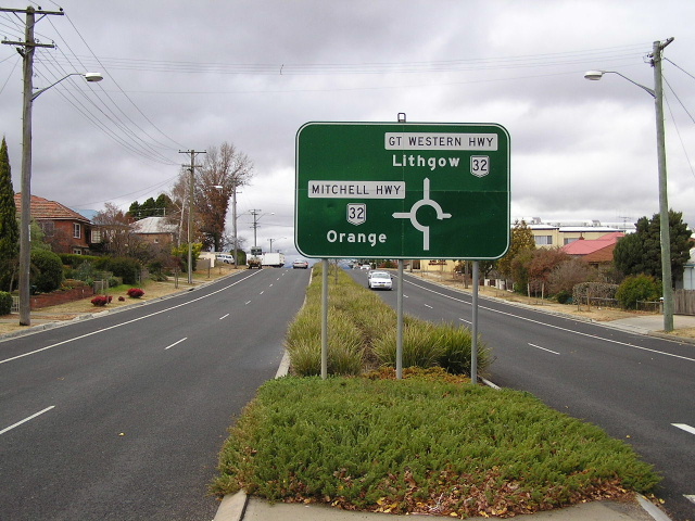
Distance sign heading east from the outskirts of Lithgow. Jan 2006. |
 |
Looking north through the outskirts of Lithgow. May 2004. |
 |
Northbound AD sign for the Bells Line of Rd (SR40) in Lithgow. April 2005. |
 |
ID sign pinting SR40 traffic onto the westbound lanes of NR32. April 2005. |
 |
Looking west along the Farmers Creek Deviation, west of Lithgow. Oct 2005. |
 |
Looking east along Cooerwul Road (Old Great Western Highway) showing the former 6m wide concrete pavement. Oct 2005. |
 |
The narrow and low railway overpass on Cooerwul Rd (Old Great Western Highway). This replaced a railway crossing in 1929. Oct 2005. |
 |
Narrow bridge on Cooerwul Rd (Old Great Western Hwy). Oct 2005. |
 |
Looking south through Marangaroo, 7km northwest of Lithgow. April 2005. |
 |
Westbound approaching the Castlereagh Hwy junction. April 2006. |
 |
Heading east from the Castlereagh Hwy junction. Oct 2005. |
 |
ID signage at the Castlereagh Hwy split. Oct 2005. |
 |
Westbound view showing the Castlereagh Hwy overpass. May 2004. |
 |
Black AD sign on Castlereagh Hwy southbound approaching the Gt Western Hwy. April 2005. |
 |
Much newer AD sign on the connection road between Castlereagh Highway and Great Western Highway (west). Oct 2005. |
 |
Heading east approaching the Castlereagh Hwy junction. April 2005. |
 |
Distance sign heading west from Castlereagh Hwy. April 2005. |
 |
Looking west along the Coxs River/Wallerawang deviation. April 2005. |
 |
Westbound approaching Barton Ave. April 2005. |
 |
Old Great Western Highway looking west approaching the Coxs River. April 2005. |
 |
Old Great Western Highway looking west towards Wallerawang. April 2005. |
 |
Fingerboard signage with a National Route shield and no numbers at Wallerawang on the old Great Western Hwy. April 2005. |
 |
old Great Western Hwy west of Wallerawang. April 2005. |
 |
Looking west from the end of the 110km/h dual carriageway onto the high standard concrete road near Mt Lambie. Oct 2005. |
 |
Looking east along the concrete section at Mt Lambie. Oct 2005. |
 |
Looking west near Bonaventure Road. Oct 2005. |
 |
Looking west near Meadow Flat. Oct 2005. |
 |
Old alignment of the Great Western Highway at Meadow Flat. Note the antiquated wire mesh fencing and wooden posts. Jan 2006. |
 |
Looking east from Meadow Flat. Oct 2005. |
 |
Looking east at Diamond Swamp Creek, near Meadow Flat. May 2004. |
 |
Heading east on the Yetholme Deviation, approaching the Yetholme service centre. May 2004. |
 |
Old Great Western Highway at Yetholme. Oct 2005. |
 |
Old Great Western Highway at Yetholme. Oct 2005. |
 |
Looking west along the Walang Deviation. Oct 2005. |
 |
Old Great Western Highway at Walang. Oct 2005. |
 |
Looking east towards the Walang Deviation. May 2004. |
 |
Looking east through Raglan. May 2004. |
 |
Distance sign heading west from Bathurst. Oct 2005. |
 |
Looking west across the Macquarie River at Bathurst. May 2004. |
 |
Black ID sign at the intersection of Gt Western Hwy and Bentnick St, Bathurst. May 2004. |
 |
Heading southwest along Stewart St in Bathurst. Oct 2005. |
 |
Looking along Stewart St. May 2004. |
 |
The current four-lane Evans Bridge over the Macquarie River in Bathurst. Oct 2005. |
 |
The old Denison Bridge over the Macquarie River, built in 1870. Oct 2005. |
 |
Signage indicating the end of the Great Western Hwy at Bathurst. National Route 32 continues west along the Mitchell Hwy. May 2004. |
 |
Mitchell Hwy eastbound approaching the Gt Western Hwy at Bathurst. May 2004. |
 |
Mid Western Hwy eastbound approaching the Gt Western Hwy at Bathurst. May 2004. |
 |
Black AD sign at the Mid Western, Mitchell and Gt Western Hwy junction at Bathurst. May 2004. |