Northern Section Windsor to Singleton via Putty Road |

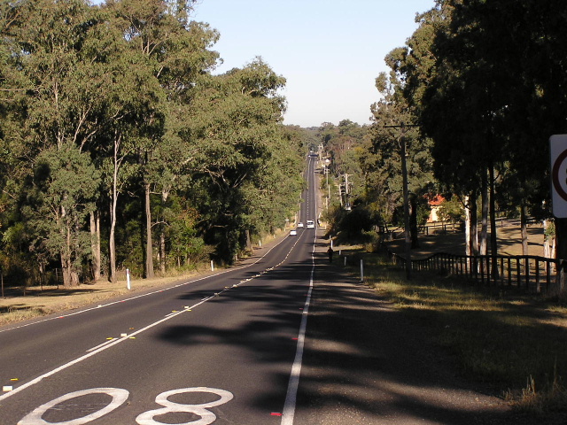
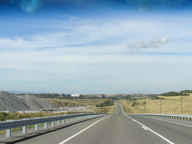
Heading south from Wilberforce. March 2005.
In 2013, RMS will be implementing a new alpha-numeric route numbering system. For more information, visit the RMS Website. |
RMS have advised that this route will be decommissioned and not replaced by an alpha-numeric route number. |
Length: 174km
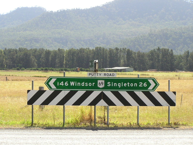
Northern Terminus: New England Hwy & Campbell St, Singleton
Southern Terminus: Bridge St & Macquarie St, Windsor
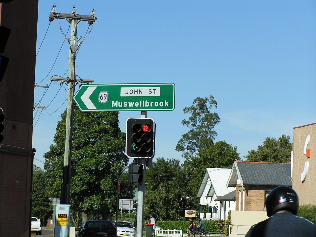
Route taken: Bridge St, Wilberforce Rd, William St, Putty Rd, Ryan Ave, John St, Campbell St
Focal Points: Windsor, Singleton
RTA Internal Classification: Main Road 182 (Windsor to Wilberforce), Main Road 503 (Wilberforce to Singleton)
For the southern section of State Route 69 click HERE.
For the decommissioned section of State Route 69 click HERE.
Route Overview:
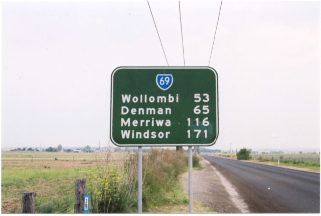
State Route 69 (NORTH) is a historic road from Sydney to the Hunter Valley, beginning at Windsor and passing through Yengo and Wollemi National Parks en route to teh Golden and New England Highways near Singleton. The route is very winding and steep, especially between Wilberforce and Milbrodale but has enough overtaking oppotrtunities relative to the amount of heavy vehicles that use the road. Services are available at least every 50km through the more isolated sections.
Putty Road was the first road constructed from Sydney to the north, being opened to traffic in 1823. It had a reputation as quite a treacherous journey and was rather indirect as a route to Newcastle - at this time the only major settlement north of Sydney. During the 1850s a new road to the north was constructed via Wisemans Ferry and the Putty Road was no longer used as a through route. The sections between Windsor and Colo and between Putty and Singleton still attracted regular traffic but across Wheelbarrow Ridge the road fell into disrepair.
In 1942, with the possibility of Australia being invaded from the north, the Department of Main Roads undertook a massive reconstruction of the road to allow for it to be used as a defence (and evacuation) route due to the vulnerability of the Hawkesbury River ferry crossings. Following the end of the war in 1945, the DMR took ownership of the road, proclaiming it Main Road No. 503 and restoring the original Putty Road name. Sealing of the road was completed in June 1964.
In 1973 a trial of state routes was begun with SR69 being signposted between the Gt Western Hwy at Penrith and the Hume Highway at Camden. The trial was a resounding success and the following year the route was fully signposted from the Princes Hwy at Bulli Tops to the New England Hwy at Singleton. In December 1986 the route was extended 250m along Campbell St to meet the new route of the New England Highway following the opening of the new Hunter River crossing. The most significant change happened in 1998 when the route was split in two by the commissioning of Metroad 9 between Windsor and Campbelltown. To this day it is the only split route in NSW and hopefully this section of the route will receive a different number than the southern section when the alpha-numeric system is introduced.
Notable events in the history of SR69(N):
1823 - Putty Road opened to traffic
1942 - Putty Road reconstructed to provide for modern motor traffic
1945 - Putty Road proclaimed Main Road No. 503
Jun 1964 - Putty Road fully sealed
Jul 1969 - McDonald River Bridge
1973 - SR69 introduced from Penrith to Camden
1974 - SR69 extended north to Singleton & south to Bulli Tops
Dec 1986 - SR69 extended 250m to meet the new route of the New England Hwy
1998 - SR69 split into two sections when Metroad 9 is commissioned between Penrith and Kenny Hill (Campbelltown)
2002 - SR69 routed onto Ryan Ave in Singleton - bypassing the commercial centre
Further reading (on-site):
Northern Terminus: New England Hwy, Singleton
Photos of State Route 69 (NORTH) |
|
 |
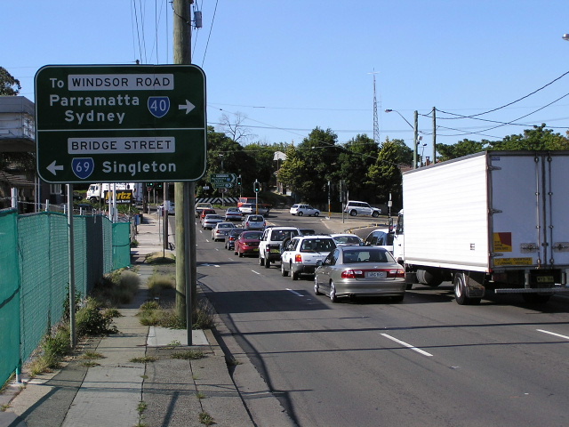
Approaching the start of SR69 from Windsor Rd (Metroad 2/SR40). Oct 2005. |
 |
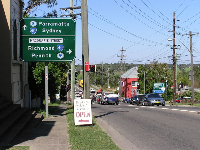
Approaching the start of SR69 from Macquarie St (Metroad 9/SR40). April 2005. |
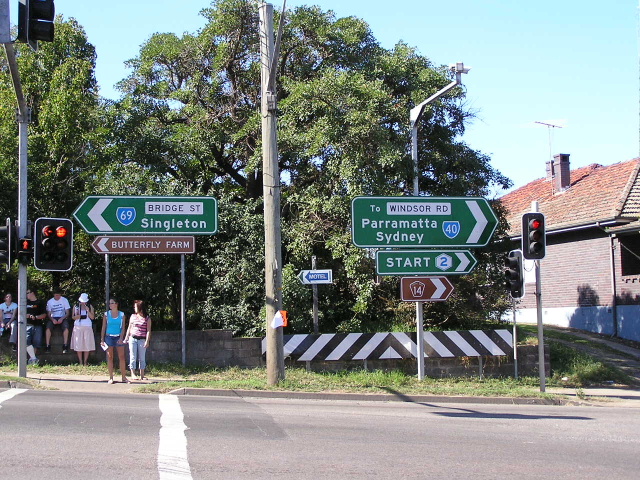 |
ID signs marking the start of SR69. April 2005. |
 |
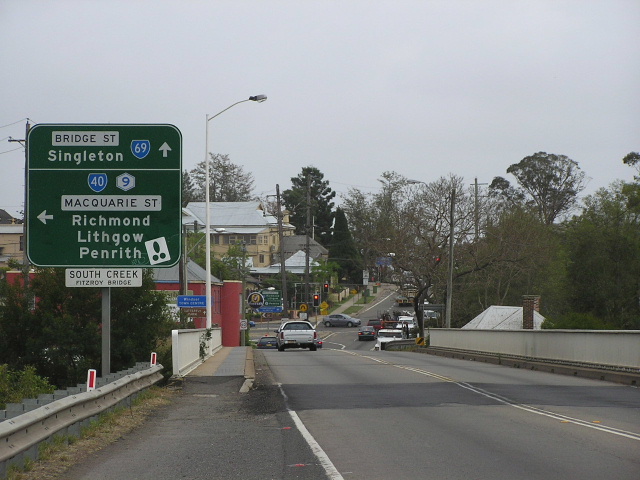
Heading south-east along Bridge St approaching the end of SR69 and the beginning of Metroads 2 and 9. April 2005. |
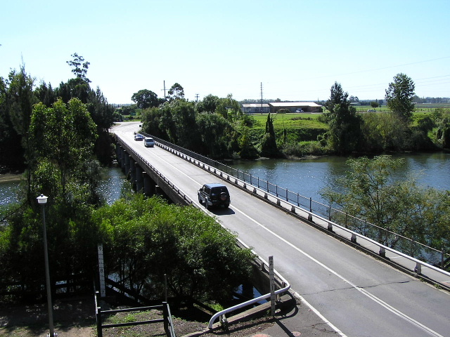 |
View of Windsor Bridge - subject to flooding - from Thompsons Square. The bridge has 9m flood markers suggesting that the Hawkesbury River has some very heavy floods. The risk of flooding has been lessened somewhat by the damming of the Nepean River further south. April 2005. |
 |
Looking east across Windsor Bridge, showing the old approach to the bridge (top left of the photo). The original, tortuous approach was replaced by the current cutting in 1934 to meet the needs of motor traffic. June 2006. |
 |
Unusual diagrammatic AD sign on the northwestern side of Windsor Bridge, for the junction with Freemans Reach Road. June 2006. |
 |
The first northbound RD sign, just north of Freemans Reach Rd. I would imagine that this section of SR69 would be underwater in times of heavy flooding as it traverses the flood plain between reaches of the Hawkesbury. March 2005. |
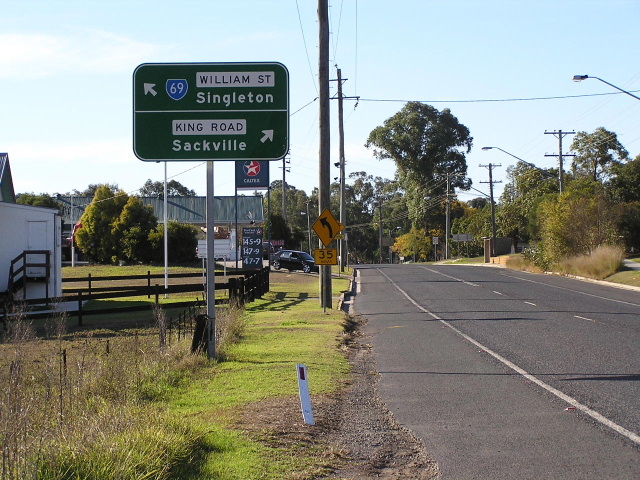 |
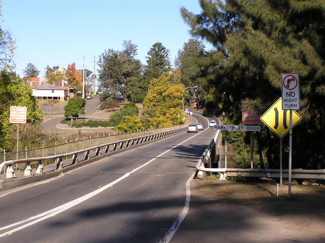
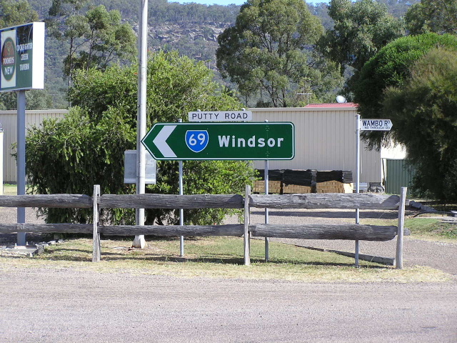
Looking north along Wilberforce Road towards the junction with King Rd (Main Road No. 182) and the beginning of Putty Road in Wilberforce. June 2006. |
 |
Unusual style of AD sign, with different road names for the left turn and the right turn - heading southwest on King Rd approaching Wilberforce Rd & William St in Wilberforce. June 2006. |
 |
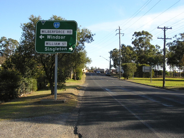
The beginning of the Putty Road! Heading north from King Rd at Wilberforce. June 2006. |
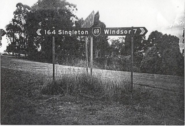 |
Photocopy of a 1994 photo showing what used to be typical signage along SR69. A major upgrade of signage was undertaken during 1995. This particular fingerboard was at Kurmond Rd, Wilberforce. |
 |
One of the several big ups-and-downs on Putty Road between Wilberforce and the Colo River. This one is looking south to the crossing of Currency Creek at Wilberforce. June 2006. |
 |
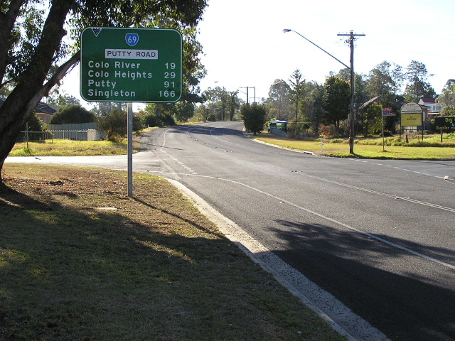
And now this is the typical style of signage - at Creek Ridge Rd. June 2006. |
 |
I included this sign because of the extremely unusual name of the road "East Kurrajong Rd Section 1". I *think* this was signed so because the East Kurrajong Rd name used to continue to the east towards Sackville via an intersection about 1km up the road. The eastern section is now called "Bull Ridge Rd". June 2006. |
 |
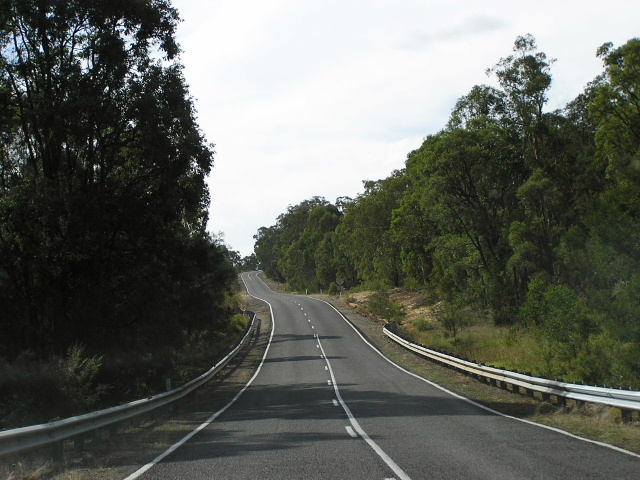
Typical terrain on Putty Rd as it crosses many ridges and valleys. This view is heading south towards Roberts Creek, Blaxlands Ridge. April 2004. |
 |
AD sign eastbound on Blaxlands Ridge Rd as it approaches Putty Rd, Blaxlands Ridge. June 2006. |
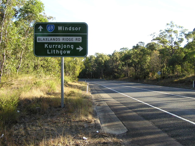 |
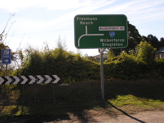
Blaxlands Ridge Rd provides a shortcut between Putty Rd and Bells Line of Road at Kurrajong. This sign is heading south approaching the intersection. June 2006. |
 |
Unusual looking State Route 69 shield with very fat text, at the junction with Packer Rd, Blaxlands Ridge. June 2006. |
 |
Descending north into the Colo River valley. April 2004. |
 |
Heading towards Colo from the north this time. April 2004. |
 |
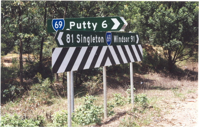
Signage at Colo Heights Rd. The ID sign that isnt quite facing us reads: "Colo Heights Rd/Upper Colo 13km". April 2004. |
 |
The 'township' of Upper Colo. April 2004. |
 |
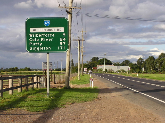
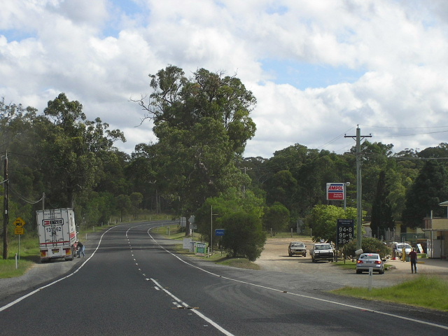
Incorrect fingerboard signs at the Putty turnoff. SR69 does not enter Putty and this sign has since been replaced. Thanks to Shayne Kerr for this 2000 pic. |
 |
Typical view between Putty and Milbrodale. April 2004. |
 |
Incorrect National Route 69 shield at Milbrodale Rd. There are several incorrect shields on the portion of this route situated in the Hunter Region. April 2004. |
 |
Unusually shaped ID sign in Bulga. April 2004. |
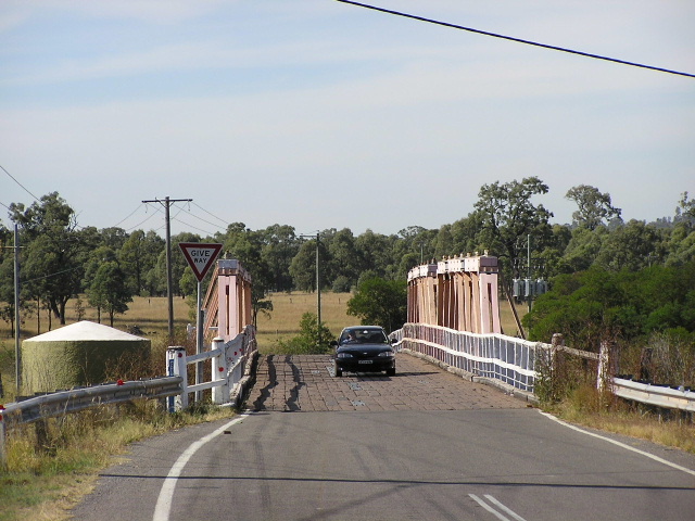 |
The historic Bulga Bridge. April 2004. |
 |
ID sign at the intersection of Charlton Rd. April 2004. |
 |
Unusual green paint on this AD sign heading south towards the intersections of Wallaby Scrub Rd & Charlton Rd. April 2004. |
 |
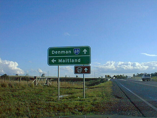
Looking north through the coal mining area near the Golden Highway. April 2004. |
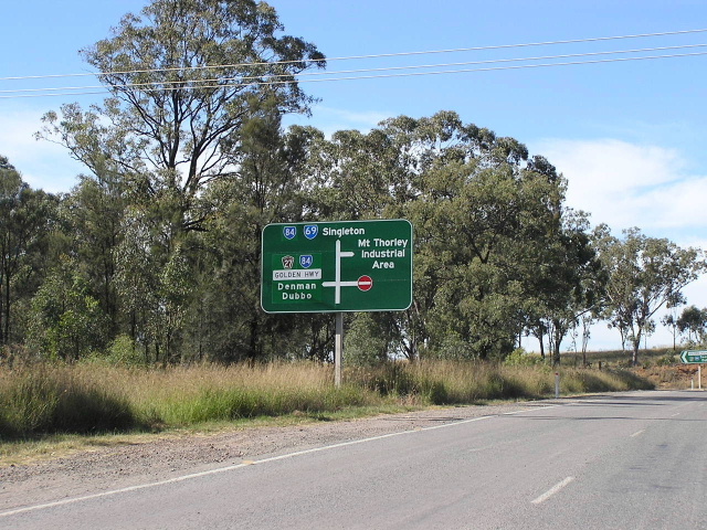 |
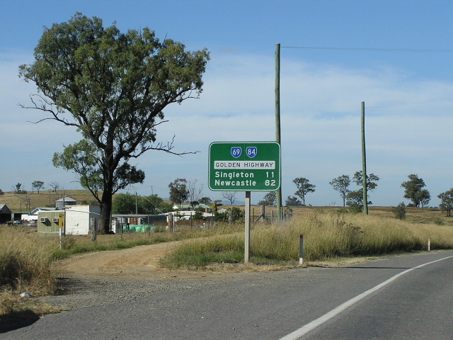
Northbound approaching the Golden Highway. April 2004. |
 |
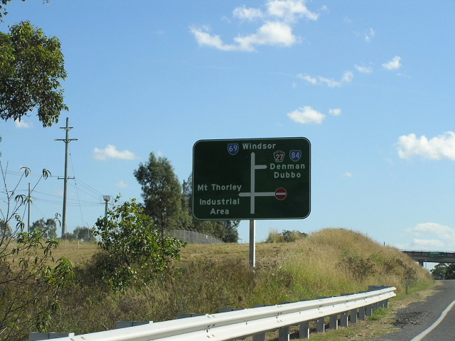
ID signs at the Mt Thorley Interchange (Golden Highway) that pre-date the proclamation of the Golden Hwy in 1997. Dec 2003. |
 |
Newer ID signs, probably installed in 1998 when most of the signage was replaced. April 2004. |
 |
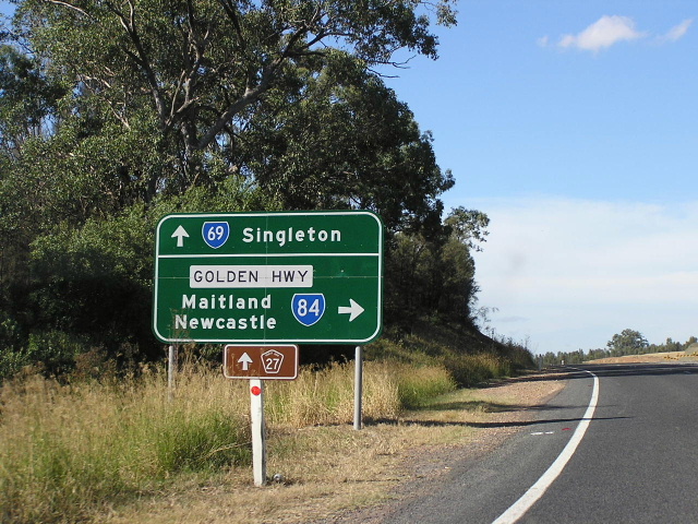
Heading south on Golden Hwy/Putty Rd approaching the Mt Thorley Interchange. April 2004. |
 |
Heading north from the Mt Thorley Interchange. April 2004. |
 |
ID sign that pre-dates the Golden Hwy. Thanks to Shayne Kerr for this 1998 pic. |
 |
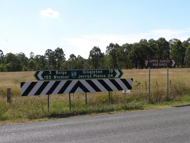
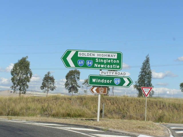
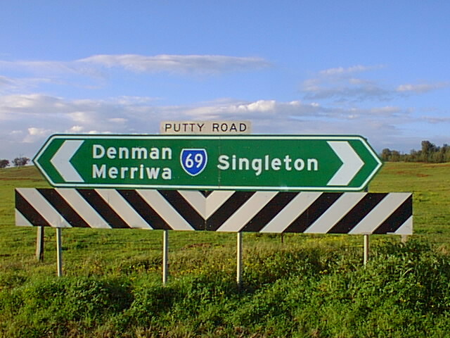
AD sign approaching the eastern split of SR69 & SR84. April 2004. |
 |
AD sign that pre-dates the Golden Hwy, southbound on Putty Rd approaching the Golden Hwy. Thanks to Shayne Kerr for this 1998 pic. |
 |
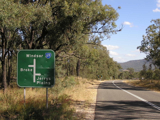
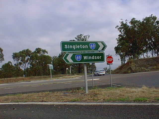
The first southbound RD sign on SR69 - heading south from Singleton. Jan 2003. |
 |
Interesting, but incorrect nonetheless, combination of SR and NR shields at Carrington St, Singleton. April 2004. |
 |
Northbound heading across the railway overpass into Singleton. Note the incorrect NR69 shield - this section of Putty Rd has been council owned since the proclamation of the Golden Hwy in 1997 so Singleton Council erected these dodgy signs. April 2004. |
 |
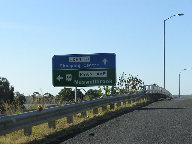
Council-made very old AD sign at the intersection of John St & Ryan Ave, Singleton. April 2004. |
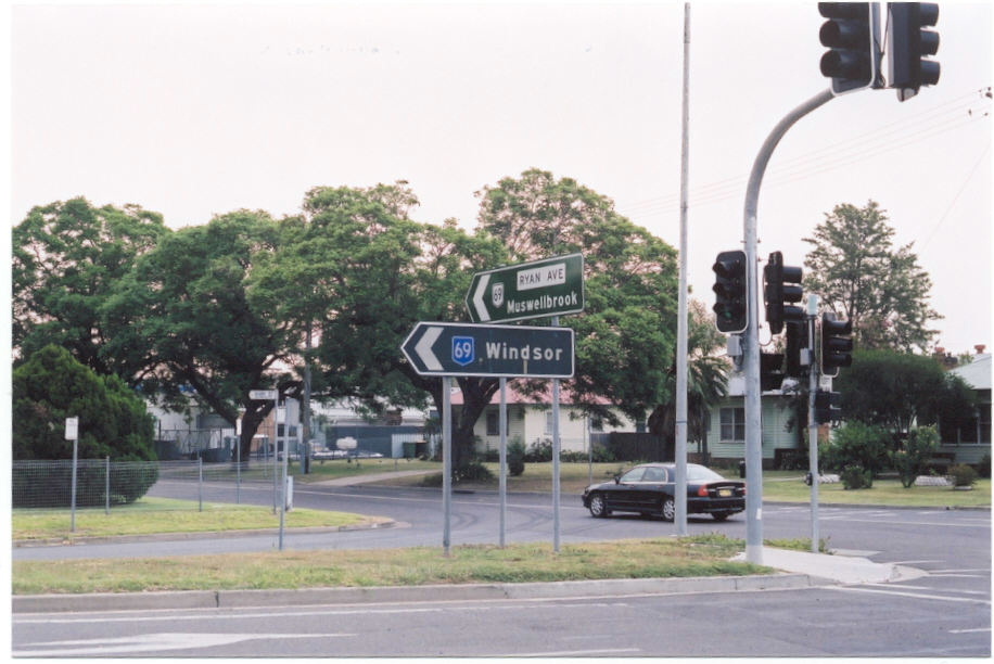 |
Assembly of old and new signs at the same intersection. Someone find me a correct shield! ;-) Jan 2003. |
 |
Yet another incorrect shield in Singleton. April 2004. |
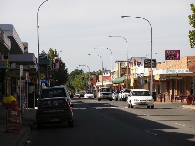 |
Looking north along John St, the commercial centre of Singleton. This section was bypassed by SR69 in 2002. April 2004. |
Last updated 10 December 2012 © Ozroads 2003-2012. |