State Route 40 Rozelle to Seven Hills & Windsor to Lithgow |
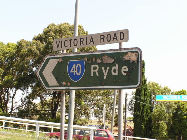
A fantatstic relic, this painted wooden sign still stands at the corner of Victoria Road & Andersen Ave, Rydalmere. Dec 2003.
NOTE: This page is out of date It was prepared prior to the changes which occurred to State Route 40 during 2007. It will be updated in the future to reflect these changes.
In 2013, RMS will be implementing a new alpha-numeric route numbering system. For more information, visit the RMS Website. |
||
Forthcoming alpha-numeric route number: |
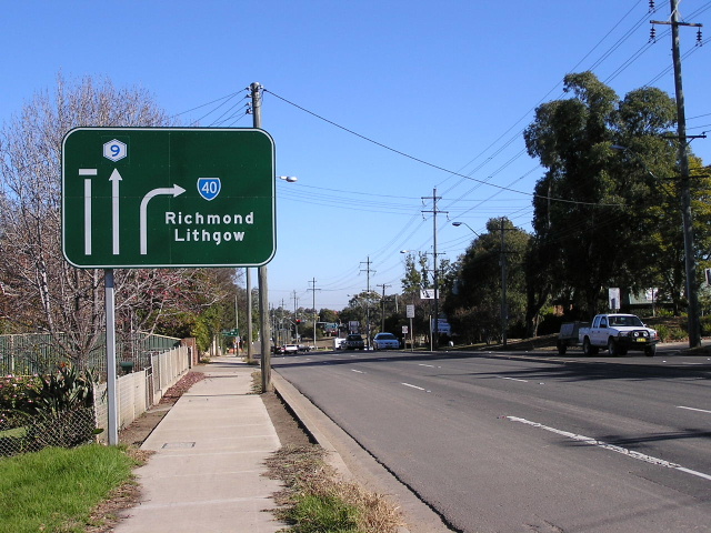
(Sydney to West Baulkham Hills section) |
|
Forthcoming alpha-numeric route number: |
(Windsor to Lithgow section) |
|
Length: 154km
Eastern Terminus: Western Distributor, Darling Harbour (according to the "END SR40" sign it does not extend to the southern approach of the Harbour Bridge)
Western Terminus: Gt Western Hwy & Main St, Lithgow
Route taken: Western Distributor, Anzac Bridge, Victoria Rd, Church St, Windsor Rd, Bridge St, Macquarie St, Richmond Rd, Windsor St, East Market St, March St, Kurrajong Rd, Bells Line of Road, Chifley Rd, Mort St, Lithgow St, Main St
Focal Points: Sydney, Ryde, Parramatta, Baulkham Hills, Windsor, Richmond, Lithgow
RTA Internal Classification: Main Road No. 165 (Sydney-Parramatta), Main Road No. 637 (Church St, Parramatta), Main Road No. 184 (North Parramatta-Bell), Main Road No. 516 (Bell-Lithgow)
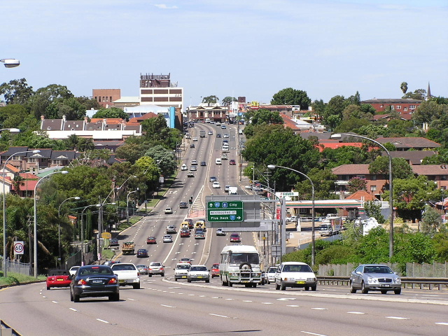
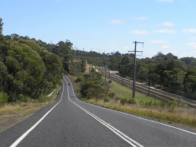
State Route 40 is the longest state route in the Sydney area, stretching from Sydney to Lithgow and providing an alternative route to the Great Western Highway corridor. It was introduced in 1974 and its alignment has not changed, meaning it is hardly ever used as a through route these days. Its foray into the Parramatta city centre, the availability of a more direct route from the CBD to Baulkham Hills and Kellyville and its omission from the Metroad system have all combined to lessen its importance. Nonetheless, between Sydney and Parramatta and between Windsor and Lithgow it is still a major through route.
Victoria Road is predominately six lanes the whole way - with S-lanes - and only short section of two lane raod in North Parramatta prevents the route from having at least four lanes all the way to Baulkham Hills. Between Baulkham Hills and Windsor the route is currently being upgraded to four lanes including a new flood free route across South Creek between Mulgrave and Richmond Road. West of Richmond the route is a typical two-lane rural road with overtaking lanes fairly evenly spaced and rather steep, winding sections at Bellbird Hill, Mt Tomah and between Clarence and Lithgow. Truck traffic is still very light on the Bells Line of Road compared to the Gt Western Highway as they find it difficult to negotiate 'Scenic Hill' on the eastern approach to Lithgow.
For more photos and/or information on featured sections of State Route 40, please follow the links below. Photos of the entire route are provided in the table below.
Western Distributor - Photos, information and maps
Anzac Bridge - Photos and information
Victoria Road - History and historic photos
Gladesville Bridge and approaches - Photos, information and map
James Ruse Drive - Photos and information
Old Windsor Rd/Windsor Rd - History and historic photos
Old Windsor Rd historic sections - History and photos
Windsor Rd historic sections - History and photos
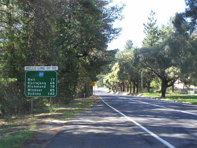
Bells Line of Road - History and historic photos
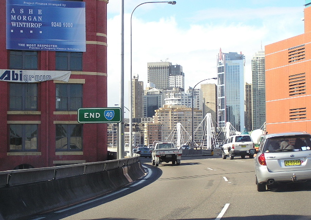 |
"END SR40" sign eastbound on the Western Distributor as it passes over Pyrmont Street, Pyrmont. May 2005. For more photos of the Western Distributor, click HERE. |
 |
Very old, freeway green ID sign that formerly resided at the intersection of Sussex St & Market St, Sydney. The freeway green paint was used as the sign points traffic onto the Western Distributor, which was formerly declared part of the F3 Freeway. This sign was removed in late 2000 or early 2001, replaced by a sign including Metroad 4 which was routed onto the City West Link and Anzac Bridge in December 2000. May 2000. |
 |
An example of the new signage that replaced the older Metroad 4-less signs around the Western Distibutor in late 2000 or early 2001. Note how the city street name (as shown in the above photo) has been replaced by "To Victoria Rd". This sign resides at the intersection of Market St & Kent St, Sydney. Nov 2005. |
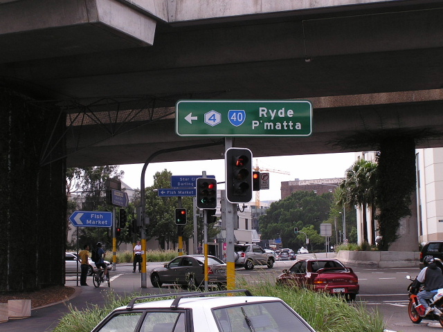 |
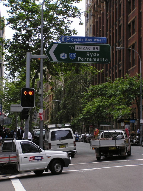
AD style sign acting as an ID sign at the Western Distributor/Pyrmont Bridge Rd interchange, Pyrmont. Note the use of the abbreviation "P'matta" - abbreviations of focal points are rare in NSW but commonplace in Victoria. In this case, the abbreviation has been used to reduce the width of the sign needed and because Parramatta has been paired with Ryde, which is a much shorter word. March 2004. |
 |
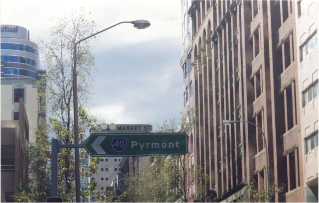
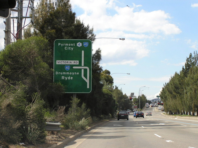
Older, mid-1990s sign at the junction of Bank St & the Fish Markets Entrance, Pyrmont. Note the placement of the State Route 40 shield with the focal points Ryde & Parramatta. This sign should be replaced with one showing the Metroad 4 shield. March 2004. |
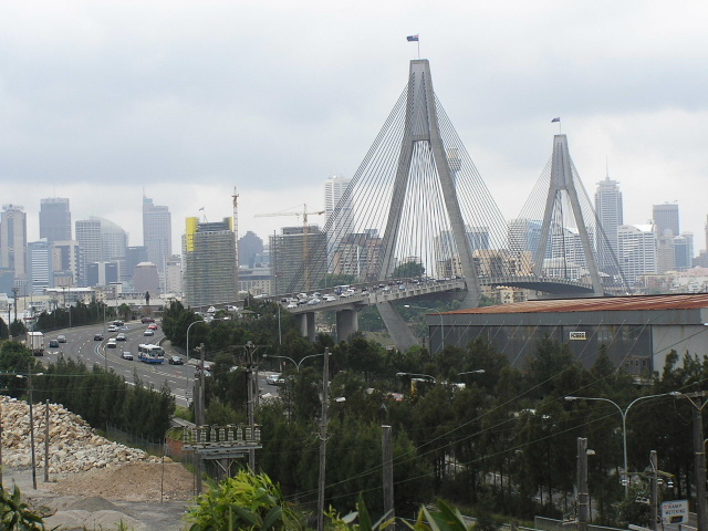 |
Anzac Bridge, which carries Metroad 4 and State Route 40 across Johnstons Bay from Rozelle to Pyrmont, as viewed from the Victoria Rd pedestrian overpass at Rozelle. March 2004. For more photos of Anzac Bridge and its approaches, click HERE. |
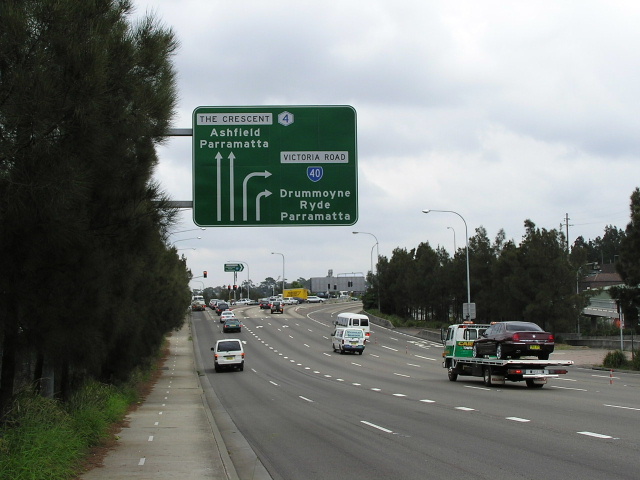 |
AD sign westbound on Victoria Rd approaching the junction with The Crescent (which leads onto the City West Link) at White Bay. The configuration of this intersection has since changed following the 8-laning of Anzac Bridge in mid-2005 and the construction of a pedestrian/cyclist overpass in early 2006. April 2004. |
 |
AD sign northeastbound on the City West Link approaching Victoria Rd at White Bay (Rozelle). Note the unusual configuration where traffic wishing the turn left onto Victoria Rd must exit to the right-hand side. This was done in order to fit in an underpass for city-bound traffic alongside the railway overpass which carries Victoria Rd over the White Bay Goods Line. June 2004. |
 |
Looking east from the pdestrian overpass across Victoria Rd at White Bay, showing the intersection with The Crescent and the railway overpass. March 2004. |
 |
Looking east along Victoria Rd towards Robert St at Rozelle. This area of Rozelle, known as White Bay, was formerly a very industrial area with the White Bay Power Station the main attraction. The now-disused power station can be seen behind the row of commercial properties that line Victoria Rd. March 2004. |
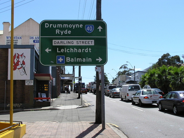 |
AD sign westbound on Victoria Rd approaching Darling St at Rozelle. Darling St is the main street of Rozelle and performs an important regional link between Balmain, Rozelle and Leichhardt. March 2004. |
A westerly view of Iron Cove Bridge with the western abutment of the original bridge visible to the left. Source: Stuart Watts. |
|
 |
Looking east along Victoria Rd towards Iron Cove Bridge, a five-lane steel truss structure that carries Victoria Rd across Iron Cove between Rozelle and Drummoyne. Note the extra lane that has been clipped on to the southern side of the bridge, replacing a footway. Sep 2005. |
 |
Dual ID signs on Park Ave southbound approaching Victoria Rd at Drummoyne. This local street provides access to Victoria Rd from the Birkenhead Point shopping centre, hence the need for directional signage. March 2004. |
 |
Looking west through Drummoyne. The junction with Lyons Rd (former State Route 21) is at the top of the hill. March 2004. |
 |
Distance sign heading west from Lyons Rd at Drummoyne. March 2004. |
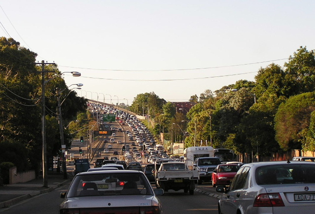 |
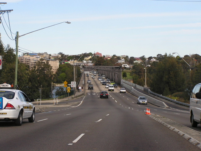
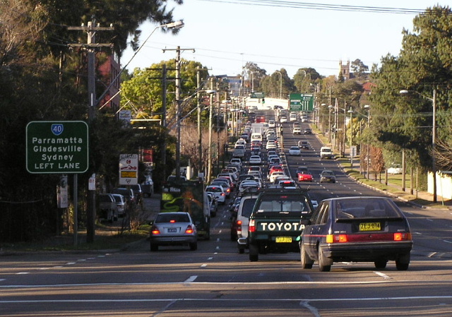
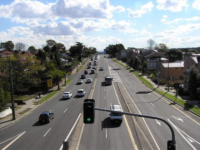
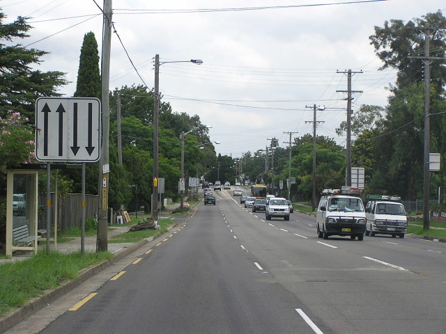
Looking west between Lyons Rd and Westbourne St, Drummoyne, showing a typical afternoon on Victoria Rd. Traffic was bakced up from the top of the hill at Drummoyne (where 3 lanes become 2 due to the provision of on-street parking) as far as Henley and Hunters Hill. Nov 2004. |
 |
ID sign showing the former State Route 21/40 duplex across Gladesville Bridge (SR21 was decommissioned in June 2004) at the junction of Victoria Rd & Westbourne St, Drummoyne. March 2004. |
 |
Looking east from Gladesville Bridge into Drummoyne. Westbourne Street is the junction in the middle-distance, whilst the Lyons Rd junction is at the top of the hill. March 2004. For more photos of Gladesville Bridge and its approaches, click HERE. |
 |
AD sign southbound on Burns Bay Rd approaching Victoria Rd, at the western end of Gladesville Bridge. Feb 2004. |
 |
Looking west from the pedestrian overpass at Huntleys Point, showing the approaches to Gladesville Bridge that were constructed in 1961-64. Aug 2003. |
 |
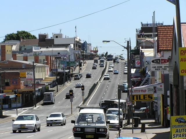
Looking east through Gladesville from Pittwater Rd. May 2005. |
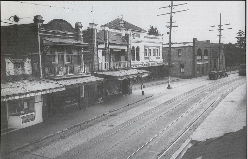 |
Victoria Rd at Gladesville CBD circa 1938, showing widening of the road reserve underway and tram lines still in operation. (Andrew Foster) |
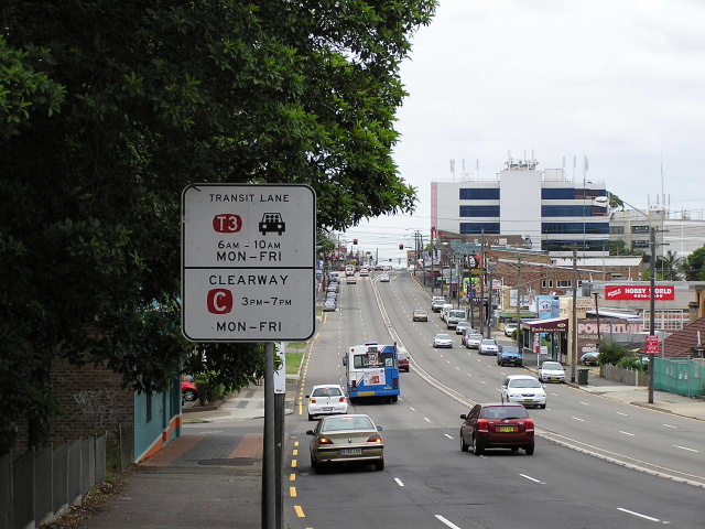 |
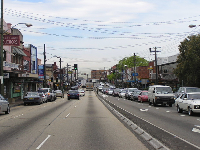
Transit lane signage, looking east from Westminster Rd at Gladesville. Victoria Rd has an eastbound transit lane operating in the mornings from Cressy Rd, Ryde as far as White Bay. March 2004. |
 |
Looking east adjacent to Holy Cross College and the Ryde Aquatic Centre. The signalised intersection with Tennyson Rd is in the distance. May 2005. |
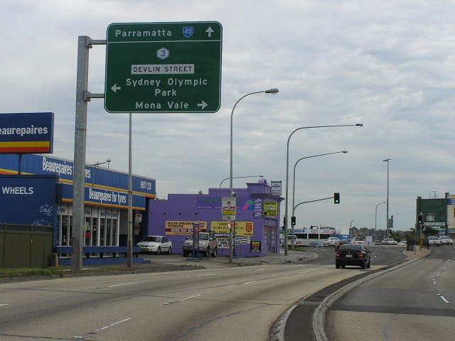 |
AD sign westbound on Victoria Rd approaching Devlin St (Metroad 3) at Ryde. Oct 2005. |
 |
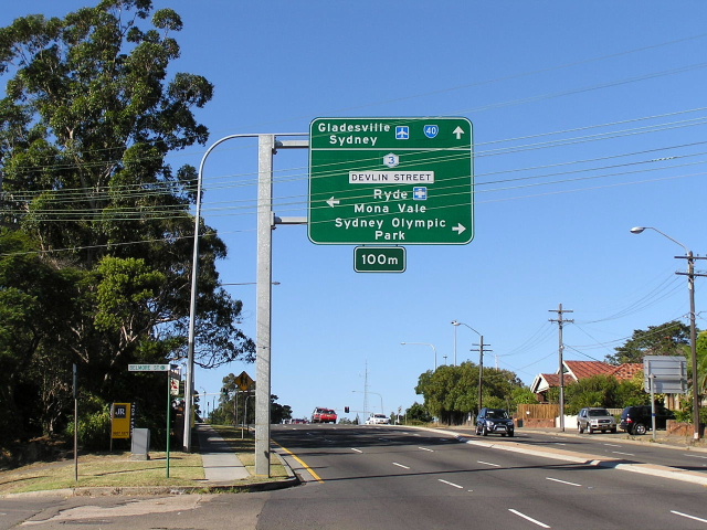
State Route 40 signage northbound on Church St (Metroad 3) approaching Victoria Rd at Ryde. Aug 2005. |
 |
AD sign eastbound on Victoria Rd approaching Devlin St (Metroad 3) at Ryde. March 2004. |
 |
Distance sign heading west from Devlin St at Ryde. This sign and structure has since disappeared, presumably being hit by a car. May 2005. |
 |
Looking west along Victoria Rd towards Hermitage Rd, West Ryde. May 2004. |
The former railway crossing at West Ryde railway station was a constant source of public nuisance and complaint. It was often impossible to cross the railway on what was then called Parramatta Road because the gates could be locked for hours at the whim of the gatekeeper. Follwoing years of community agitation a subway was constructed on the present alignment and opened on 24 July 1937. This photo shows the railway crossing in July 1929. (DMR) |
|
 |
Looking west through West Ryde during the morning peak hour. The signalised intersection is for Chatham Rd & Station St. May 2004. |
Very old, probably dating from 1974, AD sign westbound approaching Marsden Rd at West Ryde c.1991. This sign has long since been replaced. |
|
 |
Marsden Rd southbound approaching Victoria Rd at West Ryde. March 2004. |
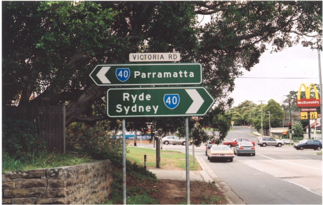 |
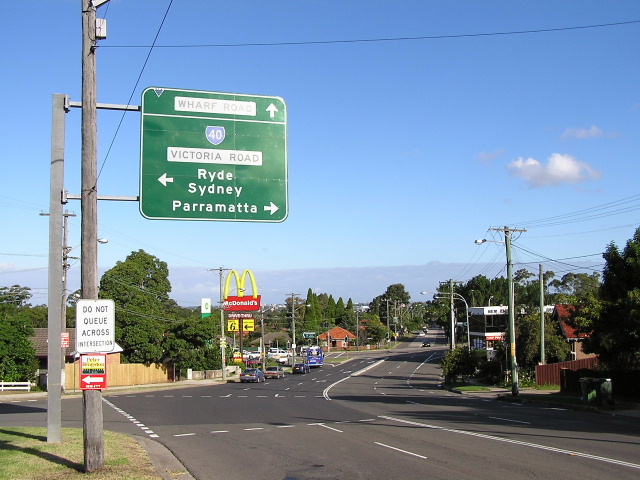
Early 1990s style ID sign assembly, extremely rare in Sydney, northbound on Wharf Rd approaching Victoria Rd at West Ryde. July 2003. |
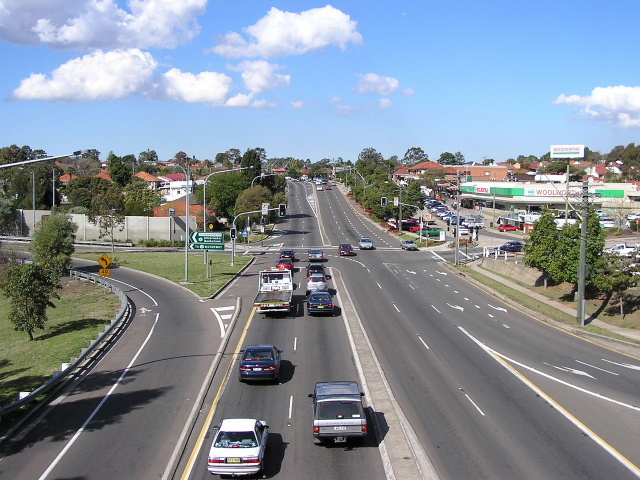 |
Looking east from Silverwater Road at Ermington. June 2004. |
 |
Looking west from Silverwater Road at Ermington. June 2004. |
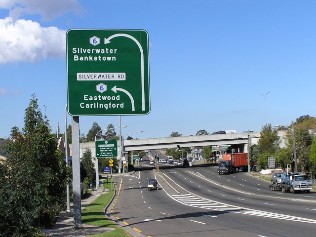 |
Looking east approaching Silverwater Rd at Ermington. June 2004. |
 |
Unusual ID sign assembly at the intersection of Victoria Rd & Park Rd, Rydalmere. March 2006. |
 |
Westbound approaching the bridge over the Carlingford Railway Line at Rydalmere. On the left is the original alignment which crosses the railway line via a level crossing until 1964, when the four-lane overpass was built. The old alignment of Victoria Rd now serves as access to Dudley and Brodie Streets, which pass beneath the overpass. May 2004. |
 |
Looking east from the entrance to the University of Western Sydney, showing the original alignment of Victoria Rd and the railway overpass. Sep 2004. |
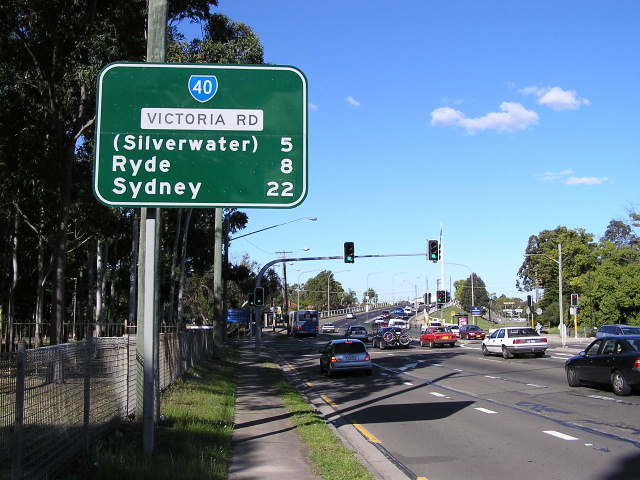 |
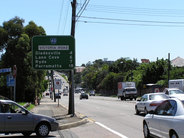
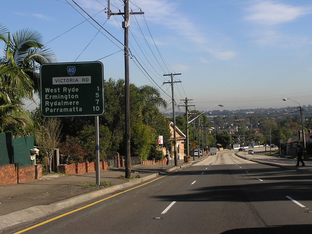
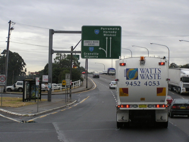
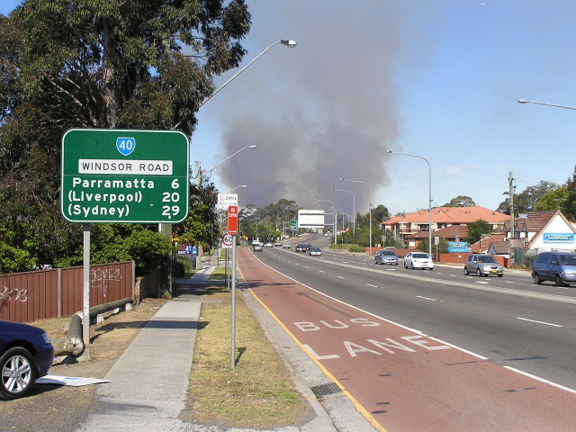
Distance sign heading east from James Ruse Drive at Rydalmere. I am not sure why Silverwater is included as a focal point, as the previous distance sign prefers Ermington. Spe 2004. |
 |
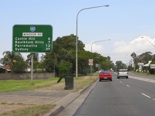
Looking east to Showground Road at Castle Hill. Jan 2004. |
 |
AD sign southbound on Pennant St approaching Victoria Rd at Shorts Corner (Parramatta). June 2006. |
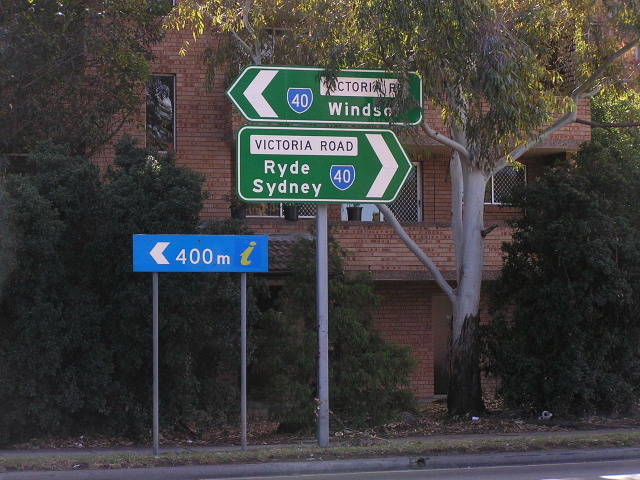 |
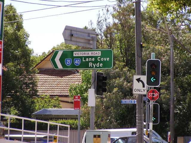
Dual ID signs at the intersection of Victoria Rd & Wilde Ave, Parramatta. It is very strange to see Windsor signage on Victoria Rd, for someone who has travelled this road all his life. June 2006. |
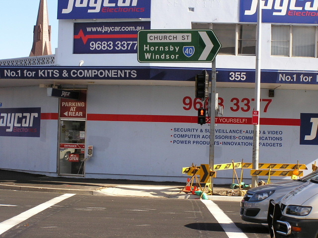 |
ID sign at the Victoria Rd & Church St intersection, Parramatta. Note the incorrect spacing of the legend Hornsby/Windsor which makes the sign look weird. June 2006. |
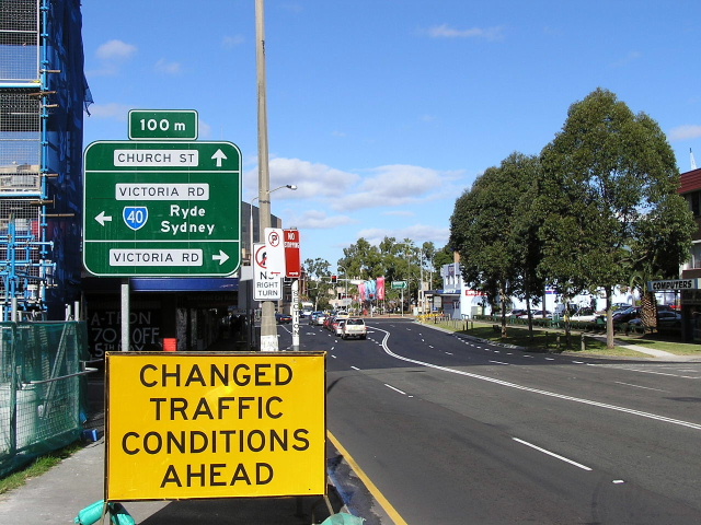 |
Church Street southbound approaching Victoria Rd at Parramatta. Note that only "Church St" is signed straight ahead, rather than of Parramatta City Centre getting a mention. June 2006. |
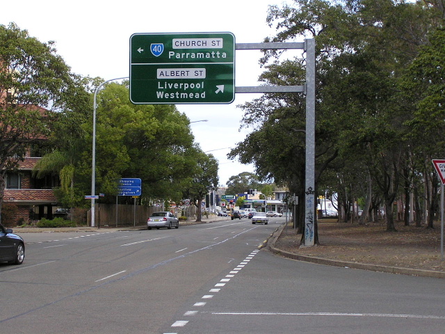 |
AD sign southeastbound on Pennant Hills Rd approaching Church St & Albert St at North Parramatta. June 2006. |
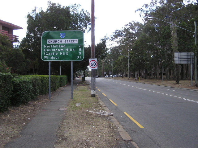 |
Distance sign heading north from Pennant Hills Rd along the two-lane section of Church St at North Parramatta. June 2006. |
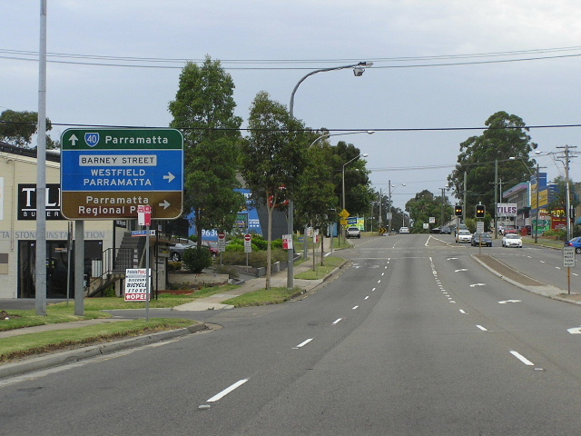 |
Church Street southbound approaching Barney St, North Parramatta. Barney St leads to O'Connell St which was used as a western bypass of Parramatta City Centre until the completion of Cumberland Highway in 1988. Dec 2005. |
 |
Unusual butterfly gantry signs at the Windsor Rd/Cumberland Hwy interchange, Northmead. These signs were removed not long after this photo was taken. Jan 2004. |
 |
AD sign eastbound on the Cumberland Hwy off-ramp approaching Windsor Rd at Northmead. Note that Baulkham Hills is done using a smaller lettering size than Windsor, to reduce the width of the sign. May 2006. |
 |
Distance sign, the first on Windsor Rd, heading north from Hammers Road at Northmead. Mar 2005. |
 |
Looking south along Windsor Rd, approaching Fletcher St at Northmead. The white lane allocation sign is needed as there is sometimes a tidal flow operation in use along this section of Windsor Rd (between Cumberland Hwy and Churchill Dr) which provides for three southbound lanes during the morning peak. I am yet to personally witness the use of this tidal flow system. Mar 2005. |
 |
Looking north on Windsor Rd approaching Churchill Drive at Baulkham Hills. This is the northern extremity of the tidal flow system and you can clearly see where one of the northbound lanes becomes a southbound lane (follow the little holes on the road). May 2006. |
 |
AD sign northbound approaching the M2 Motorway at Baulkham Hills. Unfortunately this was the best photo I could get, as the sun was right behind the signface. May 2006. |
 |
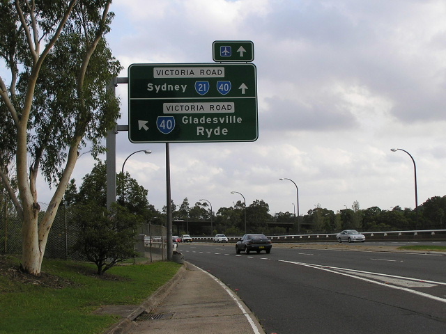
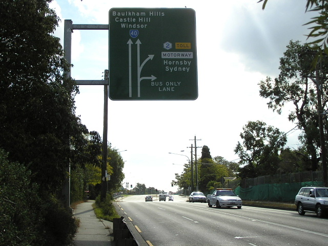
Hills (M2) Motorway westbound approaching Windsor Rd at Baulkham Hills. Note that State Route 40 and Windsor have both disappeared in the replacement of the old AD sign. This indicates that State Route 40 will be decommissioned in the future, and the preferred route to Windsor will be via Old Windsor Rd. Jan 2006. |
 |
Hills (M2) Motorway looking west to the Windsor Road interchange at Baulkham Hills. Note the heavily coverplated AD sign, which has had Windsor and the State Route 40 shield coverplated. This indicates that State Route 40 will be decommissioned in the future, and the preferred route to Windsor will be via Old Windsor Rd. Jan 2006. |
 |
Looking north towards Old Northern Road at Baulkham Hills. This formerly four-lane section of Windsor Rd was widened to the current 6-lane configuration to compliment construction of the M2 Motorway in 1993-97. Jan 2004. |
 |
Distance sign heading south from Old Northern Road at Baulkham Hills. The 24hr bus lane leads to the M2 bus lanes, which take buses express to Epping and the city. Sep 2005. |
 |
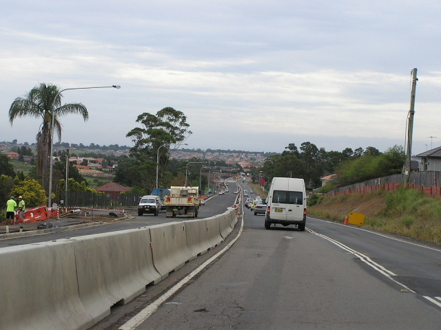
Looking north to Roxborough Park Drive at Baulkham Hills. This is where the four lane road ended prior to the commencement of an upgrade in May 2005. This photo was taken in mid 2004. |
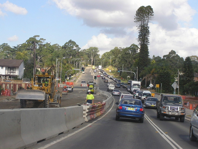 |
Looking east to Roxborough Park Drive, showing duplication works underway. March 2006. |
 |
Looking east along Windsor Road at the junction with Parsonage Rd, Castle Hill. This section was typical of Windsor Rd prior to upgrading. March 2005. |
 |
Looking west at the junction with Victoria Ave, Castle Hill. This intersection was one of the busiest unsignalised intersections in Sydney prior to the the installation of traffic signals in late 2005. March 2005. |
 |
Looking east between Victoria Ave and Norwest Boulevard, showing a curving two-lane road in a wide road reserve prior to upgrading. March 2005. |
 |
Looking east between Victoria Ave and Norwest Boulevard, showing duplication works underway. March 2006. |
 |
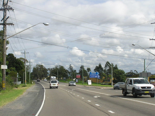
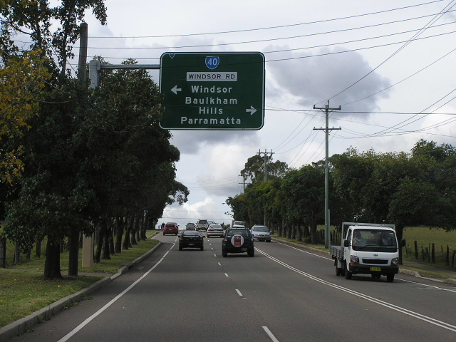
Diagrammatic AD sign southeastbound on Windsor Road approaching Showground Rd at Castle Hill. Note that Parramatta/Sydney is on a coverplate over Baulkham Hills/Parramatta (changed to encourage through traffic onto the M2 Motorway, previously Metroad 2 has used Showground Rd) and the coverplated Metroad 2 shield. March 2006. |
 |
Distance sign heading northwest from Showground Rd at Castle Hill. It is interesting that Riverstone is included on this sign, whilst subsequent distance signs only refer to McGraths Hill. March 2006. |
 |
Distance sign heading southeast from Memorial Ave at Kellyville. March 2006. |
 |
AD sign eastbound on Memorial Ave approaching Windsor Rd at Kellyville. March 2005. |
 |
Looking southeast through Kellyville towards President Rd. This section is to be upgrade to four lanes (probably just involving re-marking of the lanes). March 2006. |
 |
Looking west along Windsor Road in Kellyville, towards Poole Road and the bridge over Strangers (Smalls) Creek. This section is currently being duplicated. Jan 2004. |
 |
A similar view to the above photo, showing duplication work well and truly underway. March 2006. |
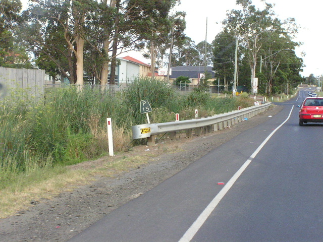 |
A very old "P15" kilometre plate, dating from the days when Windsor Road passed through completely rural areas. This sign was located on the western approach to Poole Rd, however has been removed in the process of duplicating Windsor Rd. Jan 2004. |
 |
Looking east at Strangers (Smalls) Creek, showing old and new bridges. Note the height difference in the two bridges. March 2006. |
 |
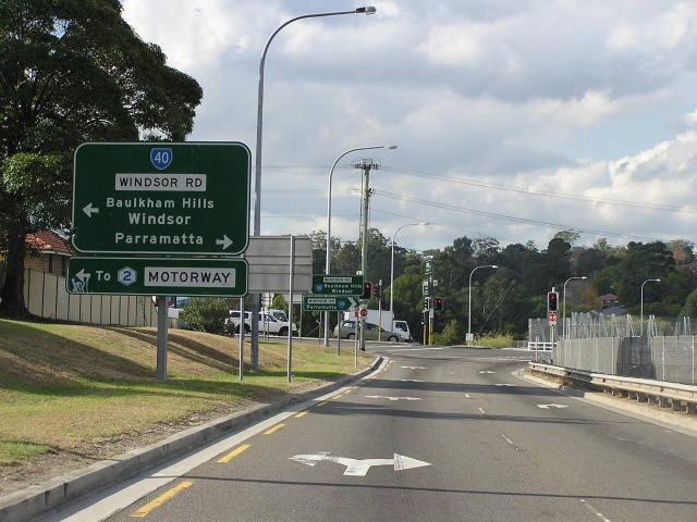
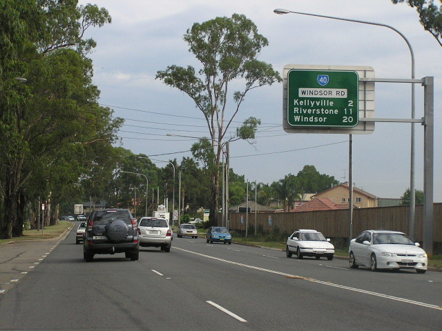
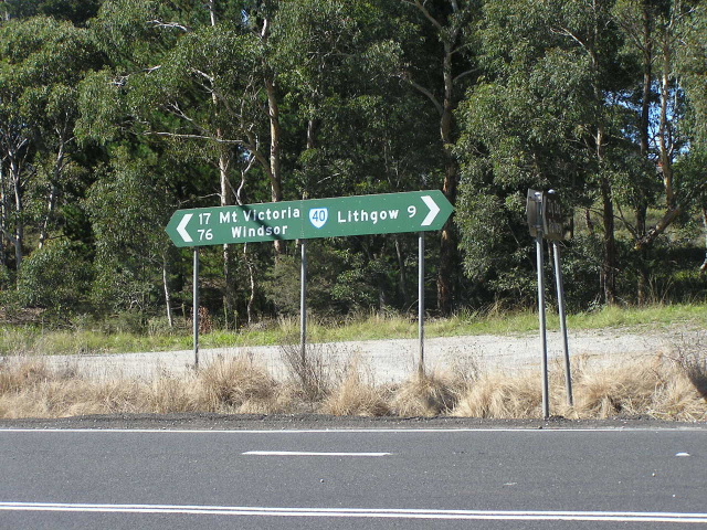
Windsor Rd westbound approaching the junction with Old Windsor Rd at Kellyville Ridge. This junction was reconstructed in 2001-02 from favouring Windsor Rd traffic to favouring Old Windsor Rd traffic, as Old Windsor Rd has once again become the major Parramatta-Windsor route. From this intersection, Metroad 2 duplexes with State Route 40 all the way to Windsor. March 2006. |
 |
Southbound AD sign on Windsor Rd approaching the Metroad 2/State Route 40 split at Kellyville Ridge. Note how Parramatta is signed via Windsor Rd, yet Sydney is signed via Old Windsor Rd! May 2005. |
 |
Looking north along Windsor Rd at Merriville Rd, Kellyville Ridge. The construction of the Parramatta-Rouse Hill Transitway can be seen on the right. March 2006. |
 |
Very undersized double-chevron ID sign showing the Metroad 2/SR40 duplex at Schofields Rd, Rouse Hill. This sign dates from prior to the duplication of Windsor Rd and, whilst it was of adequate size for the old rural T-junction, it is now way too small to be of any use at the current multi-lane intersection. March 2005. |
 |
Metroad 2/State Route 40 trailblazer southeastbound on Windsor Rd approaching Rouse Hill Town Centre. This photo shows duplication work underway in January 2004. |
 |
Looking west to the crossing of Second Ponds Creek at Rouse Hill. Windsor Rd is being deviated at this location to avoid a very narrow cutting between Rouse Hill Estate and former Primary School, as well as to preserve the heritage value of the estate. Oct 2005. |
 |
Looking northwest along Windsor Rd towards the junction with Annangrove Rd and the narrow cutting between the former Route Hill Primary School and Rosue Hill Estate. March 2006. |
 |
Double-chevron ID sign at the junction with Annangrove Rd, Rouse Hill. This section of Windsor Rd is currently being bypassed. March 2006. |
 |
Metroad 2/State Route 40 trailblazer northwestbound at Guntawong Rd, Rouse Hill. April 2005. |
 |
Looking northwest towards Nelson Rd at Box Hill, shwoing duplication and realignment work underway. Oct 2005. |
 |
Similar view, a bit closer to Nelson Rd, prior to the commencement of the roadworks. April 2005. |
 |
Distance sign heading southeast from Alan Street at Box Hill. March 2005. |
 |
Looking northeast along Garfield Rd East, approaching Windsor Rd at Box Hill. As you can see, Garfield Rd East is being realigned to join directly onto Terry Rd, making a four-way signalised intersection with Windsor Rd. March 2006. |
 |
Windsor Rd heading northwest towards Garfield Rd East at Box Hill. This cutting has since been obliterated as part of the realignment and duplication of Windsor Rd, which will improve the grade. March 2004. |
 |
Looking east on Windsor Rd towards Garfield Rd East, showing the obliterated cutting and the realignment works well underway. April 2006. |
 |
Looking west from Garfield Road East at Box Hill, prior to the commencement of upgrading. April 2005. |
 |
A similar view, this time closer to the RD sign, showing duplication and realignment works underway. Also note the surprising inclusion of Kurrajong, rather than Lithgow or McGraths Hill (the latter was shown on all previous distance signs since Northmead) as a focal point. Oct 2005. |
 |
Looking west on Windsor Rd approaching the crossing of First Ponds Creek at Box Hill. Note the overtaking lane, a rarity that was installed during the late 1980s as traffic volumes rose. Jan 2004. |
 |
Very old, probably dating from 1974, fingerboard signs at the intersection of Windsor Rd & Junction Rd, Box Hill. These will probably be removed as part of the duplication works. Jan 2004. |
 |
Metroad 2/State Route 40 trailblazer eastbound between Boundary Rd & Junction Rd, Box Hill. March 2006. |
 |
Very old "P25" kilometre plate eastbound near Boundary Rd , Box Hill. This sign has since been removed during the realignment and duplication works. Jan 2004. |
 |
Looking northwest at Otago Street, Vineyard, showing duplication and realignment works underway. Oct 2005. |
 |
Very old "W5" kilometre plate northwestbound on Windsor Rd near Bandon Rd, Vineyard. This relic has since been removed during the duplication and realignment works. Jan 2004. |
 |
ID signs acting as fingerboards assembly at the junction of Windsor Rd and Bandon Rd, Vineyard. These signs have been removed as part of the duplication and realignment works but will probably be reinstalled when the works are completed. Jan 2004. |
 |
Looking southeast along Windsor Rd between Bandon Rd and Level Crossing Rd, Vineyard, showing duplication work underway. March 2006. |
 |
Looking southeast along Windsor Rd near Latona Ave showing duplication work underway. Jan 2004. |
 |
Looking southeast along Windsor Rd to Park Rd, Vineyard, showing completed duplication work. March 2006. |
 |
Double-chevron ID sign showing an incorrect SR184 marker (Windsor Road's internal classification is Main Road No. 184, hence the confusion) at the junction with Curtis Rd, Mulgrave. March 2006. |
 |
Unusual sign southeastbound on Windsor Rd approaching Curtis Rd, Mulgrave. One of these signs has been installed on every major road leaving the Windsor/Richmond district - these have been designated Flood Evactuation Routes. March 2006. |
 |
Similar southeasterly view showing duplication work underway. Jan 2004. |
 |
Distance sign heading southeast from Mulgrave Rd, Mulgrave. March 2006. |
 |
Very extensive double-chevron ID sign, which I find unusual for such a minor side road (Mulgrave Rd) at Mulgrave. March 2006. |
 |
Looking northwest towards Mulgrave Rd (and Pitt Town Rd) at Mulgrave. Note the four-lane Windsor Rd is undivided at this point, and there is a curving pedestrian/cycling path within the wide road reserve. March 2006. |
 |
Pitt Town Rd heading southwest towards Windsor Road, McGraths Hill. April 2005. |
 |
Looking west from Pitt Town Rd across the South Creek floodplain. April 2005. |
 |
Metroad 2/State Route 40 trailblazer looking west across the South Creek floodplain at McGraths Hill. The problem of Windsor Rd flooding in this location is to be solved by the construction of a flood-free route across South Creek from Richmond Rd to Mulgrave Rd. Oct 2005. |
 |
The first distance sign on Metroad 2 (and the last on Tourist Drive 14), heading eastbound across the South Creek floodplain at McGraths Hill. April 2006. |
 |
The sign signalling the beginning of Metroad 2, on the southeastern abutment of the Fitzroy Bridge over South Creek. This terminus was created in 1993, when Metroad 2 was first signed, and represented the limits of urban Sydney (and thus the Metroad system). However, when Metroad 9 was introduced it would have made sense to extend Metroad 2 the extra 400m to meet Metroad 9 at the junction of Bridge St & Macquarie St, Windsor. I suppose it could be concluded that Metroad 2 actually does terminate at the aformentioned junction as END/START signs are often located on the approaches to the intersection, rather than right at it. April 2006. |
 |
The END Metroad 2 sign, westbound at Fitzroy St. The AD sign for the Bridge St/Macquarie St junction is located just to the left of the photo. April 2006. |
 |
ID sign assemblies at the junction of Bridge St & Macquarie St in Windsor. Note how the ID sign refers to "Start Metroad 2" rather than just showing the route shield - this is certainly the only place I have seen this in NSW. March 2005. |
 |
AD sign southeastbound on Bridge St (State Route 69) approaching Macquarie St at Windsor. The Metroad 2/SR40 duplex begins here, as does the Metroad 9/SR40 duplex - which extends southwest along Macquarie St as far as Richmond Rd. March 2005. |
 |
Macquarie St looking south from Bridge St, Windsor. March 2005. |
 |
Lane allocation AD sign southbound on Macquarie St approaching Richmond Rd at Windsor. This is the southern extremity of the short Metroad 9/SR40 duplex. June 2006. |
 |
AD sign northbound on Macquarie St approaching Richmond Rd at Windsor. March 2005. |
 |
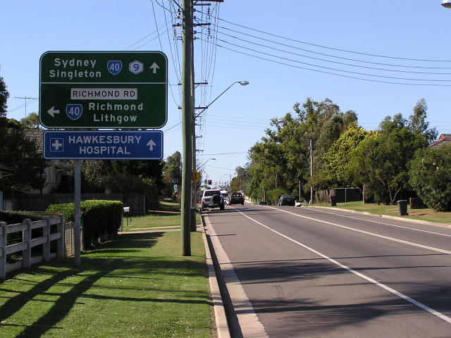
Distance sign heading west from Windsor along Richmond Rd. The bridge over Rickabys Creek is in the distance. Aug 2005. |
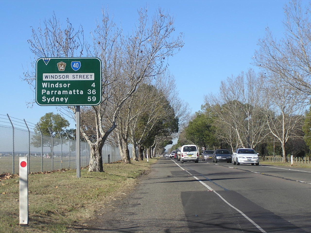 |
Distance sign heading east from Richmond along Windsor Street. June 2006. |
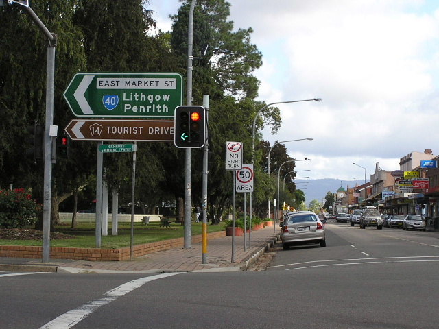 |
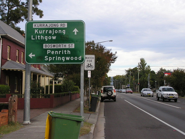
ID sign assembly at the junction of Windsor St & East Market St in Richmond town centre. April 2005. |
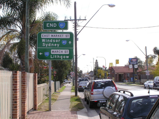 |
AD sign northbound on East Market St approaching March St in Richmond. Note the very rare END SR61 (SR61 has since been decommissioned). Aug 2005. |
 |
AD sign southbound on East Market St approaching March St in Richmond. April 2005. |
 |
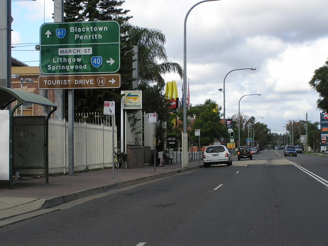
Newly-installed (late 2005) AD sign westbound on March St approaching Bosworth St in Richmond. April 2006. |
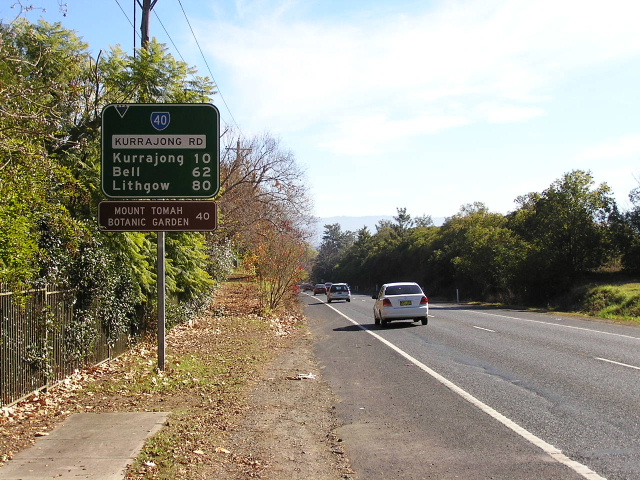 |
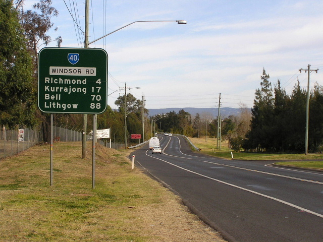
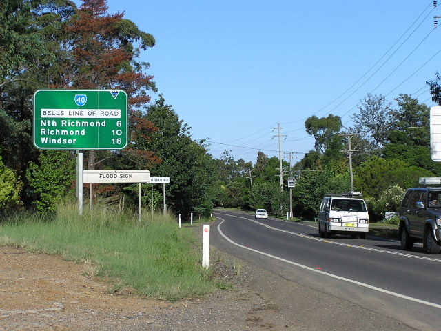
Distance sign heading west on Kurrajong Road between Chapel St and Old Kurrajong Rd. Construction of Kurrajong Rd was undertekn in 1956, utilising the reservation of the former Richmond-Kurrajong railway line, which was closed in 1952. June 2006. |
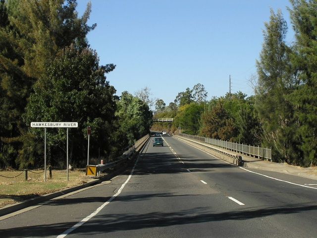 |
Looking southeast across Richmond Bridge over the Hawkesbury River. April 2006. |
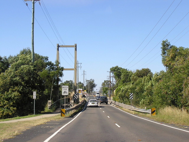 |
Looking east across the narrow bridge over Redbank Creek, North Richmond. Note the suspension bridge constructed specifically for pedestrians! April 2006. |
 |
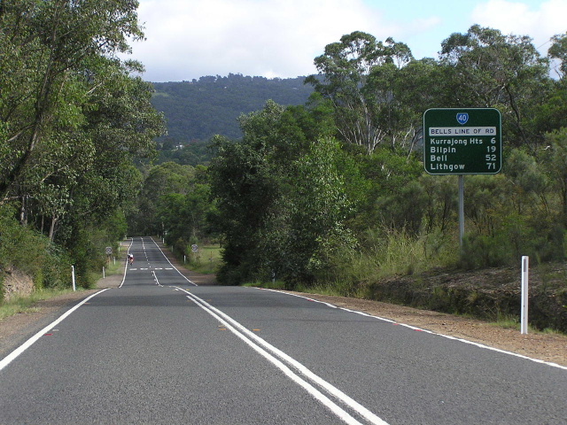
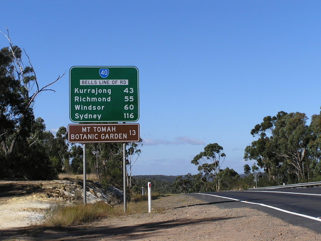
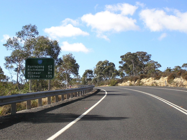
Distance sign heading east from Comleroy Road at Kurrajong. Note that Sydney is not mentioned, despite being mentioned on every previous distance sign! April 2005. |
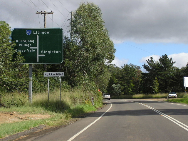 |
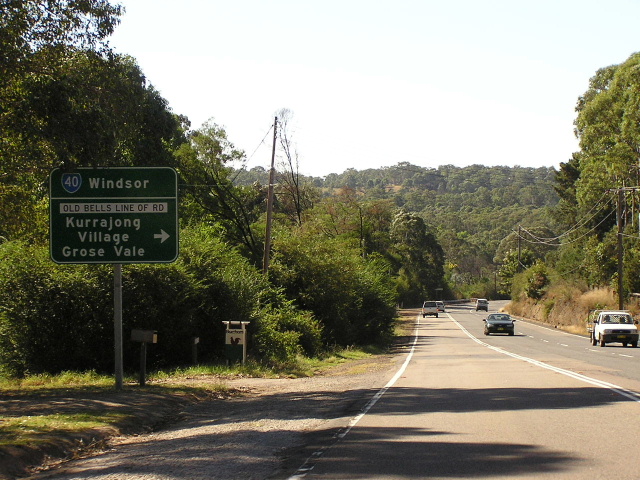
Diagrammatic AD sign westbound on Bells Line of Road approaching the staggered T-junctions with Comleroy Rd and Old Bells Line of Rd at Kurrajong. April 2005. |
 |
Distance sign heading west from Old Bells Line of Road at Kurrajong. This deviation was constructed in the 1940s, as part of the post-war reconstruction program, and involved a new bridge over Little Wheeney Creek. April 2005. |
 |
AD sign eastbound on Bells Line of Rd approaching Old Bells Line of Rd at Kurrajong. Note there is no straight arrow on this sign! April 2006. |
 |
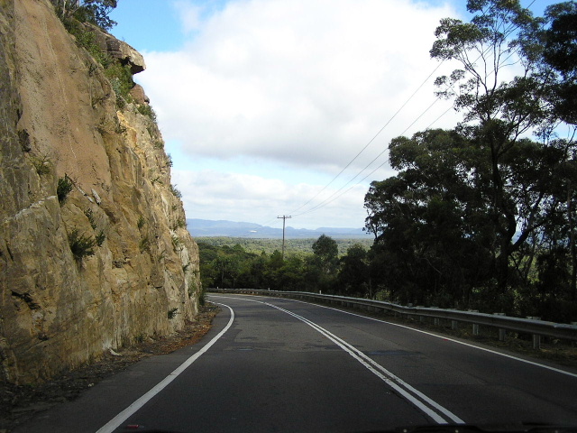
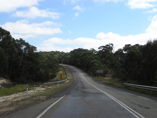
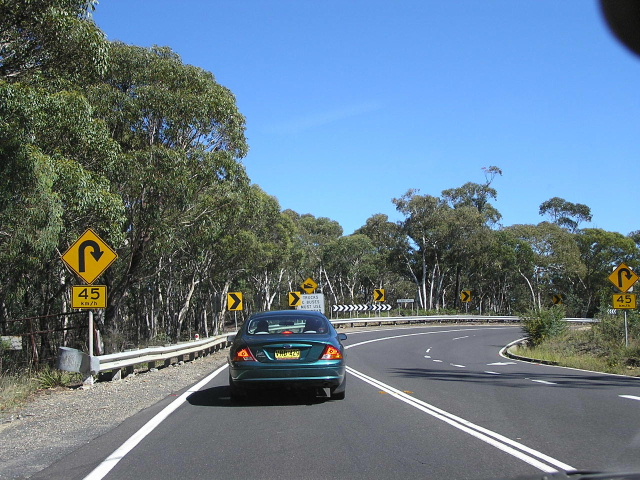
Looking west at the foot of Bellbird Hill, the steepest section of Bells Line of Road. April 2005. |
 |
Less than 1km, and one very steep ascent later is the top of Bellbird Hill. This view is looking south just before the steep and winding descent. April 2006. |
 |
Looking west along a particularly narrow section hugging the hills at Kurrajong Heights. April 2005. |
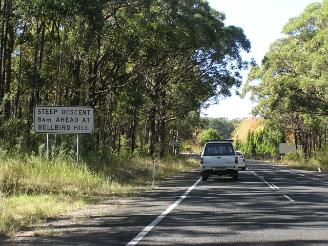 |
Looking east into Kurrajong Heights, where a sign advises motorists that 8km ahead is the very steep descent of Bellbird Hill. I am not sure what the purpose of this sign is - perhaps to try and get drivers to be more alert? April 2006. |
 |
ID signs acting as a fingerboard on Bells Line of Road at Mountain Lagoon Rd, Bilpin. April 2005. |
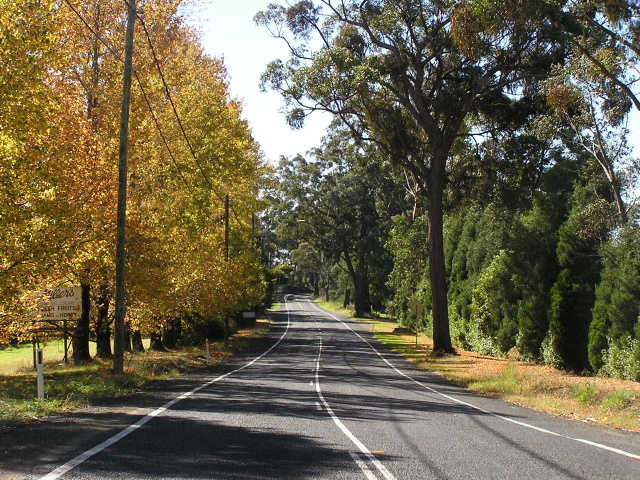 |
Attractive, tree-lined section of Bells Line of Road, looking east through Bilpin. April 2006. |
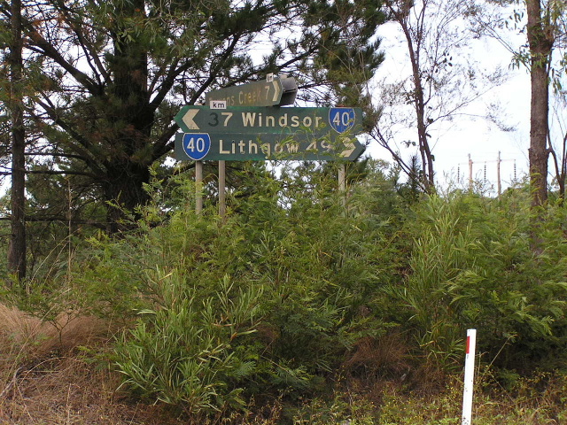 |
A fantastic relic, found hidden in the bushes at Mt Irvine Rd, Bilpin, is this fingerboard assembly dating from 1974. The white "km" plates were used on all signs during July 1974 to show that the distances had been converted to metric (as opposed to them being in miles). April 2006. |
 |
Looking west into the small locality of Berambing, west of Bilpin. Along Bells Line of Road the signage announcing the suburb/locality you are entering is superb. April 2005. |
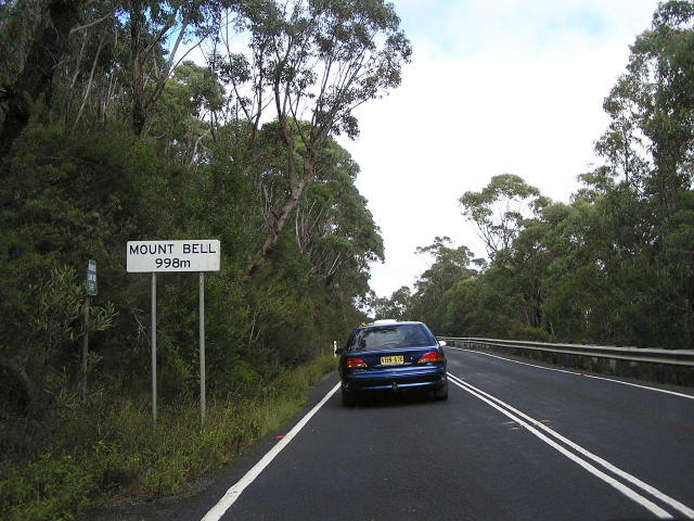 |
Signage through the Blue Mountains National Park is also quite excellent, with several of these signs informing motorists of significant peaks and their elevation. This is not the highest point on Bells Line of Road - that title goes to the tiny hamlet of Bell which is 1067m above sea level. April 2005. |
 |
Looking west through a very old cutting in Blue Mountains National Park, between Mount Tomah and Mt Wilson Rd. April 2005. |
 |
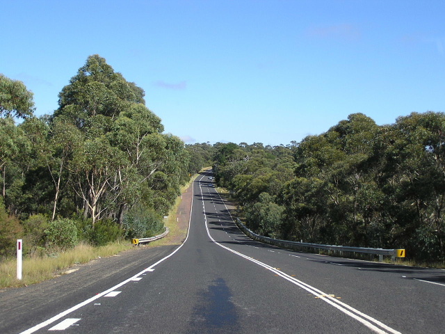
Towards Mt Wilson Rd the road flattens out a little, allowing several overtaking lanes such as this. Previously there had been no overtaking lanes since Bellbird Hill. April 2005. |
 |
Looking west near Mt Wilson Rd, showing a section of very narrow and deteriorating pavement that has since been upgraded. April 2005. |
 |
Newly-installed distance sign (early 2006) on Bells Line of Road, heading east from Mt Wilson Rd. April 2006. |
 |
Another overtaking lane, this time looking west between Mt Wilson Rd and Bell. April 2005. |
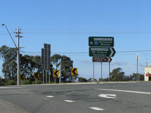 |
Sign assembly at the junction of Bells Line of Road, Chifley Rd (which is what SR40 is named on some signs between Bell and Lithgow) and Darling Causeway at Bell. April 2006. |
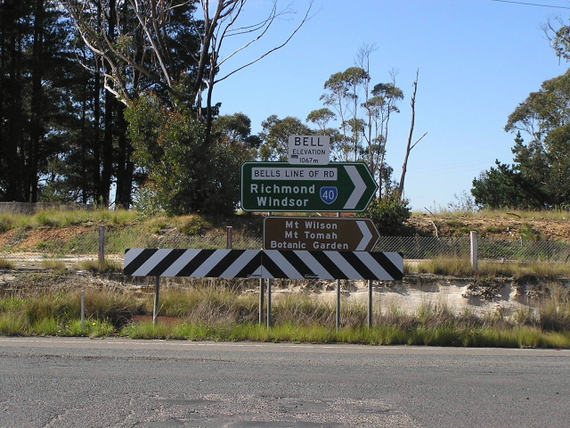 |
ID sign assembly with a sign announcing that you are in Bell, which is the highest point on the Bells Line of Road, at the junction with Darling Causeway. April 2005. |
 |
Looking west in Bell, showing the Main Western Railway Line paralleling Bells Line of Road (or Chifley Rd, depending on which signs you believe). April 2005. |
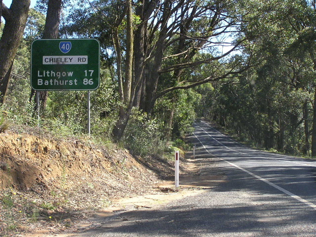 |
The very belated westbound distance sign, located about 3km west of Darling Causeway, showing Chifley Road. I believe the declared name is still Chifley although most signage in Lithgow shows Bells Line of Road (as it should! to ensure continuity). April 2005. |
 |
Fingerboard sign at the entrance to the Zig Zag Railway at Clarence. Note the inverted State Route 40 shield - I wonder how that mistake was made? April 2005. |
 |
Distance sign heading west on Bells Line of Road between Clarence and the top of Scenic Hill. Unusually there is no road name and no mention of Bell, which appears on previous distance signs. April 2006. |
 |
Looking west at the top of Scenic Hill - the very steep descent into Lithgow. April 2005. |
 |
Looking east at the foot of Scenic Hill on the eastern outskirts of Lithgow. April 2006. |
 |
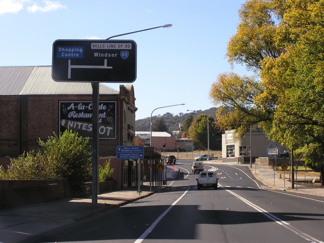
Distance sign heading east from Lithgow along Bells Line of Road (or Chifley Road, depending on what you believe!). Note that Bells Line of Road has been preferred as the road name, and is a late inclusion on this sign. April 2005. |
 |
Very old black ID sign with much newer reflective brown fingerboard sign at the junction of Mort St & Eddy St in Lithgow. April 2005. |
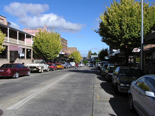 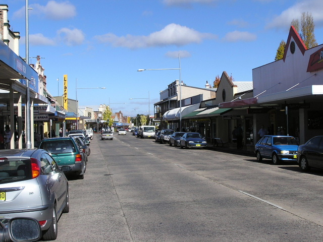 |
Two westbound views of Lithgow's Main Street, which was possibly once part of the main route through Lithgow. However, this probably pre-dates the naming of Bells Line of Road and/or the introduction of State Route 40. April 2006. |
 |
Very old black ID sign in pretty good condition at the intersection of Main St & Lithgow St, Lithgow. April 2006. |
 |
Diagrammatic AD sign eastbound on Main St approaching the junction with Lithgow St, Lithgow. This sign appears to be painted standard green (appears black to the eye after a few years of wear) but has a white road name patch! Also note the use of the Bells Line of Road name! April 2006. |
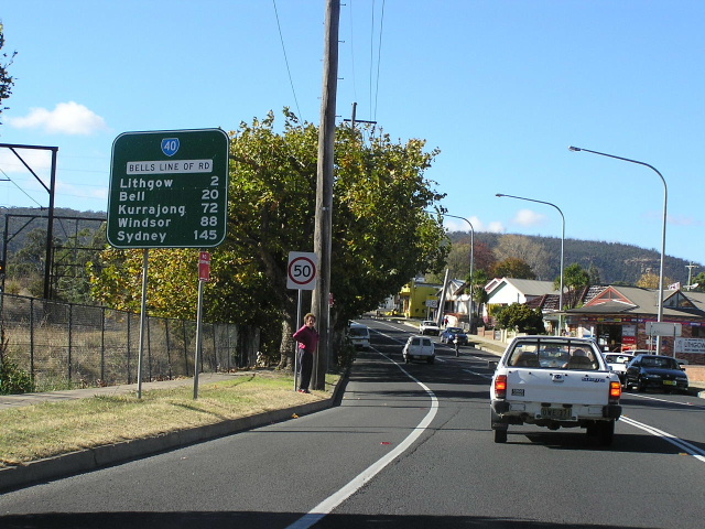 |
The first eastbound distance sign on State Route 40, heading west from the Great Western Hwy at Lithgow. April 2006. |
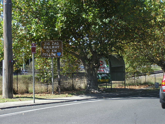 |
Very unusual sign advising motorists bound fro the Zig Zag Railway at Clarence to follow State Route 40 shields. April 2005. |
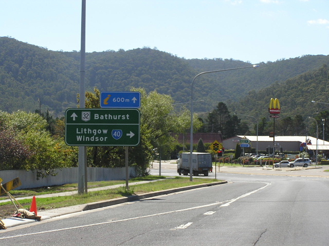 |
AD sign northbound on Gt Western Hwy approaching Main St (Bells Line of Rd) at Lithgow. April 2005. |
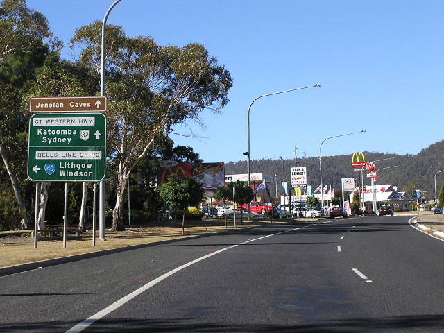 |
AD sign southbound on Gt Western Hwy approaching Main St (Bells Line of Rd) at Lithgow. Note that Sydney is signed via Gt Western Hwy although it is shorter by 1km via Bells Line of Road. April 2006. |
Last updated 10 December 2012 © Ozroads 2003-2012. |