National Route 55 |
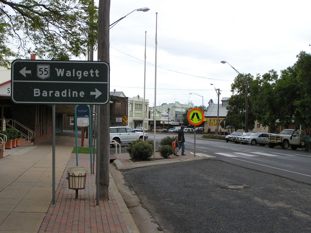
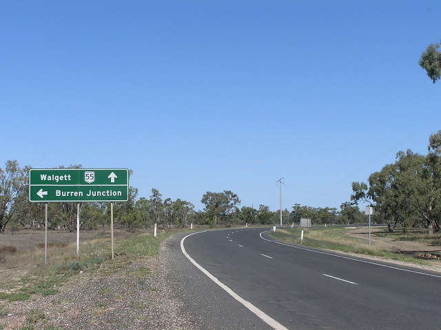
Distance sign heading south from Walgett. This sign is probably a poor replica of an old Department of Main Roads design. April 2006.
In 2013, RMS will be implementing a new alpha-numeric route numbering system. For more information, visit the RMS Website. |
|
Forthcoming alpha-numeric route number: |
|
Length: 340km
Route Names: Castlereagh Hwy
Northern Terminus: NSW/QLD Border near Hebel.
Southern Terminus: Oxley Hwy, Gilgandra
Focal Points: Gilgandra, Coonamble, Walgett, Lightning Ridge, St George.
RTA Internal Classification: State Highway No. 18
Route Overview:
National Route 55 was formerly a north-south route through central northern New South Wales and central Queensland, connecting the Newell Highway at Gilgandra with Walgett, St George, Roma, Emerald and Charters Towers. The Queensland section especially was part of a strategic route to take B-doubles and other large vehicles (which cannot use the Bruce Highway) to the Queensland ports north of Rockhampton.
However, today National Route 55 only traverses 340km of the Castlereagh Highway in New South Wales, having been replaced by the alpha-numeric designations "A55" and "A7" within Queensland during the 2004/05 financial year. According to signs that have been erected in Coonamble and Walgett Shires, National Route 55 will soon be replaced in New South Wales with the alpha-numeric route "B55". The "B" designation definitely reflects the questionable road quality.
National Route 55 signs were first erected by the NSW Department of Main Roads in 1974, between Gilgandra and Walgett. However, unlike other National Routes introduced in that year by the DMR, National Route 55's location west of National Route 39 and east of National Route 71 suggests that it had been included in the original 1954 plan. By the end of 1975, NAASRA's map titled "National Routes: Erection of Route Marking Signs" indicates that National Route 55 had been extended from Walgett to the Queensland border at Hebel - where it currently terminates. However, subsequent maps show the National Route terminating in Walgett until at least 1983.
National Route 55 first appeared in Queensland on the Gregory and Dawson Highways, between Emerald and Rolleston, during 1980. By December 1982, National Route 55 had been extended north of Emerald to Capella and the extension to Clermont was completed soon afterwards.
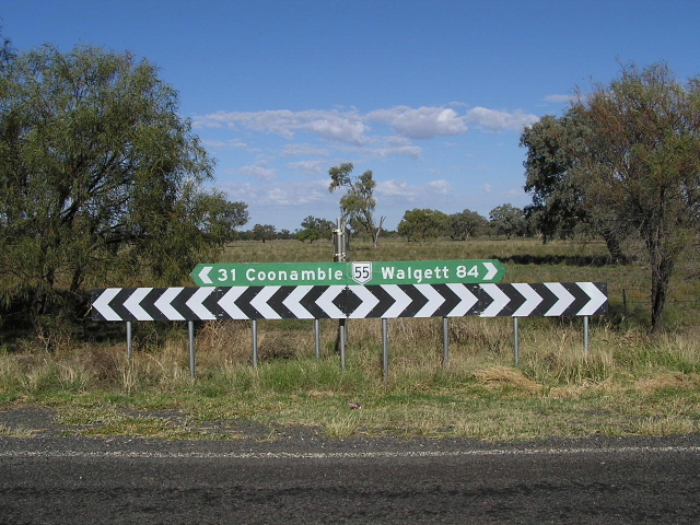
This is where we pick up an interesting discrepency between the Queensland and New South Wales interpretation of the path that National Route 55 would take. Prior to Queensland signing any section of NR55, the NSW DMR had signed the Castlereagh Highway as National Route 55 between Gilgandra and Walgett. The natural continuation would be via the Castlereagh Highway to Angledool and Hebel, thence entering Queensland. However, between 1983 and 1997 the Queensland Main Roads Department (MRD) signposted National Route 55 from Mungindi in the south, via Carnarvon Highway to the Warrego Highway at Roma, thence via Carnarvon Development Road to Rolleston, joining the pre-existing section of NR55 at Rolleston. Meanwhile, the NSW Department of Main Roads extended National Route 55 signage from Walgett north to Hebel. This created the situation where the southern leg of Queensland's NR55 was located over 100km from the northern end of NSW's NR55! This ridiculous situation continued for a number of years until Queensland gazetted the St George-Dirranbandi-Hebel route as the Castlereagh Highway (a continuation of the NSW highway) and subsequently moved National Route 55 onto the new highway. Whilst the erection of National Route 55 signs and trailblazers on the new route proceeded rather quickly, signs to this day still show the old alignment as part of National Route 55. Until 2005, signage at the pivotal Castlereagh/Carnarvon Highway junction south of St George still showed National Route 55 towards Mungindi.
The former route of National Route 55 between St George and Mungindi is now National Route 46, which was not included in the original 1954 National Route Marking Scheme.
The final leg of National Route was to extend it north from Clermont via the Gregory Developmental Road to the Flinders Highway near Charters Towers in northern Queensland. This was completed in 1997, along with the sealing of the final gravel section of the Gregory Developmental Road.
Less than 10 years after National Route 55 was fully signposted, the Queensland MRD replaced it with alpha-numeric route signage. As part of their Heritage Trails Network, route "A7" replaced National Route 55 between Roma and Charters Towers and route "A55" replaced National Route 55 between Roma and Hebel. Work was scheduled for the 2004/2005 financial year and was completed by October 2005.
For history and information on each section of National Route 55 (and the former section in Queensland) please see the individual highway pages.
Further Reading: On Site
Castlereagh Hwy (NSW)
Castlereagh Hwy (QLD)
Carnarvon Hwy
Carnarvon
Developmental Road
Gregory Hwy
Gregory
Developmental Road
|
Photos of National Route 55 |
|
 |
This black ID sign on the corner of Warren Rd (Oxley Hwy) and Miller St (Castlereagh Hwy), Gilgandra, marks the southern beginning of National Route 55. Oct 2004. |
 |
AD sign eastbound on Oxley Highway (Warren Rd) approaching the beginning of the northern section of Castlereagh Hwy (Miller St) and NR55 at Gilgandra. Oct 2004. |
 |
Looking south along Castlereagh Hwy (Miller St) approaching NR55's southern terminus at the Oxley Highway, Gilgandra. Note the remnant NR39 shield (despite the other one being coverplated!) and the missing left arrow. The junction with Oxley and Newell Highways is no longer a direct crossroads, following construction of the John Renshaw Bridge over the Castlereagh River. April 2006. |
 |
Looking north along Castlereagh Highway (Miller St) through Gilgandra's CBD. April 2006. |
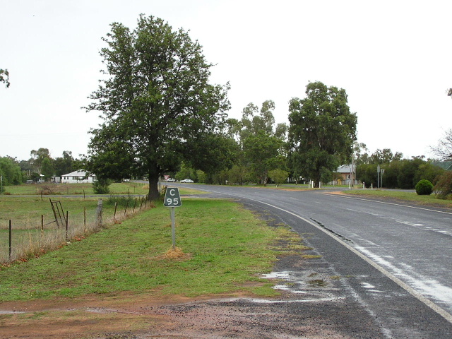 |
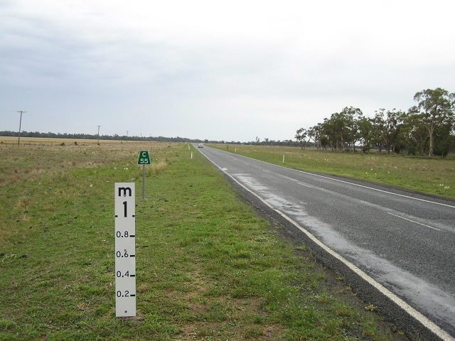
Black "C95" kilometre plate on the northern outskirts of Gilgandra. April 2006. |
 |
Black distance sign, the first northbound one on National Route 55, heading north from Gilgandra. April 2006. |
 |
Standard NSW-style fingerboard sign at the junction with Curban Rd, 22km north of Gilgandra. Note the incorrect SR55 shield - should be a National Route 55 shield. April 2006. |
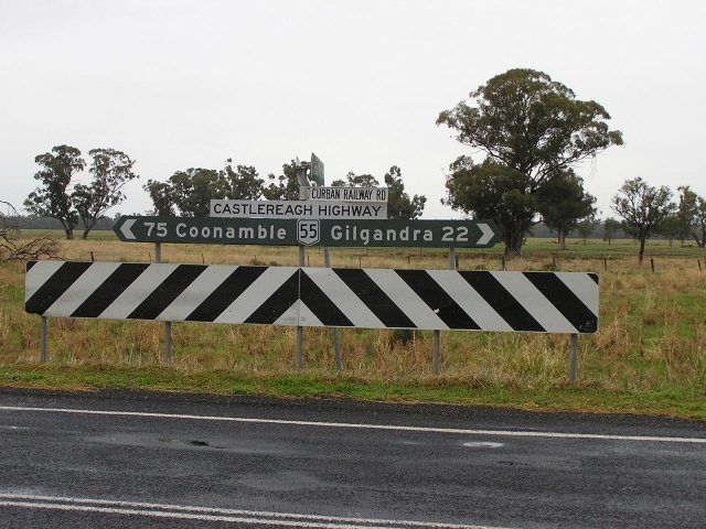 |
Black fingerboard sign with Castlereagh Highway name plate at the junction with Curban Railway Rd, also 22km north of Gilgandra. April 2006. |
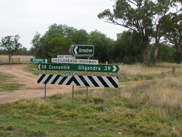 |
Standard fingerboard signage at the junction with Armatree-Warren Road near Armatree, but missing a National Route 55 shield! April 2006. |
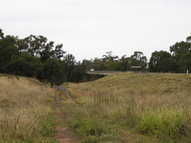 |
The western approach to the bridge over Castlereagh River at Armatree. The track on the left is either the approach to the old timber bridge or a side-track used by highway traffic during construction of the current high-level bridge in 1982. April 2006. |
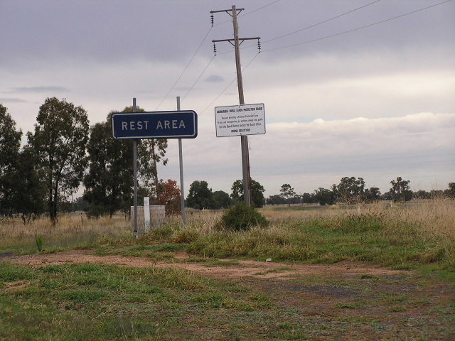 |
Unusual blue Rest Area sign with no arrow, on the western side of the Castlereagh River bridge. April 2006. |
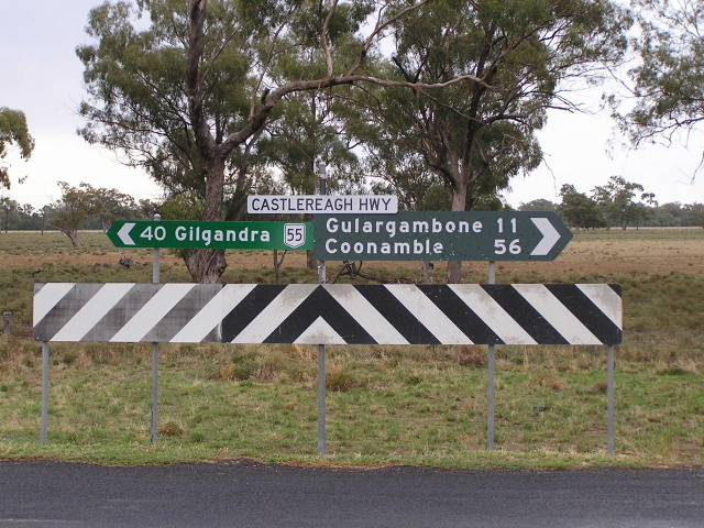 |
Unusual combination of an ol black fingerboard sign, a new green fingerboard sign with a NR55 shield and a Castlereagh Highway nameplate. At the junction with Yarrandale Road, just north of the bridge over Castlereagh River. April 2006. |
 |
Looking north at one of the many flood-prone locations along the Castlereagh Highway, this one between Armatree and Gulargambone. Because the Castlereagh Highway follows the Castlereagh River for much of its length it is subject to flooding if the river breaks it banks (which admittedly is not very often). April 2006. |
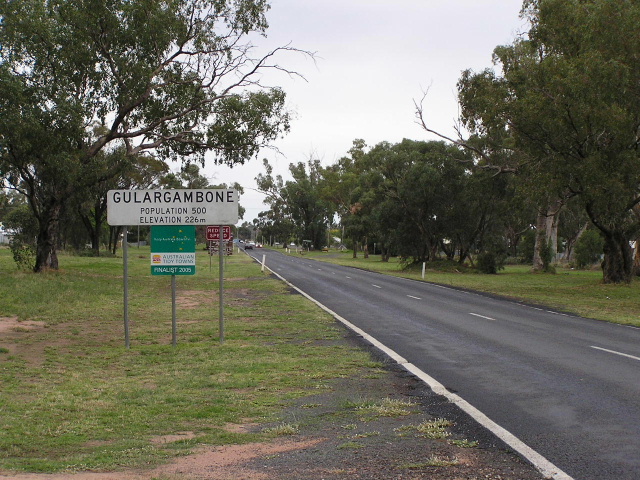 |
Looking north into the small town of Gulargambone. April 2006. |
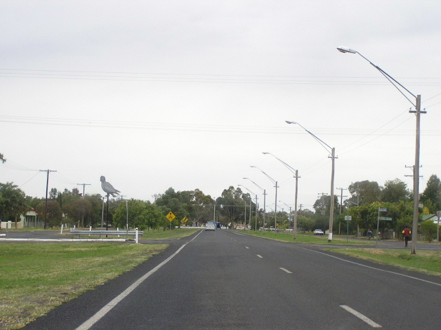 |
Looking north through Gulargambone. I'm not sure what the significance of the bird on the stick is. April 2006. |
 |
Fingerboard sign at the junction with Bourbah Street in Gulargambone. April 2006. |
 |
Very non-standard collection of fingerboard signs at the junction with Box Ridge Rd at Gulargambone. April 2006. |
 |
Looking north between Gulargambone and the Gulargambone Rest Area, showing badly deteriorating and rutting pavement. This is the case for much of the length of the Castlereagh Highway in NSW, partly due to the flat, swampy terrain through which it passes. April 2006. |
 |
Brand-spanking new fingerboard sign at the Gulargambone Rest Area, 3km north of Gulargambone. Note the National Route 55 shield is on a coverplate over probably a "B55" shield. April 2006. |
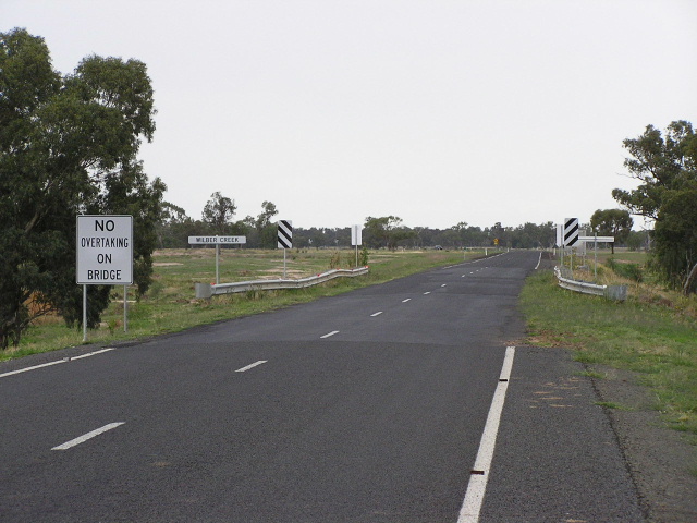 |
Looking north at a narrow culvert over Wilber Creek, about 7km north of Gulargambone. Note the drop in pavement quality on the approaches to the culvert. April 2006. |
 |
Another brand-spanking new fingerboard sign, this time at a southbound rest area 12km north of Gulargambone. April 2006. |
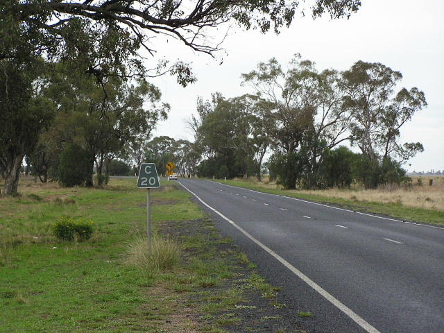 |
Black "C20" kilometre plate heading north towards Coonamble. April 2006. |
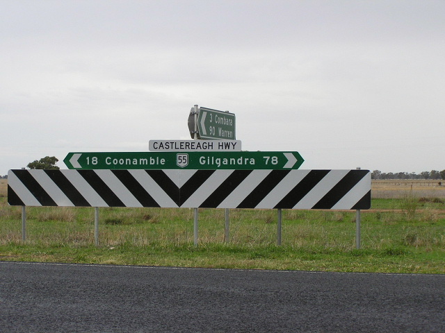 |
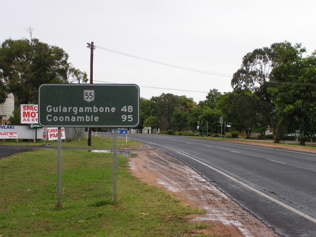
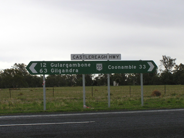
Standard NR55 fingerboard sign with a non-standard ID sign showing 3km to Combara and 90km to Warren. 16km south of Coonamble. April 2006. |
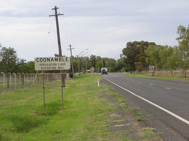 |
Looking north into Coonamble. There was no distance sign heading south from this town :-( April 2006. |
 |
"B55" signage northbound on Castlereagh Highway (Castlereagh St) approaching King St in Coonamble. I am surprised that Tooraweenah gets a mention on this sign over Coonabarabran (also reached via King St), which is a much larger and more important town. It is probably because the Coonamble-Coonabarabran road is not a declared Main Road. April 2006. |
 |
More "B55" signage, this time a fingerboard sign at the junction of Castlereagh Hwy and King St in Coonamble. April 2006. |
 |
A third B55 sign, this time heading south on Castlereagh Hwy approaching King St, Coonamble. April 2006. |
 |
Remnant black AD sign that has actually been superceded by this sign (photo courtesy Michael Greenslade) but not replaced, northbound on Castlereagh Hwy approaching Aberford St, Coonamble. April 2006. |
 |
Black AD sign westbound on Aberford St approaching Castlereagh Highway in Coonamble town centre. Also note the very old all-text "Pedestrian Crossing Ahead" warning sign. April 2006. |
Black ID sign pointing Castlereagh Highway traffic onto Aberford St and the bridge over the Castlereagh River. April 2006. |
|
 |
The concrete box-girder bridge over the Castlereagh River at Coonamble. Note the remnants of the wooden piles for the older timber bridge that was replaced in 1982. April 2006. |
 |
Looking east along Castlereagh Highway (Aberford St) approaching Castlereagh St in Coonamble. April 2006. |
 |
Looking west along Castlereagh Highway (Aberford St) approaching Back Gular Rd, Coonamble. Note the incorrect SR55 shield and the very non-standard AD sign. April 2006. |
 |
Unusual sign assembly at the junction with Back Gular Rd. It appears that what used to be a NR55 AD sign has had its NR55 shield chopped off the top (and the corners rounded for good measure!) and then relocated to the intersection itself. Also note the fairly random "Baradine" fingerboard with no distance (that also looks as though it has been imported from elsewhere). April 2006. |
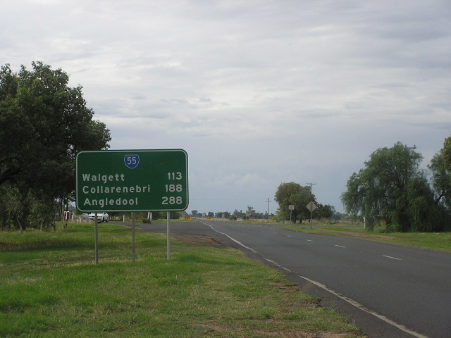 |
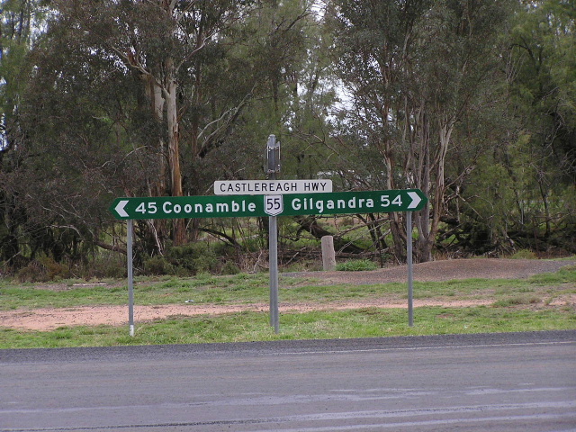
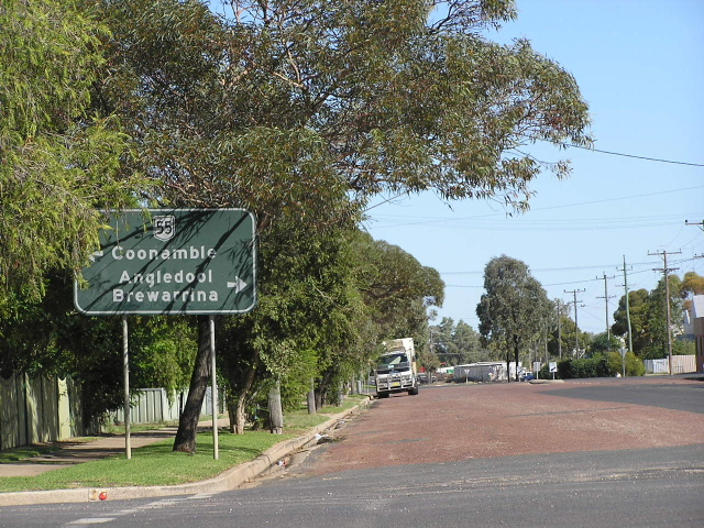
Distance sign, leaving Coonamble to the north. Note the incorrect SR55 shield. This is one of only 2 distance signs on the Castlereagh Highway between Gilgandra and Walgett! April 2006. |
 |
Non-standard fingerboard assembly (both signs are missing their chevrons!) on the northern outskirts of Coonamble, at the junction with the Coonamble-Carinda road. April 2006. |
 |
A classic rest area reassurance sign, dating from the 1970s. Once upon a time these were everywhere across the outback sections of New South Wales but nowadays are quickly being replaced by the new pictorial versions. April 2006. |
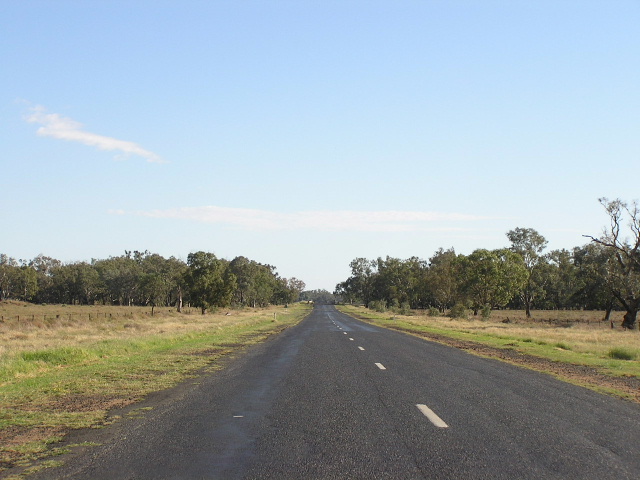 |
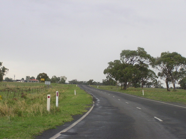
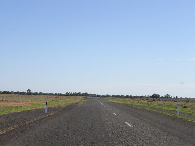
Looking north, north of Coonamble, showing deteriorated and narrow pavement. This view is typical of the Castlereagh Highway in NSW. April 2006. |
 |
Fingerboard sign at the southern turnoff for Come-by-Chance and Wingadee, 31km north of Coonamble. April 2006. |
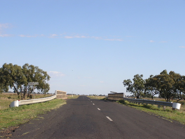 |
Looking north at a 1950s bridge over Kennedys Creek. April 2006. |
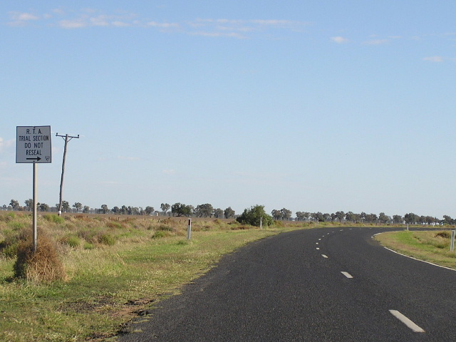 |
Unusual sign indicating the next stretch of road is an RTA trial section and warning councils (who often undertake maintenance along State Roads) not to reseal this section of the highway. The trial section had a marginally better surface than the rest of the highway. April 2006. |
 |
Another northbound view, this time showing dodgy (IMHO) resealing, patching and shoulder widening. April 2006. |
 |
New fingerboard sign with NR55 on a coverplate over B55, at the Windagee Rest Area, 62km north of Coonamble. April 2006. |
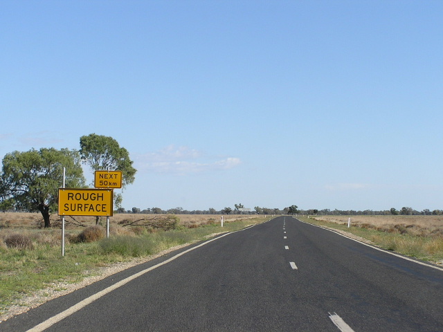 |
An ominous warning of 50km of rough surface to come! April 2006. |
 |
Looking north across the Castlereagh River about 46km south of Walgett. April 2006. |
 |
Very old black double-chevron ID sign at the northern Wingadee turnoff, 45km south of Walgett. April 2006. |
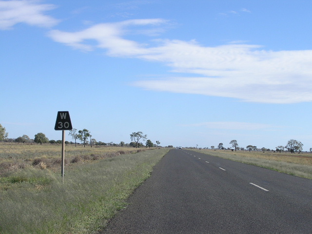 |
Black "W30" kilometre plate northbound. April 2006. |
 |
Fingerboard sign at the Carinda turnoff, 25km south of Walgett. April 2006. |
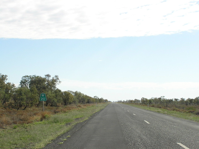 |
"W20" kilometre plate northbound, showing more dodgy surface. April 2006. |
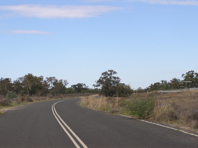 |
Looking south along a side-track used by highway traffic while the bridge over Cumberdoon Warrambool was being replaced recently. The highway bridge can just be seen in the far right of the photo. April 2006. |
|
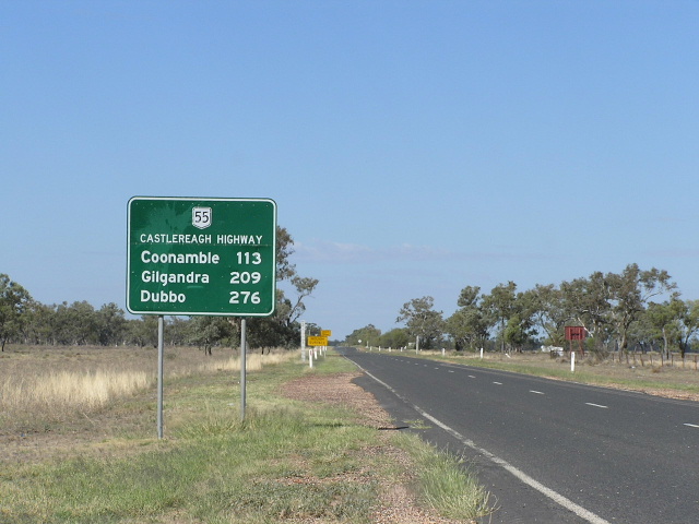
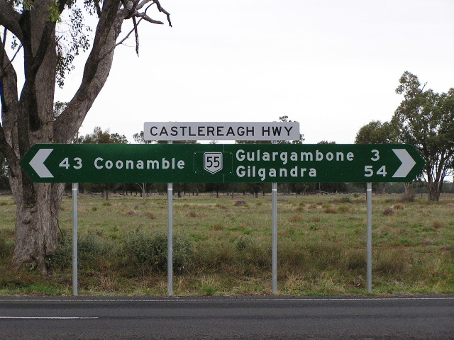
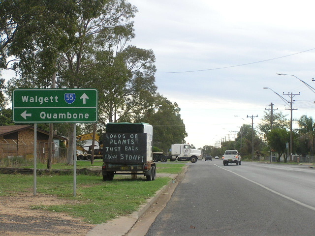
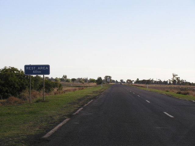
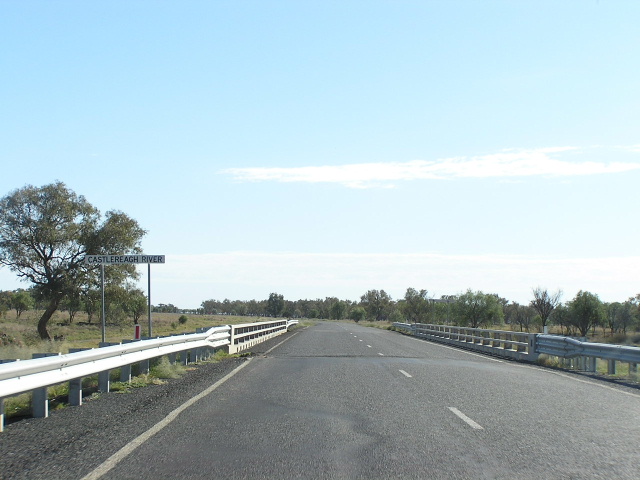
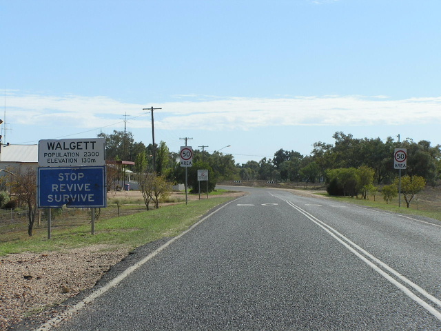
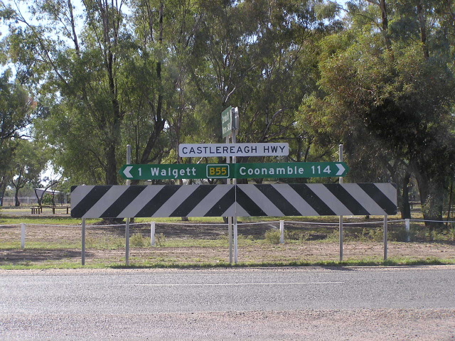
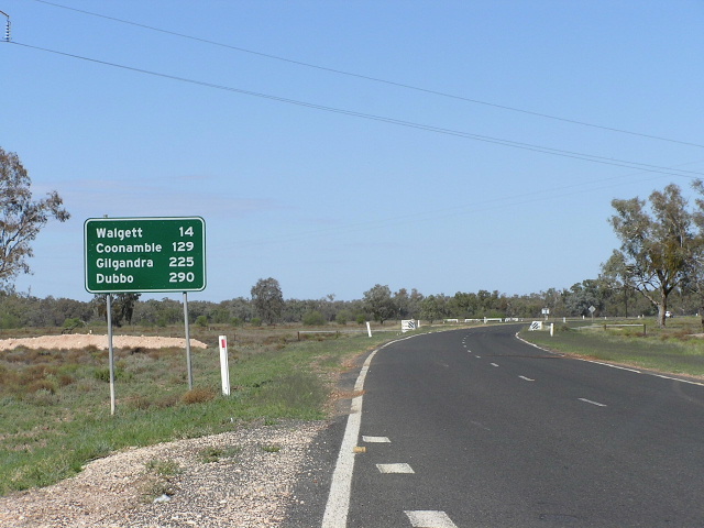
Distance sign heading south from Walgett. This is the last southbound distance sign on National Route 55! April 2006. |
 |
Looking north into Walgett. April 2006. |
 |
Old black AD sign northbound on Castlereagh Hwy (Fox St) approaching Bate St (Main Road No. 202), Walgett. April 2006. |
 |
New "B55" fingerboard sign at the junction with Bate St, Walgett. April 2006. |
 |
Black AD sign southbound on Castlereagh Hwy (Fox St) approaching Bate St at Walgett. April 2006. |
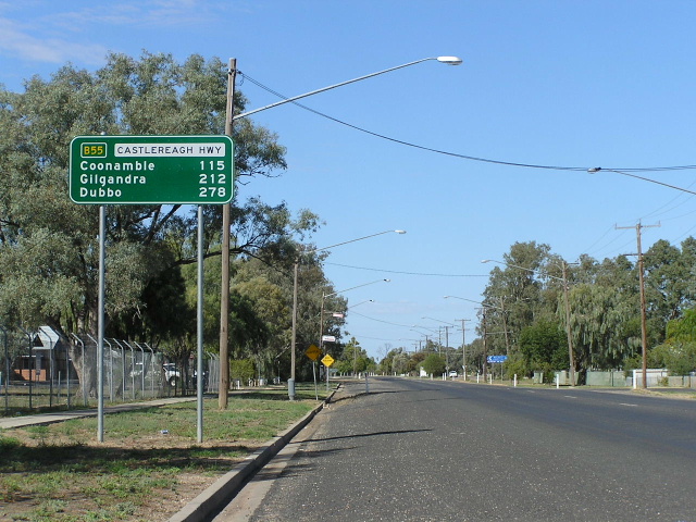 |
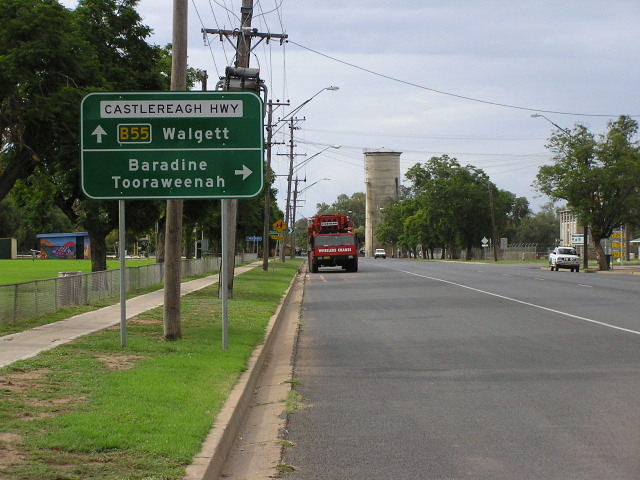
New "B55" distance sign heading south along Castlereagh Hwy (Fox St) outside Walgett District Hospital. Note the unsually high placement of the sign and the use of "Dubbo" as the last focal point. I thought that something like Sydney or Lithgow would have been used since the Castlereagh Hwy has been extended past Gilgandra, however the focus still remains on Dubbo. April 2006. |
 |
AD sign northbound on Castlereagh Highway (Fox St) approaching Euroka St (Walgett-Pilliga road). Note the non-standard design and the incorrect SR55 shield. Also note the random mention of Narrabri, which is not followed up on any other signs in town. April 2006. |
 |
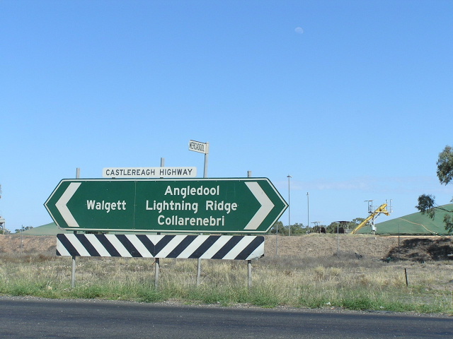
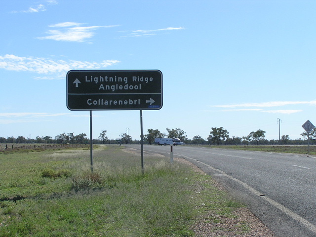
Black AD sign westbound on Euroka St approaching the Castlereagh Hwy (Fox St) in Walgett. Note the use of Angledool as the focal point - this is now being phased out in favour of Lightning Ridge and Hebel. April 2006. |
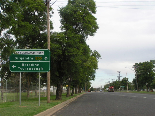
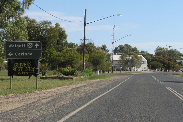
New fingerboard signs at the junction of Castlereagh Hwy and Euroka St. Note that Lightning Ridge appears on this sign rather than Angledool. April 2006. |
|
 |
Non-standard AD sign northbound on Castlereagh Hwy (Fox St) approaching Kamilaroi Highway (Wee Waa St) in Walgett. Note no mention of NR55 or NR37, but the recent addition of a Kamilaroi Highway name plate to the sign. April 2006. |
 |
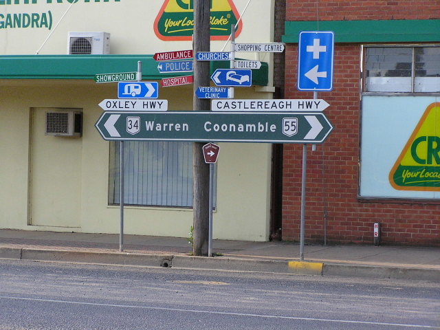
AD sign eastbound on Kamilaroi Highway (Wee Waa St) approaching Castlereagh Hwy (Fox St) in Walgett. Note the "B55" shield, but no shield for the Kamilaroi Highway (currently NR37). This indicates that either the Kamilaroi Highway will receive two different route markers under the alpha-numeric system or the designer of this sign was incompetent. April 2006. |
 |
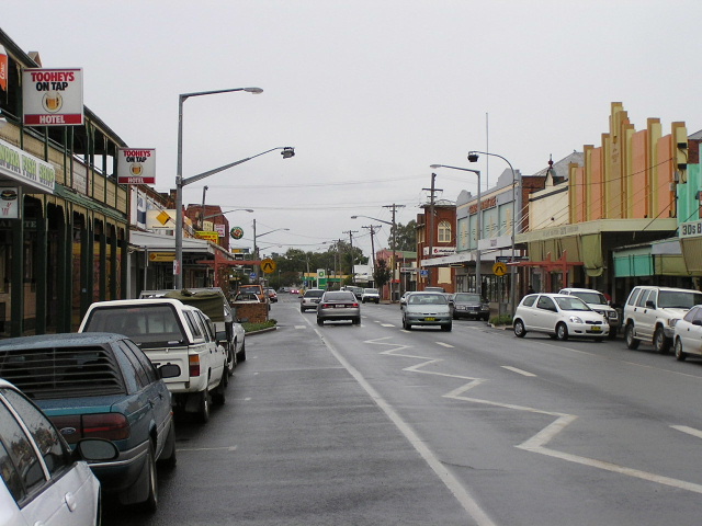
Looking north along Castlereagh Highway (Fox St) through Walgett's CBD. Unfortunately because it was pension day, the town was pretty much closed up except for petrol stations when I passed through. April 2006. |
 |
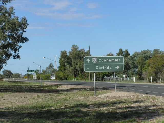
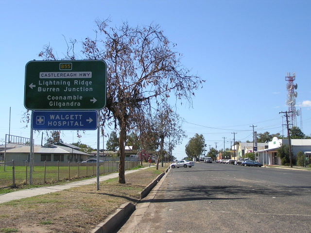
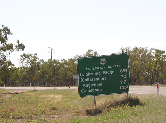
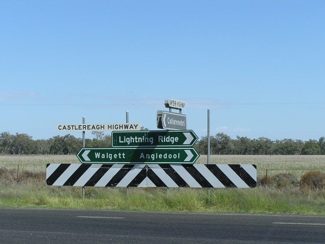
New "B55" distance sign heading north from Walgett along the Castlereagh Highway. Note there is no mention of St George, which is the focal point beyond Lightning Ridge on Castlereagh Highway. April 2006. |
 |
AD sign northbound on Castlereagh Hwy approaching the northern junction with Kamilaroi Highway, 5km north of Walgett. Note no mention of National Route 37 but there is a hastily-added Kamilaroi Highway name plate. April 2006. |
 |
Non-standard ID signs acting as fingerboard signs at the northern Kamilaroi Highway junction. Note there is no mention of NR37 on the Kamilaroi Highway sign. April 2006. |
 |
Another non-standard sign, this time the southbound AD sign approaching Kamilaroi Highway. April 2006. |
 |
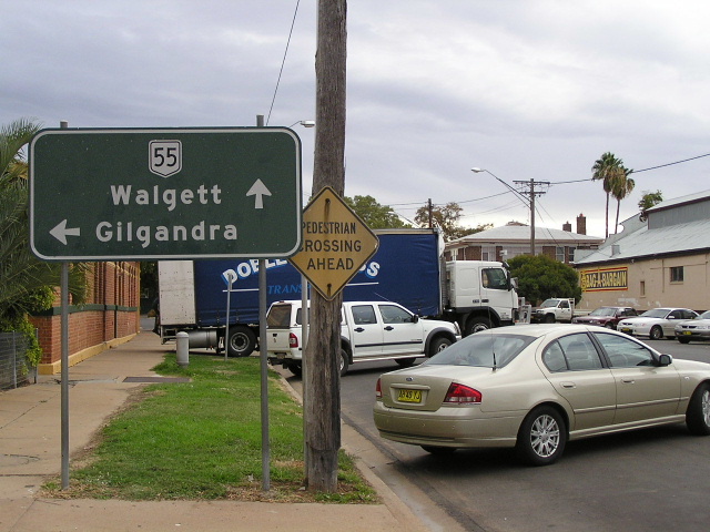
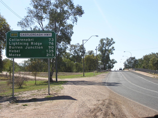
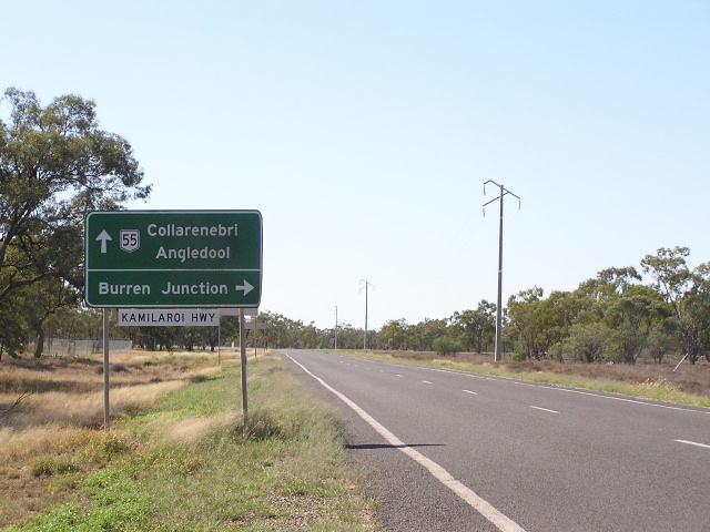
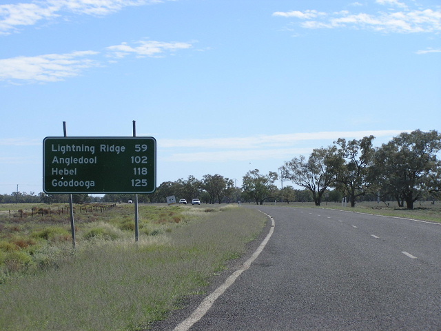
Poorly-located and poorly-designed distance sign heading north from the Kamilaroi Highway junction. This sign is probably a poor replica of an old DMR sign. April 2006. |
 |
Non-standard double-chevron ID sign with the wrong font, at the junction with the road that runs along the southern side of the Barwon River to Collarenebri. April 2006. |
 |
Looking north to the bridge overrt Pagan Creek. Note the side-track on the left that was probably used by highway traffic during the recent replacement of this bridge. April 2006. |
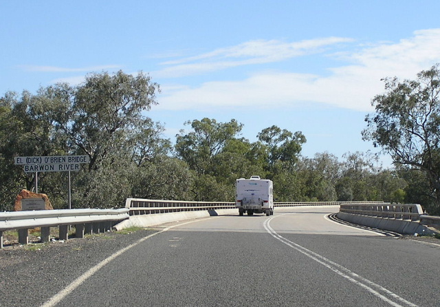 |
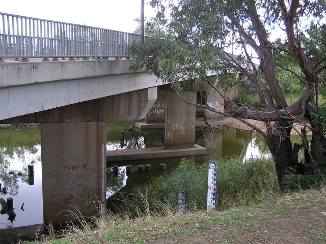
Looking north across the Dick O'Brien Bridge over the Barwon River at Euminibah. This structure replaced a 1920s timber bridge in 1991. April 2006. |
 |
Distance sign heading south from the Gwydir Highway junction, missing a National Route 55 shield. April 2006. |
 |
Black AD sign northbound approaching the Gwydir Highway junction. This sign outdates both the signposting of NR55 north of Walgett and the extension of Gwydir Highway/NR38 west of Collarenebri. April 2006. |
 |
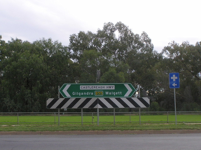
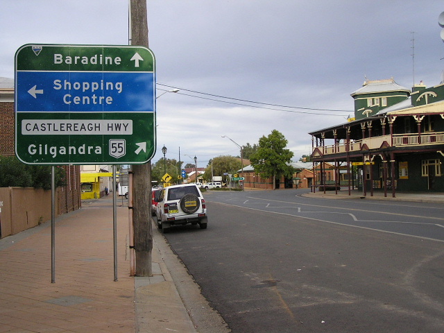
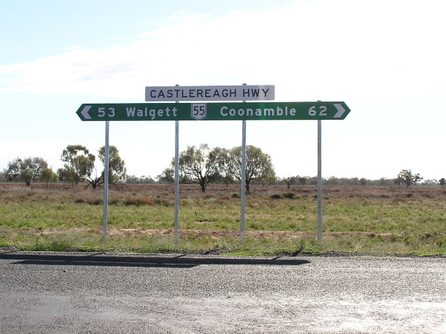
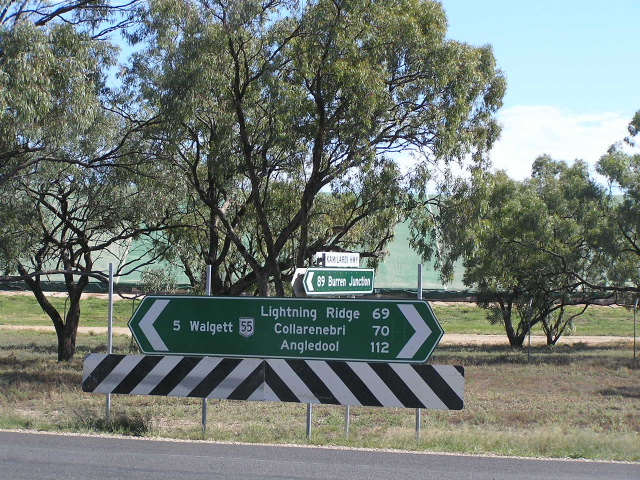
Sign assembly at the Gwydir Highway junction. April 2006. |
 |
Gwydir Highway westbound approaching the junction with Castlereagh Hwy. Note the lack of a NR55 shield - this sign is probably a poor replica of an old DMR sign that outdates the signposting of NR55 north of Walgett. April 2006. |
 |
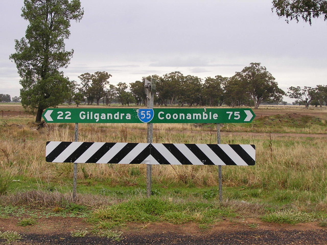
Unusually correct AD sign southbound approaching the Gwydir Highway junction. I am very surprised to see both NR38 and NR55 shields on this sign! April 2006. |
 |
Distance sign heading north from the junction with Gwydir Highway, missing a National Route 55 shield. April 2006. |
Last updated 13 December 2012 © Ozroads 2003-2012. |