National Highway Route 25 |

NH25 fingerboard sign at Spring Ridge Rd, January 2004.
In 2013, RMS will be implementing a new alpha-numeric route numbering system. For more information, visit the RMS Website. |
|
Forthcoming alpha-numeric route number: |
|
Length: 54km
Route Name: Barton Highway
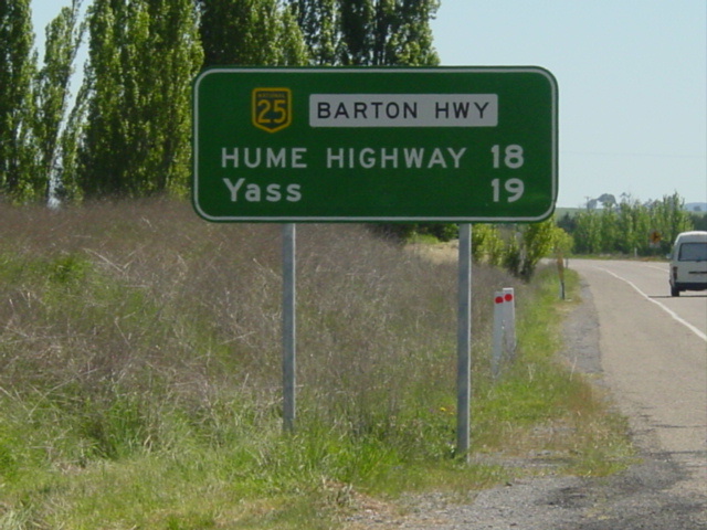
Northern Terminus: Hume Highway, Yass Bypass
Southern Terminus: Federal Highway & Northbourne Ave, Lyneham
Focal Points: (Goulburn/Gundagai), Yass, Canberra
RTA Internal Classification: State Highway 15
Proclaimed a state highway: 1935
Named: August 1954
Route Overview:
Barton Highway is a short north-south highway connecting Canberra to the Hume Hwy at Yass, and is part of the National Highway system being one of the 'Canberra Connectors' which connect Canberra to Melbourne and Sydney via the Hume Hwy. It was proclaimed a state highway in 1935 to service the new Australian Capital Territory being constructed. Previously it had been a trunk road servicing the farms in the area. In August 1954, the DMR named it Barton Hwy after Australia's first Prime Minister, Edmund Barton and only a few years later it gained the National Route 25 shield when it was fully sealed in 1960. In 1974, the National Highway system was born and Barton Hwy gained the National Highway 25 shield as one of the Canberra Connectors.
The route is all dual carriageway in the ACT, constructed during the 1990's, but is single carriageway through NSW except for a 6km section known as the 'Barton Connector' which joins NH25 to the Hume Hwy on the Yass Bypass. This connector was opened in May 1995 (commenced in April 1993) and replaced a 1km section of single carriageway highway that met the Old Hume Hwy near Cooma Cottage. Planning for construction of dual carriageways in NSW has been talked about but nothing concrete as yet.
Within the ACT, the first section of dual carriageway opened in 1986, bypassing Hall, a village right on the ACT/NSW border. The dual carriageways steadily headed south through the late 1980's and early 1990's until they reached the new Gungahlin Dr intersection. It wasn't until December 2002 that the last section of single carriageway was eliminated between Gungahlin Dr and Federal Hwy.
Initially the Barton Hwy met Northbourne Ave where at Antill St via what is now Ellenborough St and Mouat St. The current alignment was constructed in the late 1970's with the assistance of federal funding under the National Highway system.
Notable events in the history of NH25-Barton Hwy:
1935 - Proclaimed a State Highway
Aug 1954 - Named Barton Hwy
1956 - Proclaimed and signposted National Route 25
1960 - Fully sealed
1974 - Proclaimed a National Highway
Jun 1980 - Hall Bypass
1990's - Dual carriageways between Hall and Kaleen
May 1995 - 'Barton Connector' opened at Yass Bypass
Dec 2002 - Dual carriageways between Gungahlin Dr and Federal Hwy
Further reading (on-site):
Barton Highway Northern terminus: Hume Hwy, Yass Bypass
Barton Highway Southern terminus: Federal Hwy, Lyneham
Further reading (off-site):
Barton Hwy - Michael Greenslade
Photos of National Highway 25 - Barton Highway |
|
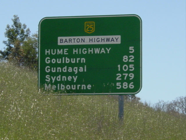 |
Northbound RD sign from Yass Valley Way interchange. Note the use of 'Hume Hwy' as a focal point, marking the northern terminus of NH25 & Barton Hwy. Photo taken January 2004. |
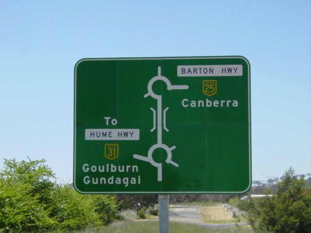 |
Unusual double-roundabout AD sign on Yass Valley Way (Old Hume Hwy) approaching Barton Hwy. Photo taken January 2004. |
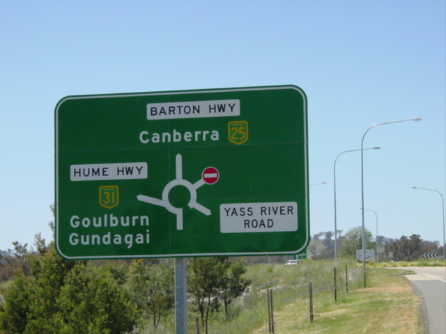 |
AD sign at the Yass Valley Way interchange near Yass. I can't remember which approach to the interchange this sign is on. Photo taken Januray 2004. |
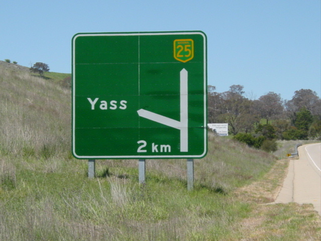 |
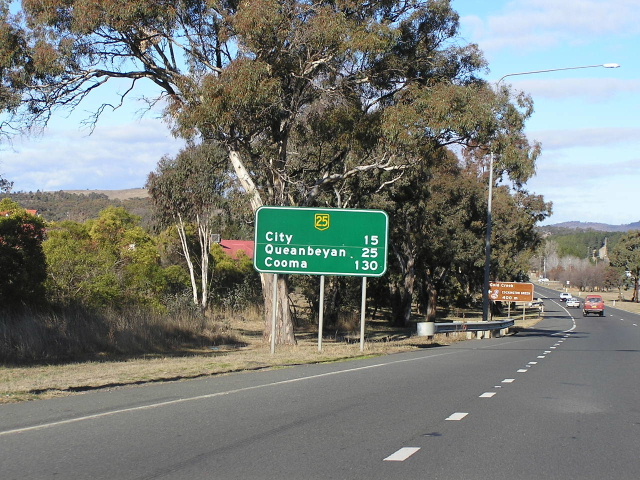
Southbound 2km AD for Yass Valley Way exit. Photo taken January 2004. |
 |
Southbound RD sign from Yass Valley Way interchange, just before the freeway conditions end and the highway reverts to single carriageway. Photo taken January 2004. |
 |
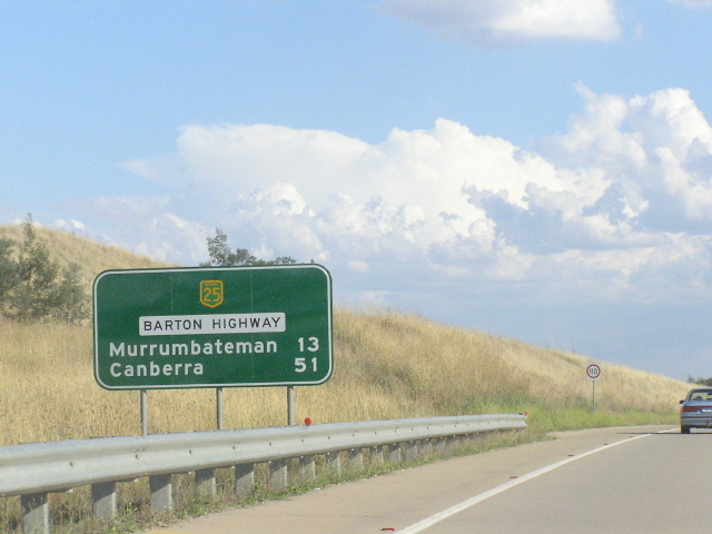
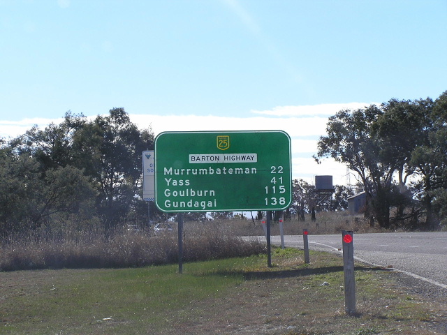
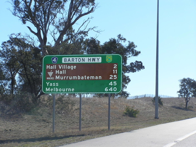
Barton Hwy northbound from Murrumbateman Rd, Murrumbateman. Photo taken January 2004. |
 |
Southbound from Murrumbateman Rd, Murrumbateman. Photo taken January 2004. |
 |
NH25 trailblazer southbound south of Murrumbateman. Photo taken January 2004. |
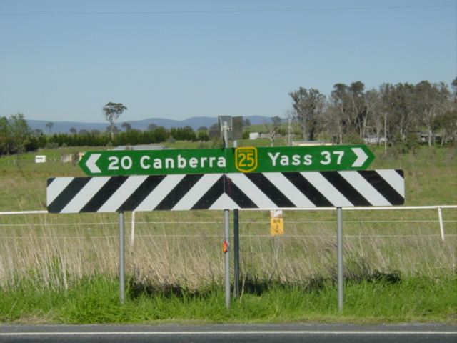 |
Fingerboard sign at Nomina Rd between Murrumbateman and Hall. Photo taken January 2004. |
 |
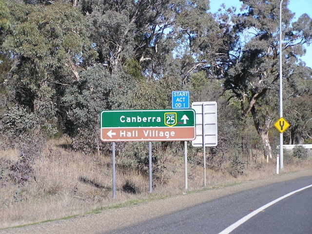
Northbound at the NSW/ACT border, Hall. Photo taken July 2004. |
 |
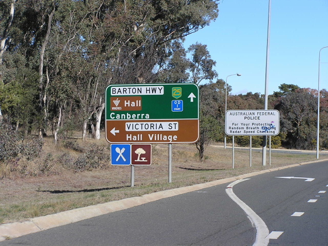
Southbound approaching Victoria St (Old Barton Hwy), Hall. Photo taken July 2004. |
 |
Southbound approaching Victoria St, Hall: 2nd AD sign. Photo taken July 2004. |
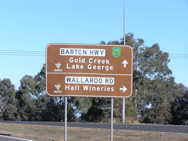 |
Southbound at Wallaroo Rd, Hall. Photo taken July 2004. |
 |
Southbound across Halls Creek on the dual carriageway Hall Bypass, opened to traffic in 1986. Photo taken July 2004. |
 |
Southbound from Gladstone St, still on the Hall Bypass. Photo taken July 2004. |
 |
Northbound from Kuringa Drive just before the Hall Bypass begins. Photo taken July 2004. |
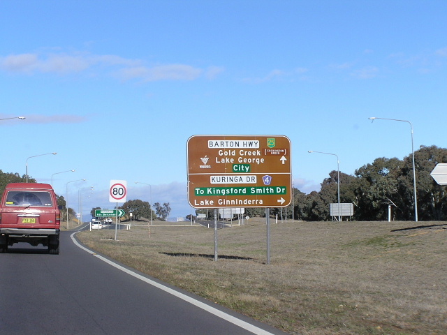 |
Southbound at Kuringa Drive. Photo taken July 2004. |
 |
Northbound from Currans Drive, Nicholls. Photo taken July 2004. |
 |
Southbound from Currans Drive. Photo taken July 2004. |
 |
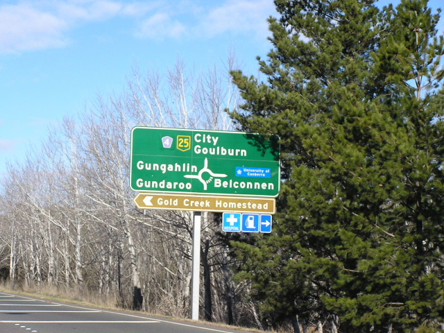
Northbound approaching the William Slim Dr/Gundaroo Dr intersection, a large roundabout in the middle of a 100km/h zone. Photo taken July 2004. |
 |
Southbound approaching the William Slim Dr/Gundaroo Dr roundabout. Photo taken July 2004. |
 |
AD style sign acting as an ID sign at the William Slim Dr/Gundaroo Dr roundabout. Note the absence of a NH25 shield on the lower panel. Photo taken July 2004. |
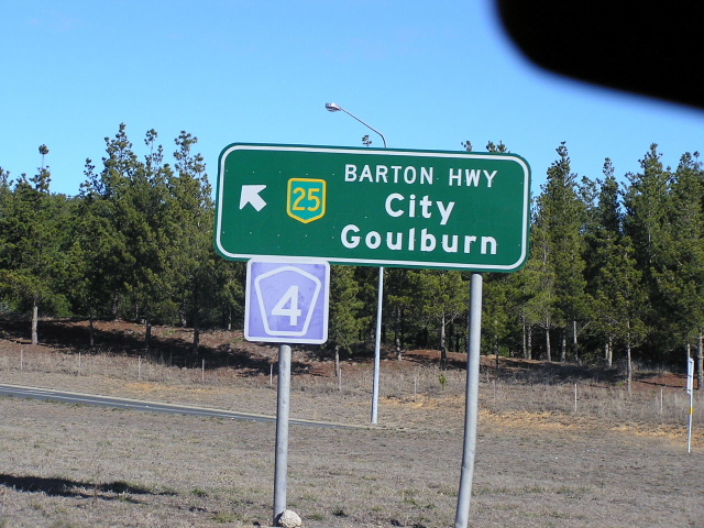 |
Mid 1990's style roundabout ID sign at the same intersection. Note the purple TD4 trailblazer attached to the sign. Photo taken July 2004. |
 |
Northbound from the same intersection. Photo taken July 2004. |
 |
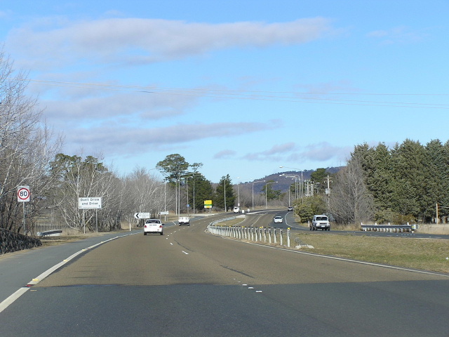
Looking south between Gundaroo Dr and Gungahlin Dr in the 100km/h zone. This dual carriageway was constructed during the 1990's. Photo taken July 2004. |
 |
Looking south at Bellendeen St which was closed when Gungahlin Drive was constructed in the 1990's. Photo taken July 2004. |
 |
Southbound approaching the Gungahlin Dr interchange, reconstructed in 2004 as part of the Gungahlin Dr extension project. Photo taken July 2004. |
 |
Looking south to the Gungahlin Dr interchange. Photo taken July 2004. |
 |
Northbound AD sign for Gungahlin Drive. Note the incorrect NR25 shield. Photo taken July 2004. |
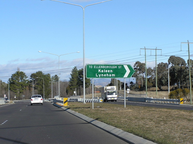 |
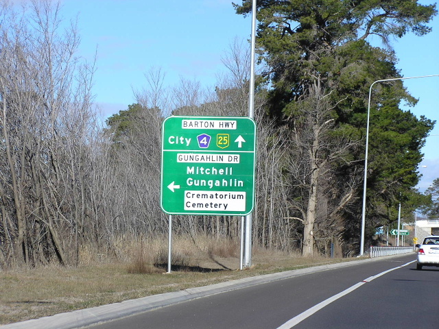
Southbound at Ellenborough Street on the dual carriageway section completed in December 2002. |
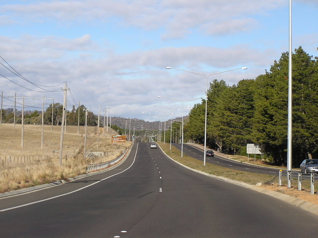 |
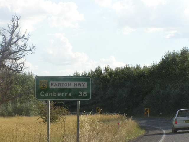
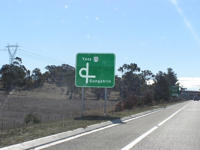
Southbound at Lyneham on the new dual carriageway section. Over the hill is the Federal Hwy/Northbourne Ave intersection that marks the southern terminus of NH25 & Barton Hwy. Photo taken July 2004. |
Last updated 12 December 2012 © Ozroads 2003-2012. |