Port Wakefield to Eudunda |
RD sign westbound on Michael Street (B82) after the junction with Barrier Highway (A32) at Saddleworth. Source: Peter Renshaw, October 2011.
Length: 100km
Eastern Terminus: Thiele Highway (B81) & Curio Road (B84), Eudunda
Western Terminus: Port Wakefield Highway (NHRA1) & Balaklava Road (B84), Port Wakefield
Route taken: From Port Wakefield, via Balaklava, Auburn, Saddleworth and Marrabel to the Thiele Highway (B81), 1.5km south west of Eudunda
Focal Points: Port Wakefield, Balaklava, Auburn, Saddleworth, Eudunda
Route B84 is an east-west route linking the major northward radial routes, approximately 100km north of Adelaide.
Commencing at Port Wakefield, B84 heads east through Balaklava to Auburn, thence southeast through Saddleworth and Marrabel to terminate at the B81 (Thiele Highway) 1.5 kilometres southwest of Eudunda. As the route is made up of a number of separate secondary east-west links there are two short duplexes where it crosses B82 at Auburn and A32 at Saddleworth.
Prior to the introduction of alpha-numeric route marking in South Australia, the route was unnumbered.
Notable Events:
1998/99 - Route B81 introduced
Photos of route B84 (Port Wakefield to Eudunda) |
|
  |
ID signs with B84 topknots at the junction of Port Wakefield Highway & Balaklava Road, Port Wakefield. This is the western terminus of the route. Photos taken: January 2005. |
 |
RD sign westbound on Balaklava Road as you leave Balaklava. Photo taken: October 2003. |
  |
ID sign, and AD sign acting as an ID sign, at the junction of Balaklava Road, Whitwarta Street, Edith Terrace & Gwy Terrace, Balaklava. Photos taken: October 2003. |
 |
RD sign eastbound on Balaklava Road as you leave Balaklava. Photo taken: October 2003. |
 |
AD sign eastbound on Balaklava Road approaching the turnoff to Rhynie and Riverton, 8km east of Balaklava. Photo taken: October 2003. |
 |
AD sign eastbound on Balaklava Road approaching the junction with Blyth Plains Road, 10km east of Balaklava. Photo taken: October 2003. |
 |
ID sign at the junction of Balaklava Road & Blyth Plains Road, 10km east of Balaklava. Photo taken: October 2003. |
 |
AD sign southbound on Horrocks Highway approaching the junction with Balaklava Road at Auburn. There is a short, 200m long, duplex with B82 through Auburn. Source: Peter Renshaw, October 2011. |
   |
ID signs at the junction of Horrocks Highway & Balaklava Road, Auburn. Note that the B82/B84 duplex is correctly shown, unlike many other duplexes in South Australia. Source: Peter Renshaw, October 2011. |
  |
Old and new ID signs at the junction of Horrocks Highway & Saddleworth Road, Auburn. Top photo: October 2003. Bottom photo: Peter Renshaw, October 2011. |
 |
New ID sign assembly at the junction of Horrocks Highway & Saddleworth Road, Auburn. Note how the B82/B84 duplex is separated onto two signs in this assembly unlike the sign at the other intersection. Source: Peter Renshaw, October 2011. |
  |
Old and new AD signs westbound on Saddleworth Road approaching the junction with Horrocks Highway at Auburn. You can just make out the old National Route 83 shields beneath the B82 stickers on the old sign, however it was missing a reference to B84 for the right turn. Top photo: January 2003. Bottom photo: Peter Renshaw, October 2011. |
 |
RD sign eastbound on Saddleworth Road as you leave Auburn. Note the missing B84 route marker - it appears that a topknot was not installed on this sign when alpha-numeric route marking was introduced in 1998/99. Photo taken: January 2003. |
 |
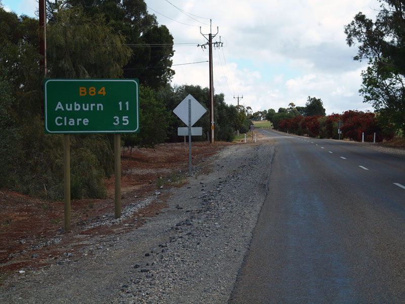
RD sign westbound on Saddleworth Road as you leave Saddleworth. Note the reference to Clare rather than Balaklava and Port Wakefield - perhaps recognition that many tourists in this area head to the Clare wine region. Source: Peter Renshaw, October 2011. |
 |
AD sign eastbound on Saddleworth Road, approaching the junction with Barrier Highway at Saddleworth. There is a short, 750m long duplex with A32 through Saddleworth before B84 continues its easterly journey. The use of smaller text for the B84 route marker is rather strange and must surely be a design error. Source: Peter Renshaw, October 2011. |
 |
ID signs at the junction of Barrier Highway & Saddleworth Road (north), Saddleworth. Source: Peter Renshaw, October 2011. |
 |
AD sign northbound on Barrier Highway approaching the junction with Saddleworth Road (north), Saddleworth. Source: Peter Renshaw, October 2011. |
 |
ID signs at the junction of Barrier Highway & Saddleworth Road (Belvidere Street), Saddleworth. Note this sign assembly shows routes B82 and B84 on two separate signs. Source: Peter Renshaw, October 2011. |
 |
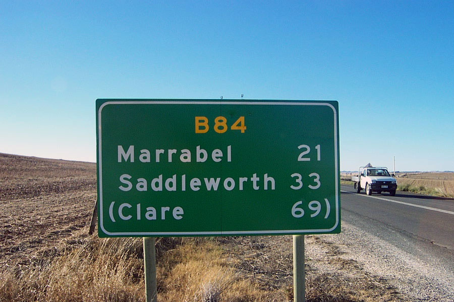
AD sign eastbound on Saddleworth Road approaching the junction with Marrabel Road, Marrabel. B84 turns right onto Marrabel, heading south through the village of Marrabel, before then turning left onto Curio Road to reach Eudunda. Source: Peter Renshaw, October 2011. |
 |
Fading, non-standard green ID sign at the junction of Marrabel Road & Saddleworth Road, Marrabel. Photo taken: January 2003. |
 |
AD sign northbound on Marrabel Road approaching Saddleworth Road, Marrabel. Source: Peter Renshaw, October 2011. |
 |
Marrabel Road looking south through the tiny village of Marrabel. Source: Peter Renshaw, October 2011. |
 |
ID signs at the junction of Marrabel Road & Curio Road, just south of Marrabel. Marrabel Road continues south to meet B81 at Kapunda. Source: Peter Renshaw, October 2011. |
 |
AD sign northbound on Marrabel Road approaching the junction with Curio Road, just south Eudunda. Note no mention of Burra for traffic going straight despite this being the focal point shown on signs for this road at Kapunda. Source: Peter Renshaw, October 2011. |
 |
The eastern-most RD sign on B84 - heading west on Curio Road from the junction with Thiele Highway at Eudunda. Photo taken: January 2003. |
 |
Older, pre-alpha-numeric AD sign assembly eastbound on Curio Road approaching the junction with Thiele Highway at Eudunda. Note the missing B81 route marker - by the looks of it, the topknot has been stolen. Photo taken: January 2003. |
 |
AD sign southbound on Thiele Highway approaching the junction with Curio Road at Eudunda, complete with accurate route marking. Photo taken: January 2003. |
Last updated 8 December 2012 © Ozroads 2003-2012. |