Murray Bridge-Mannum-Palmer |
ID sign assembly at the junction of Mannum Road & Reedy Creek Road, 3km north of Murray Bridge. Source: Peter Renshaw, October 2011.
Length: 38km
Northern Terminus: Randell Road (B35/B36) & Reedy Creek Road (B35), Palmer
Southern Terminus: Mannum Road (B35/B36) & Reedy Creek Road (B35), 3km north of Murray Bridge
Route taken: Mannum Road, Randell Road
Focal Points: Murray Bridge, Mannum, (Mt Pleasant/Birdwood)
Route B36 is essentially a loop route to the east of route B35, linking Murray Bridge with Mannum and then connecting Mannum with route B35 at Palmer.
As at October 2011, the route was still only partially signed. Signs were installed at the southern terminus, and at the junction near Mannum in 2009, however there was still no signage showing the route in Palmer. As at early 2014, new signage showing B36 has appeared in Palmer and it seems that the route is now fully signed.
Photos of route B36 (Murray Bridge to Palmer) |
|
 |
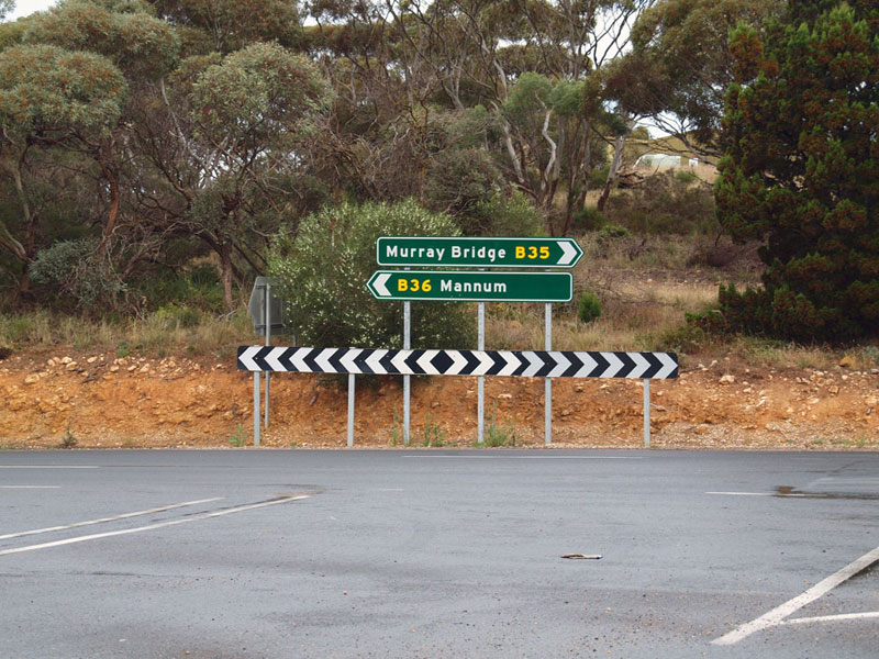
ID sign assembly, installed in 2011, at the southern terminus - the junction of Mannum Road (B35/B36) & Reedy Creek Road (B35), 3km north of Murray Bridge. Source: Peter Renshaw, October 2011. |
 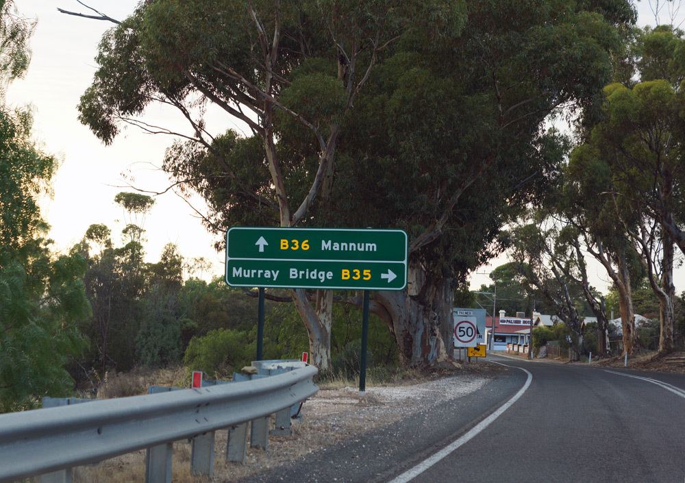 |
Ageing black AD sign assembly, pre-dating alpha-numeric route marking, eastbound on Randell Road (B35) approaching the northern terminus of the route at Palmer. B35 turns right onto Reedy Creek Road with Randell Road continuing straight ahead as B36. Bottom photo: New AD sign showing both B35 and B36, installed during 2012. |
Last updated 16 February 2014 © Ozroads 2003-2014. |