B1/A1 - PRINCES HIGHWAY
Section: Tailem Bend to Vic/SA Border

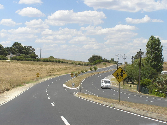
Princes Highway heading east from Mount Gambier. Jan 2005.
Length: 368km
Eastern Terminus: Vic/SA Border, 16km west of Mt Gambier
Western Terminus: Princes Hwy & Dukes Hwy, Tailem Bend
Continuation: Princes Hwy continues west to Adelaide and east to Melbourne
Focal Points: Portland, Mt Gambier, Millicent, Kingston S.E., Meningie, Tailem Bend
Route Overview:
This section of Princes Highway, from Tailem Bend southeast to the Victoria Border, is the least important section of Highway One in South Australia. So much so that part of it has even received the B1 designation - rather unusual to see Highway One defamed in such a way. Thus, between Mt Gambier and Tailem Bend the Princes Highway is B1 and east of Mt Gambier it is again A1.
Not much major work has been done on this road to speak of. It was fully sealed, albeit narrowly over much of its length, by 1955, when it gained the National Route 1 shield. The alignment in Mount Gambier was shifted onto what is known locally as Jubilee Highway (from Commercial Street) in the 1970s (not 100% sure on this one) and a deviation bypassing the town of Glencoe was constructed in the 1980s. In 1998 Transport SA replaced National Route 1 with the B1 and A1 designations, howver, many NR1 signs still remain.
A feature of the highway is the journey hugging the coastline and The Coorong between Kingston and Meningie. During 2003 and 2004 Transport SA undetook some pavement rehabilitation and shoulder widening along The Coorong making it a much more pleasant journey.
The Princes Highway has dual carriageway conditions through Mount Gambier and east to the Glenelg Highway junction.
For photos showing the former National Route 1 shield in action please see the National Route 1 page.
Notable Events:
1933 - Millicent-Kingston route constructed (previous route was via Southern Ports)
1938 - Princes Highway named
1955 - Signposted with National Route 1
1980s - Glencoe Deviation
1998 - National Route 1 replaced by B1 and A1
Photos of Princes Highway between Tailem Bend and Victoria Border |
|
 |
The beginning of the B1 at the intersection of Princes Highway and Dukes Highway at Tailem Bend. It is unusual that this sign was coverplated, but with a blank coverplate not a B1 coverplate! Jan 2005. |
 |
The end of the B1, Princes Hwy northbound approaching the Dukes Highway at Tailem Bend. Jan 2005. |
 |
Heading south from Tailem Bend. Another instance of a blank coverplate rather than a B1 coverplate being installed. Jan 2005. |
 |
Looking north from Fleurieu Way near Wellington. Jan 2005. |
 |
B1 signage at the Fleurieu Way turnoff near Wellington. Note the route numbers are all on coverplates. Jan 2005. |
 |
Looking north adjacent to The Coorong, between Salt Creek and Kingston S.E. Jan 2005. |
 |
Southbound 5km from Kingston. Jan 2005. |
 |
Heading south at the Southern Ports Highway turnoff in Kingston. Jan 2005. |
 |
And again. Jan 2005. |
 |
B1 signage on the Bordertown-Kingston Rd near Kingston. Jan 2005. |
 |
Newer, fluro coloured B1 sign near Tantanoola. Jan 2005. |
 |
Princes Hwy at the turnoff for the former highway alignment through Glencoe. Jan 2005. |
 |
Looking east on the outskirts of Mount Gambier. Jan 2005. |
 |
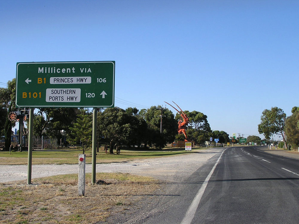
Something of a rarity, B1 signage in Millicent at the intersection with Ridge Terrace. Jan 2005. |
 |
Heading east through Millicent town centre. Jan 2005. |
 |
RD sign eastbound leaving Millicent. Jan 2005. |
 |
Rare B1 signage on Princes Highway near Tantanoola. Jan 2005. |
 |
Heading east approaching the Riddoch Highway in Mt Gambier. Jan 2005. |
 |
Riddoch Highway northbound approaching Princes Hwy. This sign shows the change from B1 to A1. Jan 2005. |
 |
Incorrect sign southbound on Riddoch Highway approaching Princes Highway. The sign should include a B66 route marker. Jan 2005. |
 |
AD sign in Mt Gambier for C192 (Pick Ave). Jan 2005. |
 |
Commercial Street East at Pick Ave in Mt Gambier showing A1 shield. Jan 2005. |
 |
Looking west between the Glenelg Highway and Mt Gambier. Jan 2005. |
 |
AD sign eastbound for the Glenelg Highway, a shorter route to Melbourne via Ballarat. Jan 2005. |
 |
Heading west at the Glenelg Highway. Jan 2005. |
 |
Heading east from the Glenelg Highway. Jan 2005. |
 |
Princes Highway westbound entering SA from Victoria near Mt Gambier. Jan 2005. |