NSW STATE ROUTE 50
Decomissioned
Lifespan: 1974-1998 (24 years)
Length: 32km
Eastern Terminus: Hume Hwy & Cabramatta Rd, Cabramatta
Western Terminus: Park Rd & Mulgoa Rd & Greendale Rd & Silverdale Rd, Wallacia
Route Names: Cabramatta Rd, Elizabeth Dr, The Northern Rd, Park Rd
Focal Points: Bankstown/Sydney, Cabramatta/Liverpool, Wallacia/Penrith
RTA Internal Classification: Main Road 534 (Cabramatta Rd), Main Road 535 (Elizabeth Dr), Main Road 154 (The Northern Rd), Main Road 155 (Park Rd)
Route Overview:
State Route 50 was a radial east-west route in Sydney's south west, passing through largely semi-rural farmland. The eastern portion of the route is the four-lane undivided Cabramatta Rd, passing through dense development and joining the 5-lane Elizabeth Drive at Bonnyrigg. Elizabeth Dr continues west as a 6-lane road till Cowapsture Rd where it reverts to its original 2-lane undivided formation. It is a great suprise that this route was decomissioned, as it provides access to the proposed Badgery's Creek Airport Site and has not been replaced by any other route number. SR50 was decomissioned in 1998, at the same time as several other western Sydney state routes were decomissioned. Two signs with the SR50 shields still exist, both at its former western terminus in Wallacia, and all along the route you can clearly see blank coverplates covering what once was SR50.
Notable events in the history of SR50:
1941 - Elizabeth Dr constructed between Hume Hwy & Wallgrove Rd
November 1971 - Cabramatta railway overpass
1974 - designated SR50
1998 - SR50 decomissioned
2000 - Elizabeth Dr 6-laned (Cabramatta Rd to Cowpasture Rd)
2003 - Elizabeth Dr 4-laned (Cowpasture Rd to Windsor Rd)
Photos pertaining to the former State Route 50 |
|
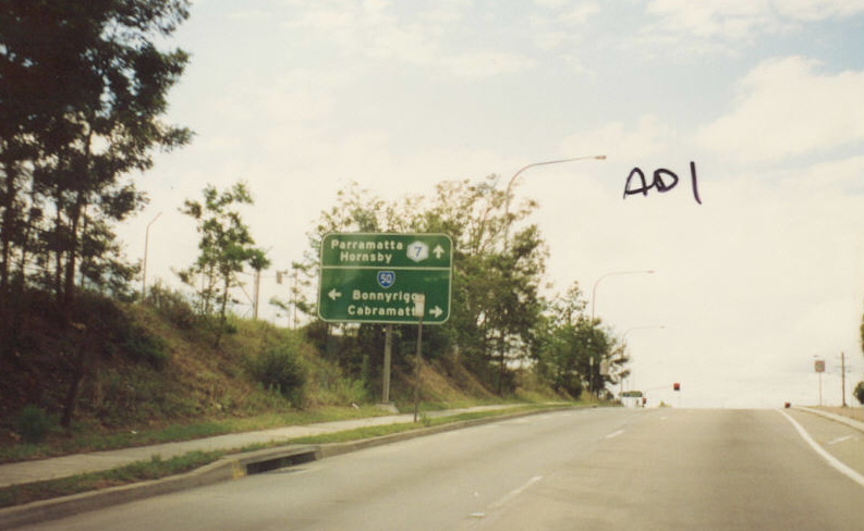
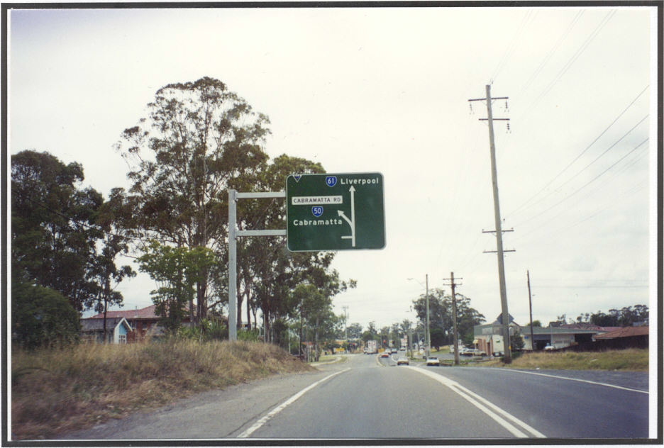
AD sign at Cumberland Highway intersection, Cabramatta. Photo taken 1994. |
|
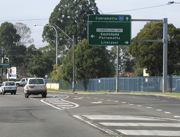
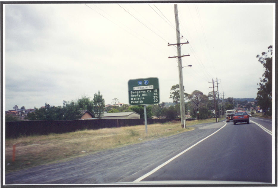
Same intersection. Photo taken 1994. |
|
 |
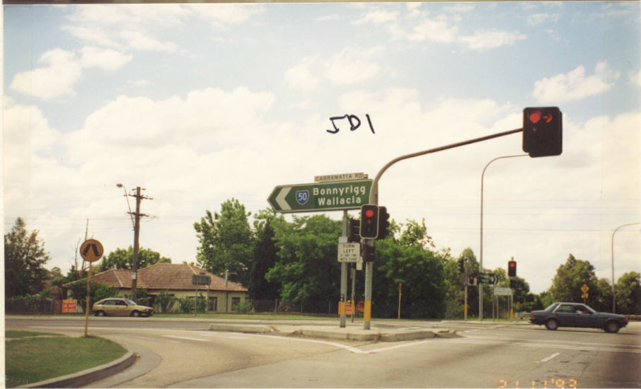
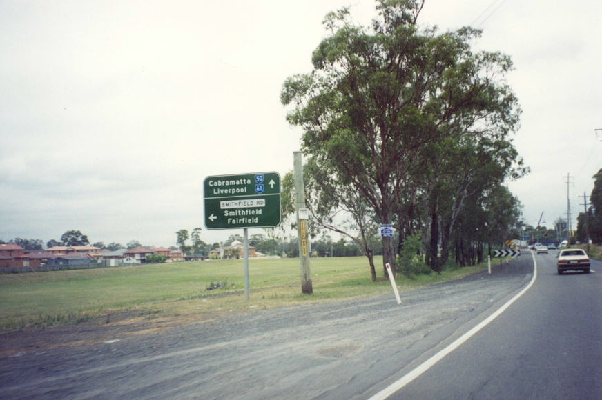
Same intersection. Photo taken 1993. |
 |
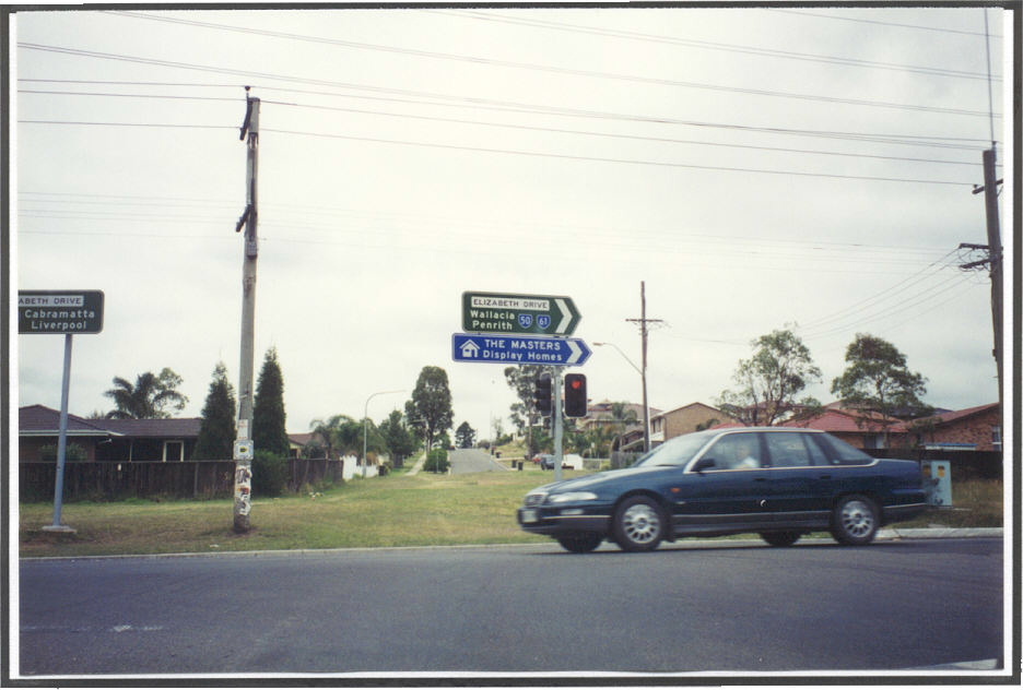
Same intersection. Photo taken 1993. |
 |
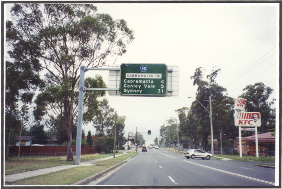
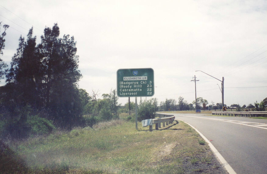
Remnant SR50 shield eastbound on Cabramatta Road approaching Cumberland Highway. June 2006. |
 |
Cabramatta Rd eastbound from Elizabeth Drive. Photo taken 1996. |
 |
Eastbound approaching the Cabramatta Rd/Elizabeth Dr intersection at Bonnyrigg. This 1996 photo shows Elizabeth Drive in its original form as a 2-lane semi-rural road. |
 |
Elizabeth Dr westbound from Cabramatta Rd, Bonnyrigg. This 1996 photo shows the former SR50/61 duplex between Cabramatta Rd and Wallgrove Rd. |
 |
Eastbound at Smithfield Rd. Photo taken 1996. |
 |
Southbound Smithfield Rd ID signs. Photo taken 1996. |
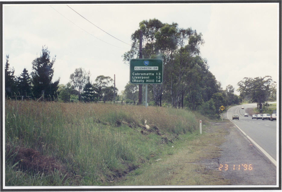 |
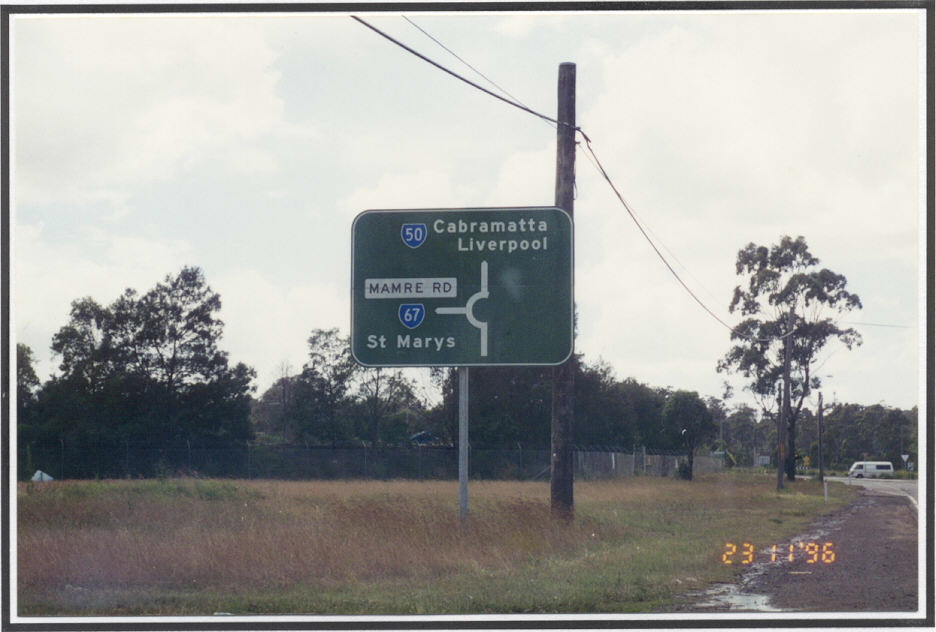
Eastbound RD sign from Mamre Rd. Photo taken 1996. |
 |
Westbound approaching Mamre Rd (former SR67). Photo taken 1996. |
 |
Southbound Mamre Rd approaching Elizabeth Dr. Photo taken 1996. |
 |
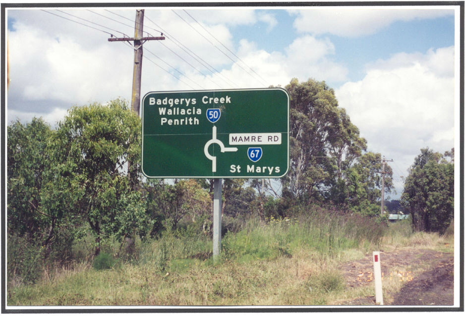
Westbound ID sign at Mamre Rd roundabout. Photo taken 1996. |
 |
Eastbound approaching Mamre Rd, Kemps Creek. Photo taken 1996. |
 |
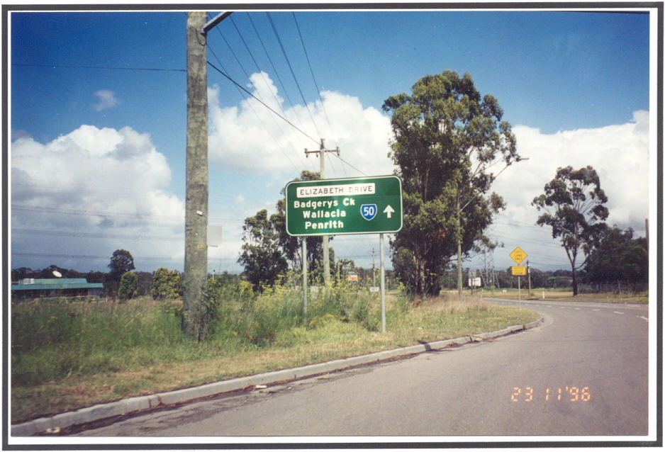
Westbound RD sign from Mamre Rd. Photo taken 1996. |
 |
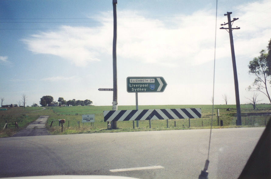
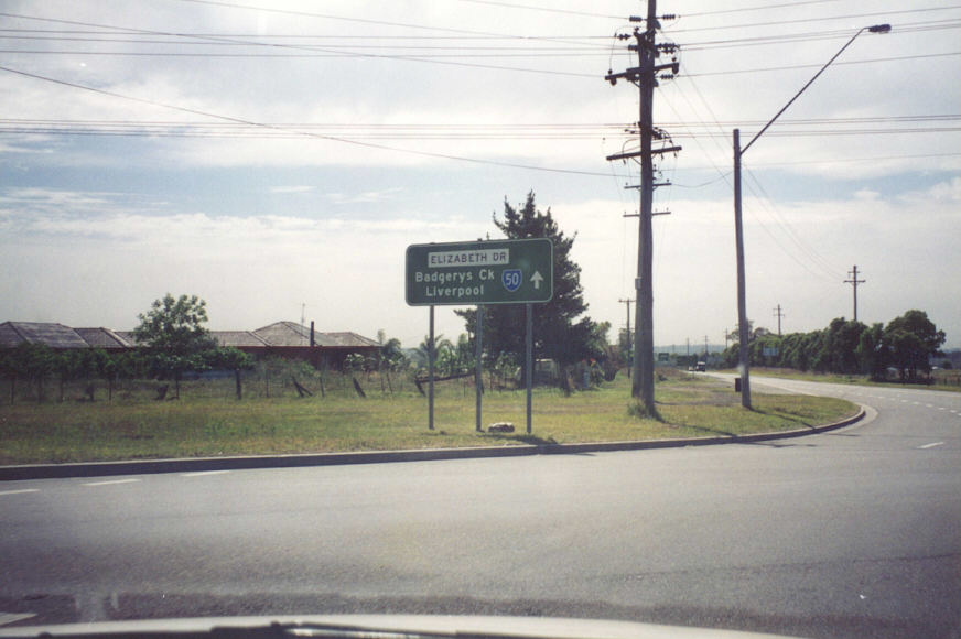
Westbound approaching Badgery's Creek Rd, Badgery's Creek. Photo taken 1996. |
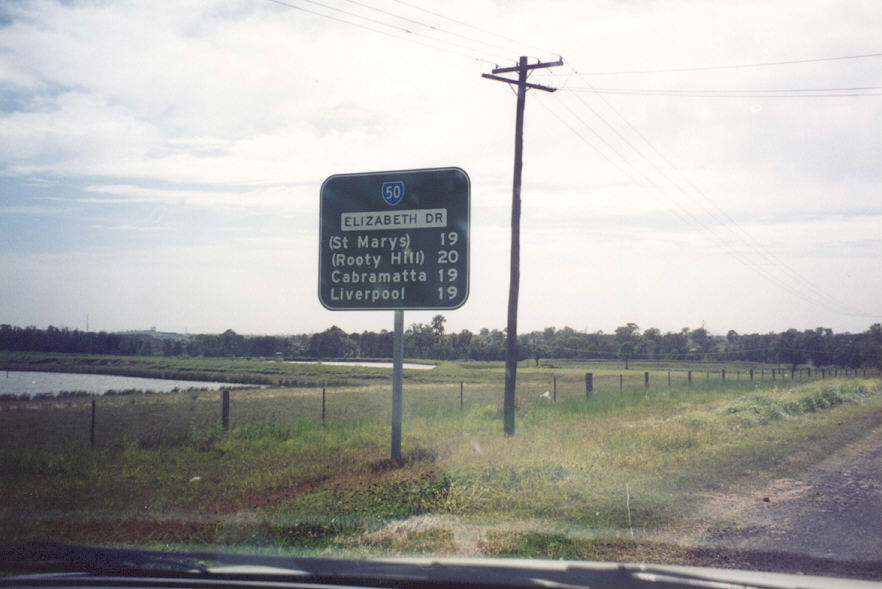 |
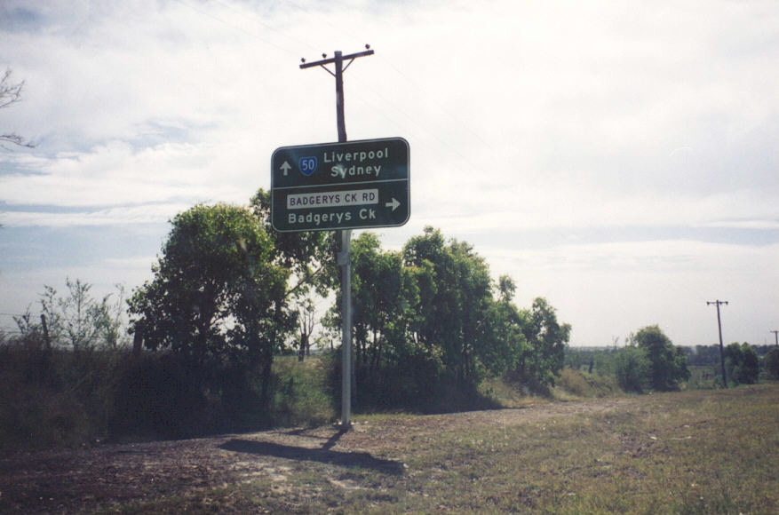
Eastbound RD sign from Badgery's Ck Rd. Note the use of parenthisis to indicate destinations that are reached via a connecting route. Photo taken 1996. |
 |
Northbound ID sign on Badgery's Ck Rd. Photo taken 1996. |
 |
Another northbound ID sign on Badgery's Ck Rd. Photo taken 1996. |
 |
Eastbound approaching Badgery's Ck Rd. Photo taken 1996. |
 |
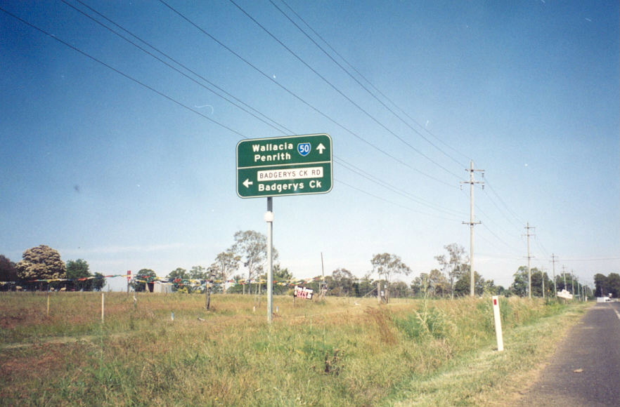
Westbound RD sign from Badgery's Ck Rd. Photo taken 1996. |
 |
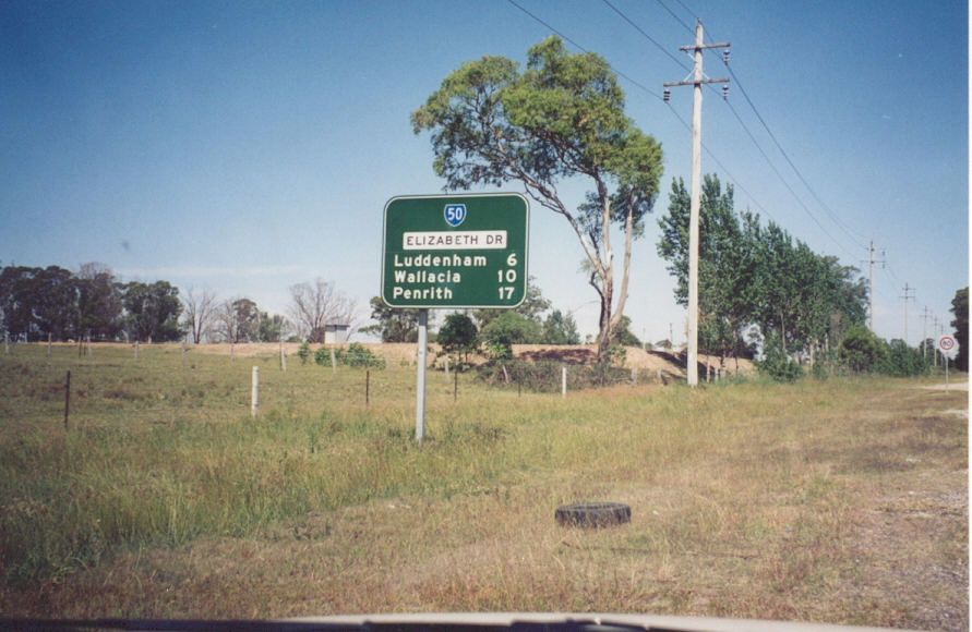
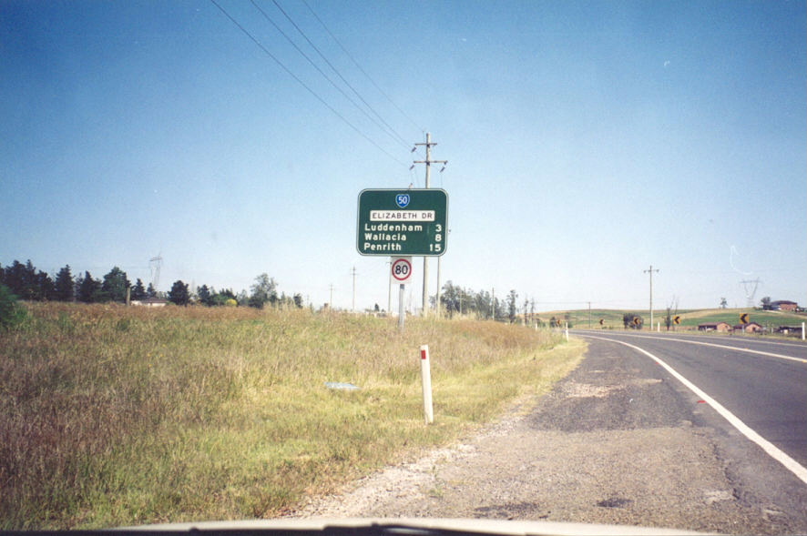
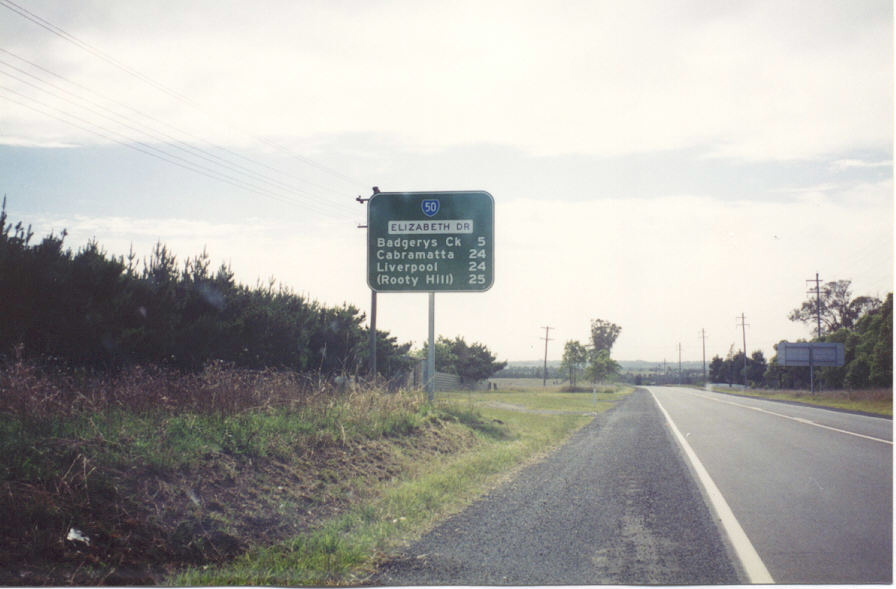
RD sign eastbound from Luddenham Rd. Photo taken 1996. |
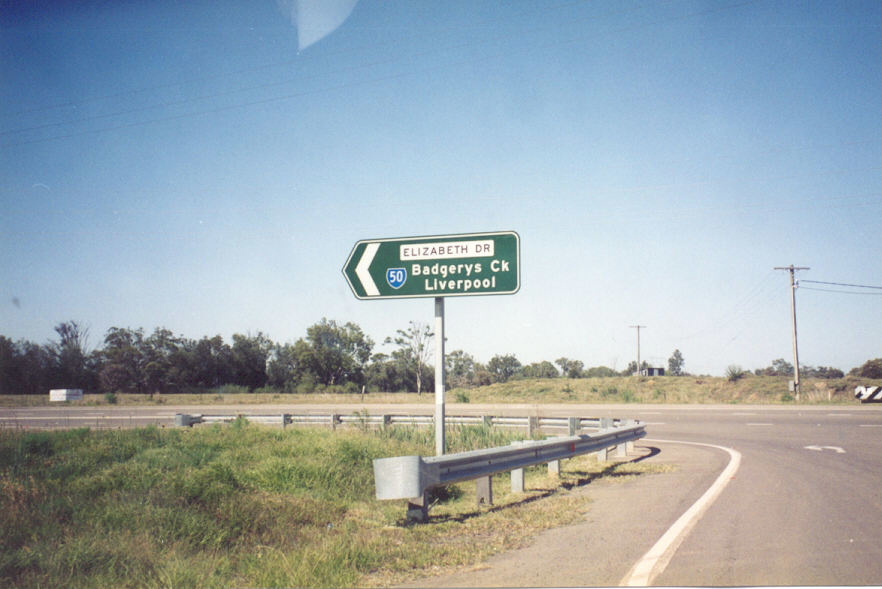 |
ID sign at Luddenham Rd, Luddenham. Photo taken 1996. |
 |
Another ID sign at Luddenham Rd. Photo taken 1996. |
 |
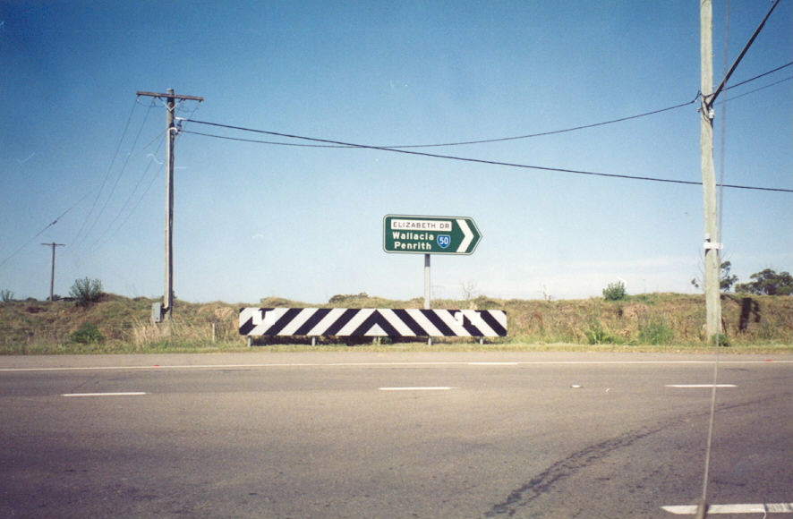
RD sign westbound from Luddenham Rd. Photo taken 1996. |
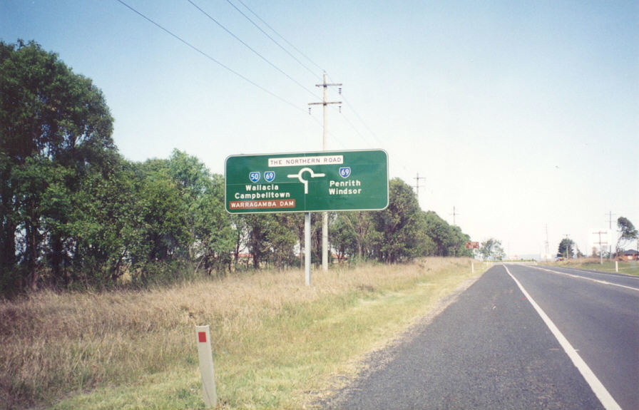 |
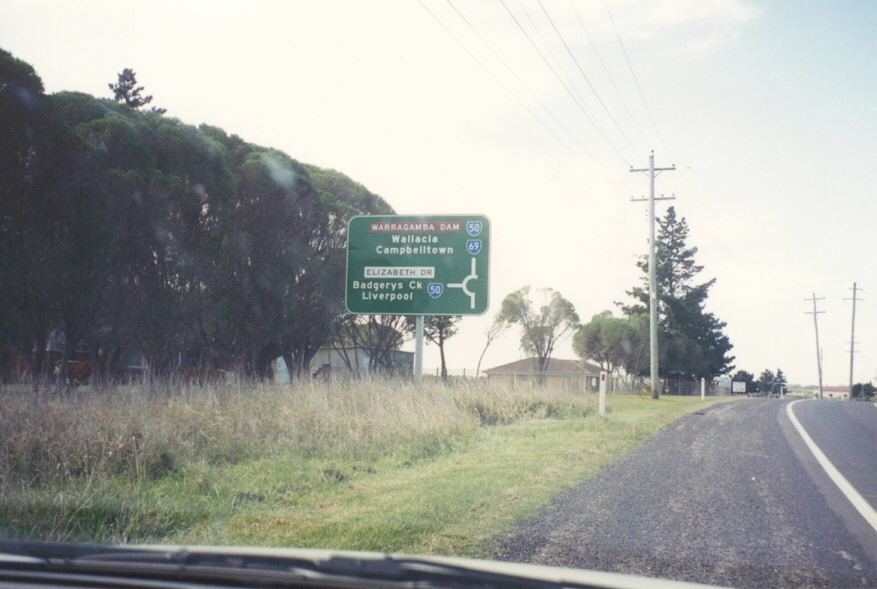
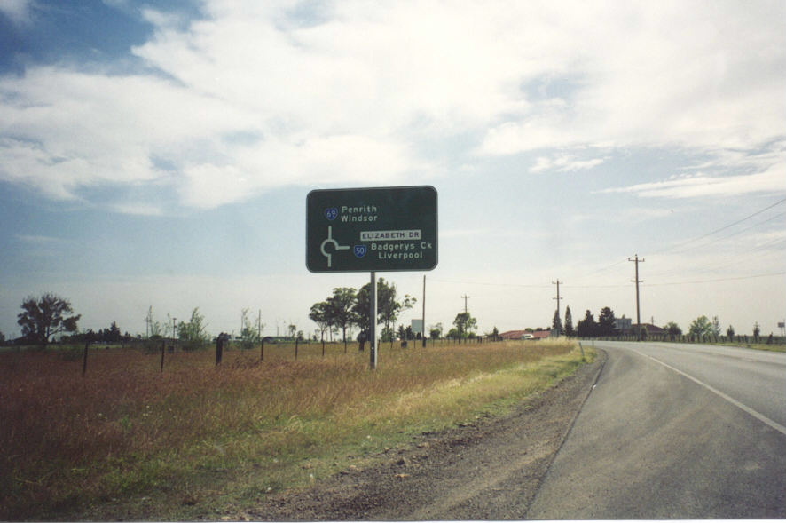
Westbound approaching The Northern Rd and the duplex with SR69 (now Metroad 9). Photo taken 1996. |
 |
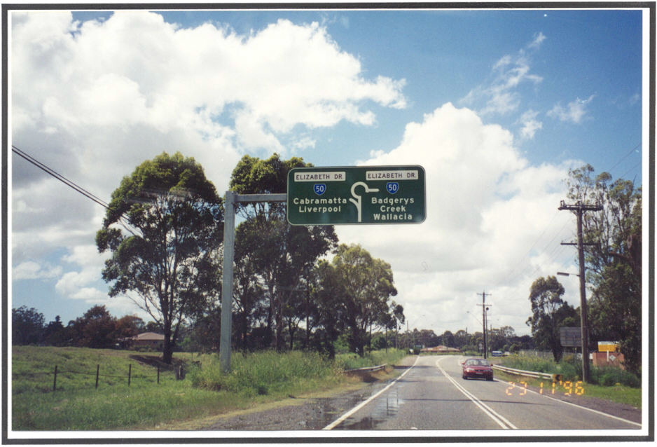
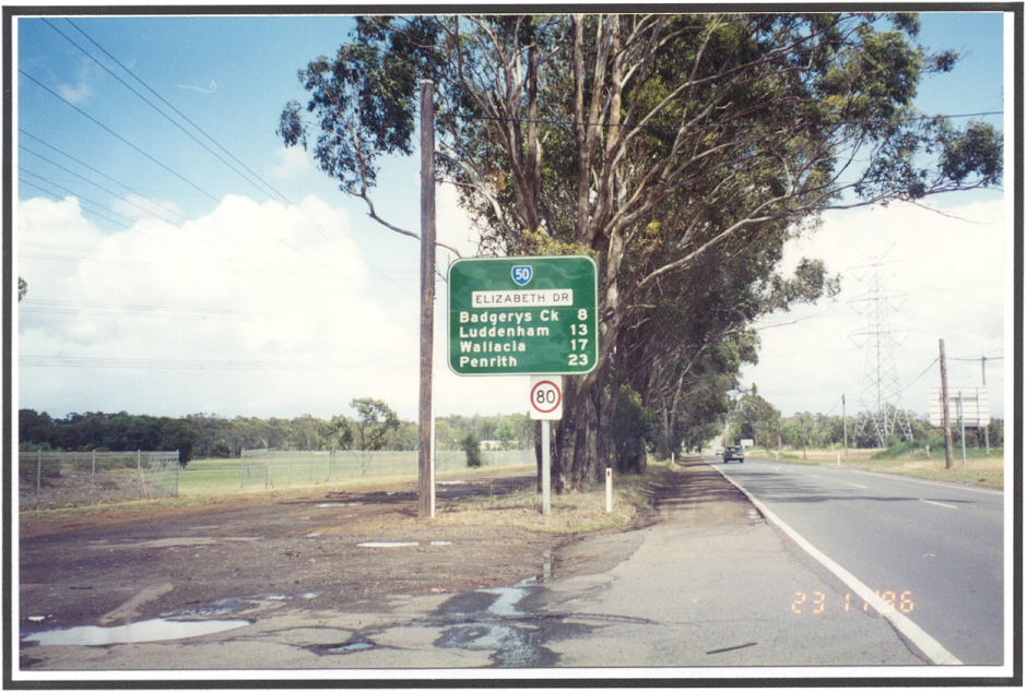
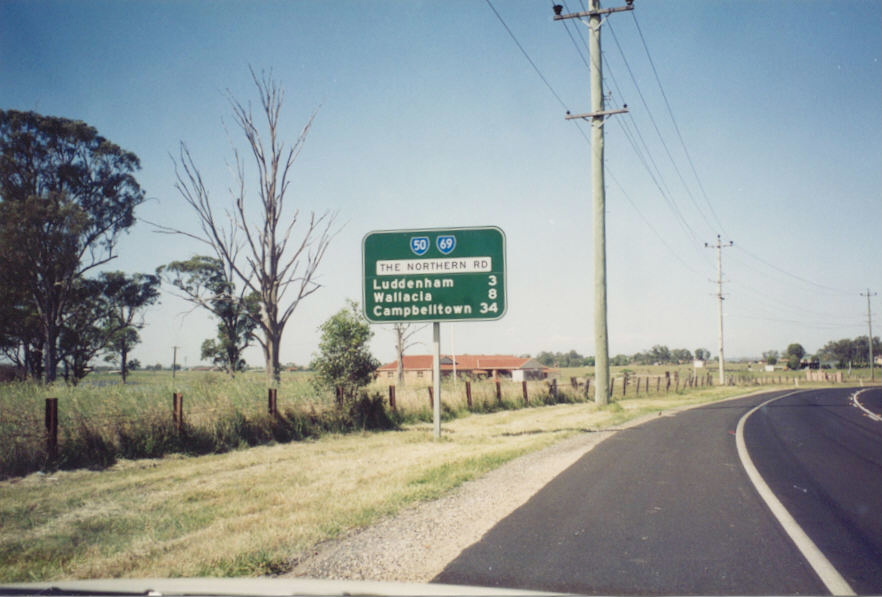
Eastbound SR50 RD sign. Photo taken 1996. |
 |
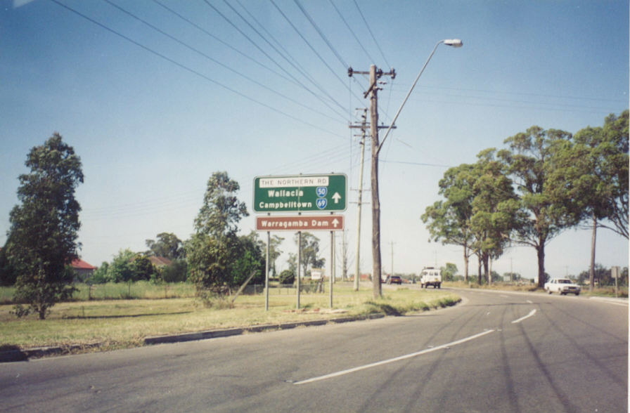
Southbound on The Northern Rd. Photo taken 1996. |
 |
ID signs at the roundabout. Photo taken 1996. |
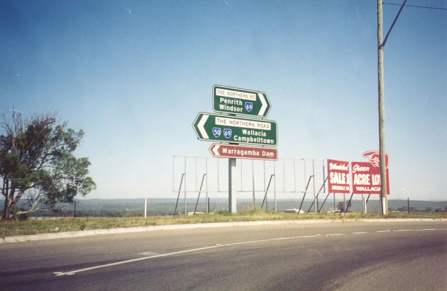 |
More ID signs at the roundabout. Photo taken 1996. |
 |
Eastbound SR50 ID sign at the roundabout. Photo taken 1996. |
 |
Northbound on The Northern Rd. Photo taken 1996. |
 |
Southbound SR50/69 duplex RD sign. Photo taken 1996. |
 |
Northbound The Northern Rd approaching Park Rd, Luddenham. Photo taken 1996. |
 |
Park Rd eastbound approaching the SR50/69 duplex. Photo taken 1996. |
 |
Park Rd ID signs at The Northern Rd. Photo taken 1996. |
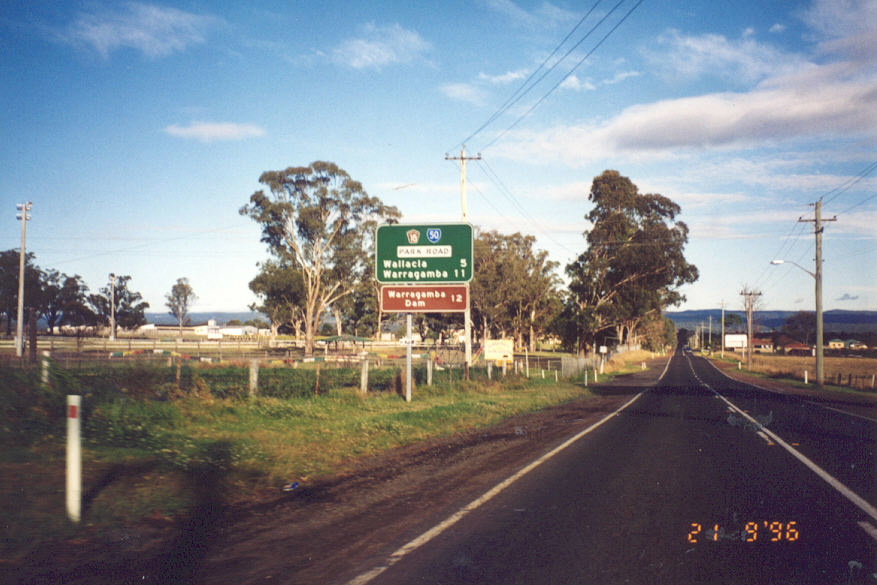 |
Park Rd RD sign. Photo taken 1996. |
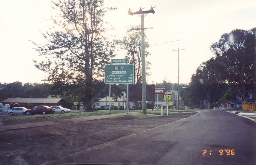 |
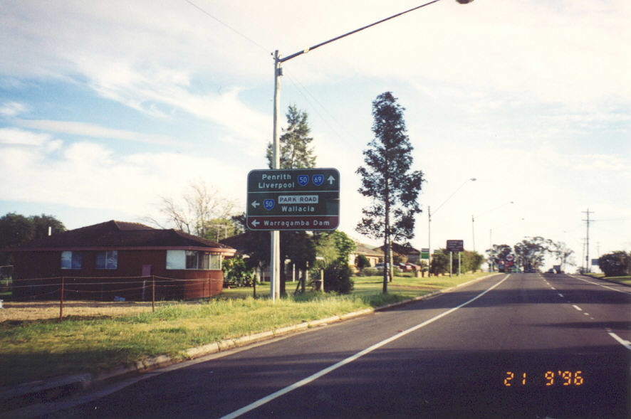
Park Rd RD sign, complete with 'START SR50' topknot. I have never ever seen that topknot on another route so it is quite a find! Photo taken 1996. |
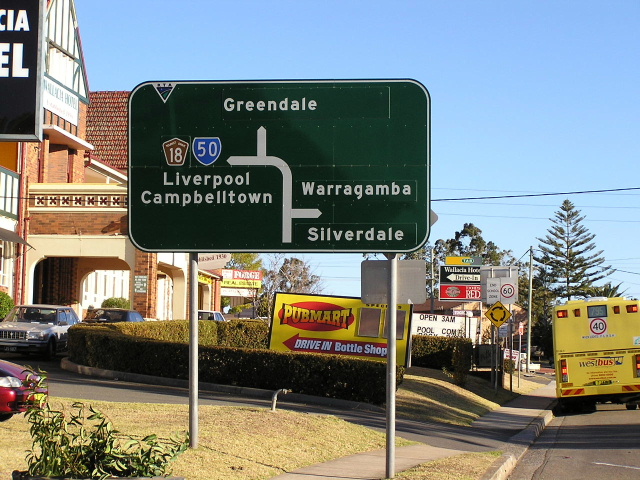 |
One of the two remaining SR50 remnants at Wallacia. Photo taken August 2004. |
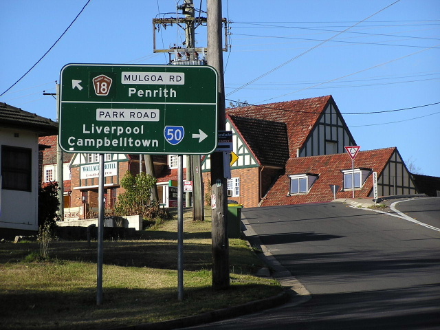 |
The other remaining SR50 remnant at Wallacia. Photo taken August 2004. |