NSW ROUTE NUMBERING:
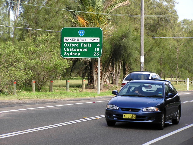
State Route 22
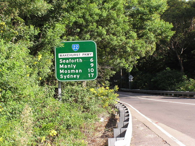
Wakehurst Pkwy (SR22) at Frenchs Forest Rd, Frenchs Forest. Photo taken April 2004
Lifespan: 1974-June 2004, 30 years
Length: 16km
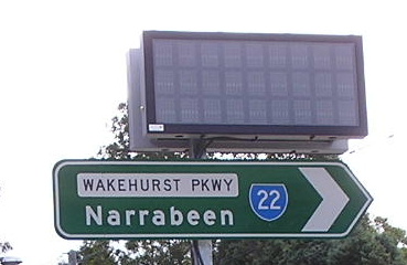
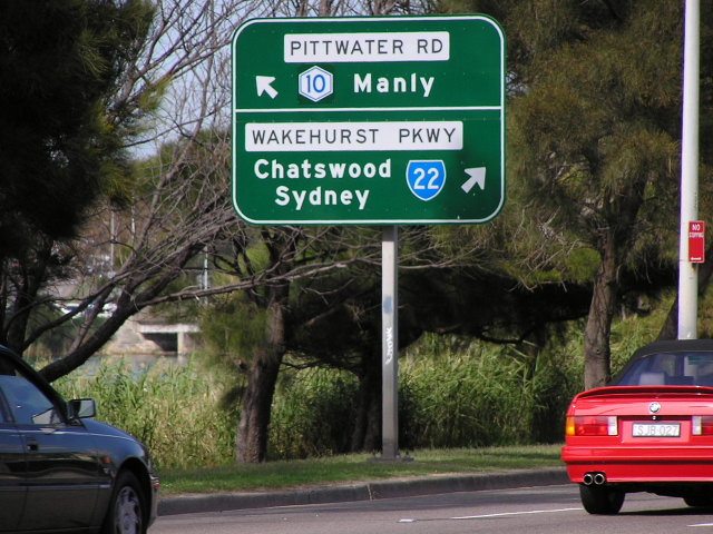
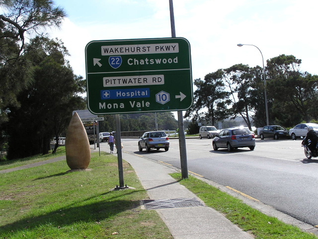
Northern Terminus: Pittwater Road (Metroad 10) & Wakehurst Pkwy, North Narrabeen
Southern Terminus: Manly Rd/Burnt Bridge Ck Deviation (Metroad 10) & Sydney Rd, Seaforth
Route Taken: From Seaforth via Sydney Rd, Frenchs Forest Rd, Clontarf St, Wakehurst Pkwy to North Narrabeen
RTA Internal Classification: Main Road No. 397
Focal Points:
Northbound: Frenchs Forest, Narrabeen
Southbound: (Chatswood/Manly), Sydney
ROUTE OVERVIEW
State Route 22 is a north-south bypass of the Warringah/Manly area on Sydney's northern peninsula. It is a mostly 2-lane route with short four-lane sections at Frenchs Forest and Seaforth, providing some peak hour-relief for Metroad 10 especially through Brookvale and Dee Why. From the southern end, State Route 22 is not signed as a through route to Narrabeen and Mona Vale due to low turning capacity from northbound Metroad 10 at Seaforth. From the northern end, State Route 22 is signposted as a through route to Chatswood and Sydney, with the northern terminus configured so State Route 22 is the through route.
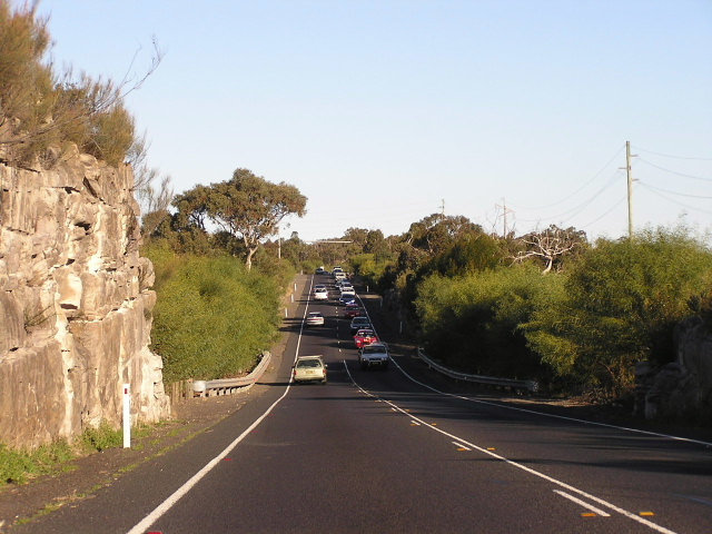
During peak hours State Route 22 often gets quite clogged, ironically its usally the four-lane sections that get clogged. North from Seaforth the route is 3 lanes to Clontarf Street where the route goes semi-rural and 2-lane all the way to Frenchs Forest. Overtaking is permitted along this straight, undulating stretch although during peak times there is way too much oncoming traffic to try and overtake, but most of the time it flows reasonably well. North of Frenchs Forest the road descends close to sea level and climbing lanes are provided (2 southbound, 1 northbound). The Wakehurst Pkwy is flood prone between Oxford Falls and North Narrabeen as it closely follows Middle Creek and Narrabeen Lagoon. Variable Message signs exist at Frenchs Forest and North Narrabeen alerting motorists of any road closures and to use alternate routes.
The majority of the route (Wakehurst Parkway) was constructed new in the 1940's as employment relief. The project was approved in October 1939 and work was progressing well until in March 1942 work was stopped because of the war. Construction was recommenced following the end of the war in March 1945 and opened to traffic in March 1946. The name comes from the Governor of NSW (April 1937-January 1946), Lord Wakehurst, who passed away in January 1946.On a side-note, his wife, Lady Wakehurst, had a road named after her in the Royal National Park, south of Sydney.
The remainder of the route around Seaforth was taken from upgraded residential streets.
Following the unveiling of the County of Cumberland Planning Scheme (1951), Wakehurst Parkway looked destined for bigger and better things. It was proposed that the Wakehurst become the main road to the City from the Northern Beaches via a Warringah Freeway extension to Seaforth. An EIS was even completed in 1963 regarding proposed grade-separation of the Warringah Road intersection. Ultimately, nothing came of these plans, with the Neville Wran Government in February 1977 cancelling all future extensions of the Warringah.
In 1973, the first state routes were rolled out by the Department of Main Roads. The Wakehurst Parkway was given its 'State Route 22' designation a year later. Since then there has been little change to the road itself, until June 2004 when it was decomissioned as part of a wave of decomissionings, brought on by the imminent conversion to alpha-numeric route numbering in New South Wales. Sadly this route will no longer have a number as part of the new system......So sit back and enjoy the photographic chronicle below.
 |
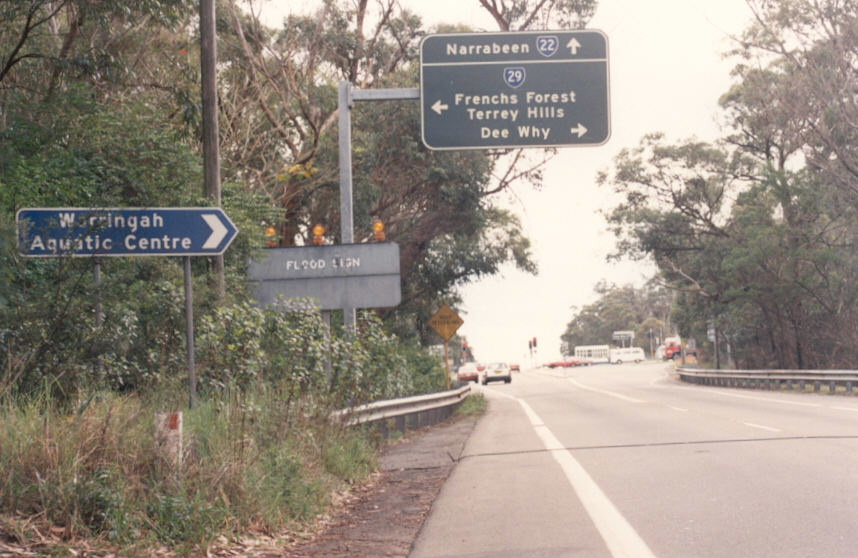
Pittwater Rd southbound approaching Wakehurst Parkway at North Narrabeen. April 2004. |
 |
Pittwater Rd northbound approaching Wakehurst Pkwy. April 2004. |
 |
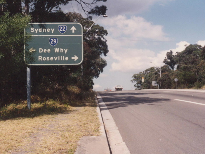
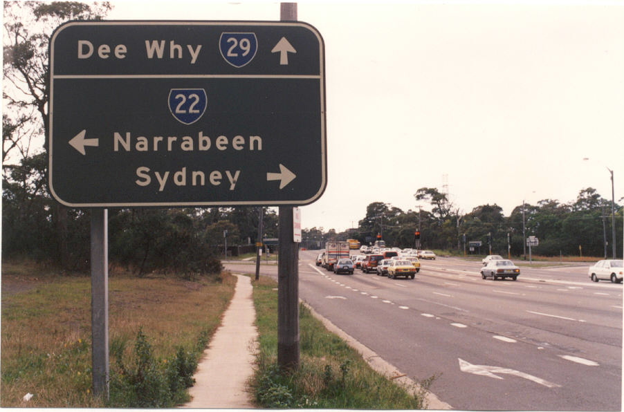
Wakehurst Pkwy approaching the end of SR22 at Pittwater Rd. April 2004. |
 |
The first southbound RD sign on SR22 from Pittwater Rd. April 2004. |
 |
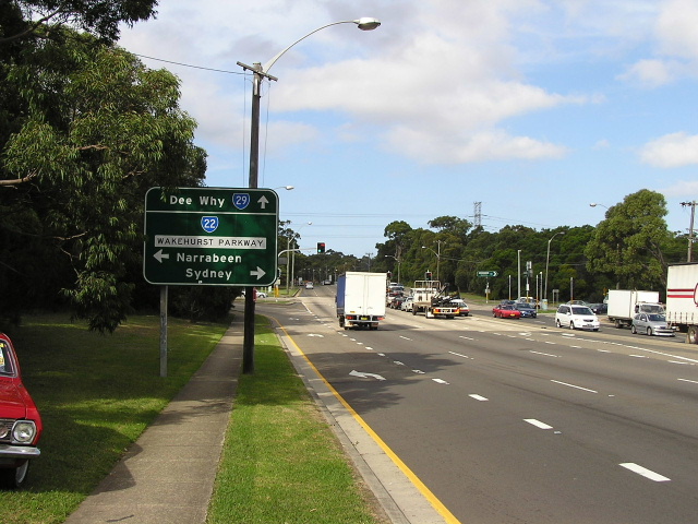
Looking west alongside Narrabeen Lakes near the NSW Academy of Sport. June 2004. |
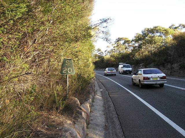 |
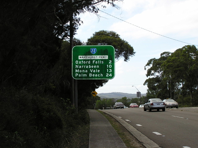
Old 'S20' kilometre plate southbound near Oxfords Falls Road. June 2004. |
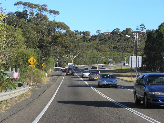 |
Looking south towards Dreadnought Rd at Oxford Falls. June 2004. |
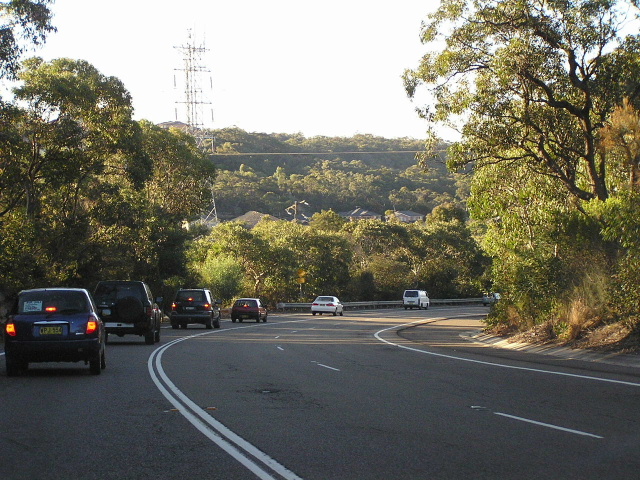 |
Looking north as you descend from Frenchs Forest towards Oxford Falls. June 2004. |
 |
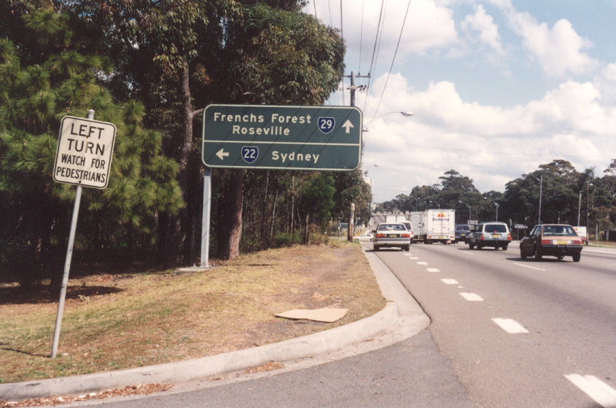
Old black AD sign, probably installed in 1974, southbound appraoching Warringah Rd. 1991. |
 |
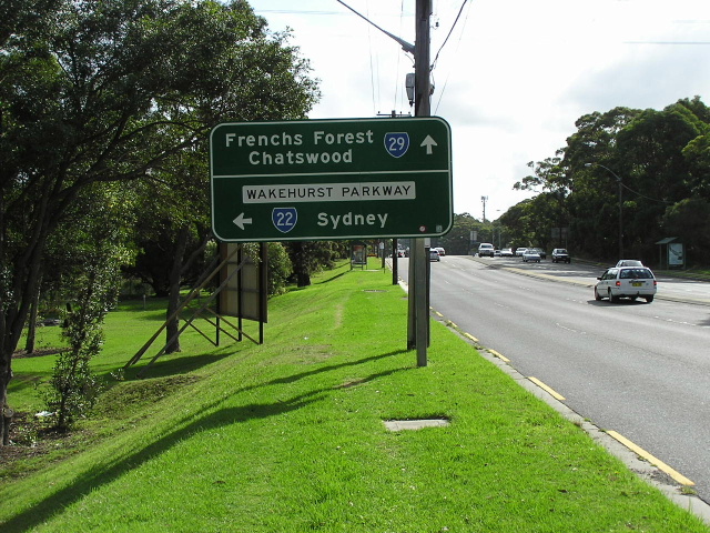
This sign replaced the one in the above photo. April 2004. |
 |
RD sign northbound from Warringah Rd. April 2004. |
 |
Another old black AD sign, this time westbound on Warringah Rd. 1991. |
 |
This sign replaced the sign in the above photo. April 2004. |
 |
Another old black AD sign, this time northbound on Wakehurst Pkwy approaching Warringah Rd. 1991. |
 |
More black AD signs, this eastbound on Warringah Rd. 1991. |
 |
Warringah Rd eastbound approaching Wakehurst Pkwy. April 2004. |
 |
Black ID sign at the same intersection. 1991. |
 |
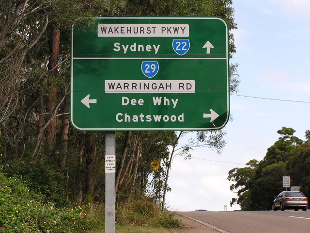
RD sign southbound from Warringah Rd. April 2004. |
 |
Looking south between Frenchs Forest and Seaforth. On the left is Manly Dam Reserve and on the right is Garigal National Park. June 2004. |
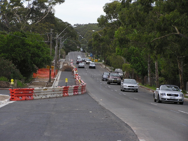 |
Looking north along Wakehurst Parkway from Castle Cct at Seaforth, showing widening work underway. Dec 2005. |
New, post-SR22, ID sign installed during 2005 at the intersection of Frenchs Forest Rd & Clontarf St. Dec 2005. |
|
 |
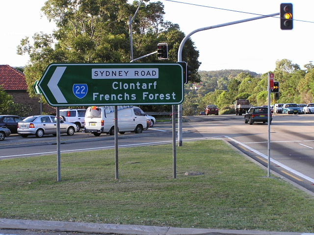
ID sign at the Sydney Rd/Frenchs Forest Rd intersection. Sep 2003. |
 |
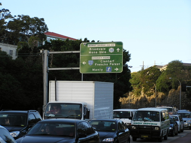
Sydney Rd heading east towards the Metroad 10 junction and the end of SR22. Sep 2003. |
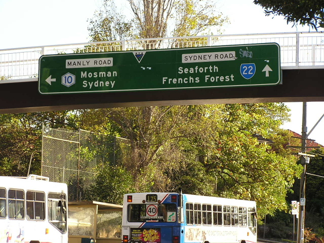 |
Unusual style of AD sign mounted on the footbridge crossing Sydney Rd outside the former Balgowlah Boys High School. April 2004. |
 |
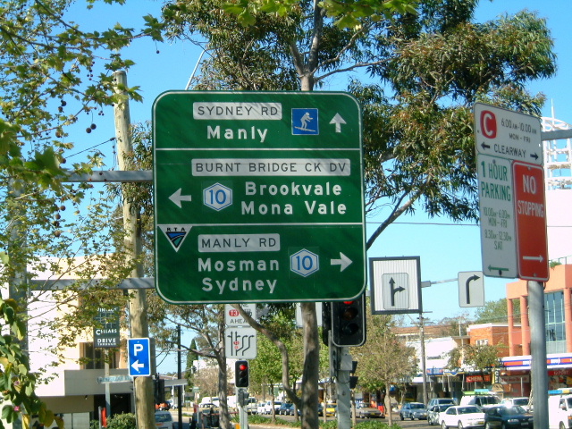
Manly Rd northbound approaching Sydney Rd. April 2004. |
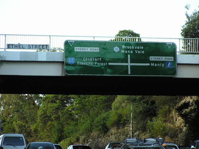 |
Unusual diagrammatic sign for northbound Manly Rd traffic on the Ethel St overpass. April 2004. |
 |
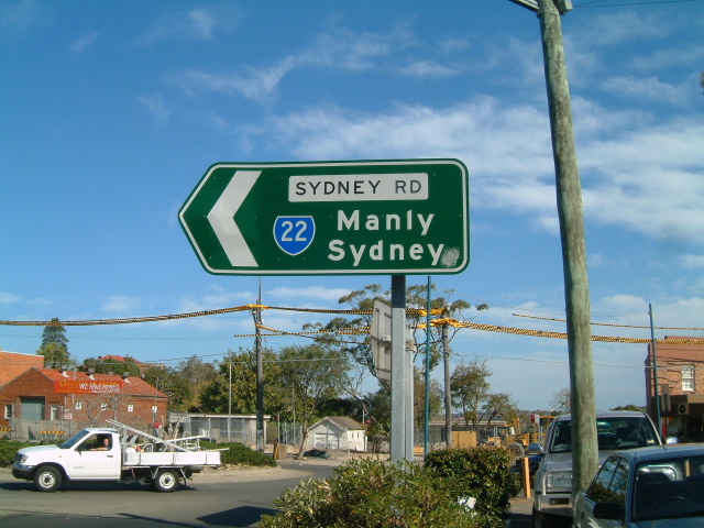
ID sign marking the start of SR22 at Seaforth. April 2004. |
Back to NSW Decommissioned Routes