NSW STATE ROUTE 21
Decomissioned
Lifespan: 1974-2004 (30 years)
Length: 10km
Northern Terminus: Epping Rd & Centennial Ave, Lane Cove West
Southern Terminus: Parramatta Rd & Gt North Rd, Five Dock
Route taken: Great North Rd, Lyons Rd, Bayswater St (nb)/Marlborough St (sb), Westbourne St, Victoria Rd, Burns Bay Rd, Centennial Ave
Focal Points: Parramatta, Five Dock, Drummoyne, Gladesville/Hunters Hill, Lane Cove, Willoughby
RTA Internal Classification: Main Road 395 (Gt North/Lyons/Marlborough/Bayswater/Westbourne), Main Road 165 (Victoria), Main Road 166 (Burns Bay/Centennial)
Route Overview:
State Route 21 was a circumferential route through Sydneys inner north/west. It consisted mainly of four-lane undivided roads, with a short freeway-grade section from Drummoyne to Lane Cove. Proclaimed in 1974, SR21 initially stretched from Five Dock to SR26 - Eastern Valley Way at Castlecrag. The DMR's "Schedule of descriptions of State Routes" provides this description of SR21 in June 1982: "From to the junction of Secondary Road No. 2092 [Edinburgh Rd] and Main Road No. 599 [Eastern Valley Way] at Willoughby, then via Secondary Road No. 2092 [Edinburgh Rd/Alpha Rd/Mowbray Rd/Centennial Ave], Main Road Nos. 166, 165 and 395 to the junction with State Highway No. 5 at Five Dock with a possible future extension." This possible future extension is news to me, and seeing as SR21 went as far north/east it could, my guess is that any extension would have been southerly, through Ashfield on Frederick St most likely. This plan never came to fruition.
In 1995, the RTA decided to decomission a large chunk of SR21 between Lane Cove West and Castlecrag along council-owned roads. In June 2004, SR21 was fully decomissioned and all traces of the route have been removed, apart from blank coverplates on may direction signs. I was fortunate enough to have explored this route only months before it was decomissioned, and the pictures can be seen below.
Notable events in the history of SR21:
1882 - Old Lane Cove River Bridge on Joubert St, Hunters Hill
June 1930 - Burns Bay Rd reconstruction in cement concrete completed
September 1963 - Fig Tree Bridge across Lane Cove River, Hunters Hill
October 1964 - Gladesville Bridge opened to traffic
December 1965 - Tarban Creek Bridge (full use of freeway section from Drummoyne to Lane Cove)
1974 - SR21 proclaimed from Five Dock to Castlecrag
1995 - SR21 truncated at Lane Cove West
2004 - Five Dock shops reconstruction
June 2004 - SR21 fully decomissioned
Further reading (on-site):
Gladesville/Tarban Creek/Fig Tree Bridges
Photos of State Route 21 |
|
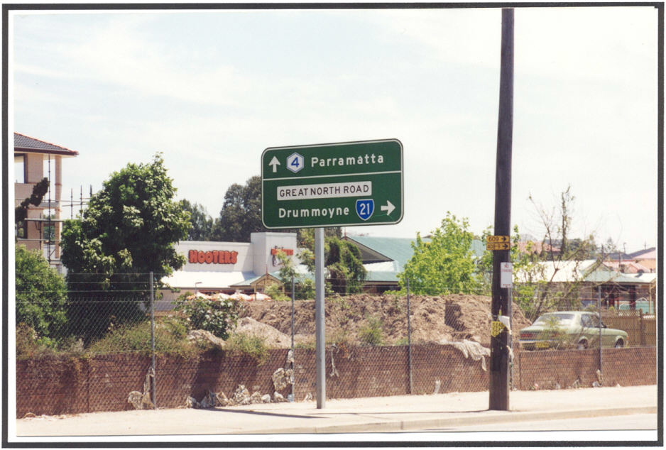 |
Parramatta Rd westbound approaching Gt North Rd, Five Dock. Photo taken 1997. This sign has since been removed. |
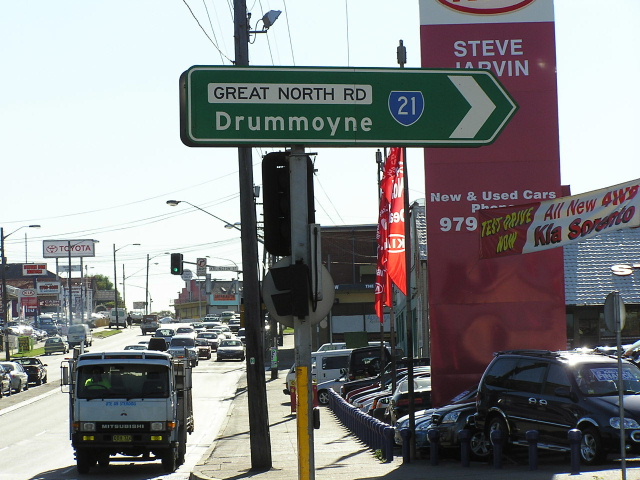 |
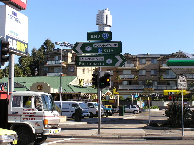
Parramatta Rd & Gt North Rd, Five Dock. Photo taken May 2004. |
 |
Parramatta Rd & Gt North Rd, Five Dock. Photo taken May 2004. |
 |
Parramatta Rd & Gt North Rd, Five Dock. Photo taken May 2004. |
 |
Elusive 'END SR21' sign at Parramatta Rd & Gt North Rd, Five Dock. Photo taken May 2004. |
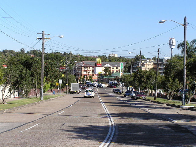 |
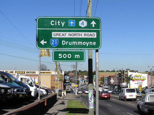
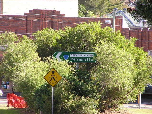
Great North Rd looking south to Parramatta Rd, Five Dock. Photo taken May 2004. |
 |
Great North Rd again looking south to Five Dock shops. Photo taken May 2004. |
 |
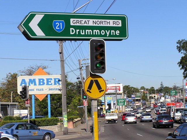
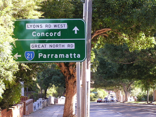
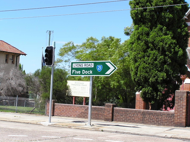
Great North Rd & Lyons Rd, Five Dock. Photo taken May 2004. |
 |
Great North Rd & Lyons Rd. Photo taken May 2004. |
 |
Great North Rd & Lyons Rd. Photo taken May 2004. |
 |
Great North Rd & Lyons Rd. Photo taken May 2004. |
 |
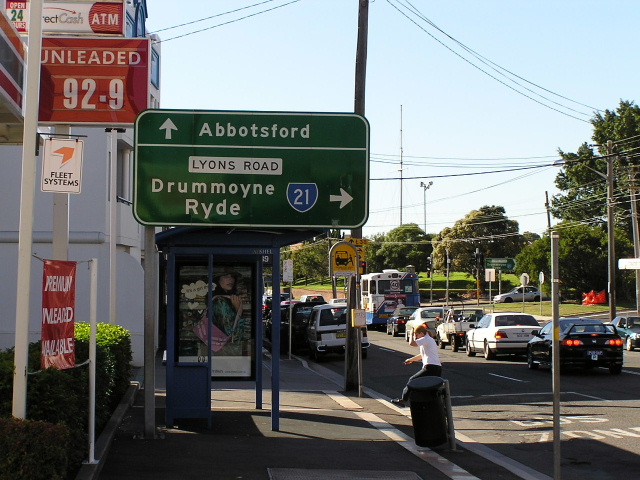
Lyons Rd & Hampden Rd, Russell Lea. Photo taken May 2004. |
 |
Lyons Rd & Bayswater St, Drummoyne. Photo taken May 2004. |
 |
Lyons Rd & Bayswater St, Drummoyne. Photo taken May 2004. |
 |
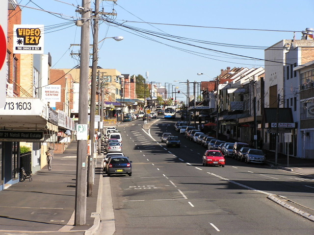
Looking south on Lyons Rd in Drummoyne. Photo taken May 2004. |
 |
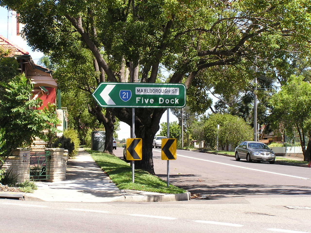
Victorian-style ID sign at Lyons Rd & Marlborough St, Drummoyne. Photo taken May 2004. |
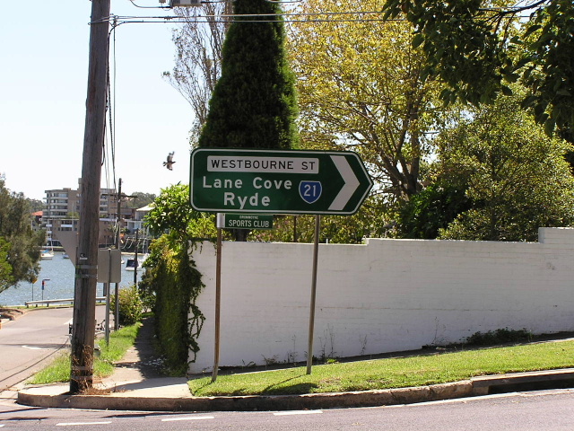 |
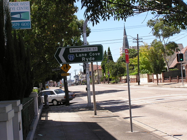
Westbourne St & Bayswater St, Drummoyne. Photo taken May 2004. |
 |
Westbourne St & Marlborough St, Drummoyne. Photo taken May 2004. |
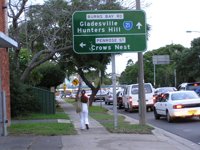 |
Burns Bay Rd & Penrose St, Lane Cove. Photo taken March 2004. |
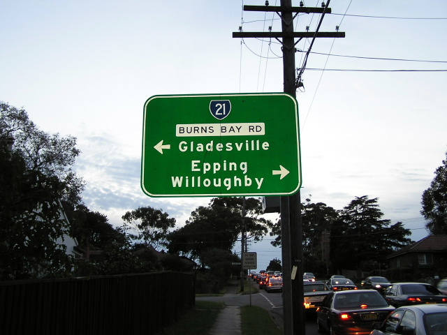 |
Burns Bay Rd & Penrose St, Lane Cove. Photo taken March 2004. |
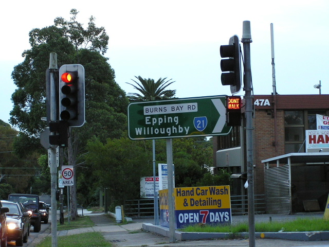 |
Burns Bay Rd & Penrose St, Lane Cove. Photo taken March 2004. |
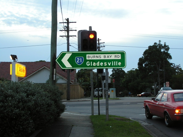 |
Burns Bay Rd & Penrose St, Lane Cove. Photo taken March 2004. |
 |
Burns Bay Rd & Centennial Ave, Lane Cove. Photo taken March 2004. |
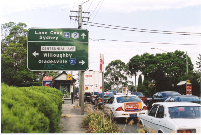 |
The 1995-2004 northern terminus of SR21: Epping Rd at Lane Cove West. Photo taken March 2003. |
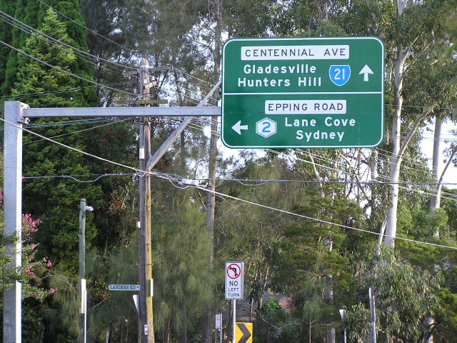 |
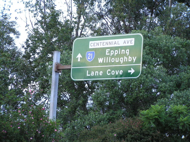
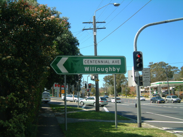
Centennial Ave & Epping Rd, Lane Cove West. Photo taken March 2004. |
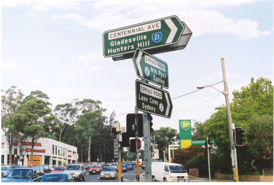 |
Centennial Ave & Epping Rd, Lane Cove West. Photo taken March 2003. |
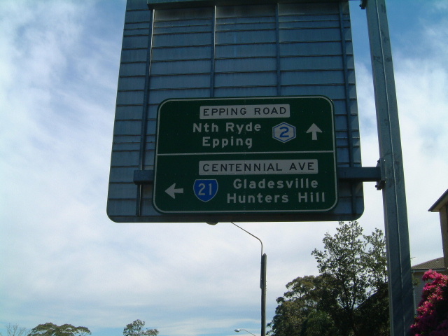 |
Centennial Ave & Epping Rd, Lane Cove West. Photo taken September 2003. |
 |
Centennial Ave & Epping Rd, Lane Cove West. Note the blank coverplate over SR21 shield for straight ahead. Photo taken September 2003. |
 |
Centennial Ave & Epping Rd, Lane Cove West. Note the blank coverplate over SR21 shield. Photo taken September 2003. |
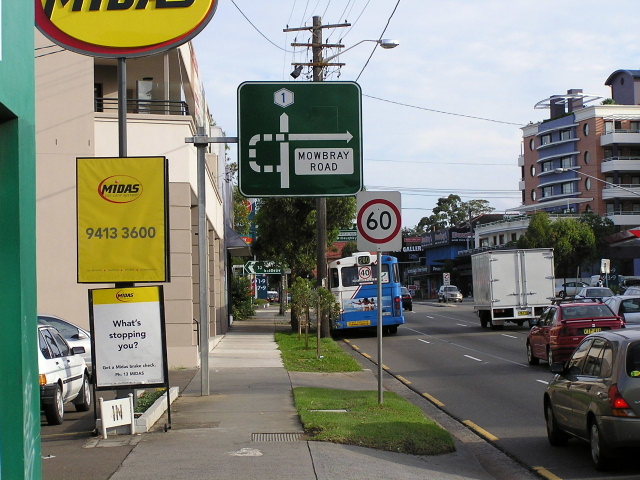 |
Pacific Hwy & Mowbray Rd, Chatswood. Note the blank coverplate over SR21 shield. Photo taken March 2004. |
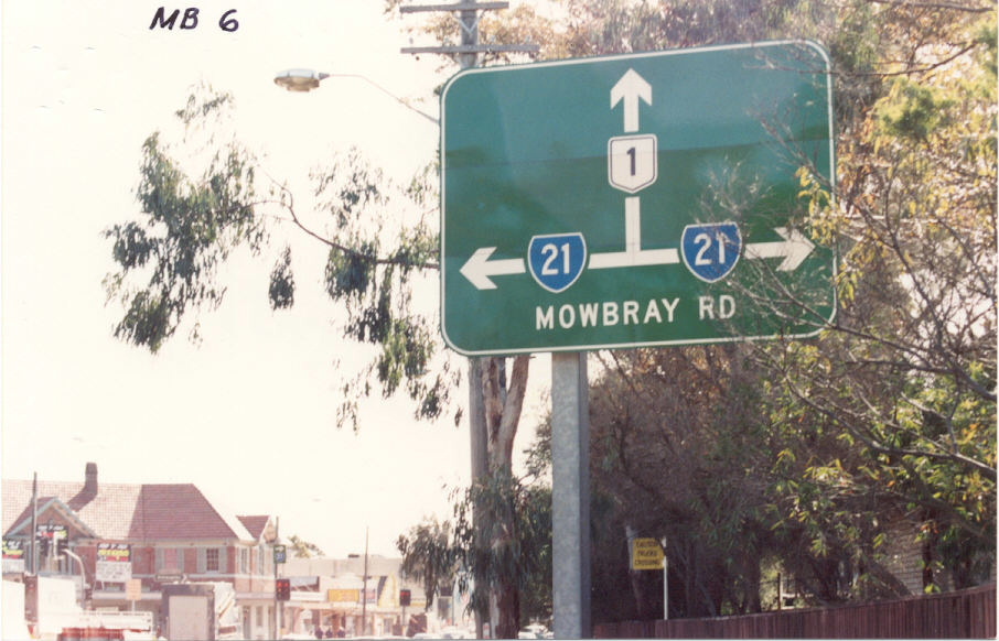 |
Pacific Hwy & Mowbray Rd, Chatswood. Note the strange-style AD sign with obsolete NR1 shield and SR21 shield on fomrer alignment. Photo taken c. 1990.. |
Pacific Hwy & Mowbray Rd, Chatwsood. Note same features as above photos. Photo taken c.1990. |
|