Former State Route 12 Balgowlah - Manly - Dee Why |
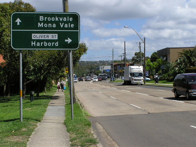
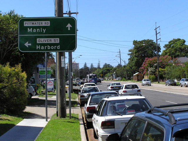
AD sign north-westbound on Pittwater Rd approaching Oliver St, Harbord, showing blank coverplate over State Route 12 shield. Jan 2006.
Lifespan: 1974-1995 (21 years)
Length (1995): 7km
Northern Terminus (1995): Pittwater Rd & Condamine St, North Manly
Southern Terminus: Sydney Rd & Manly Rd & Burnt Bridge Creek Deviation, Seaforth
Route taken (1995): Sydney Rd, Belgrave St, Pittwater Rd
Focal Points: Sydney, Manly, Brookvale
RTA Internal Classification (current): Main Road No. 159
Route Overview:
State Route 12 was a short northern beaches route, forming a loop from State Route 14 for access to the popular Manly and the beachside areas north to Dee Why. It was introduced in 1974, along with most of the NSW State Route system, although comprehensive signage may not have appeared for several years after this date.
State Route 12’s main purpose was twofold; firstly to provide a link from State Route 14 to Manly; and secondly to link Manly and Dee Why and the beaches between them.
Upon introduction in 1974, State Route 12 branched from State Route 14 at the intersection of Sydney Rd & Condamine Rd, Balgowlah, (State Route 14 at that time went via Sydney Rd and Condamine St as the Burnt Bridge Creek Deviation was not yet constructed), entering Manly via Sydney Road. At Manly, State Route 12 turned north onto Belgrave Street, continued along Pittwater Road to Harbord, thence turning onto Oliver Street and following the route of Bennet St, Adams St, Griffin Rd, The Strand and Howard Ave to rejoin State Route 14 in Dee Why.
The Department of Main Roads’ Schedule of Descriptions of State Routes from 1st July 1982 provides the following description of State Route 12:
“From the junction of Main Road Nos. 159 (Sydney Rd) and 164 (Sydney Rd/Condamine St) at Balgowlah, then via Main Road Nos. 159 (Sydney Rd, Belgrave St & Pittwater Rd) and 530 (previously mentioned route through Harbord & Curl Curl) to the junction with Main Road No. 164 (Pittwater Rd) at Dee Why.”
The first change to the alignment of State Route 12 came in March 1985 with the opening of the Burnt Bridge Creek Deviation. State Route 14 was relocated from Condamine Street and Sydney Road onto the new road and State Route 12 was extended 1.5km west along Sydney Road to meet it.
The second, and most significant, change came in 1993 when responsibility of the Oliver St/Bennett St/Adams St/Griffin Rd/The Strand/Howard Ave section of the route was transferred from the Roads and Traffic Authority to Warringah Council. State Route 12 was relocated from its original route to follow Pittwater Road all the way to its junction with Condamine Street at Brookvale. This removed the second component of its original purpose, relegating the route to a simple loop route serving Manly.
Even this relocation did not last very long, as State Route 12 was decommissioned soon afterwards. I estimate to the year of decommissioning to be 1995, as signs at the Sydney Rd/Manly Rd/Burnt Bridge Creek Deviation intersection appeared in 1994 still showing the State Route 12 shield, yet SR12 disappeared soon afterwards. If you can provide a more reliable date of decommissioning please let me know. (Contact details on home page)
There are no surviving State Route 12 shields that I have been able to find, and I have searched the route fairly comprehensively. However, there are several signs still showing a blank coverplate over a State Route 12 shield remaining on Pittwater Road, some of which are shown in the photos section. On the original route through Harbord, Curl Curl and Dee Why there aren’t even any directional signs left!
Notable events in the history of SR12:
1974 - State Route 12 introduced along original route via Manly, Harbord, Curl Curl to Dee Why
1985 - State Route 12 extended from Balgowlah west to Seaforth, a distance of 1.5km
1993 - Major relocation of State Route 12 onto Pittwater Rd between Harbord and Brookvale
1995 - State Route 12 decommissioned
Photos of former State Route 12 |
|
 |
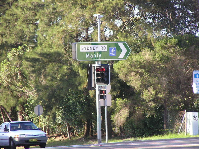
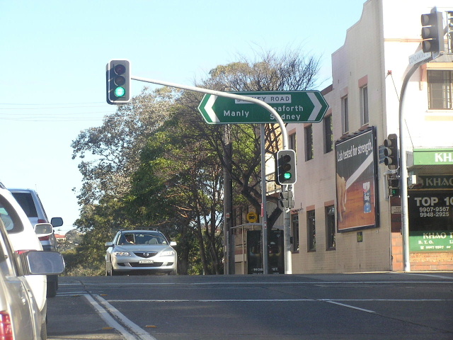
AD sign eastbound on Sydney Rd at Seaforth, approaching Manly Rd and Burnt Bridge Creek Deviation. The surfer symbol covers the former State Route 12 shield. April 2004. |
 |
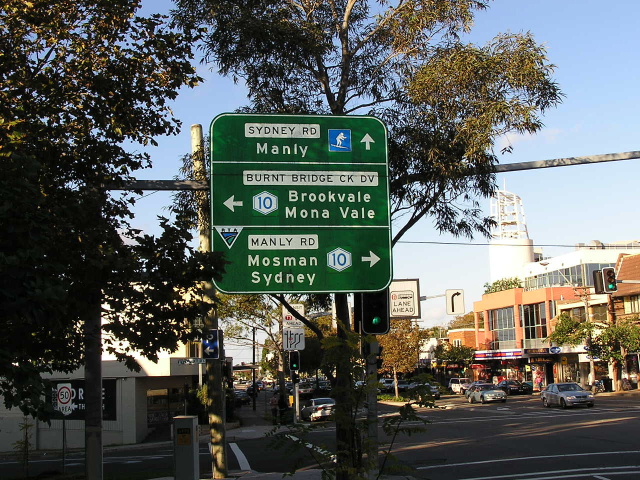
ID sign facing northbound traffic at the intersection of Sydney Rd, Manly Rd & Burnt Bridge Creek Deviation, with the surfer symbol covering a State Route 12 shield. April 2004. |
 |
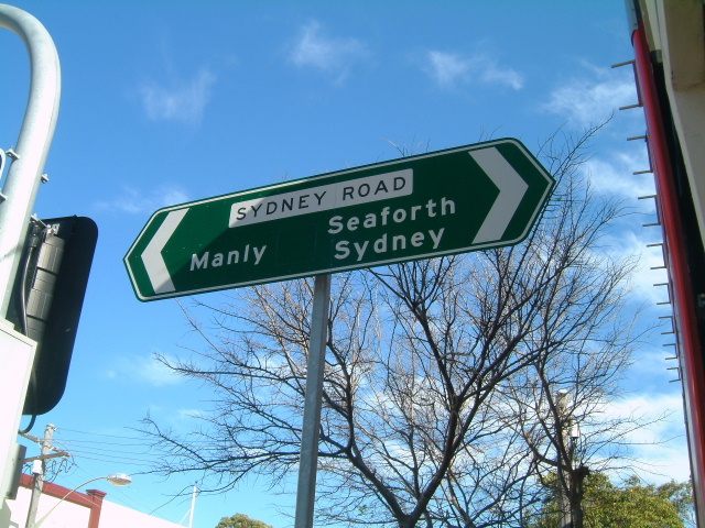
AD sign eastbound on Sydney Rd approaching Condamine St, Balgowlah, with blank coverplate over a State Route 12 shield. Sep 2003.
|
  |
Two photos of an ID sign at the same intersection, with a blank coverplate over a State Route 12 shield. Note the poor placement of the sign - hidden behind a traffic signal assembly. Top photo taken September 2003, bottom photo taken June 2006. |
 |
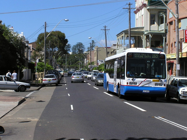
An eastbound view of former State Route 12 - Sydney Rd - near Hill Street in Fairlight. Sep 2003. |
 |
Interesting diagrammatic AD sign showing location of parking, the beach and Brookvale for eastbound traffic on Sydney Rd approaching Manly. This sign appears to outdate the decommissioning of State Route 12. Jan 2006. |
 |
Looking south along Pittwater Rd at Manly. Jan 2006. |
 |
ID sign at the intersection of Pittwater Rd & Balgowlah Rd, Manly, showing blank coverplate over State Route 12 shield. Jan 2006. |
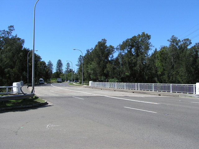 |
Looking southeast along Pittwater Road at the bridge over Manly Lagoon, completed in 1953. Jan 2006. |
|
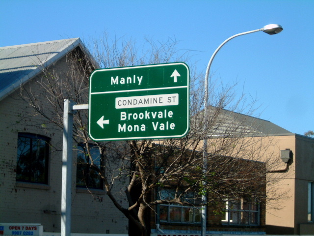
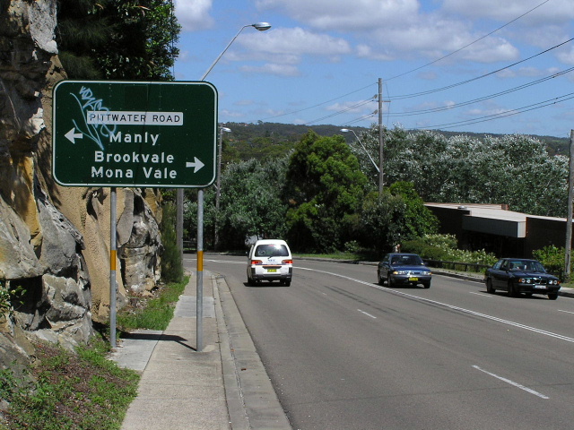
Northbound on Pittwater Rd approaching Oliver Street at North Manly. This sign dates from when State Route 12 was moved from Oliver Street (and onwards to Dee Why) to Pittwater Rd, connecting more directly to State Route 14 (now Metroad 10). Jan 2006. |
 |
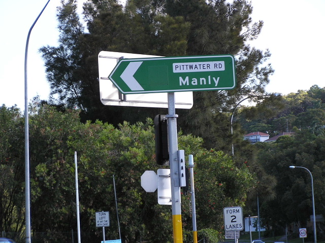
Southbound AD sign on Oliver Street, approaching Pittwater Rd. This sign again shows a blank coverplate covering a SR12 shield for Pittwater Rd. Jan 2006. |
 |
Southeastbound on Pittwater Rd approaching Oliver St. Again note blank coverplate covering SR12 shield straight, but not left. Jan 2006. |
 |
Very old (1970s?) painted ID sign on Pittwater Rd at Riverview Pde, North Manly. Glad to see something along this route has survived from the old days, even if it doesnt have a SR12 shield. Jan 2006. |
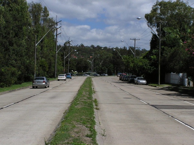 |
Pittwater Road looking north between Riverview Pde and Kentwell Rd, showing cement concrete construction across very sandy ground. Jan 2006. |
 |
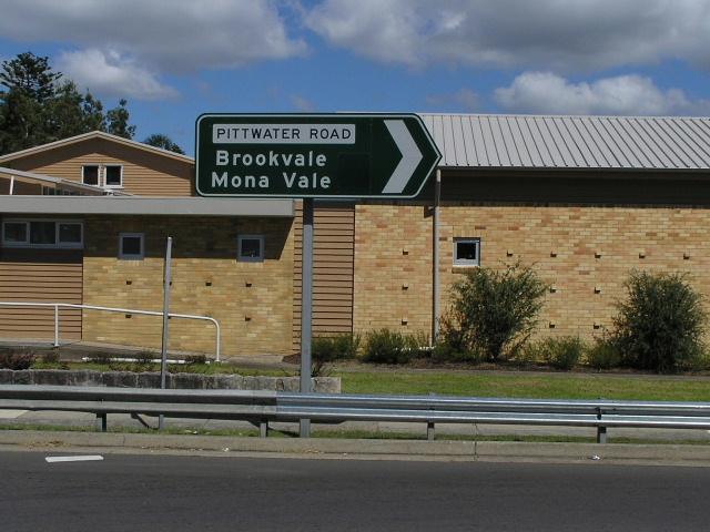
ID sign at the intersection of Pittwater Rd & Condamine St, Brookvale, showing blank coverplate over State Route 12 shield. April 2004. |