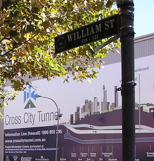
WILLIAM STREET UPGRADE
Part of the Cross City Tunnel project
In this section:
Brief History of William Street
- Establishment
- Resumption and Widening
- An urban boulevard?
- References
Photographs
As part of the Cross City Tunnel project, which was planned to reduce traffic along William Street between Kings Cross and the CBD, it was proposed to upgrade William Street and turn it into an ‘urban boulevard’. Original plans called for, if I remember correctly, bus lanes in each direction, together with one lane of general traffic in each direction and protected right-turn lanes. However, the end result was a modest widening of the footpaths on either side, removal of the median strip and a reduction from 3 lanes to 2 lanes in each direction – one of which is a peak hour Transit Lane - plus protected right turn lanes. Parking bays were also provided where practicable, mainly at the eastern end of the street. The political football that the Cross City Tunnel project became caused the original objectives to the plan to largely be abandoned, represented here in the scaled-down upgrade of William Street.
Proposals for William Street to be an ‘urban boulevard’ existed long before the advent of the Cross City Tunnel project. The following paragraphs present a brief history of William Street.
Brief History of William Street
William Street was created in 1830 as part of the construction of a new road to South Head – now New South Head Road – but also served the dual purpose of connecting Kings Cross, Elizabeth Bay and Potts Point with the Sydney CBD. At this stage those areas were still largely rural, typified by large land holdings with large mansions – it was the dormitory for the wealthy, who gained their wealth from the City but could afford not to live in the cramped and often unsanitary conditions that were rife. Even at this early stage of the colony of New South Wales, it was the power of private property that largely determined the location of many of the early streets.
William Street was surveyed to width of 41 feet, considered adequate at the time, as it served only as an access to South Head and a commuter road for the Kings Cross and Elizabeth Bay area. However, with the rapid growth of Sydney over the next seventy years, urban development filled the Woolloomooloo valley and William Street became lined with hotels, boarding houses and terrace dwellings. As development of the eastern suburbs progressed, William Street became more and more congested and an increasingly important city artery.
As part of a general push towards civic reform, slum clearance and general improvement of the City, a Royal Commission for the Improvement of the City of Sydney and its Suburbs was set up in 1908. One of the recommendations of the Royal Commission’s report was that William Street should be widened since it was the principal route to the ‘eastern foreshore suburbs’. It was also argued by the Commissioners that the street widening would “lead to a rapid development of Woolloomooloo as an industrial portion of the city” and would “open up with is a comparatively poor neighbourhood, and fire an impulse to the general development of the whole district” (cited in Kelly, 1983, p.12).
Political wrangling within Sydney City Council following the release of the Commission’s report in 1909 meant that a start on the widening of William Street, among other improvements recommended by the Commission, was delayed by a number of years. However in 1915 political support was behind the notions of ‘beautification’ and ‘slum clearance’ as well as proposals to widen important traffic arteries leading to and from the CBD. The Lord Mayor of Sydney, Richard Meagher, reintroduced the William Street widening proposal in March 1916:
“The Street at the present time is only 41 feet wide between kerb and kerb…and a large proportion of this area is occupied for the purposes of a double tram line, and this, needless to say, very materially contributes to traffic congestion and public inconvenience…At Victoria Street the width between the edge of the tram footboards and the kerb on the southern side is 11”1’ only…” (cited in Kelly, 1983, p.14).
“The proposal which is now submitted will materially affect…the congested transit problem to the eastern foreshores in addition to providing a means of beautification in the vicinity…by constructing a straight avenue of one hundred feet in width…and in regard to which there will be no 100ft. avenue in the city to compare with it in length when completed” (cited in Kelly, 1983, p.15).
The estimated cost, excluding rebuilding, was ₤210,000. The date of resumption was to be 1 June 1916, however once the formal procedures regarding resumption had been achieved, the City Council passed a motion to defer actual demolition for a period of about three years.
Unlike the widening schemes undertaken in other city streets such as Oxford Street and George Street West, construction was completed in fairly quick time – a period of about 2 years (pers. comm. Shirley Fitzgerald). The social aspects of the widening of William Street are extensively covered by Max Kelly in his book Faces of the Street: William Street.
Following its widening to 100 feet, William Street remained almost unchanged for many years. Even the construction of the Kings Cross Tunnel in 1975 failed to significantly alter its appearance. However some had greater visions.
In 1969 Sydney City Council, led by the Civic Reform party, commissioned planner George Clarke to prepare a City of Sydney Strategic Plan to guide the future development of the city. From this plan, released in 1971, came a number of Action Plans for various precincts across the city which spelt out exactly what would be done to achieve the objectives in the strategic plan. The William Street Boulevard was selected for the first of the Council’s action plans. But as the then City Planner, John Doran, reluctantly though openly admitted, it was produced
as a publicity stunt to give a boost to the [Strategic Plan]. Virtually the only research done on it was to look at William Street very loosely and [then it was] decided that it ought to be widened to look like the Champs-Elysees. Somebody over one weekend produced a perspective sketch which was reproduced in the newspapers. And that kicked the William Street Boulevard off. (cited in Ashton, 1993, p. 102 and Ashton, 1992, p.74)
Despite the lack of research behind the proposal for a William Street boulevard, it certainly gave a boost to the strategic plan and was, by and large, well received by the public. Construction of the Westfield and Olivetti buildings on the northern side during the 1970s brought some of the plan to fruition, however State Government indecision about the ultimate layout of the Eastern Distributor and indecision from the Department of Main Roads regarding the realignment of William Street meant the southern side of the street never really got off the ground. Much later, when a new Local Environmental Plan was prepared for Darlinghurst, the William Street boulevard died completely – or so they thought; it would eventually be reincarnated as part of the Cross City Tunnel project in 2005-2006.
Ashton, P. (comp.) 1992. Planning Sydney: Nine Planners Remember. Sydney: Council of the City of Sydney.
Ashton, P. 1993. The Accidental City: Planning Sydney since 1788. Sydney, Australia: Hale & Iremonger.
Kelly, M. (1983) Faces of the Street: William Street, Sydney, 1916. Paddington, NSW: Doak Press.
 |
This view, taken by the City of Sydney Engineer, shows William Street on the day of resumption - 1 June 1916 - looking east. College Street is in the foreground and there is no Coca-Cola sign yet :-) Source: (Kelly, 1983 ) |
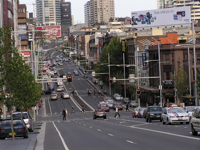
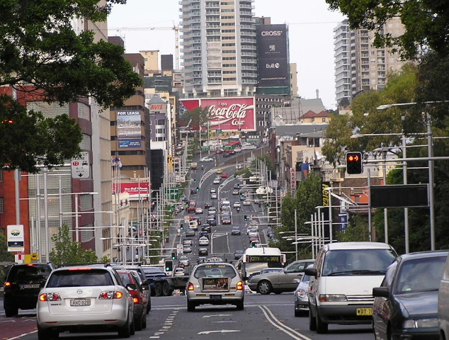
Before the upgrade - 2004 & 2005 |
|
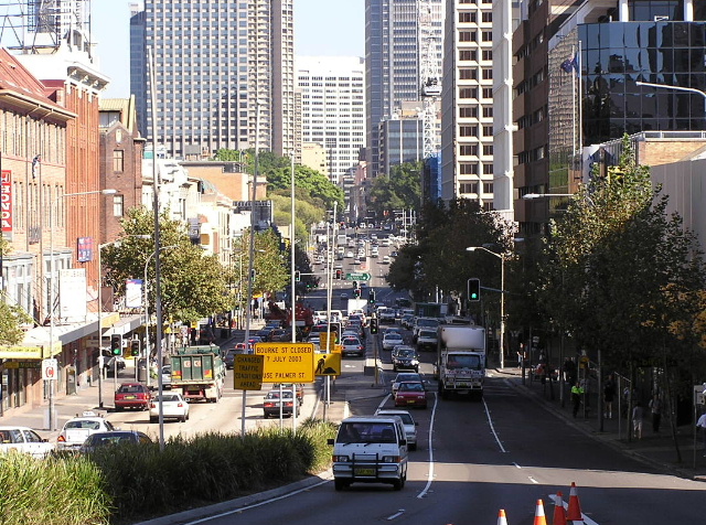 |
Looking west from Kings Cross towards the CBD showing a very congested, noisy and unattractive William Street. April 2004. |
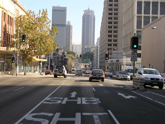 |
Looking west at Bourke Street from a driver's perspective. June 2005. |
 |
Looking east approaching Riley Street. June 2005. |
 |
Looking east approaching Crown Street. June 2005. |
|
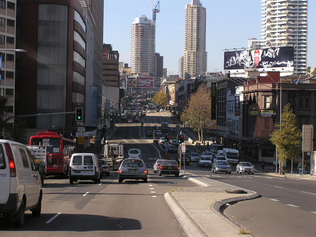
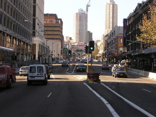
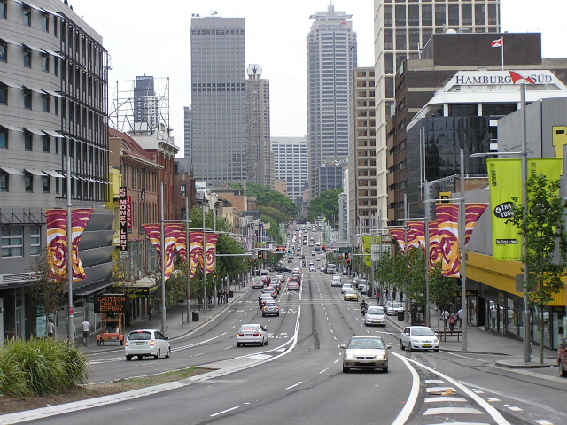
After the upgrade - 2006 |
|
 |
Looking west from Kings Cross towards the CBD. As you can see, the footpaths have been widened, the roadway narrowed and the median strips removed. Oct 2006. |
 |
Looking east from College Street towards Kings Cross. There is a noticable decrease in traffic in the "after' photos, despite them being taken closer to peak hour. Oct 2006. |
 |
The view across the Woolloomooloo Valley from the middle of Park Street. The Coca-Cola billboard is as prominent as ever. Oct 2006. |
Last updated 21 February 2009 © Ozroads 2004-2009. |