Pioneer to Banca Road |

Deteriorating fingerboard sign assembly at the southern intersection of Racecourse Rd (C839) & Old Port Rd. Source: Peter Renshaw, January 2008.
Introduced: 1980
Length: 10km
Eastern Terminus: Gladstone Main Rd (B82) & Racecourse Rd (C839), Pioneer
Western Terminus: Banca Rd (C840) & Banca Link Rd (C839), 4km north of Winnaleah
Route taken: Racecourse Rd, Banca Link Rd
Focal Points: Pioneer
Responsibility: Local Government
C839 is a 10km long east-west link in north eastern Tasmania. It links the small timber village of Pioneer with Winnaleah and the Banca Road (C840), which is the shortest route from this area to the northern coast. With no significant tourist features along its length it is lightly used, mainly serving local timber and farming traffic.
The route is mostly unsealed, except for a length of approximately 2.5km east from where the unnumbered section of Racecourse Rd branches off.
|
Photos of route C839 |
|
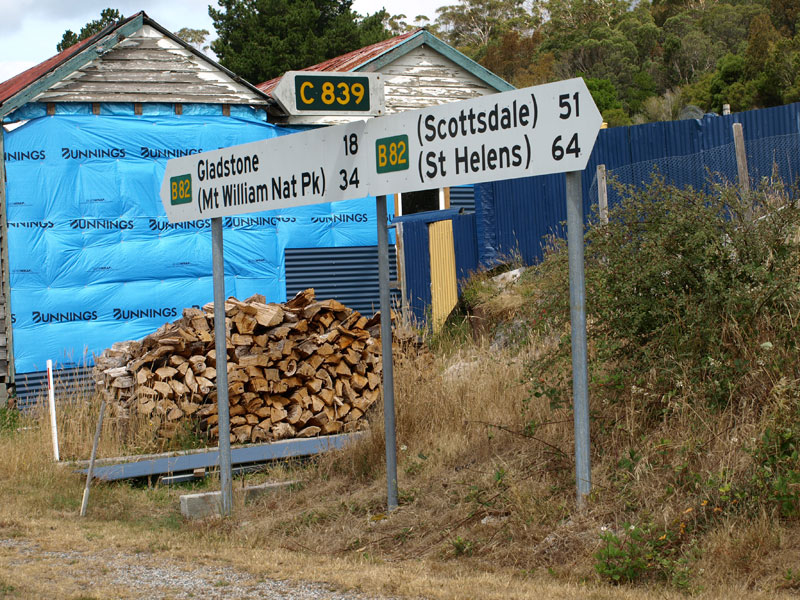 |
Fingerboard sign assembly at the intersection of Gladstone Main Rd (B82) & Racecourse Rd (C839), Pioneer. Note the absence of a focal point for C839. |
 |
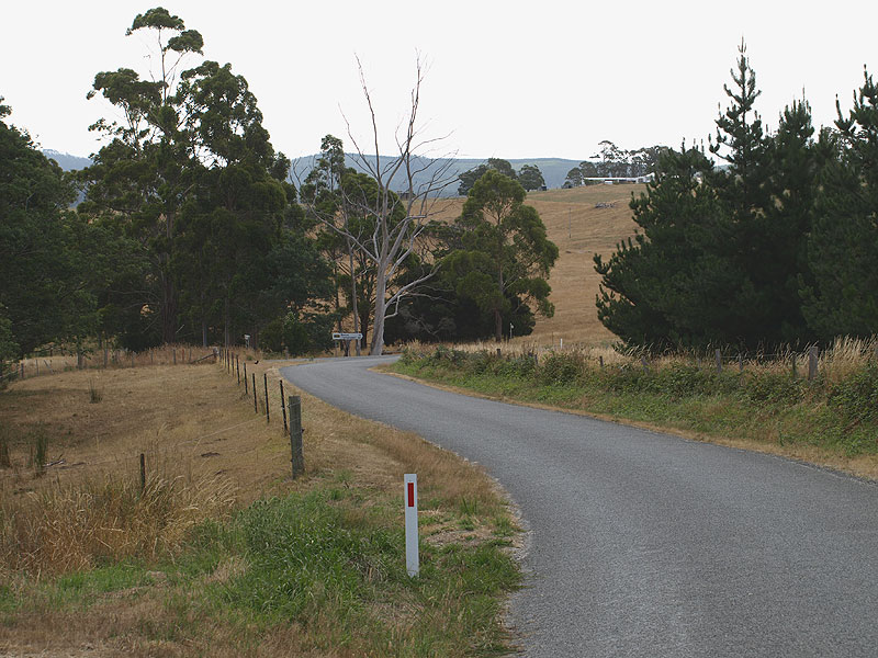
Racecourse Rd (C839) looking west from the junction with Gladstone Main Rd (B82) at Pioneer, showing the immediate transition to gravel road. |
 |
Racecourse Rd (C839) looking west across Racecourse Creek, approximately 1km west of Pioneer. |
 |
Racecourse Rd (C839) looking west towards the southern junction with Old Port Rd, 4km west of Pioneer. C839 turns to the right. |
|
Close-up of deteriorating fingerboard signs at the southern intersection of Racecourse Rd (C839) & Old Port Rd. Source: Peter Renshaw, January 2008. |
 |
Racecourse Rd (C839) looking north across Bradshaws Creek through the forest between the junctions with Old Port Rd. Source: Peter Renshaw, January 2008. |
| Fingerboard signs at the northern junction of Racecourse Rd (C839) & Old Port Rd, 4.5km west of Pioneer. |
|
 |
Racecourse Rd (C839) looking east towards the northern junction with Old Port Rd, 4.5km west of Pioneer. Source: Peter Renshaw, January 2008. |
 |
Racecourse Rd (C839) looking west through the pine forests, 5km west of Pioneer. Source: Peter Renshaw, January 2008. |
 |
Racecourse Rd (C839) looking west across Gilham Creek as you emerge from the pine forests, 5.5km west of Pioneer. Source: Peter Renshaw, January 2008. |
A view of the mountains to the northeast from Racecourse Rd (C839), 6km west of Pioneer. Source: Peter Renshaw, January 2008. |
|
 |
Racecourse Rd (C839) looking east from the slopes of Wagners Hill, 7.5km west of Pioneer. Source: Peter Renshaw, January 2008. |
 |
Racecourse Rd (C839) looking west from the slopes of Wagners Hill. In the background you can see the unsealed Banca Link Rd (C839) heading north west. Source: Peter Renshaw, January 2008. |
  |
Fingerboard signs at the intersection of Racecourse Rd (C839) & Banca Link Rd (C839). C839 turns northwestwards onto Banca Link Rd, whilst Racecourse Rd continues un-numbered towards Winnaleah. Source: Peter Renshaw, January 2008. |
 |
Banca Link Rd (C839) looking southeast towards the junction with Racecourse Rd (C839). A small damn on Crothers Creek can be seen in the background. Source: Peter Renshaw, January 2008. |
 |
Banca Link Rd (C839) looking northwest alongside Crothers Creek. Source: Peter Renshaw, January 2008. |
 |
Banca Link Rd (C839) looking west towards the junction with Banca Rd (C840), the western terminus of the route. Source: Peter Renshaw, January 2008. |
 |
Fingerboard sign facing westbound C839 traffic at the junction of Banca Rd (C840) & Banca Link Rd (C839), 4km north of Winnaleah. There is no fingerboard sign pointing southwards. Source: Peter Renshaw, January 2008. |
 |
Fingerboard sign facing southbound traffic at the junction of Banca Rd (C840) & Banca Link Rd (C839), 4km north of Winnaleah. Source: Peter Renshaw, January 2008. |


Last updated 17 April 2011 © Ozroads 2004-2011. |