Branxholm to Winnaleah |

Fingerboard sign at the junction of Warrentinna Rd (C835) & Wagners Rd, 3km west of Winnaleah. Source: Peter Renshaw, January 2008.
Introduced: 1980
Length: 17km
Northeastern Terminus: Banca Rd (C840) & Main St (C835), Winnaleah
Southwestern Terminus: Tasman Highway (A3) & Stoke St (C835), Branxholm
Route taken: Stoke St, Warrentinna Rd, Main St
Focal Points: Branxholm, Warrentinna, Winnaleah
Responsibility: Local Government
C835 is a minor rural route in northern eastern Tasmania, running north and then eastwards from Branxholm to Winnaleah. It serves fertile farmland, as well as logging areas in the west, however its main significance for tourists is as an access route to the Forestry Commission's water tower at Mt Horror. The tower is open to the public when attended during the summer months and provides commanding views across the district.
The route is sealed at both ends, however the 12km long central section is still unsealed bar a few short dust nuisance seals.
|
Photos of route C835 |
|
 |
AD sign westbound on Tasman Hwy (A3) approaching the junction with Stoke St (C835), Branxholm. |
 |
AD sign eastbound on Tasman Hwy (A3) approaching the junction with Stoke St (C835), Branxholm. |
 |
Original white fingerboard sign assembly at the intersection of Tasman Hwy (A3) & Stoke St (C835), Branxholm. |
 |
Stoke St (C835) looking north from Tasman Hwy (A3) through the sleepy timber town of Branxholm. |
 |
Warrentinna Rd (C835) looking south on the northern approach to Branxholm. The area on the left appears to be a storage area for the timber mill. The former railway siding was located to the right of the photo. Source: Peter Renshaw, November 2007. |
 |
Warrentinna Rd (C835) looking north towards the single-lane concrete bridge across Legerwood River, 1km north of Branxholm. Note the deteriorating remains of the railway bridge on the right. While the railway was still operational, a level crossing was located just around the corner. Source: Peter Renshaw, November 2007. |
| Warrentina Rd (C835) looking north alongside the Ringarooma River, 2km north of Branxholm. The seal ends just beyond the corner in the distance. | |
 |
Warrentinna Rd (C835) looking south at the transition between sealed and unsealed road, 2km north of Branxholm. Source: Peter Renshaw, November 2007. |
 |
Warrentinna Rd (C835) looking north through the forests, approximately 4km north of Branxholm. Source: Peter Renshaw, November 2007. |
 |
Warrentinna Rd (C835) looking north through the forests, approximately 5km north of Branxholm. Source: Peter Renshaw, November 2007. |
 |
Fingerboard sign assembly at the intersection of Warrentinna Rd (C835) & Forester Rd (C834), 6km north of Branxholm. Source: Peter Renshaw, November 2007. |
 |
Warrentinna Rd (C835) looking south towards the junction with Forester Rd (C834), 6km north of Branxholm. |
 |
Warrentinna Rd (C835) looking south at the locality of Warrentinna, near the junction with Connors Rd. There's no settlement to speak of in this area, just state forests. Source: Peter Renshaw, January 2008. |
 |
Warrentinna Rd (C835) looking north at Warrentinna, showing the junction with Connors Rd. Connors Rd leads to the Forestry Commission's water tower at Mt Horror which commands impressive views. Source: Peter Renshaw, April 2008. |
|
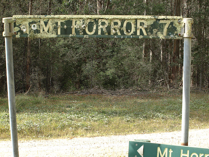
Fingerboard signs located at the junction of Warrentinna Rd (C835) & Connors Rd, Warrentinna. The sign pointing towards Mt Horror is the typical style found on unnumbered local roads throughout Tasmania. Top and middle photos: Peter Renshaw, January 2008. Bottom photo: Peter Renshaw, April 2009. |
 |
Looking south through the junction of Warrentinna Rd (C835) & Connors Rd at Warrentinna. This view shows the bizarre Tasmanian phenomenon of placing fingerboards so that they are not visible to the unnumbered side road.
Source: Peter Renshaw, January 2008. |
 |
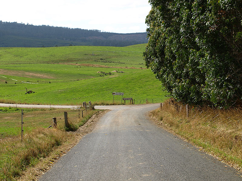
Warrentinna Rd (C835) looking east through farmland, 8km west of Winnaleah. The sealed section in the foreground is a short dust-nuisance seal adjacent to a farm house. Source: Peter Renshaw, April 2008. |
 |
Warrentinna Rd (C835) looking west across Linton Creek , 7km west of Winnaleah. Source: Peter Renshaw, April 2009. |
 |
Warrentinna Rd (C835) looking northeast through an s-bend, approximately 5.5km west of Winnaleah.
Source: Peter Renshaw, January 2008. |
Warrentinna Rd (C835) looking east through a short winding section in the forest, approximately 4.5km west of Winnaleah. Source: Peter Renshaw, January 2008. |
|
 |
Warrentinna Rd (C835) looking east, approximately 4km west of Winnaleah. Source: Peter Renshaw, January 2008. |
 |
Warrentinna Rd (C835) eastbound approaching the junction with Swanee Rd, 3.5km west of Winnaleah. Source: Peter Renshaw, January 2008. |
 |
Fingerboard signs at the intersection of Warrentinna Rd (C835) & Swanee Rd , 3.5km west of Winnaleah. Top photo: Peter Renshaw, December 2007. Bottom photo: Peter Renshaw, April 2008. |
 |
Warrentinna Rd (C835) looking west towards the junction with Swanee Rd , 3.5km west of Winnaleah. C835 continues to the left. Source: Peter Renshaw, January 2008. |
 |
Warrentinna Rd (C835) looking west approximately 2.5km west of Winnaleah. Source: Peter Renshaw, April 2008. |
 |
Fingerboard sign for eastbound traffic at the intersection of Warrentinna Rd (C835) & McNaughts Rd, 2km west of Winnaleah. Source: Peter Renshaw, January 2008. |
 |
Warrentinna Rd (C835) looking west approximately 2km west of Winnaleah. |
 |
Warrentinna Rd (C835) looking east towards the tiny town of Winnaleah. Source: Peter Renshaw, January 2008. |
 |
Warrentinna Rd (C835) looking east into the tiny town of Winnaleah. Warrentinna Rd becomes Main St as you enter town. Source: Peter Renshaw, January 2008. |
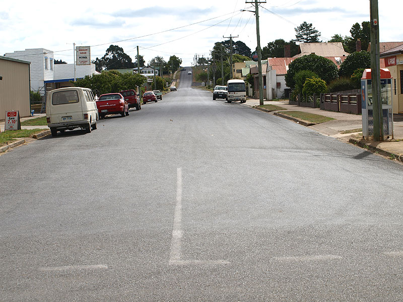 |
Main St (C835) looking west through the town of Winnaleah. The sign for the petrol station states "If unattended, try hotel!" |
 |
Newer fingerboard sign assembly at the junction of Banca Rd (C840) & Main St (C835), Winnaleah. This is the eastern terminus of route C835. Source: Peter Renshaw, October 2007. |

Last updated 3 June 2011 © Ozroads 2004-2011. |