Lebrina to Pipers Brook |

Lone C818 fingerboard facing northbound traffic at the intersection of Pipers Brook Rd (C818) & Hall Rd, Pipers Brook. Source: Peter Renshaw, October 2007.
Introduced: 1980
Length: 14km
Northern Terminus: Bridport Main Rd (B82) & Pipers Brook Rd (C818), 21km south-west of Bridport
Southern Terminus: Golconda Rd (B81) & Pipers Brook Rd (C818), 2km north of Lebrina
Route taken: Pipers Brook Rd
Focal Points: Pipers Brook, Lebrina
Responsibility: Local Government
C818 is a sealed north-south route in northern Tasmania. It is a popular tourist route traversing forestry and agricultural areas and serving some of the best known Tamar Region wineries.
|
Photos of route C818 |
|
 |
AD sign eastbound on Bridport Main Rd (B82) approaching the junction with Pipers Brook Rd (C818), 21km south-west of Bridport. Source: Peter Renshaw, June 2007. |
 |
Bridport Main Rd (B82) looking west to the intersection with Pipers Brook Rd (C818). There is no AD sign on this approach. Source: Peter Renshaw, October 2007. |
 |
Fingerboard sign assembly at the intersection of Bridport Main Rd (B82) & Pipers Brook Rd (C818). Source: Peter Renshaw, June 2007. |
 |
Pipers Brook Rd (C818) looking north to the junction with Bridport Main Rd (B82). The yellow sign refers to the Tamar Region Wine Route. Source: Peter Renshaw, October 2007. |
 |
Pipers Brook Rd (C818) looking south from Bridport Main Rd (B82). Source: Peter Renshaw, October 2007. |
 |
Pipers Brook Rd (C818) looking south towards Pipers Brook Vineyard, 1.5km south of Bridport Main Rd (B82). Source: Peter Renshaw, October 2007. |
 |
Pipers Brook Rd (C818) looking south towards Pipers Brook locality, 2km south of Bridport Main Rd (B82). Source: Peter Renshaw, October 2007. |
Pipers Brook Rd (C818) looking south towards Hall Rd, Pipers Brook. Source: Peter Renshaw, October 2007. |
|
|
Lone C818 fingerboard facing northbound traffic at the intersection of Pipers Brook Rd (C818) & Hall Rd, Pipers Brook. Source: Peter Renshaw, October 2007. |
 |
Pipers Brook Rd (C818) looking north towards Hall Rd, Pipers Brook. Hall Rd runs west to link with Retreat Rd (C819) at its intersection with Bridport Main Rd (B82). Source: Peter Renshaw, October 2007. |
 |
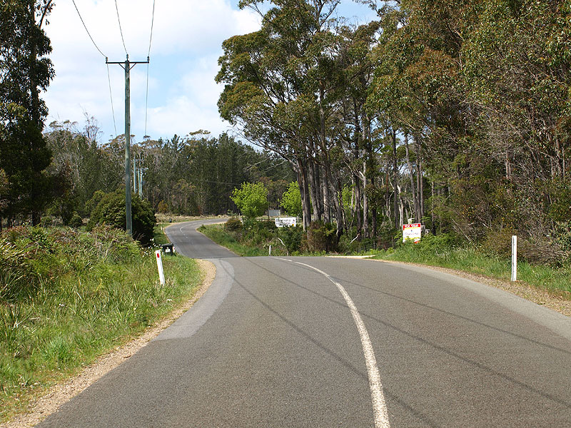
Pipers Brook Rd (C818) looking north through Pipers Brook, approximately 250m south of Hall Rd. Source: Peter Renshaw, October 2007. |
 |
Pipers Brook Rd (C818) looking south near Hills Rd, 2.5km south of Pipers Brook. Source: Peter Renshaw, October 2007. |
 |
Pipers Brook Rd (C818) looking south 4.5km south of Pipers Brook. Source: Peter Renshaw, October 2007. |
 |
Pipers Brook Rd (C818) looking south across a branch of Pipers Brook, 5km south of Pipers Brook. Source: Peter Renshaw, October 2007. |
 |
Pipers Brook Rd (C818) looking south, approximately 4km north of Golconda Rd (B81). Source: Peter Renshaw, October 2007. |
 |
Pipers Brook Rd (C818) looking south towards Short Cut Rd with Mt Wilson in the background, 2km north of Golconda Rd (B81). Source: Peter Renshaw, October 2007. |
 |
Pipers Brook Rd (C818) looking south, 1km north of Golconda Rd (B81). Source: Peter Renshaw, October 2007. |
 |
Pipers Brook Rd (C818) looking south towards Golconda Rd (B81). The yellow sign advises traffic that the Tamar Region Wine Route turns to the right. Source: Peter Renshaw, October 2007. |
Top: Fingerboard sign facing north-eastbound traffic on Golconda Rd (B81) at Pipers Brook Rd (C818), 2km north of Lebrina. Bottom: Launceston City Council added this horrible fingerboard to the sign assembly in July 2007 - it should read "< C818 (Bridport B82) 37" |
|
 |
Fingerboard sign assembly facing southbound traffic at the intersection of Golconda Rd (B81) & Pipers Brook Rd (C818), 2km north of Lebrina. Note that no directions are given to Lebrina, despite that being the focal destination for traffic heading south on C818. Source: Peter Renshaw, September 2007. |


Last updated 31 May 2009 © Ozroads 2004-2007. |