Flinders Island |

Fingerboard sign at the intersection of Lady Barron Main Rd (B85) & Trousers Point Rd (C806), 6km south of Whitemark. Source: Peter Renshaw, April 2008.
Introduced: 1980
Length: 10km
Northern Terminus: Lady Barron Main Rd (B85) & Trouser Point Rd (C806), 6km south of Whitemark
Southern Terminus: Big River Rd, Strzelecki National Park
Route taken: From the intersection of Lady Barron Main Rd (B85) & Trouser Point Rd (C806), 6km south of Whitemark, via Trouser Point Rd and Big River Rd to the Strzelecki National Park
Focal Points: Whitemark, Strzelecki National Park
Responsibility: Local Government
C806 is a mostly-unsealed access road from the Flinders Islands trunk route (B85) near Whitemark, to the Trousers Point on the south-eastern tip of Flinders Island. It provides access to the iconic tourist destination of Strzelecki National Park.
|
Photos of route C806 |
|
 |
What's this? A very out-of-place C806 fingerboard sign at the intersection of Lady Barron Main Road (B85), Palana Road (B85) and Lagoon Rd, Whitemark. C806 does not begin for a further 6km south of Whitemark, branching off the B85. Source: Peter Renshaw, Dec 2006. |
 |
What's this? A very out-of-place C806 fingerboard sign at the intersection of Lady Barron Main Road (B85), Palana Road (B85) and Lagoon Rd, Whitemark. C806 does not begin for a further 6km south of Whitemark, branching off the B85. Source: Peter Renshaw, April 2008. |
 |
AD sign southbound on Lady Barron Main Road (B85) approaching Trousers Point Road (C806), 6km south of Whitemark. The imposing figure of Mt Strzelecki provides an atmospheric background. Source: Peter Renshaw, April 2008. |
 |
AD sign northbound on Lady Barron Main Rd (B85) approaching Trouser Point Rd (C806). Note the absence of an arrow - which means the junction is on the left. Source: Peter Renshaw, April 2008. |
 |
There are no C806 fingerboards at the junction of Lady Barron Main Rd (B85) and Trouser Point Rd (C806), only these B85 fingerboards. Source: Peter Renshaw, April 2008. |
|
Fingerboard sign at the intersection of Lady Barron Main Rd (B85) & Trousers Point Rd (C806), 6km south of Whitemark. Source: Peter Renshaw, April 2008. |
 |
Fingerboard sign at the intersection of Lady Barron Main Rd (B85) & Trousers Point Rd (C806), 6km south of Whitemark. Source: Peter Renshaw, April 2008. |
 |
Trousers Point Rd (C806), looking east towards the intersection with Lady Barron Main Rd (B85). Source: Peter Renshaw, April 2008. |
 |
Trousers Point Rd (C806) looking west approximately 750m from Lady Barron Main Rd (B85). The triangular peak in the background is Mt Chappell Island, the home of deadly tiger snakes. Source: Peter Renshaw, April 2008. |
 |
Trousers Point Rd (C806) looking south in the shadows of Mt Strzelecki, approximately 1km from Lady Barron Main Rd (B85). Source: Peter Renshaw, April 2008. |
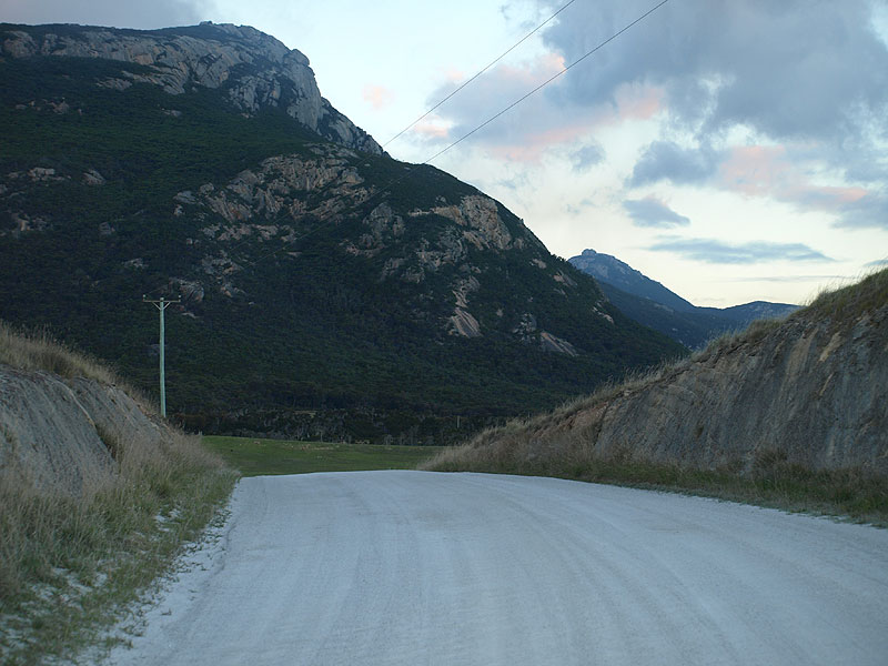 |
Trousers Point Rd (C806) looking south in the shadows of Mt Strzelecki, 2.5km south of Lady Barron Main Rd (B85). Source: Peter Renshaw, April 2008. |
 |
Trousers Point Rd (C806) looking north towards the cutting in the previous photo, 3km south of Lady Barron Main Rd (B85). Source: Peter Renshaw, April 2008. |
 |
Trousers Point Rd (C806) looking north towards the bridge over Fotheringate Creek, with Mt Strzelecki on the right. Source: Peter Renshaw, April 2008. |
 |
Brown (tourist) fingerboard sign on Trousers Point Road (C806) at its junction with Big River Road near Loccotta. This is the last sign on C806 as it ends only 2km further on at Trousers Point. The road straight ahead is Big River Road. Source: Peter Renshaw, April 2008. |
 |
Trousers Point Rd (C806) looking west from the intersection with Big River Rd. Source: Peter Renshaw, April 2008. |
 |
Trousers Point Rd (C806) looking east approximately 750m west of Big River Rd with Mt Strzelecki in the background. Source: Peter Renshaw, April 2008. |
 |
Trousers Point Rd (c806) approaching the end of the road at Trousers Point, just inside Strzelecki National Park. The road branching off to the right leads a short distance to Fotheringate Beach. Source: Peter Renshaw, April 2008. |
 |
The end of the road - the car park at Trousers Point. Source: Peter Renshaw, April 2008. |
Last updated 7 February 2009 © Ozroads 2004-2009. |