| Clarence Point Loop |

Fingerboards at the southern terminus of C722 - the junction of Greens Beach Rd (A7) & Clarence Point Rd (C722). Source: Peter Renshaw, April 2007.
Introduced: 1980
Length: 6km
Northern Terminus: Kelso Rd (A7) & Bevic Rd (C734), 10km south of Greens Beach
Southern Terminus: Kelso Rd (A7) & Clarence Point Rd (C722), 6km south of Greens Beach
Route taken: Clarence Point Rd, Bevic Rd (with a spur via Clarence Point Rd to Anchor Point)
Focal Points: Clarence Point
Responsibility: Local Government
Route C722 is a minor rural route in northern Tasmania, forming a loop from the A7 via the tiny fishing village of Clarence Point. The Clarence Point Road section of the route is sealed (the southern arm), however Bevic Road - the northern connection to the A7 - is unsealed.
Route C722 has a spur route along Sunset Boulevard, extending 2km south-easterly to the end of the road at Anchor Point, on the shore of the Tamar River.
|
Photos of route C722 |
|
 |
AD sign northbound on Kelso Rd (A7) approaching Clarence Point Rd (C722). Source: Peter Renshaw, April 2007. |
 |
AD sign southbound on Kelso Rd (A7) approaching the junction with Clarence Point Rd (C722). Source: Peter Renshaw, July 2007. |
|
Fingerboards at the southern terminus of C722 - the junction of Kelso Rd (A7) & Clarence Point Rd (C722). Source: Peter Renshaw, April 2007. |
 |
Clarence Point Rd (C722) looking east from the junction with Kelso Rd (A7). Source: Peter Renshaw, July 2007. |
 |
Looking west along Clarence Point Rd (C722) between Greens Beach Rd and Clarence Point. Source: Peter Renshaw, April 2007. |
 |
An avenue of trees, looking east on Clarence Point Rd, 3km west of Clarence Point. Source: Peter Renshaw, April 2007. |
 |
Clarence Point Rd (C722), looking east in Clarence Point along the World War 1 memorial avenue. Source: Peter Renshaw, April 2007. |
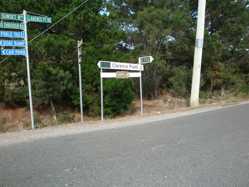 |
Fingerboard signs at the junction of Clarence Point Rd & Sunset Boulevard, showing C722 spur via Sunset Boulevard. Also note the use of the route marker only for southbound traffic - even 'To A7' could have been used. Source: Peter Renshaw, April 2007. |
 |
Another view of the fingerboards at the junction of Clarence Point Rd & Sunset Boulevard. Source: Peter Renshaw, April 2007. |
 |
Sunset Boulevard at its south-eastern end - this is where the spur of C722 would end. Source: Peter Renshaw, April 2007. |
 |
Looking east along Bevic Road (C722) from Kelso Rd (A7) - the northern arm of C722 is unsealed as most traffic comes from the south. Source: Peter Renshaw, April 2007. |
 |
Looking east along Bevic Road (C722) at the junction with Kelso Rd (A7). Source: Peter Renshaw, April 2007. |
 |
Fingerboards at the intersection of Kelso Rd (A7) & Bevic Rd (C722), the northern terminus of C722. Source: Peter Renshaw, April 2007. |
Last updated 8 July 2007 © Ozroads 2004-2007. |