| Beaconsfield - Winkleigh - Exeter |

Fingerboards at the junction of Winkleigh Rd (C717) & South Winkleigh Rd, Winkleigh. Source: Peter Renshaw, June 2007.
Introduced: 1980
Length: 21km
Northern Terminus: West Tamar Highway (A7) & Flowery Gully Rd (C717), 2km south of Beaconsfield
Southern Terminus: West Tamar Highway (A7) & Winkleigh Rd (C717), Exeter
Route taken: Winleigh Rd, Flowery Gully Rd
Focal Points: Exeter, Winkleigh, Flowery Gully, "A7"
Responsibility: Local Government
Route C717 is a rural loop route from the A7 (West Tamar Highway) between Exeter and Beaconsfield. It has one tourist attraction - the old Supply River Methodist Chruch - otherwise serves the agricultural and logging communities of Winkleigh and Flowery Gully. Two large quarries ensure that C717 is sealed, and constructed to a good standard, throughout its length.
|
Photos of route C717 |
|
 |
Fingerboard/ID signs at the junction of West Tamar Highway (A7) & Winkleigh Rd (C717), Exeter. Source: Peter Renshaw, June 2007. |
 |
Fingerboard/ID signs at the junction of West Tamar Highway (A7) & Winkleigh Rd (C717), Exeter. Source: Peter Renshaw, June 2007. |
 |
Winkleigh Rd (C717), looking south-east to the junction with West Tamar Highway (A7), Exeter. Source: Peter Renshaw, June 2007. |
 |
Winkleigh Rd (C717) looking north-west as it leaves Exeter. Source: Peter Renshaw, June 2007. |
 |
Winkleigh Rd (C717) looking south-east as it enters Exeter. Source: Peter Renshaw, June 2007. |
 |
Winkleigh Rd (C717) looking north-west, 1km out of Exeter. Source: Peter Renshaw, June 2007. |
 |
Winkleigh Rd (C717) heading north-west, approaching the locality of Loira. Source: Peter Renshaw, June 2007. |
 |
Winkleigh Rd (C717) looking west from Crawfords Rd at Loira. Source: Peter Renshaw, June 2007. |
 |
Winkleigh Rd (C717) looking east towards the junction with Crawfords Rd at Loira. The historic Supply River Church is on the left. Source: Peter Renshaw, June 2007. |
 |
Winkleigh Rd (C717) looking west between Crawfords Rd and Glengarry Rd (C718), about 4km west of Exeter. Source: Peter Renshaw, June 2007. |
 |
Winkleigh Rd (C717) looking east about 2km from Glengarry Rd (C718). Source: Peter Renshaw, June 2007. |
 |
Winkleigh Rd (C718) looking west about 1km from Glengarry Rd (C718). Source: Peter Renshaw, June 2007. |
 |
Fingerboards at the junction of Winkleigh Rd (C717) & Glengarry Rd (C718), 7km west of Exeter. Source: Peter Renshaw, April 2007. |
Winkleigh Rd (C717), looking north-west across the Supply River, just west of the Glengarry Rd (C718) junction, 2km south of Winkleigh. Source: Peter Renshaw, June 2007. |
|
 |
Winkleigh Rd (C717) looking south towards the Supply River bridge and the Glengarry Rd (C718) junction. Source: Peter Renshaw, June 2007. |
 |
Winkleigh Rd (C717) looking north from the same spot as the above photo - I love this sort of light, it brings out the most beautiful colours in photos! Source: Peter Renshaw, June 2007. |
 |
Winkleigh Rd (C717) looking north approaching the junction with South Winkleigh Rd at Winkleigh. Source: Peter Renshaw, June 2007. |
 |
Winkleigh Rd (C717) looking south at the junction with South Winkleigh Rd at Winkleigh. Note the fingerboards facing Winkleigh Rd, despite it not having a route marker. Source: Peter Renshaw, June 2007. |
|
Deteriorating fingerboards at the intersection of Winkleigh Rd (C717) & South Winkleigh Rd, Winkleigh. Source: Peter Renshaw, June 2007. |
 |
At Winkleigh, Winkleigh Rd (C717) becomes Flowery Gully Rd - this view is looking north through the locality of Winkleigh. Source: Peter Renshaw, June 2007. |
 |
Flowery Gully Rd (C717) looking south at Winkleigh - a small Presbyterian Church is on the left. Source: Peter Renshaw, June 2007. |
 |
Flowery Gully Rd (C717) looking north as it leaves the locality of Winkleigh. Source: Peter Renshaw, June 2007. |
 |
Deteriorating fingerboards at the intersection of Flowery Gully Rd (C717) & O'Reillys Rd. O'Reillys Rd, like South Winkleigh Rd, provides a link between the C717 and the C716, which runs parallel but about 5km to the west in another valley. Source: Peter Renshaw, June 2007. |
 |
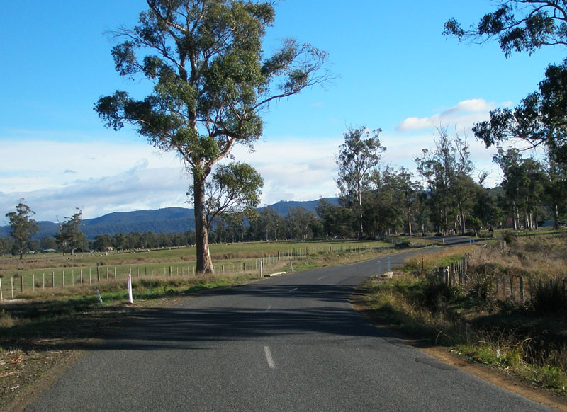
Flowery Gully Rd (C717) looking north from the junction with O'Reillys Rd. |
 |
Flowery Gully Rd (C717) northbound as it descends towards Flowery Gully. Source: Peter Renshaw, June 2007. |
 |
Flowery Gully Rd (C717) looking north on the descent to Flowery Gully. Source: Peter Renshaw, June 2007. |
 |
Flowery Gully Rd (C717) looking south through the locality of Flowery Gully. Source: Peter Renshaw, June 2007. |
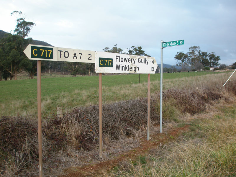 |
Fingerboard signs at the junction of Flowery Gully Rd (C717) & Denmans Rd, 4km north of Flowery Gully. Denmans Rd is an unsealed link between C717 and the C715, which runs parallel about 5km to the west. Source: Peter Renshaw, June 2007. |
 |
Flowery Gully Rd (C717) looking north from the junction with Denmans Rd. Not far to the West Tamar Highway (A7) now. Source: Peter Renshaw, June 2007. |
 |
Flowery Gully Rd (C717) looking north as it descends to the Tamar River valley where Beaconsfield lies. Source: Peter Renshaw, June 2007. |
 |
Flowery Gully Rd (C717) looking north approaching the junction with West Tamar Highway (A7). Source: Peter Renshaw, June 2007. |
 |
Looking south on West Tamar Highway (A7) at the junction with Flowery Gully Rd (C717), 2km south of Beaconsfield. Source: Peter Renshaw, April 2007. |
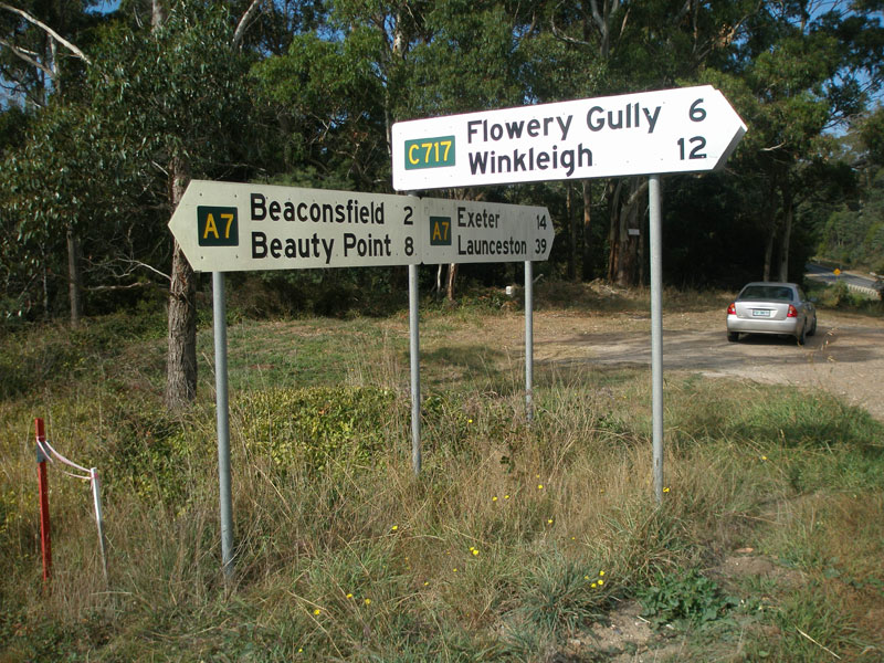 |
Fingerboard signs at the junction of West Tamar Highway (A7) & Flowery Gully Rd (C717), 2km south of Beaconsfield. Source: Peter Renshaw, April 2007. |
 |
West Tamar Highway (A7) northbound approaching the junction with Flowery Gully Rd (C717), 2km south of Beaconsfield. Source: Peter Renshaw, April 2007. |
 |
West Tamar Highway (A7) southbound approaching the junction with Flowery Gully Rd (C717), 2km south of Beaconsfield. Source: Peter Renshaw, July 2007. |
Last updated 8 July 2007 © Ozroads 2004-2007. |