Latrobe to Moriarty |

Moriarty Rd (C702) looking north in Latrobe. Source: Peter Renshaw, March 2009.
Introduced: 1980
Length: 6km
Eastern Terminus: Frankford Main Rd (B71) & Moriarty Rd (C702), Moriarty
Western Terminus: Mersey Main Rd (B19) & Bradshaw St (C702), Latrobe
Route taken: Bradshaw St, Moriarty Rd
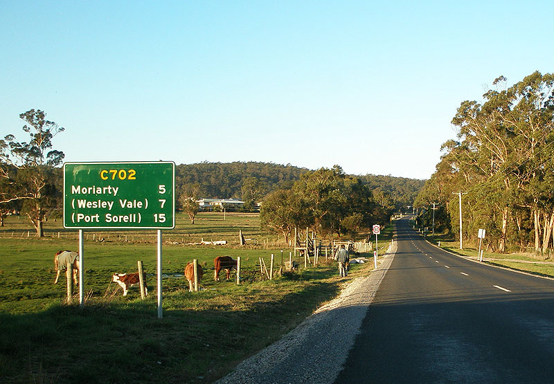
Focal Points: Latrobe, (Wesley Vale/Port Sorell), Moriarty
Responsibility: Local Government
C702 is an east-west route on the northern coast of Tasmania, linking Latrobe with Frankford Main Road (B71) at Moriarty. The western part of the route forms part of the preferred route between Latrobe and holiday area of Port Sorell.
Midway along the route, Moriarty Rd originally met C701 (Wesley Vale Rd) at an oblique Y-junction with a poor crash history. During late 2007, a new intersection and realignment of Wesley Vale Rd was constructed approximately 150m to the west. This work changed the priority of the intersection to make traffic to/from Moriarty Rd east give way to other traffic, and was undertaken with Roads to Recovery funding as part of the development of a preferred route between Latrobe and Port Sorell.
Notable Events:
2007 - Intersection of Moriarty Rd & Wesley Vale Rd reconstructed to favour traffic between Moriarty Rd west and Wesley Vale Rd.
|
Photos of route C702 |
|
 |
AD sign on Mersey Main Rd (B19) westbound approaching the junction with Bradshaw St (C702) at Latrobe. |
 |
AD sign on Mersey Main Rd (B19) eastbound approaching the junction with Bradshaw St (C702) at Latrobe. |
 |
Bradshaw St (C702) southbound approaching the junction with Mersey Main Rd (B19) at Latrobe. |
|
Moriarty Rd (C702) heading north from the junction with Bradshaw St (C702) in Latrobe. Source: Peter Renshaw, March 2009. |
 |
Moriarty Rd (C702) looking south from the junction with Torquay Rd, outside Mersey Hospital. Note the missing C702 route code on this sign. Source: Peter Renshaw, June 2007. |
 |
Moriarty Rd (C702) looking northeast to the junction with Bass Highway (NH1) outside Mersey Hospital at Latrobe. Note how close the AD sign is placed to the intersection. Source: Peter Renshaw, November 2008. |
  |
Top: AD sign southbound on Bass Highway (NH1) approaching the junction with Moriarty Rd (C702) at Latrobe. Note the missing C702 route code for the right turn. Bottom: Supplementary AD sign southbound on Bass Highway (NH1) approaching the junction with Moriarty Rd (C702) at Latrobe. Note the incorrect route code on this sign - it should either say C702 or 'To B19'. |
  |
Top: AD sign northbound on Bass Highway (NH1) approaching the junction with Moriarty Rd (C702) at Latrobe. Note the missing C702 route code for the left turn. Bottom: Supplementary AD sign northbound on Bass Highway (NH1) approaching the junction with Moriarty Rd (C702) at Latrobe. Note the incorrect route code on this sign - it should either say C702 or 'To B19'. |
 |
ID sign facing westbound C702 traffic at the junction of Bass Highway (NH1) & Moriarty Rd (C702) at Latrobe. Note the absence of the C702 route code. |
 |
ID sign facing eastbound C702 traffic at the junction of Bass Highway (NH1) & Moriarty Rd (C702) at Latrobe. Source: Peter Renshaw, March 2009. |
 |
Moriarty Rd (C702) looking west to the junction with Bass Highway (NH1) at Latrobe. Note how close the AD sign is located to the intersection. Source: Peter Renshaw, March 2009. |
 |
Moriarty Rd (C702) heading east on the outskirts of Latrobe. Source: Peter Renshaw, June 2007. |
 |
Moriarty Rd (C702) looking west, 2km east of Latrobe. Source: Peter Renshaw, March 2009. |
 |
Moriarty Rd (C702) looking east at Latrobe Creek, 2.8km east of Latrobe. Source: Peter Renshaw, March 2009. |
 |
Moriarty Rd (C702) looking east at the crossing of Latrobe Creek. Source: Peter Renshaw, March 2009. |
 |
Moriarty Rd (C702) looking east on approach to the reconstructed junction with Wesley Vale Rd (C701). Source: Peter Renshaw, March 2009. |
Top: Fingerboard sign assembly at the original intersection of Moriarty Rd (C702) & Wesley Vale Rd (C701), 3km east of Latrobe. Middle: Fingerboard sign assembly erected at the reconstructed intersection with incorrect C701 marker pointing left - this should be C702. Bottom: Following representations from Peter Renshaw, Latrobe Council fixed their error and installed a C702 overlay. |
|
 |
Moriarty Rd (C702) looking west to the junction with Wesley Vale Rd (C701), 3km east of Latrobe. Source: Peter Renshaw, March 2008. |
 |
A westerly view of the remnants of the original alignment of Moriarty Rd (C702) which is located to the south of the present intersection. Source: Peter Renshaw, March 2008. |
 |
Moriarty Rd (C702) looking west towards the junction with Wesley Vale Rd (C701). The original, poorly located junction, can just be seen around the corner. Source: Peter Renshaw, March 2008. |
 |
Moriarty Rd (C702) looking west, approximately 600m east of Wesley Vale Rd (C701). Source: Peter Renshaw, March 2009. |
Panoramic easterly view of Moriarty Rd (C702) as it descends towards Moriarty, 1.5km west of Frankford Main Rd (B71). Source: Peter Renshaw, June 2007. |
|
Moriarty Rd (C702) looking east into Moriarty. |
|
 |
Moriarty Rd (C702) looking north towards the junction with Bonneys Lane (C705) at Moriarty. Source: Peter Renshaw, March 2009. |
 |
Moriarty Rd (C702) looking north at the junction with Bonneys Lane (C705) at Moriarty. This was the original terminus of C702, as Frankford Main Rd (B71) entered from the left and then turned left onto the final leg of what is now Moriarty Rd. Note the non-standard C705 marker installed by Latrobe Council. Source: Peter Renshaw, December 2008. |
 |
C702 fingerboard sign at the intersection of Moriarty Rd (C702) & Bonneys Lane (C705), Moriarty, prior to the installation of the C705 marker. |
 |
East-pointing C702 fingerboard sign at the intersection of Moriarty Rd (C702) & Bonneys Lane (C705), Moriarty. Source: Peter Renshaw, September 2008. |
  |
Top: Fingerboard sign assembly at the intersection of Frankford Main Rd (B71) & Moriarty Rd (C702) at Moriarty. Note the missing C702 route marker. Bottom: Following representations from Ozroads, DIER provided a new fingerboard sign assembly which included a C702 marker. |
  |
Top: AD sign eastbound on Frankford Main Rd (B71) approaching the junction with Moriarty Rd (C702) at Moriarty. Bottom: New AD sign assembly eastbound on Frankford Main Rd (B71) approaching the junction with Moriarty Rd (C702) at Moriarty. |
  |
Top: AD sign westbound on Frankford Main Rd (B71) approaching the junction with Moriarty Rd (C702) at Moriarty. Bottom: New AD sign assembly westbound on Frankford Main Rd (B71) approaching the junction with Moriarty Rd (C702) at Moriarty. |


Last updated 8 June 2009 © Ozroads 2004-2009. |