Bishopsbourne to Longford |

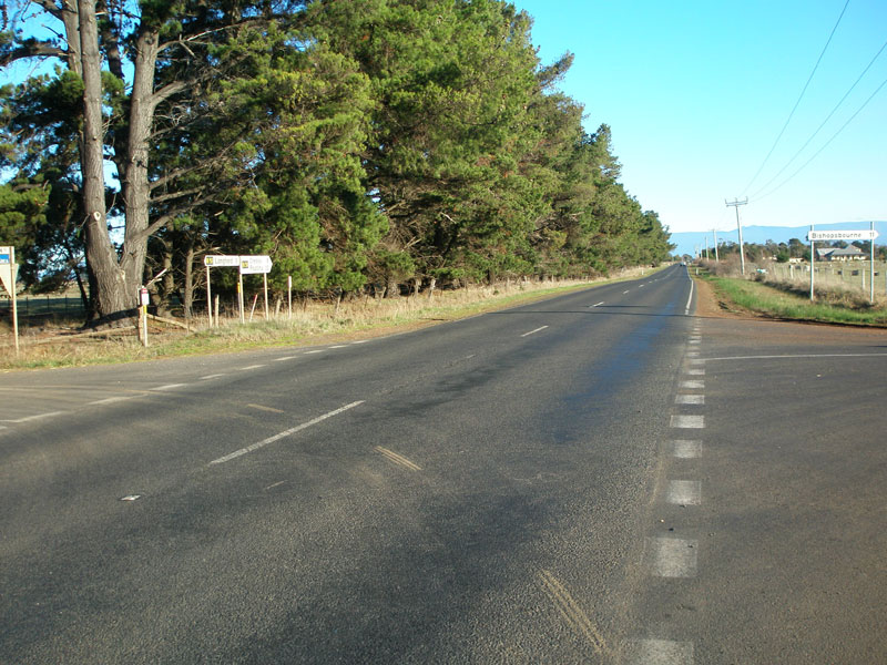
C518 fingerboards at the junction of C518 (Bishopsbourne Rd) & Maitland Rd, Toiberry. Source: Peter Renshaw, May 2007.
Introduced: 1980
Length: 11km
Eastern Terminus: Poatina Main Rd (B51) & Wilmores Lane (C518), 3km south of Longford
Western Terminus: Bishopsbourne Rd (C513/C518) & Liffey Rd (C513), Bishopsbourne
Route taken: Wilmores Lane, Bishopsbourne Rd
Focal Points: Bishopsbourne, Longford
Responsibility: Local Government
C518 is a rural route south-west of Launceston, connecting the town of Longford with the Liffey Valley area. It begins at the B51 south of Longford, running almost due west to the C513 at Bishopsbourne, meeting the C519 in the process. It is sealed throughout its 11km length.
|
Photos of route C518 |
|
 |
Poatina Main Rd (B51) looking south at the junction with Wilmores Lane (C518), 3km south of Longford. Source: Peter Renshaw, June 2007. |
 |
Fingerboard sign at the junction of Poatina Main Rd (B51) & Wilmores Lane (C518) pointing traffic down the C518 towards Bishopsbourne - well, it would if the sign had a C518 shield! Source: Peter Renshaw, June 2007. |
 |
Wilmores Lane (C518) looking west from its eastern terminus at Poatina Main Rd (B51). Source: Peter Renshaw, June 2007. |
 |
Wilmores Lane (C518) looking east towards Poatina Main Rd (B51), which is in front of the line of trees in the distance. Source: Peter Renshaw, June 2007. |
 |
Wilmores Lane (C518) climbs a small ridge between Poatina Main Rd (B51) and Bishopsbourne Rd (C519) - this view is looking east towards Poatina Main Rd which lies in between the trees in the distance. Source: Peter Renshaw, June 2007. |
 |
Wilmores Lane (C518) looking east about 1km from the junction with Bishopsbourne Rd (C519). Source: Peter Renshaw, June 2007. |
 |
Wilmores Lane (C518) looking east, just east of the junction with Bishopsbourne Rd (C519), showing open level crossing of the Hobart to Devonport railway line. Source: Peter Renshaw, May 2007. |
 |
Fingerboard signs facing westbound C518 traffic at the intersection of Bishopsbourne Rd (C518/C519) & Wilmores Lane (C518), 6km east of Bishopsbourne. Source: Peter Renshaw, May 2007. |
 |
Fingerboard sign facing eastbound C518 traffic, pointing it down Wilmores Lane (C518) towards Longford. Bishopsbourne Rd continues straight through this junction as C519. Source: Peter Renshaw, May 2007. |
 |
Fingerboard sign facing westbound Bishopsbourne Rd (C519) traffic at the junction of Wilmores Lane (C518) & Bishopsbourne Rd (C518/C519). Note the deteriorating '8' on the route shield. Source: Peter Renshaw, May 2007. |
 |
A wide easterly view of the Bishopsbourne Rd (C518/C519) & Wilmores Lane (C518) intersection. C519 branches off to the left, whilst C518 continues to the right. Source: Peter Renshaw, May 2007. |
|
Fingerboard signs at the junction of Bishopsbourne Rd (C518) & Maitland Rd, Toiberry. Source: Peter Renshaw, May 2007. |
 |
Bishopsbourne Rd (C518) looking east on the outskirts of Bishopsbourne village. Source: Peter Renshaw, May 2007. |
 |
Bishopsbourne Rd (C518) looking west into Bishopsbourne village. Source: Peter Renshaw, May 2007. |
 |
Fingerboard signs at the junction of Bishopsbourne Rd (C518/C513) & Liffey Rd (C513) in Bishopsbourne village. This is the western terminus of C518. Source: Peter Renshaw, May 2007. |
 |
Close-up of the C518 route shield on the above fingerboard sign, showing deteriorating '8' numeral. Source: Peter Renshaw, May 2007. |
Last updated 17 June 2007 © Ozroads 2004-2007. |