Flinders Island |

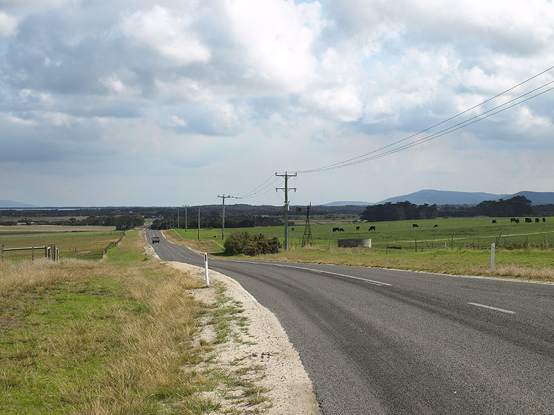
B85 (Palana Road) at its junction with the entrance to Flinders Island airport, 5km north of Whitemark. Source: Peter Renshaw, April 2008.
Introduced: 1980
Length: 72km
Northern Terminus: Palana Rd (B85) & Edens Rd, Palana
Southern Terminus: Main St (B85) & Coast Rd (C805) & Pot Boil Rd, Lady Barron
Route taken: From the intersection of Main St (B85) & Coast Rd (C805), Lady Barron, via Main St, Lady Barron Main Road and Palana Road to the northern end of Palana Rd (B85), Palana
Focal Points: Lady Barron, Whitemark, Emita, (Killiecrankie), Palana
Responsibility: State Government (Lady Barron Main Road) Local Government (Main Street, Palana Road)
B85 is the major route on Flinders Island, located off the north-eastern coast of Tasmania. Beginning at Lady Barron, at the south-eastern tip of the island, B85 heads north to Whitemark, which is the largest population centre of the island. North of Whitemark, the route passes through more remote areas of the island before terminating at the tiny fishing village of Palana, near the north-eastern tip of the island.
B85 is a good standard, sealed rural road from Lady Barron to Flinders Island Airport (6km north of Whitemark). North of the Airport, the road narrows and loses its centreline, eventually losing its sealed surface 2km north of Emita. The remaining 29km of the route to Palana is a well-graded gravel road.
The route has spectacular scenery along its entire length, particularly north of Whitemark.
|
Photos of route B85 |
|
 |
Main St (B85) looking south at the intersection with Franklin St (C805), showing the southern terminus of B85. Main Street ends approximately 100m further south at Lady barron wharf. Source: Peter Renshaw, April 2008. |
  |
Fingerboard signs at the junction of Main St (B85) & Franklin St (C805), Lady Barron. This is assumed to be the southern terminus of both routes as no signs point further south. Top: Peter Renshaw, July 2007. Bottom: Peter Renshaw, April 2008. |
 |
Very old wooden fingerboard sign that pre-dates metrification at the junction of Main St (B85) & Coast Rd (C805), Lady Barron. Source: Peter Renshaw, July 2007. |
 |
Main St (B85) looking south towards the junction with Franklin St (C805) in Lady Barron. Source: Peter Renshaw, July 2007. |
 |
Lady Barron Main Rd (B85) looking south at the Lady Barron town boundary. B85 becomes Main Street when it enters the town limits. Source: Peter Renshaw, July 2007. |
 |
Lady Barron Main Rd (B85) looking south on the northern approach to Lady Barron. Source: Peter Renshaw, July 2007. |
 |
Lady Barron Main Rd (B85) looking west from the intersection with Reedy Lagoon Rd, about 4km north of Lady Barron. The light brush which is typical of the eastern part of the island opens up into fertile agricultural and grazing country. Source: Peter Renshaw, July 2007. |
 |
Lady Barron Main Rd (B85) looking west across the Bootjack Flats, late in the evening, approximately 6km from Lady Barron. Source: Peter Renshaw, April 2008. |
 |
Lady Barron Main Rd (B85) looking west towards the intersection with Lackrana Rd (C803), 6km north of Lady Barron. Source: Peter Renshaw, July 2007. |
 |
Fingerboard signs at the junction of Lady Barron Main Rd (B85) & Lackrana Rd (C803) , 7km north-west of Lady Barron. Note the original fingerboard signs have been supplemented by service signage and a new fingerboard pointing to Emita - these were installed within the last two years. Source: Peter Renshaw, July 2007. |
 |
Lady Barron Main Rd (B85) looking west just west of Red Creek, showing beautiful countryside and mountain backdrop. Source: Peter Renshaw, July 2007. |
 |
One of the most spectacular windbreaks on Flinders Island - Lady Barron Main Rd (B85) looking west from the intersection with Willis Rd, 12km north-west of Lady Barron. Source: Peter Renshaw, July 2007. |
 |
Lady Barron Main Rd (B85) looking west approaching the locality of Ranga. Source: Peter Renshaw, July 2007. |
 |
Lady Barron Main Rd (B85) westbound approaching the junction with Coast Rd (C805) at Ranga. Not sure why Lady Barron is in parenthesis, though, as C805 takes you all the way there. Source: Peter Renshaw, July 2007. |
 |
B85 fingerboard signs at the junction of Lady Barron Main Rd (B85) & Coast Rd (C805), Ranga. Source: Peter Renshaw, July 2007. |
 |
Looking east at the bifurcation of Lady Barron Main Rd (B85) and Coast Rd (C805). Coast Road was the original road north from Lady Barron. Source: Peter Renshaw, July 2007. |
 |
AD sign eastbound on Lady Barron Main Rd (B85) approaching the junction with Coast Rd (C805) at Ranga. Source: Peter Renshaw, April 2008. |
 |
Lady Barron Main Rd (B85) looking west towards Reids Peak, Ranga. Source: Peter Renshaw, July 2007. |
 |
Lady Barron Main Rd (B85) looking west as it descends from Reids Peak, approaching Trousers Point Rd (C806). Source: Peter Renshaw, April 2008. |
 |
Lady Barron Main Rd (B85) looking north, approaching the junction with Trousers Point Rd (C806), 6km south of Whitemark. Source: Peter Renshaw, July 2007. |
 |
Lady Barron Main Rd (B85) looking east from the intersection with Trousers Point Rd (C806), with Reids Peak forming an imposing backdrop. Source: Peter Renshaw, April 2008. |
 |
Fingerboard signs on B85 (Lady Barron Main Road) at its junction with Trousers Point Rd (C806), 6km south of Whitemark. Source: Peter Renshaw, July 2007. |
 |
Lady Barron Main Rd (B85) looking south towards the junction Trousers Point Rd (C806), 6km south of Whitemark. Source: Peter Renshaw, Dec 2006. |
 |
Lady Barron Main Rd (B85) looking south towards Nalinga Creek, with the imposing Mt Strzelecki as a backdrop. Source: Peter Renshaw, April 2008. |
 |
Lady Barron Main Rd (B85) looking north-west, 2.5km south of Whitemark. Source: Peter Renshaw, April 2008. |
 |
Fingerboard and ID sign assembly at the intersection of Lady Barron Main Road (B85), Palana Road (B85) and Lagoon Rd, Whitemark. Source: Peter Renshaw, Dec 2006. |
 |
What's this? A very out-of-place C806 fingerboard sign at the intersection of Lady Barron Main Road (B85), Palana Road (B85) and Lagoon Rd, Whitemark. C806 does not begin for a further 6km south of Whitemark, branching off the B85. Source: Peter Renshaw, Dec 2006. |
 |
More fingerboards and an airport ID sign, at the intersection of Lady Barron Main Road (B85), Palana Road (B85) and Lagoon Rd, Whitemark. Source: Peter Renshaw, April 2008. |
 |
More fingerboards and an airport ID sign, at the intersection of Lady Barron Main Road (B85), Palana Road (B85) and Lagoon Rd, Whitemark. Source: Peter Renshaw, Dec 2006. |
 |
Fingerboard assembly at the intersection of Palana Road (B85) and Memana Road (C803), 3km north of Whitemark. Source: Peter Renshaw, April 2008. |
 |
Fingerboard and ID signs facing northbound traffic at the junction of Palana Road (B85) and Memana Road (C803), 3km north of Whitemark. Source: Peter Renshaw, Dec 2006. |
 |
Palana Rd (B85) looking north across Pats River, approaching Flinders Island Airport. |
 |
Palana Road (B85) looking south from the entrance to Flinders Island airport, 6km north of Whitemark. Source: Peter Renshaw, April 2008. |
|
Fingerboards and a lone ID sign at the junction of Palana Road (B85) and the entrance to Flinders Island airport, 6km north of Whitemark. Source: Peter Renshaw, April 2008. |
 |
Palana Rd (B85) looking south alongside Flinders Island Airport, 7km north of Whitemark. Source: Peter Renshaw, July 2007. |
 |
Palana Rd (B85) looking north near Blue Rocks, about 12km north of Whitemark. Source: Peter Renshaw, July 2007. |
 |
Palana Rd (B85) looking south at the turnoff to Sawyers Bay Beach, 2km south of Emita. Source: Peter Renshaw, April 2008. |
 |
Palana Rd (B85) looking north, showing the descent to Emita and Port Davies. Source: Peter Renshaw, July 2007. |
 |
Palana Rd (B85) looking north into Emita. Source: Peter Renshaw, July 2007. |
 |
Fingerboard signs at the junction of Palana Rd (B85) & Port Davies Rd, Emita. Despite what the sign says (or doesn't say!), B85 continues north from Emita to Killiecrankie and Palana. Source: Peter Renshaw, July 2007. |
 |
Another sweeping vista of the gorgeous countryside - Palana Rd (B85) looking north towards the 40 degrees south parallel, 1km north of Emita. Source: Peter Renshaw, July 2007. |
 |
Sign marking the 40 degree south parallel, 1km north of Emita. Source: Peter Renshaw, July 2007. |
 |
Palana Rd (B85) looking south about 2km north of Emita. Source: Peter Renshaw, July 2007. |
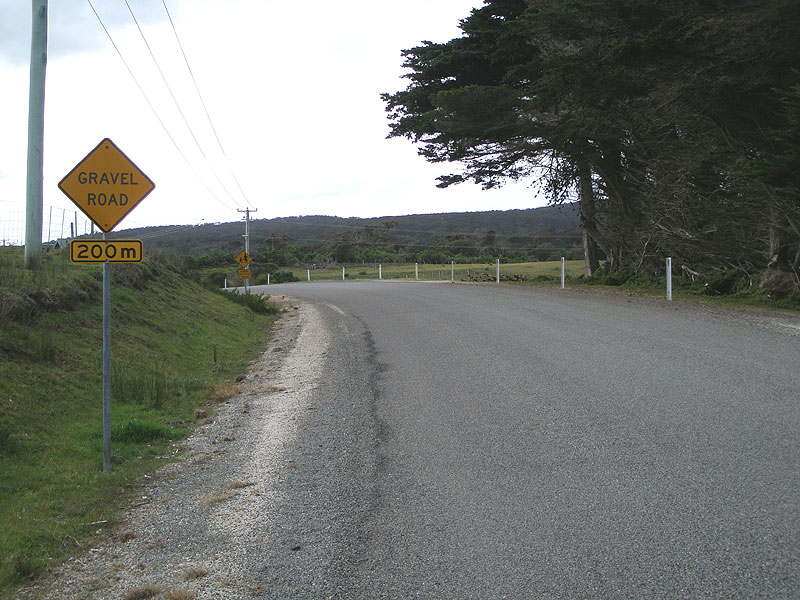 |
Palana Rd (B85) looking north, approaching the junction with Fairhaven Rd (C801), 2km north of Emita. B85 loses its sealed surface at this intersection and remains gravel until its northern terminus at Palana. Source: Peter Renshaw, July 2007. |
 |
Fingerboard signs at the junction of Palana Rd (B85) & Fairhaven Rd (C801), 2km north of Emita. Note the recent addition of supplementary fingerboards, making for a rather untidy sign assembly. Source: Peter Renshaw, April 2008. |
 |
Palana Rd (B85) looking north from the intersection with Fairhaven Rd (C801), showing the end of the sealed pavement and a raging bushfire in the background. Source: Peter Renshaw, April 2008. |
 |
Palana Rd (B85) looking north at the locality of Lughrata, which doesn't appear to actually have any houses. The northern section of the Island is considerably more remote than the southern part. Source: Peter Renshaw, July 2007. |
 |
Palana Rd (B85) looking south at the junction with Five Mile Rd, Lughrata. This is a very unusual intersection - it almost looks like a channelised intersection on a dirt road! Source: Peter Renshaw, July 2007. |
 |
Palana Rd (B85) looking north towards the junction with West End Rd in another homeless locality of Leeka. Source: Peter Renshaw, July 2007. |
 |
Palana Rd (B85) looking south towards Reedy Lagoon from near the junction with West End Rd. Source: Peter Renshaw, July 2007. |
 |
Tourist signage facing northbound traffic at the junction with West End Rd, Leeka. Note the remnants of a bushfire in the background, which gives the photo a hazy look. Source: Peter Renshaw, July 2007. |
 |
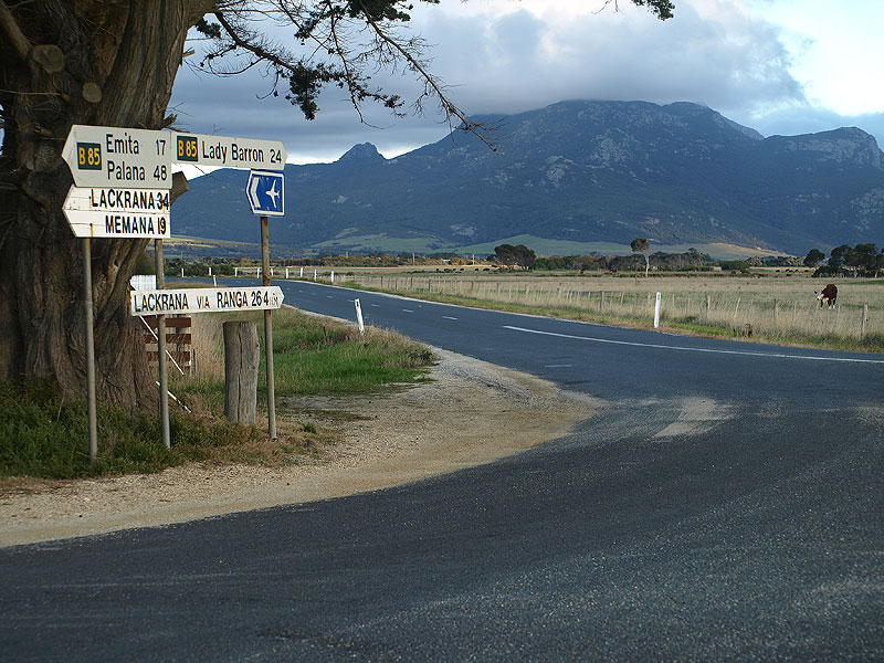
Palana Rd (B85) looking north at the junction with Killiecrankie Rd, 13km south of Palana. Killiecrankie is famous for Killiecrankie Diamonds, which are actually topazes, and are found in the waters of Killiecrankie Bay. Source: Peter Renshaw, July 2007. |
 |
B85 fingerboard signs at the intersection of Palana Rd (B85) & Killiecrankie Rd. Mount Blythe is in the background. Source: Peter Renshaw, July 2007. |
 |
Palana Rd (B85) looking south towards Mount Blythe from the junction with North East River Road, 5km south of Palana. Source: Peter Renshaw, July 2007. |
 |
Recently-installed fingerboard signs at the intersection of Palana Rd (B85) & North East River Rd, 5km south of Palana. Given the remoteness of the north of the island it is rather surprising that there is no south-pointing fingerboard here. Source: Peter Renshaw, July 2007. |
 |
A view of Palana Beach from Palana Rd (B85) as it approaches the tiny fishing and tourist village of Palana. |
 |
Palana Rd (B85) looking north through Palana - note the poor quality of the road at its far northern end. Source: Peter Renshaw, July 2007. |
 |
The unceremonius end of B85 at the northern end of Palana village. Skinner Island can be seen in the background. Source: Peter Renshaw, July 2007. |
Last updated 7 February 2009 © Ozroads 2004-2009. |