THE NATIONAL HIGHWAY SYSTEM
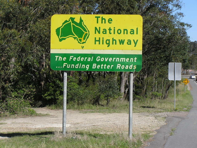
The National Highway system was formed as Australia's federally funded highway system, connecting all the state capitals (including Hobart) and the de-facto capitals of Cairns and Burnie. The system is signed with green and gold shields that are otherwise identical to the black and white National Route shields. In fact, the numbering for the National Highway system was taken directly from the existing National Route system so many of the National Highway numbers continue with the black and white shield.
As of June 2005 the National Highway system was no longer the federally funded highway system of Australia, replaced by the Auslink funding program. However, the National Highway routes continue to be signed by all states (there is evidence that NSW will discontinue the use of the green and gold shield when it rolls out its alpha-numeric route marking system). The routes still have major significance as the shortest/most favourable routes between capital cities and should continue to be signposted to aid navigation.
Below is a brief history of the National Highway system until its replacement by Auslink in June 2005.
The case for a national system of primary arterial roads was first made out in September 1956 by the then New South Wales Minister for Highways and Minister for Local Government, John Renshaw. It was made out again by him two years later. His proposal envisioned the Commonwealth Government using the full amount of motor vehicle taxes to develop a road system of 15,500 miles over 15 years at an estimated cost of £350 million or $700 million (1956).
In 1960, the National Assosciation of Australian State Road Authorities adopted the New South Wales proposal for "principal National Routes", shown HERE, but was unable to provide any legislation or funding to get the construction side of it happening. As the years passed support for Renshaw's plan was gained, particularly from the Royal Automobile Assosciation who lobbied the Commonwealth Government at every opportunity. In 1973, the Royal Automobile Assosciation twice shortened the length of the proposed federally funded highway system, firstly to about 14,000 miles and then to 10,500 miles.
The reduced mileage was presented at the 46th annual Conference of the Australian Automobile Asosciation in October 1973. The RAA gave this outline for the system:
Western Australia - Great Northern, Great Eastern and Eyre Highways (3030 miles)
South Australia - Eyre, Stuart and Dukes Highways, including sections of 3 others (1900 miles)
Victoria - Western and Hume Highways (470 miles)
New South Wales - Hume, New England, Barrier and Mitchell Highways (1555 miles)
Queensland - Warrego, Landsborough and Barkly Highways, with Bruce and Flinders Hwy warranting consideration (1490 miles)
Tasmania - Midland and Bass Highways (210 miles)
Northern Territory - Stuart, Barkly and Victoria Highways (1740 miles)
The RAA also determined that the following construction standards should apply to these highways:
(a) a sealed-surface two-lane minimum, all-weather road, 20-24 feet wide with 6 feet shoulders
(b) a minimum of sections with low allowable speeds
(c) high standards of safety eg. climbing lanes for slow vehicles and reasonably frequent overtaking lanes in the two lane sections, wide bridges and culverts, good sight distances, no poles or trees on shoulder edge and median strips and overpasses in the 4 and 6 lane sections
The Commonwealth Government took a liking to this reduced mileage plan, making few adjustments before legislating the "National Roads Act, 1974" which made the new "National Highway" system enshrined in law. This new system, connecting all the state and territory capitals (Cairns and Burnie were included as de-facto state capitals), would be 100% federally funded and construction would begin as soon as possible to bring these highways up to the accepted standards.
The National Highways were known as "links" and terminated at the edge of each capital city. Also included were two "Canberra Connectors" which linked the Hume Highway (Sydney-Melbourne Link) with the national capital. The following "links" were declared on 20 September 1974:
Sydney-Melbourne Link -----> Hume Highway
Sydney-Brisbane Link -----> Sydney-Newcastle (F3) Freeway, New England & Cunningham Highways
Melbourne-Adelaide Link -----> Western, Dukes and Princes Highways
Adelaide-Perth Link -----> Pt Wakefield Rd, Pt Wakefield to Pt Augusta Rd, Eyre/Coolgardie-Esperance and Gt Eastern Highways
Adelaide-Darwin Link -----> Stuart Highway
Perth-Darwin Link -----> Great Northern and Victoria Highways
Darwin-Brisbane Link -----> Barkly, Landsborough and Warrego Highways
Brisbane-Cairns Link -----> Bruce Highway
Hobart-Burnie Link -----> Midland and Bass Highways
Canberra Connectors -----> Federal and Barton Highways
Construction commenced almost immediately to seal these highways and bring then up to National Highway standards. It was a huge and expensive project, involving major deviations of the Stuart, Great Northern and Landsborough Highway as well as over 3000km of bitumen surfacing. It was until 1986 that the bitumen sealing of the last section of the Gt Northern Highway marked the completion of an all-weather route around Australia.
In March 1976, the Commonwealth Bureau of Roads presented its report to the Australian Government dismissing the proposal to add another route to the National Highway system in the form of a yet-to-be-constructed highway between Broken Hill and Mt Isa. The proposal is discussed in detail HERE.
In 1988 the legislation was changed, bringing the system under the governance of the Australian Land Transport Development Act, 1988 which protected the integrity of the existing federally funded routes while providing for the addition of two more inter-capital links in November 1992 and for designated National Highway routes through each capital city in January 1994.
The two links introduced in November 1992 connected Sydney-Adelaide (Sturt Highway) and Melbourne-Brisbane (Goulburn Valley/Newell/Gore Highways) – however, the route between Goondiwindi and Brisbane was not finalised until October 1993. The following routes were included in the National Highway system for intra-capital city travel:
Sydney ----> Hume and Cumberland Highways from Prestons to Wahroonga
Melbourne ----> Western Ring Road from Hume Hwy to Western Hwy
Adelaide ----> Portrush & Lower Portrush Roads, Ascot Ave, Hampstead Rd, Grand Junction Rd and the South Rd-Salisbury Hwy Connector
Perth ----> Roe Highway
Brisbane -----> Ipswich Motorway, the Metroad 2 corridor and the Gateway Motorway (but not the Gateway Bridge)
The Gateway Bridge was not included in the National Highway system as it is a toll bridge, although it may have been slated for inclusion once the 30 year tolling period was completed.
As route marking in some states was changed from the traditional shielded style to the alpha-numeric style, beginning in Victoria 1995/96 the National Highway shield was adapted and widened to fit an extras character in the shield. This seemed to be the way it was to be done until NSW and the Northern Territory installed signage without the shield. Once Auslink replaced the National Highway system funding and legislation wise in June 2005 it was evident why the shield was no longer to be signposted.
In my personal opinion, despite the demise of the National Highway system, the routes which previosuly formed the system still retain their strategic significance for long-distance travel. The continued use of the green and gold shield gives an easy indication to motorists that they are on one of the major interstate highways that connects only capital city to capital city (Cairns and Burnie included). The contrast between the former NH routes and the new alpha-numeric routes is quite obvious now with most states leaving other route without a shield.
For information on the individual route numbers and highways that made up the National Highway system please see the National Routes page. Also note that some route numbers continue as normal National Routes beyond the boundaries of the National Highway system.