NSW Route B56 Oxley Highway: Port Macquarie to Coonabarabran |
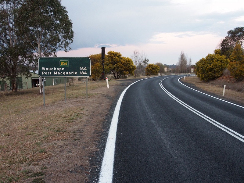
RD sign eastbound on Oxley Highway as you climb out of Walcha. Source: Peter Renshaw, August 2013.
Introduced: April-May 2013
Replaced: National Route 34 (Port Macquarie to Newell Highway section)
Length: 449km
Eastern Terminus: Oxley Highway, Gordon Street, Hindman Street & Hastings River Drive, Port Macquarie
Western Terminus: Newell Highway & Oxley Highway, 5km north of Coonabarabran
Route taken: Oxley Highway from Port Macquarie to Bendemeer (includes Gordon Street through Port Macquarie; Carrington Street and High Street through Wauchope; Fitzroy Street through Walcha), then via New England Highway to Tamworth (includes Armidale Road through Tamworth), then via Oxley Highway from Tamworth to the Newell Highway junction, 5km north of Coonabarabran (includes Marius Street, Brisbane Street, Bridge Street, Stewart Avenue and Gunnedah Road through Tamworth; Breeza Street through Carroll; Conadilly Street, Abbott Street, South Street and Mullaley Road through Gunnedah; and Nombi Street through Mullaley)
Duplexes: A15 from Bendemeer to Tamworth; B51 for 2km through Gunnedah
Focal Points: Port Macquarie, Wauchope, Walcha, Tamworth, Gunnedah, Coonabarabran
Roads Act 1993 classification: Highway No. 11 (Oxley Highway sections), Highway No. 9 (New England Highway section)
Notable Events:
Jan 2008 - first uncovered B56 signs spotted in Port Macquarie
September 2012 - Alpha-numeric route marking scheme announced by RMS
April-May 2013 - route B56 signposted
Description:
Route B56 is an east-west route in northern New South Wales, connecting the Mid North Coast with the New England and central western New South Wales. It follows two portions of the Oxley Highway between Port Macquarie and near Coonabarabran but does not extend to Gilgandra, Warren and Nevertire as the Oxley Highway does. B56 replaces that portion of National Route 34 between Port Macquarie and the Newell Highway junction near Coonabarabran.
History:
Coming soon...
Signage:
The vast majority of signs along the route pre-dated the preparations for alpha-numeric route marking and accordingly have been adorned with coverplates and/or topknots during the initial signposting of the route.
Several key sections of alpha-numeric ready signage can be found at Port Macquarie and along the A15 duplex between Bendemeer and Tamworth. Signage along this duplex is generally pretty good - a welcome change after many years of terrible signage on the National Highway 15 / National Route 34 duplex.
- Port Macquarie to Pacific Highway
- Pacific Highway to Ellenborough
- Ellenborough to Walcha
- Walcha to Bendemeer
- Bendemeer to Tamworth
- Tamworth to Gunnedah
- Gunnedah to Newell Highway
- Incorrect B56 signs - Gilgandra to Nevertire
|
Photos of route B56 - Port Macquarie to Pacific Highway |
|
 |
Prematurely uncovered AD sign westbound on Oxley Highway (Gordon Street) approaching the junction with Ocean Drive & Hastings River Drive, Port Macquarie. The signs at this intersection were installed when Ocean Drive was extended from Lake Road to Gordon Street and, as far as I can remember, the B56 route markers were never covered. Photo taken: January 2008. |
   |
Prematurely uncovered ID signs at the junction of Oxley Highway (Gordon Street), Ocean Drive and Hastings River Drive, Port Macquarie. Photo taken: January 2008. |
 |
Prematurely uncovered AD sign westbound on Oxley Highway (Gordon Street) approaching the junction with Ocean Drive & Hastings River Drive, Port Macquarie. The signs at this intersection were installed when Ocean Drive was extended from Lake Road to Gordon Street and, as far as I can remember, the B56 route markers were never covered. Photo taken: January 2008. |
 |
Prematurely uncovered AD sign southbound on Hastings River Drive approaching the junction with Oxley Highway (Gordon Street) & Ocean Drive. This is the eastern terminus of route B56. Source: Peter Renshaw, August 2013. |
 |
Prematurely uncovered AD sign eastbound on Oxley Highway (Gordon Street) approaching the junction with Hastings River Drive & Ocean Drive. This is the eastern terminus of route B56. Source: Peter Renshaw, August 2013. |
 |
AD sign westbound on Oxley Highway approaching the junction with Widderson Street, Port Macquarie. Source: Peter Renshaw, August 2013. |
 |
AD sign eastbound on Oxley Highway approaching the junction with Widderson Street, Port Macquarie. Source: Peter Renshaw, August 2013. |
 |
AD sign eastbound on Oxley Highway approaching the junction with Clifton Drive & Fernhill Road, Port Macquarie. Source: Peter Renshaw, August 2013. |
  |
ID signs at the junction of Oxley Highway, Lake Road & Sherwood Road, Port Macquarie. Source: Peter Renshaw, August 2013. |
 |
AD sign north(east)bound on Oxley Highway approaching the junction with Lake Road & Sherwood Road, Port Macquarie. Source: Peter Renshaw, August 2013. |
  |
AD signs southbound on Oxley Highway approaching the junction with John Oxley Drive & Wrights Road, Port Macquarie. John Oxley Drive was, up until 2012, the route of the Oxley Highway. Now the highway turns right at this intersection. Source: Peter Renshaw, August 2013. |
 |
AD sign facing eastbound Oxley Highway traffic at the junction with John Oxley Drive & Wrights Road. Photo taken: July 2012. |
  |
AD signs eastbound on Oxley Highway approaching the junction with John Oxley Drive & Wrights Road. Unlike westbound traffic, eastbound traffic has a free flow merge towards Port Macquarie. Source: Peter Renshaw, August 2013. |
 |
RD sign westbound on Oxley Highway after the junction with John Oxley Drive & Wrights Road, 4km west of Port Macquarie. Source: Peter Renshaw, August 2013. |
 |
Eastbound view of the Oxley Highway deviation at the second junction with John Oxley Drive, 6km west of Port Macquarie. Photo taken: July 2012. |
 |
Eastbound view of Oxley Highway as it crosses John Oxley Drive, 6km west of Port Macquarie. |
 |
Eastbound view of Oxley Highway approximately 7.5km west of Port Macquarie. |
 |
Eastbound view of Oxley Highway as it crosses Carlie Jane Drive approximately 8.5km west of Port Macquarie. |
 |
AD sign westbound on Oxley Highway approaching the third junction with John Oxley Drive at Thrumster. The junction with Pacific Highway can be seen in the distance. |
   |
ID signs at the junction of Oxley Highway & John Oxley Drive, Thrumster. Note the dodgy white patch on the 'Service Centre' sign. Source: Peter Renshaw, August 2013. |
 |
AD sign southbound on John Oxley Drive approaching the junction with Oxley Highway, Thrumster. Source: Peter Renshaw, August 2013. |
 |
AD sign eastbound on Oxley Highway approaching the junction with Oxley Highway, Thrumster. Source: Peter Renshaw, August 2013. |
 |
AD sign westbound on Oxley Highway approaching the junction with Pacific Highway, Thrumster. Note that B56 had been signed at this point but A1 was still be signed. Source: Peter Renshaw, August 2013. |
  |
B56 ID signs at the junction of Pacific Highway & Oxley Highway, Thrumster. Note the incorrect Tourist Drive 5 shield - this should be Tourist Drive 8. Source: Peter Renshaw, August 2013. |
   |
Northbound signage on Pacific Highway approaching the junction with Oxley Highway, Thrumster. Note that B56 had been signed at this point but A1 was still be signed. Source: Peter Renshaw, August 2013. |
  |
Southbound signage on Pacific Highway approaching the junction with Oxley Highway, Thrumster. Note that B56 had been signed at this point but A1 was still be signed. Source: Peter Renshaw, August 2013. |
 |
AD sign eastbound on Oxley Highway approaching the junction with Pacific Highway, Thrumster. Source: Peter Renshaw, August 2013. |
Photos of B56 - Pacific Highway to Ellenborough |
|
 |
Tourist Drive 8 RD sign westbound on Oxley Highway approaching the junction with Burrawan Forest Drive, 1.5km west of Pacific Highway. There is currently no RD sign for B56 as you head west from the Pacific Highway junction. Source: Peter Renshaw, August 2013. |
 |
ID and fingerboard sign assembly at the junction of Oxley Highway & Burrawan Forest Drive, 1.5km west of Pacific Highway. This was formerly the junction of the Pacific & Oxley Highways, which probably explains the existence of this sign. Source: Peter Renshaw, August 2013. |
 |
Fingerboard sign assembly at the junction of Oxley Highway & Redbank Road, 1km east of Wauchope. Source: Peter Renshaw, August 2013. |
 |
RD sign eastbound on Oxley Highway on the eastern outskirts of Wauchope. The junction with Redbank Road can be seen in the background. Source: Peter Renshaw, August 2013. |
  |
ID and fingerboard signs at the junction of Oxley Highway & Randall Street, Wauchope. Source: Peter Renshaw, August 2013. |
 |
ID sign assembly at the junction of Oxley Highway (High Street) & Wallace Street, Wauchope. Source: Peter Renshaw, August 2013. |
 |
Looking east along Oxley Highway (High Street) from the junction with Cameron Street, Wauchope. Source: Peter Renshaw, August 2013. |
  |
ID signs at the junction of Oxley Highway (High Street) & Cameron Street, Wauchope. Cameron Street leads south to become Bago Road. Source: Peter Renshaw, August 2013. |
 |
AD sign westbound on Oxley Highway (High Street) approaching the junction with Beechwood Road, Wauchope. Beechwood Road provides an alternative route to the Pacific Highway at Telegraph Point via Pembrooke. Source: Peter Renshaw, August 2013. |
 |
ID and fingerboard signs at the junction of Oxley Highway (High Street) & Beechwood Road, Wauchope. Source: Peter Renshaw, August 2013. |
 |
AD sign eastbound on Oxley Highway (High Street) approaching Beechwood Road, Wauchope. Source: Peter Renshaw, August 2013. |
 |
RD sign westbound on Oxley Highway adjacent to Timbertown on the western outskirts of Wauchope. Source: Peter Renshaw, August 2013. |
 |
Fingerboard sign assembly at the junction of Oxley Highway & Rosewood Road, 5km west of Wauchope. Source: Peter Renshaw, August 2013. |
 |
RD sign eastbound on Oxley Highway after the junction with Comboyne Road, 11km west of Wauchope. Source: Peter Renshaw, August 2013. |
 |
AD sign westbound on Oxley Highway approaching the junction with Comboyne Road, 11km west of Wauchope. Source: Peter Renshaw, August 2013. |
 |
ID and fingerboard signs at the junction of Oxley Highway & Comboyne Road, 11km west of Wauchope. Source: Peter Renshaw, August 2013. |
 |
AD sign eastbound on Oxley Highway approaching the junction with Comboyne Road, 11km west of Wauchope. Source: Peter Renshaw, August 2013. |
 |
RD sign westbound on Oxley Highway after the junction with Comboyne Road, 11km west of Wauchope. Source: Peter Renshaw, August 2013. |
 |
Fingerboard signs at the junction of Oxley Highway & Kindee Road, 32km west of Wauchope. Source: Peter Renshaw, August 2013. |
Photos of B56 - Ellenborough to Walcha |
|
 |
Fingerboard sign assembly at the junction of Oxley Highway & Forbes River Road, 48km west of Wauchope. Source: Peter Renshaw, August 2013. |
 |
Eastbound view of Oxley Highway as it winds its way into the mountains near Mount Seaview, approximately 57km west of Wauchope. Source: Peter Renshaw, August 2013. |
 |
Fingerboard sign assembly at the junction of Oxley Highway & Doyles River Road, in Cotton-Bimbang National Park, 77km west of Wauchope. Source: Peter Renshaw, August 2013. |
  |
Dodgy ID and fingerboard signs at the junction of Oxley Highway & Kangaroo Flat Road, 109km west of Wauchope/54km east of Walcha. Source: Peter Renshaw, August 2013. |
 |
Fingerboard sign at the junction of Oxley Highway & Mitchell Hill Road, 53km east of Walcha. Source: Peter Renshaw, August 2013. |
 |
Looking east from Chandlers Road towards the bridge over Yarrowitch River at Yarrowitch, 49km east of Walcha. Source: Peter Renshaw, August 2013. |
 |
ID sign at the junction of Oxley Highway & Chandlers Road, 49km east of Walcha. Source: Peter Renshaw, August 2013. |
 |
Fingerboard sign at the junction of Oxley Highway & Oaklands Road, 46km east of Walcha. Source: Peter Renshaw, August 2013. |
 |
Oxley Highway looking west from near Oaklands Road, 46km east of Walcha. Source: Peter Renshaw, August 2013. |
 |
Oxley Highway looking east at the junction with Tia Diggings Road, 35km east of Walcha. The bridge over the Tia River is located at the bottom of the hill. Source: Peter Renshaw, August 2013. |
 |
Fingerboard sign assembly at the junction of Oxley Highway & Hartford Road, 8km east of Walcha. Source: Peter Renshaw, August 2013. |
 |
Fingerboard sign assembly at the junction of Oxley Highway & Brackendale Road, 4km east of Walcha. Source: Peter Renshaw, August 2013. |
 |
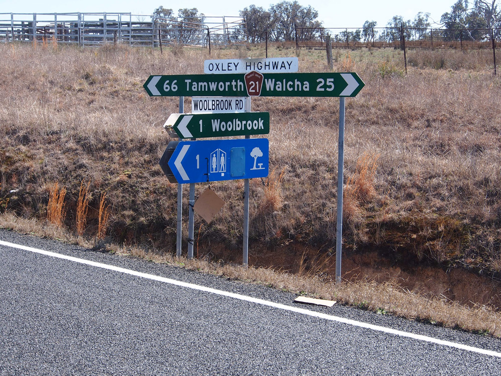
Nice old black RD sign with a B56 coverplate, eastbound on Oxley Highway as you climb out of Walcha. Source: Peter Renshaw, August 2013. |
 |
AD sign westbound on Oxley Highway (Fitzroy Street) approaching the junction with Thunderbolts Way (Derby Street), Walcha. Source: Peter Renshaw, August 2013. |
 |
AD sign southbound on Thunderbolts Way (Derby Street) approaching the junction with Oxley Highway (Fitzroy Street), Walcha. Source: Peter Renshaw, August 2013. |
 |
Oxley Highway (Fitzroy Street) looking west through the roundabout at Thunderbolts Way (Derby Street), Walcha. Source: Peter Renshaw, August 2013. |
 |
Oxley Highway (Fitzroy Street) looking west through Walcha town centre. Source: Peter Renshaw, August 2013. |
 |
AD sign westbound on Oxley Highway (Fitzroy Street) approaching the junction |
 |
RD sign westbound on Oxley Highway (Fitzroy Street) at the Towers Street intersection as you leave Walcha. Source: Peter Renshaw, August 2013. |
Photos of B56 - Walcha to Bendemeer |
|
 |
Dodgy fingerboard sign assembly at the junction of Oxley Highway & Scrubby Gully Road, 4km west of Walcha. Note the dodgy Tourist Drive 21 route markers, installed by Walcha Shire Council. Source: Peter Renshaw, August 2013. |
 |
Old dodgy black fingerboard sign assembly at the junction of Oxley Highway & Ruby Hills Road, 10km west of Walcha. Note the dodgy TD21 shield and the missing B56 route marker. Source: Peter Renshaw, August 2013. |
 |
Dodgy RD sign eastbound on Oxley Highway at Walcha Road. This sign replaced an old black RD sign circa 2012 but omitted the B56 route marker. Source: Peter Renshaw, August 2013. |
 |
Oxley Highway looking west across the narrow bridge over Surveyors Creek at Walcha Road. Source: Peter Renshaw, August 2013. |
   |
Dodgy ID and fingerboard signs at the junction of Oxley Highway & Wollun Road, Walcha Road. Note the terribly placed TD21 route markers. Source: Peter Renshaw, August 2013. |
 |
RD sign westbound on Oxley Highway at Walcha Road. Source: Peter Renshaw, August 2013. |
 |
Dodgy fingerboard sign assembly at the junction of Oxley Highway & Niangala Road, 21km west of Walcha. Note the dodgy TD21 shield and the missing B56 route marker. Source: Peter Renshaw, August 2013. |
 |
Dodgy fingerboard sign assembly at the junction of Oxley Highway & Woolbrook Road, Woolbrook. Note the dodgy TD21 shield. Source: Peter Renshaw, August 2013. |
 |
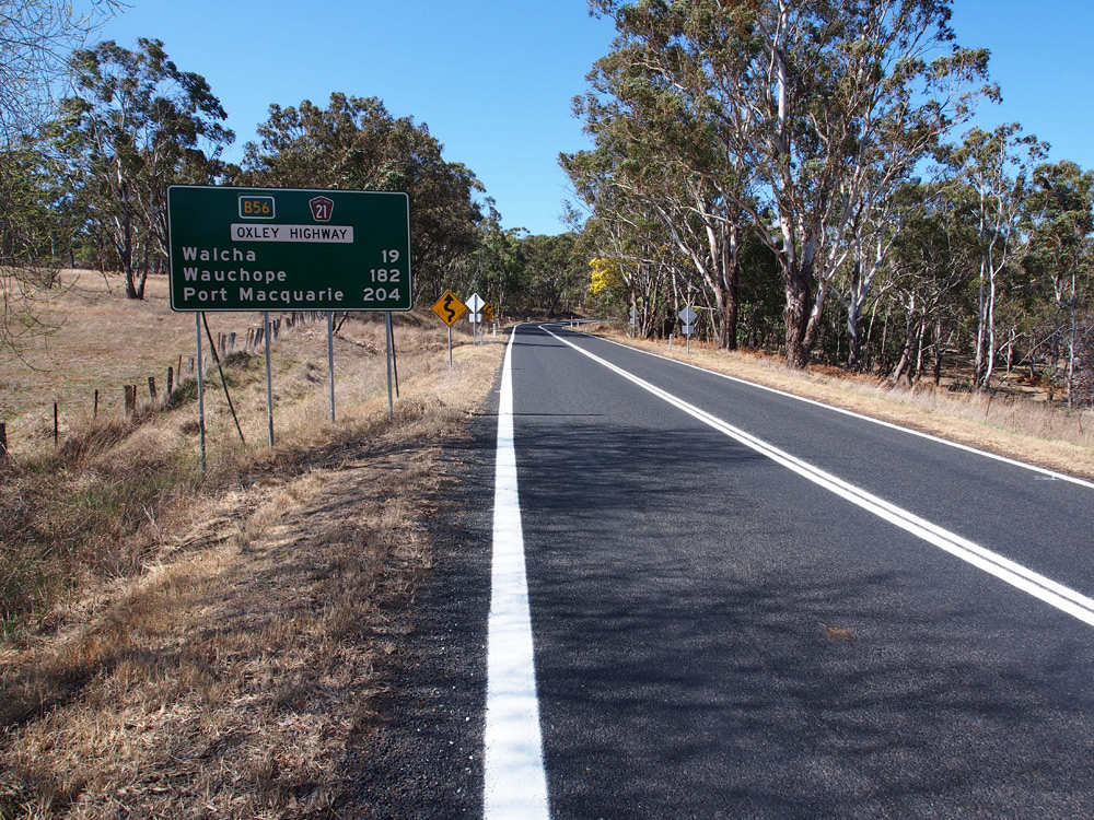
Coverplated RD sign eastbound on Oxley Highway after the junction with New England Highway, Bendemeer. Note the recently added TD21 route marker. Source: Peter Renshaw, August 2013. |
 |
AD sign westbound on Oxley Highway approaching the junction with New England Highway at Bendemeer. After many years of the NH15/NR34 duplex being terribly signed, it is great to see the A15/B56 duplex mostly being signed properly from the start. Source: Peter Renshaw, August 2013. |
  |
ID signs at the junction of New England & Oxley Highways, Bendemeer. B56 continues south along the New England Highway to Tamworth before picking up the western continuation of the Oxley Highway. Note the dodgy TD21 shield. Source: Peter Renshaw, August 2013. |
 |
AD sign southbound on New England Highway approaching the junction with Oxley Highway, Bendemeer. Note the missing B56 route marker for the through movement as well as the missing TD21 route marker for the left turn. Source: Peter Renshaw, August 2013. |
 |
AD sign northbound on New England Highway approaching the junction with Oxley Highway, Bendemeer. Note the dodgy TD21 route marker. Source: Peter Renshaw, August 2013. |
 |
AD sign southbound on New England Highway approaching Havana Street, Bendemeer. Note the missing B56 route marker. Source: Peter Renshaw, August 2013. |
 |
RD sign southbound on New England Highway after Havana Street, Bendemeer, correctly showing the A15/B56 duplex. Source: Peter Renshaw, August 2013. |
Photos of B56 - Bendemeer to Tamworth |
|
 |
RD sign east(north)bound on New England Highway (Armidale Road) after the junction with Murray Street, Tamworth. Source: James Semple, October 2013. |
 |
ID sign (with bonus thumb) at the junction of New England Highway (Armidale Road/Murray Street) & Oxley Highway (Marius Street), Tamworth. Source: James Semple, October 2013. |
 |
AD sign eastbound on Oxley Highway (Marius Street) approaching the junction with New England Highway (Murray Street), Tamworth. Source: James Semple, October 2013. |
 |
Terrible AD sign at the junction of Oxley Highway (Marius Street) & Brisbane Street, Tamworth. Three B56 coverplates but they couldn't manage an A15 coverplate (or destroying this abomination). Source: James Semple, October 2013. |
 |
ID sign at the junction of Oxley Highway (Marius Street) & Brisbane Street, Tamworth. Source: James Semple, October 2013. |
 |
Another horrible AD sign, this time northbound on Oxley Highway (Brisbane Street) approaching the junction with Marius Street, Tamworth. I am looking forward to the B95 coverplate, as well as this sign meeting a fiery death. Source: James Semple, October 2013. |
  |
More horrible AD signs, this time at the Marius Street/Darling Street and Peel Street/Darling Street intersections respectively, referencing B56. Source: James Semple, October 2013. |
Photos of B56 - Tamworth to Gunnedah |
|
 |
Dodgy fingerboard sign at the junction of Oxley Highway & Wilkinson Road (former Oxley Highway), 4km east of Gunnedah. This sign previously had a standalone NR34 shield which has been replaced by a B56 route marker - this must be the only alpha-numeric trailblazer in NSW? Source: Peter Renshaw, September 2013. |
 |
Another dodgy fingerboard sign, this time including B56 in the sign itself, at the junction of Oxley Highway & Ruvigne Road, 4km east of Gunnedah. Source: Peter Renshaw, September 2013. |
 |
Coverplated RD sign eastbound on Oxley Highway after the junction with Kamilaroi Highway, 2km east of Gunnedah. The bridge over the Mooki River can be seen just beyond the change in speed limit. Source: Peter Renshaw, September 2013. |
 |
AD sign westbound on Oxley Highway approaching the junction with Kamilaroi Highway, 2km east of Gunnedah. Source: Peter Renshaw, September 2013. |
   |
Dodgy low-mounted ID signage at the junction of Oxley & Kamilaroi Highways, 2km east of Gunnedah. Source: Peter Renshaw, September 2013. |
 |
AD sign northbound on Kamilaroi Highway approaching the junction with Oxley Highway, 2km east of Gunnedah. The Kamilaroi Highway has a break in it from this intersection for 2km into Gunnedah where the Oxley Highway takes precedence. Source: Peter Renshaw, September 2013. |
 |
AD sign eastbound on Oxley Highway approaching the junction with Kamilaroi Highway, 2km east of Gunnedah. Source: Peter Renshaw, September 2013. |
 |
RD sign westbound on Oxley Highway after the junction with Kamilaroi Highway, 2km east of Gunnedah. Source: Peter Renshaw, September 2013. |
 |
Fingerboard sign at the junction of Oxley Highway (Conadilly Street) & Boundary Road on the eastern outskirts of Gunnedah. Source: Peter Renshaw, September 2013. |
 |
AD sign northwestbound on Oxley Highway (Conadilly Street) approaching the junction with Abbott Street. As the sign suggests, the Oxley Highway turns left here and the Kamilaroi Highway resumes. Source: Peter Renshaw, September 2013. |
   |
ID signs at the junction of Oxley & Kamilaroi Highways, Gunnedah. Source: Peter Renshaw, September 2013. |
 |
AD sign southeastbound on Kamilaroi Highway (Conadilly Street) approaching the junction with Oxley Highway, Gunnedah. Note the unusual coverplating arrangement - the National Route 34 & 37 shields were covered with blank plates and the route numbers placed on the right hand side of the panel where there was more room. Source: Peter Renshaw, September 2013. |
 |
AD sign northbound on Oxley Highway (Abbott Street) approaching the junction with Kamilaroi Highway (Conadilly Street). Source: Peter Renshaw, September 2013. |
Photos of B56 - Gunnedah to Newell Highway |
|
 |
RD sign eastbound on Oxley Highway after the junction with Newell Highway, 5km north of Coonabarabran. Source: Peter Renshaw, November 2012. |
 |
AD sign westbound on Oxley Highway approaching the junction with Newell Highway, 5km north of Coonabarabran. Route B56 terminates at this junction, whilst the Oxley Highway has a break for approximately 100km to Gilgandra, then resuming its westerly course to Warren. Source: Peter Renshaw, November 2012. |
   |
ID signs at the junction of Newell Highway & Oxley Highway, 5km north of Coonabarabran. Note the gigantic Newell Highway name plates which are left over from the previous ID signs at this junction. Source: Peter Renshaw, November 2012. |
 |
AD sign southbound on Newell Highway approaching the junction with Oxley Highway, 5km north of Coonabarabran. Source: Peter Renshaw, November 2012. |
 |
AD sign northbound on Newell Highway approaching the junction with Oxley Highway, 5km north of Coonabarabran. Source: Peter Renshaw, November 2012. |
Incorrect B56 signs - Gilgandra to Nevertire
For some strange reason, the former RTA decided to terminate route B56 at the Newell Highway junction near Coonabarabran, rather than continuing along the remainder of the then National Route 34. This would have involved a 100km long duplex with the A39, then a further 106km continuation along Oxley Highway through Collie and Warren to Nevertire. This rather important extension would have completed the connection between the coast and western NSW.
Despite the long term plan to terminate B56 at the Newell Highway, several incorrect B56 signs have appeared between Gilgandra and Nevertire. These are illustrated in the gallery below.
Incorrect B56 signs - Gilgandra to Nevertire |
|
 |
Fingerboard sign at the junction of Oxley Highway (Warren Road) & Federation Street, Gilgandra. The NR34 coverplate hides a B56 route marker. I was rather surprised to find this sign as all the other alpha-numeric signs in Gilgandra correctly omit B56. Photo taken: July 2011. |
  |
Prematurely exposed and incorrect B56 fingerboard signs at the junction of Mitchell Highway & Oxley Highway, Nevertire. Top photo: Peter Renshaw, June 2012. Bottom photo: Paul Rands, August 2011. |
Last updated 21 February 2014 © Ozroads 2003-2014. |