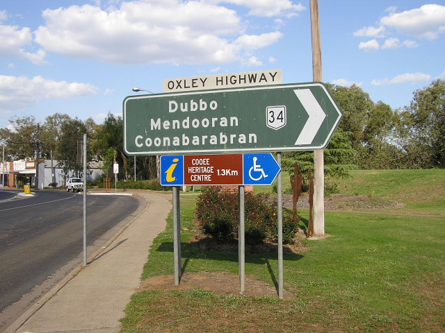
National Route 34 |

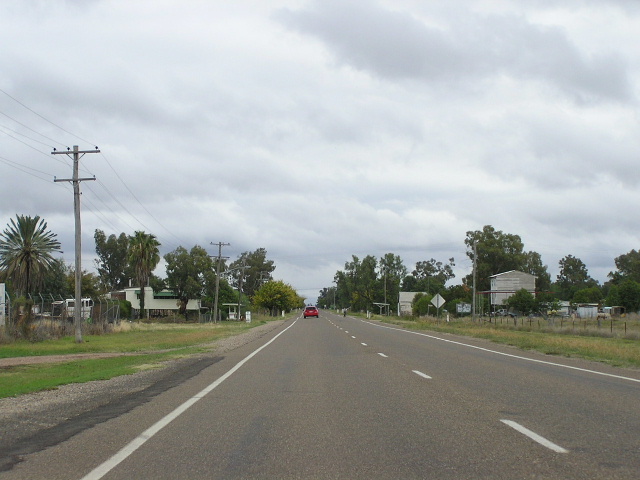
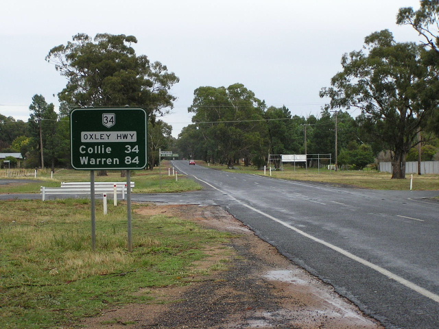
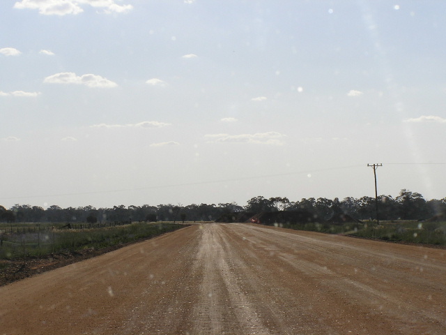
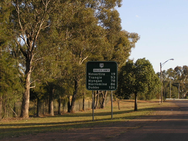
Oxley Highway heading northeast from the Mitchell Highway at Nevertire. Oct 2004.
In 2013, RMS will be implementing a new alpha-numeric route numbering system. For more information, visit the RMS Website. |
||
Forthcoming alpha-numeric route number: |
(Port Macquarie to Coonabarabran section only) |
|
Length: 513km (NR34 is 653km including duplexes with NH15 and NH39)
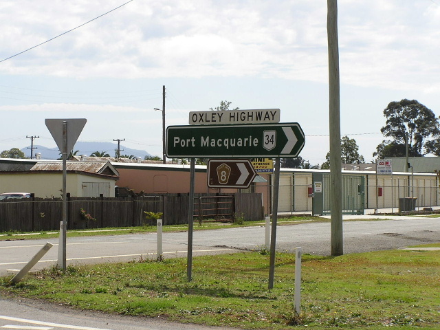
Eastern Terminus: Gordon St & Hindman St, Port Macquarie
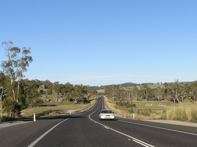
Western Terminus: Mitchell Hwy, Nevertire
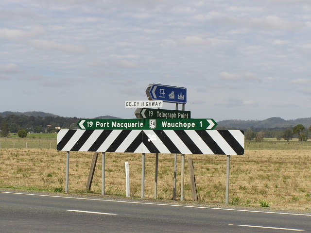
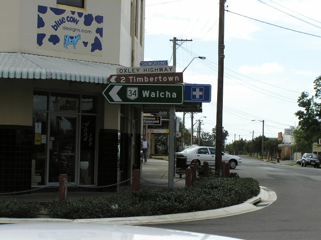
Route taken: From Gordon St at Hindman St, Port Macquarie, via Wauchope and Walcha to the New England Hwy at Bendemeer. Then from the New England Hwy at Tamworth, via Marius St, Brisbane St, Bridge St, Stewart Ave, Gunnedah and Mullaley to the Newell Hwy, 5km northeast of Coonabarabran. Thence from the Newell Hwy at Gilgandra via Collie and Warren to the Mitchell Hwy at Nevertire.
Note: NR34 is continuous over the gaps in the Oxley Hwy created by the New England and Newell Highways.
Focal Points: Port Macquarie, Wauchope, Walcha, Tamworth, Gunnedah, Coonabarabran, Gilgandra, Warren, Nevertire
RTA Internal Classification: State Highway No. 11
(Note: NR34 traverses parts of State Highway No. 9 and State Highway No. 17 where there are gaps in the Oxley Highway)
Proclaimed a State Highway: 7 August 1928
Named: 7 August 1928
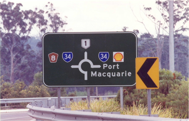
The Oxley Highway , National Route 34 for its entire length, is an east-west artery connecting the coast at Port Macquarie with the New England plateau, the western plains and outback NSW. It was proclaimed State Highway No. 11 on 7 August 1928 and named Oxley Highway , because it was Surveyor-General John Oxley who blazed the trail from the New England plateau to the coast at Port Macquarie.
The original western terminus of the Oxley Highway was the junction with the Mitchell Highway at Trangie – turning south from the current route at Collie – but on 6 June 1951 the Highway was re-routed through Warren to Nevertire, in order to provide a more direct route to/from the west. The eastern end of the Highway has seen a number of changes, originally the Highway terminated at the former junction with the Pacific Highway about 10km east of Port Macquarie. Following realignment of the Pacific Hwy in December 1961 the Oxley Hwy was extended east to the intersection of Gordon St & Horton St in Port Macquarie. Further realignment of the Pacific Hwy in March 1990 saw the removal of a short duplex, on which the Pacific Hwy was the dominant classification and the eastern terminus was moved to its current location, at the intersection of Gordon St & Hindman St in Port Macquarie, in November 1996.
The Oxley Highway has four duplexes, resulting in two breaks in the legal classification of the Highway – both the New England and Newell Highways are considered the dominant highway in their respective duplexes. The Oxley Highway was formerly the dominant highway on the Newell Hwy duplex, but the duplex was reclassified in January 1993 to become part of the Newell Highway .
It is important to note that National Route 34 shield passes unchanged over the aforementioned duplexes, from Port Macquarie to Nevertire, despite the poor signage from the RTA indicating otherwise.
Explore the Oxley Highway:
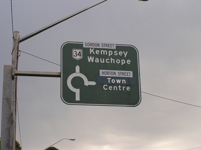 |
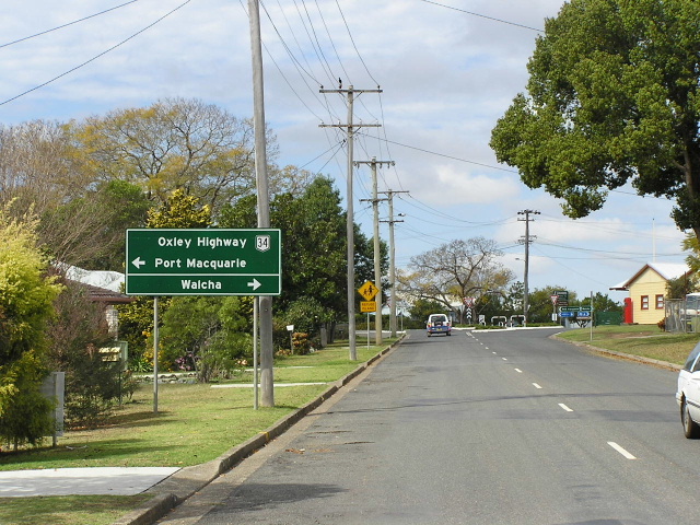
The old beginning of the Oxley Highway at Gordon St & Horton St, Port Macquarie. Now, both NR34 and the Oxley Hwy begin further west at Hindman St. Aug 2004. |
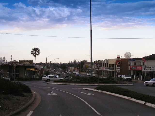 |
Looking east at the eastern terminus of the Oxley Hwy in Port Macquarie. Aug 2004. |
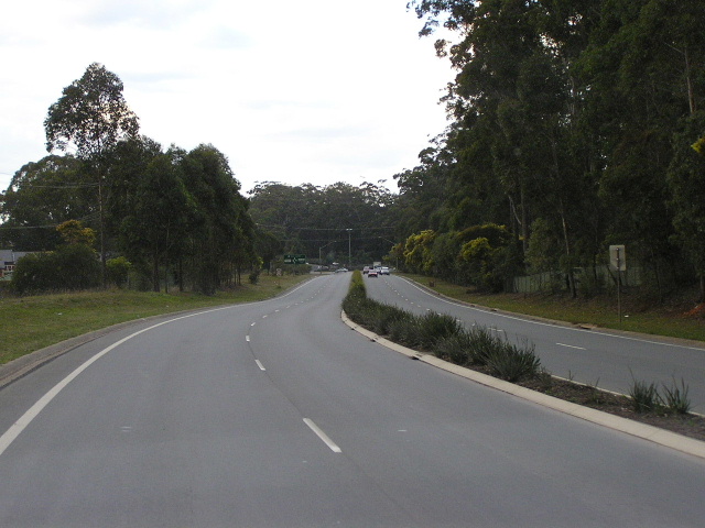 |
Looking east along the duplicated section of Oxley Hwy on the outskirts of Port Macquarie. Aug 2004. |
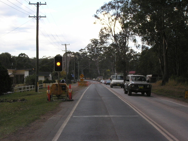 |
Roadwork on the remaining single carriageway section east of Pacific Hwy. Aug 2004. |
 |
AD sign westbound approaching the Pacific Hwy. Aug 2004. |
 |
Pacific Highway northbound approaching the Oxley Highway junction. Aug 2004. |
 |
Northbound signage for the Oxley Hwy on Pacific Hwy. Aug 2004. |
 |
Erroneous SR34 signage that has since been coverplated. 1998. |
 |
Pacific Hwy southbound approaching the Oxley Highway junction. Aug 2004. |
 |
Eastbound approaching the Pacific Hwy. Aug 2004. |
 |
Black ID sign adjacent to the railway station in Wauchope. Aug 2004. |
 |
Fingerboard signage at Stony Creek Rd, east of Wauchope. Aug 2004. |
 |
Another black ID sign at Cameron St in Wauchope. Aug 2004. |
 |
Poorly designed AD sign on Beechwood Rd approaching Oxley Hwy. Aug 2004. |
 |
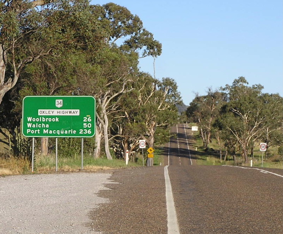
Distance sign heading west from Wauchope outside Timbertown. Aug 2004. |
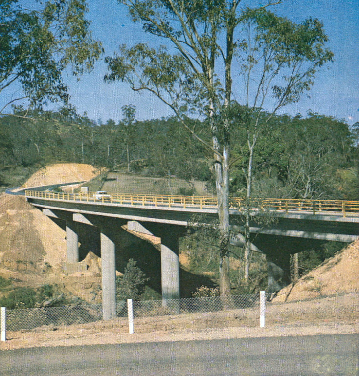 |
The newly-opened Ellenborough River bridge in 1974. (DMR). |
 |
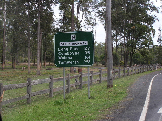
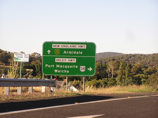
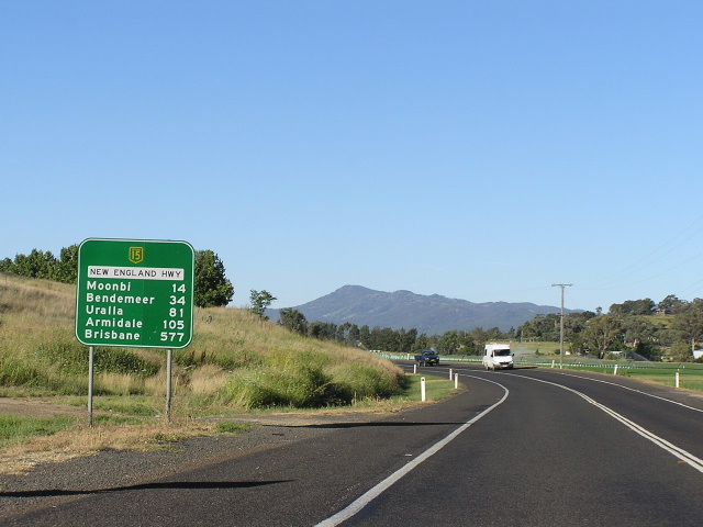
Distance sign heading east from the New England Hwy at Bendemeer. Jan 2005. |
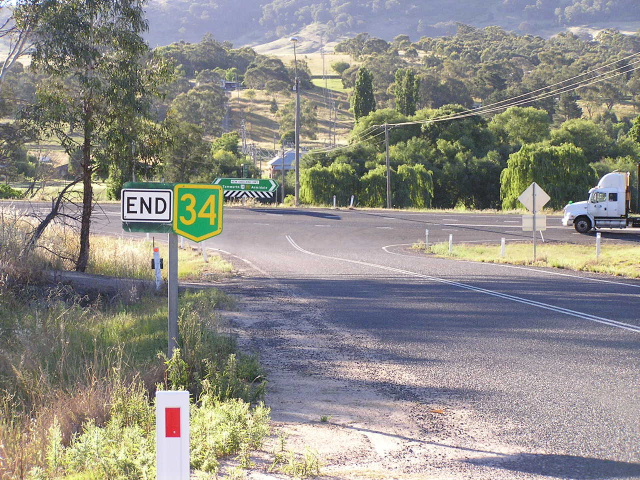 |
Erroneous END NH34 sign at the New England Hwy junction. This sign is wrong for two reasons - kit is NR34 not NH34 and NR34 does not end, it continues south along the New England Hwy and beyond. Jan 2005. |
 |
ID sign at the New England Hwy junction. Note NR34 should be for left only. Jan 2005. |
 |
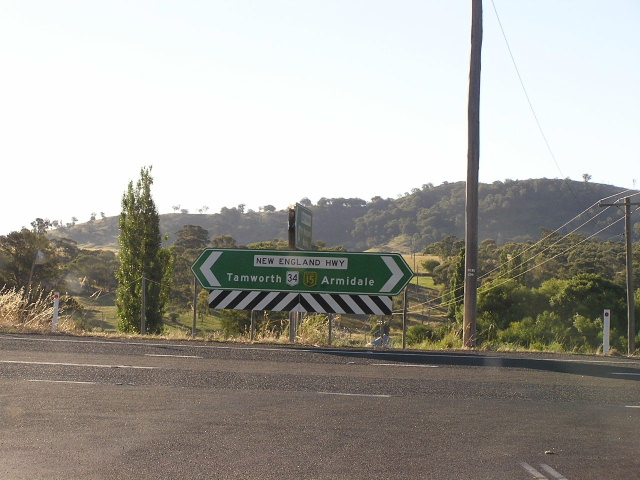
New England Hwy northbound approaching the Oxley Hwy. Jan 2005. |
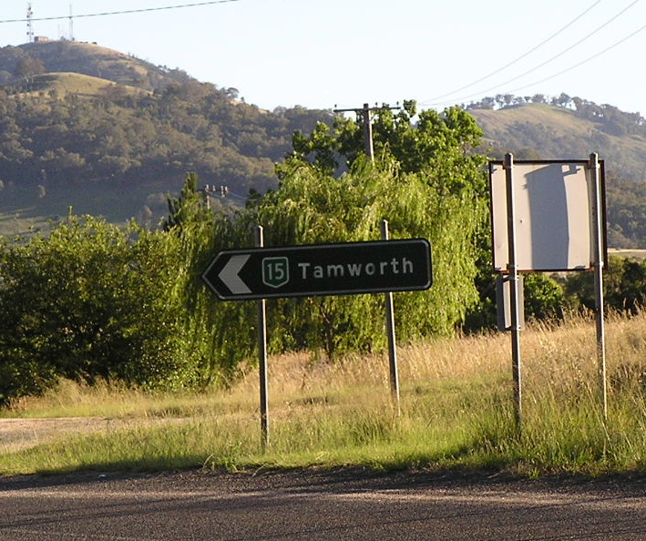 |
Remnant black NH15 sign on the Old New England Hwy in Bendemeer. Jan 2005. |
 |
NH15/NR34 looking north along the Bendemeer Bypass. Jan 2005. |
 |
Looking north up 2nd Moonbi Hill. Jan 2005. |
 |
Looking north up 1st Moonbi Hill. Jan 2005. |
 |
Looking north from Kootingal towards the Moonbis. Jan 2005. |
 |
Heading north from Nemingha. Note the absence of a NR34 shield. Jan 2005. |
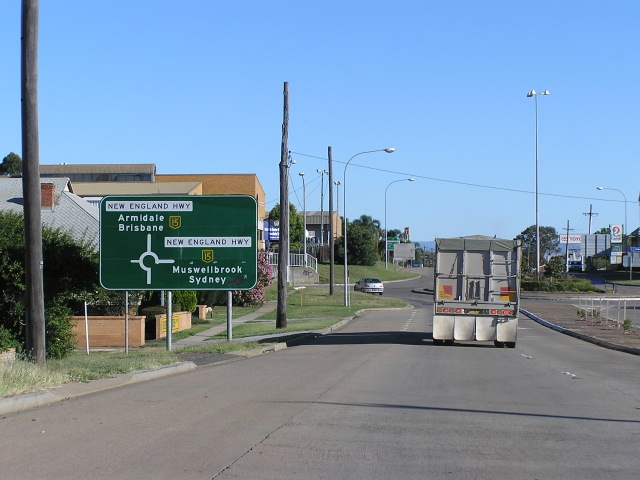 |
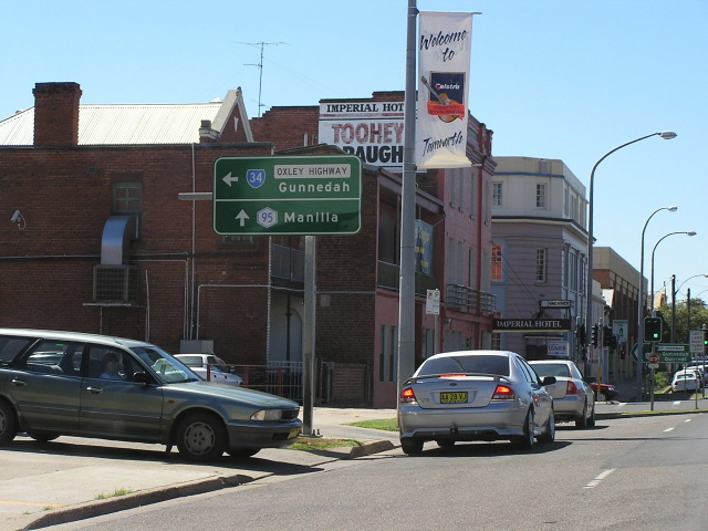
Eastbound approaching the New England Hwy junction in Tamworth. Jan 2005. |
 |
New England Hwy northbound approaching the Oxley Hwy in Tamworth. Jan 2005. |
 |
Distance sign with numerous incorrect shields heading east on Marius St from Brisbane St, Tamworth. Jan 2005. |
 |
Marius St westbound approaching Brisbane St and the beginning of State Route 95 in Tamworth. Note the incorrect shields. Jan 2005. |
 |
More incorrect shields at the smae intersection. At least on this sign it is recognised that routes 15 and 15 do duplex. Jan 2005. |
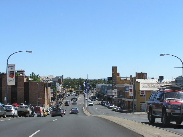 |
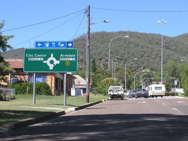
Looking southwest along Brisbane Street in Tamworth. Jan 2005. |
 |
ID signage at the Werris Creek Rd junction. Jan 2005. |
 |
AD sign for the Oxley Hwy on Werris Creek Rd. Jan 2005. |
 |
Very non-standard fingerboard sign at the junction with Keepit Dam Rd at Carroll Gap. April 2006. |
 |
Looking east between Carroll Gap and Carroll township, showing the pretty good quality of the Oxley Highway. April 2006. |
 |
Looking west across a concrete causeway on the eastern approach to Carroll. April 2006. |
 |
Looking east through the ribbon settlement (i.e. spread out along the Oxley Highway) of Carroll. April 2006. |
 |
Another westbound view of the Oxley Highway through Carroll. April 2006. |
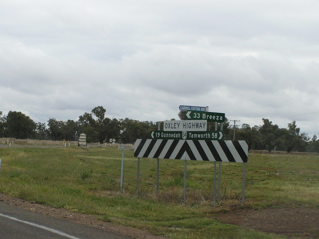 |
Fingerboard signage with a very oversized Oxley Highway nameplate at the turnoff to Breeza, 1km west of Carroll. April 2006. |
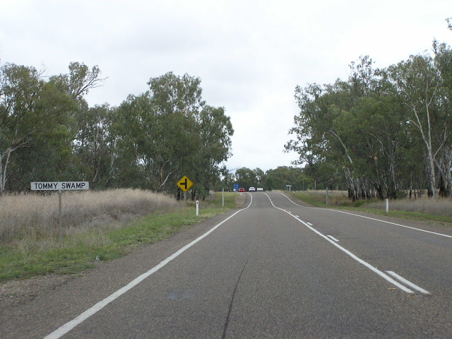 |
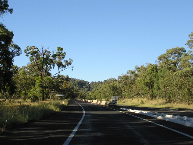
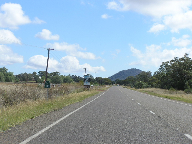
Looking west along the Oxley Highway at Tommy Swamp, between Carroll and Gunnedah. At this location the highway follows the Namoi River and thus passes through a number of low-lying areas. April 2006. |
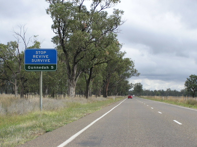 |
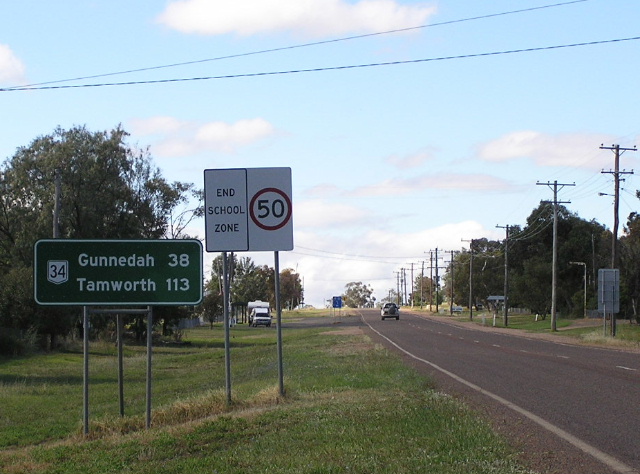
Typical "stop revive survive" signage found all across RTA's Northern Region, 5km east of Gunnedah. April 2006. |
 |
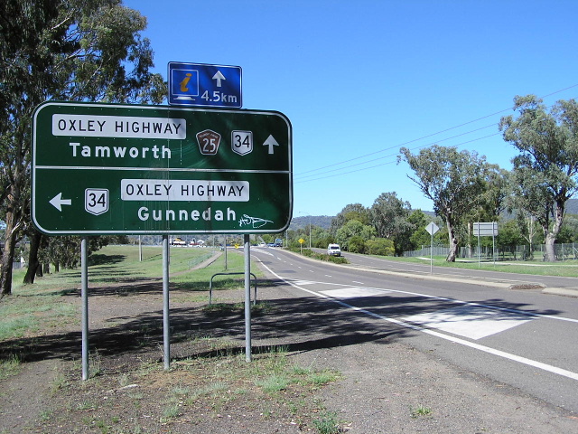
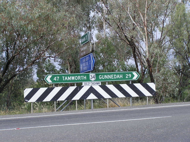
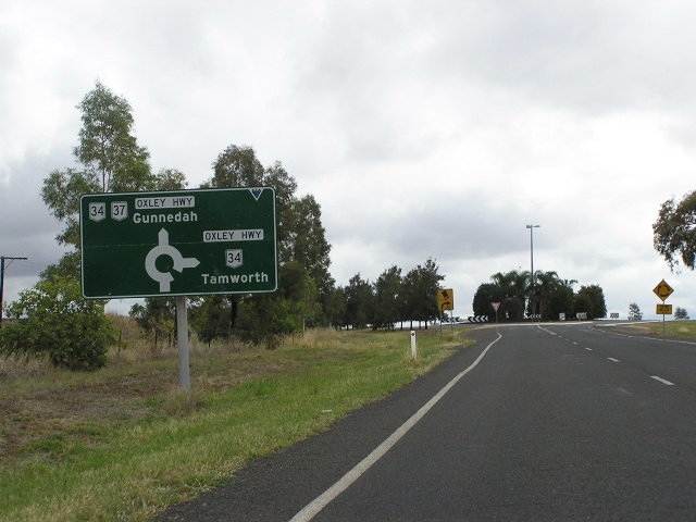
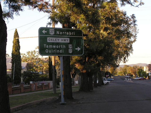
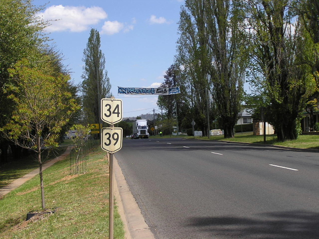
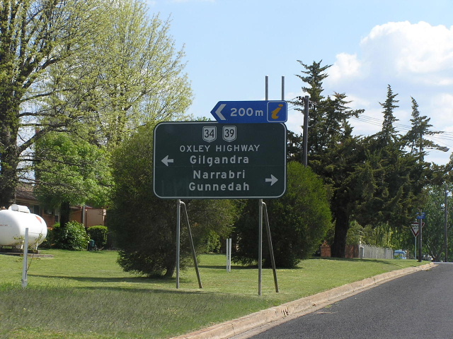
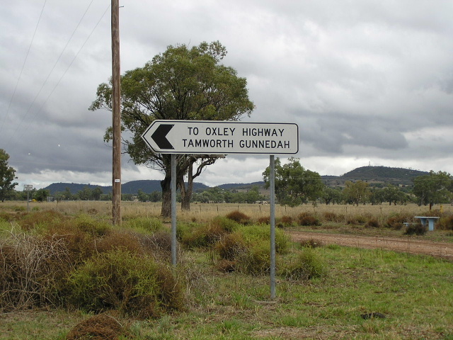
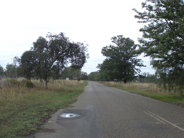
Unusual sign combination with a trailblazer at the intersection of Oxley Hwy & Tamworth Rd, east of Gunnedah. Oct 2004. |
For photos of the former alignment of Oxley Highway at Gunnedah, please scroll down to the bottom of the page. |
|
 |
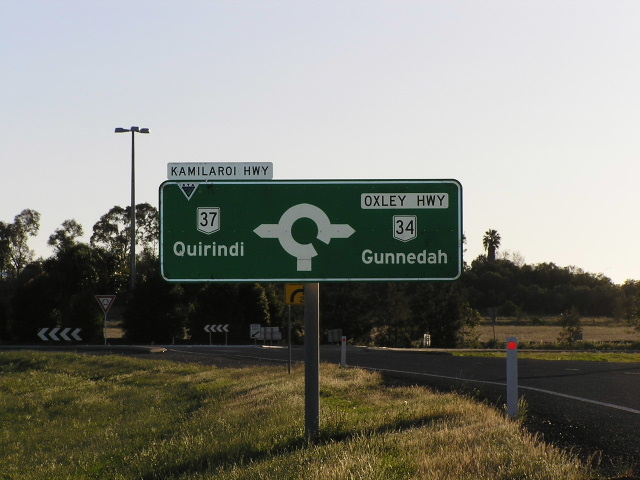
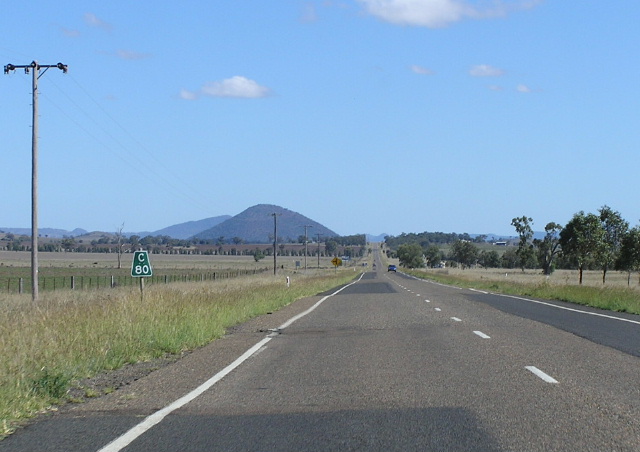
Distance sign heading west from the Kamilaroi Hwy junction, 2km south of Gunnedah. The new bridge over Mooki River is in the distance. April 2006. |
 |
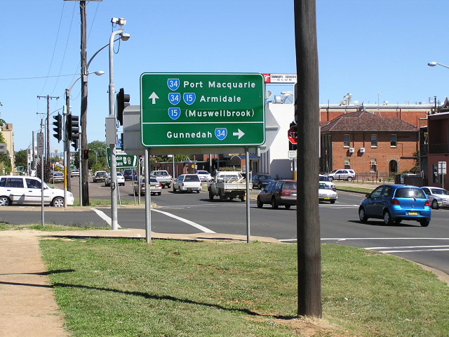
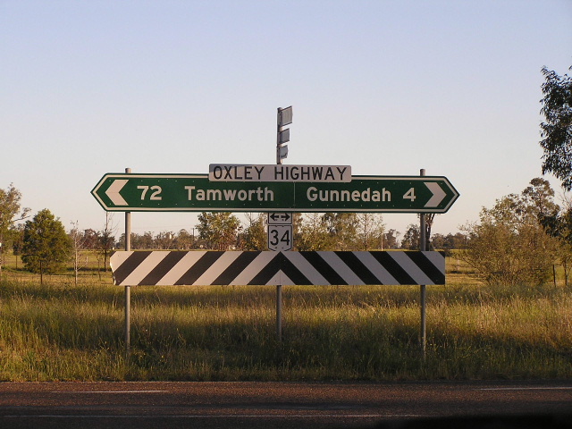
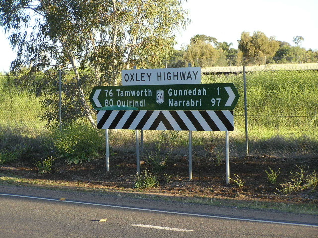
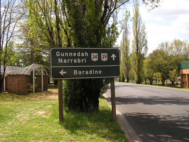
AD sign indicating the Oxley/Kamilaroi Highways junction. Note that there should be a NR37 shield right as well, as NR37 duplexes with NR34 for 2km along the Oxley Hwy into Gunnedah. Oct 2004. |
 |
AD sign northbound on Kamilaroi Highway approaching the Oxley Highway, 2km south of Gunnedah. April 2006. |
 |
Fingerboard signage on the NR34/NR37 duplex. Note the lack of a NR37 shield. Oct 2004. |
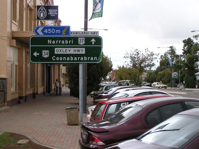 |
AD sign westbound on Oxley Highway (Conadilly St) approaching the junction with Kamilaroi Highway in Gunnedah. April 2006. |
 |
Kamilaroi Hwy (Conadilly St) southbound approaching the NR34/NR37 duplex in Gunnedah. Oct 2004. |
 |
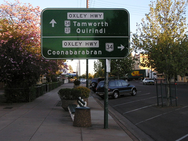
Oxley Hwy (Abbott St) eastbound approaching the NR37/NR34 duplex in Gunnedah. Oct 2004. |
 |
Ridiculous looking non-standard AD sign, southbound on Marquis St approaching Oxley Hwy (South St) in Gunnedah. April 2006. |
 |
Fingerboard signage on the western side of Gunnedah. Oct 2004. |
 |
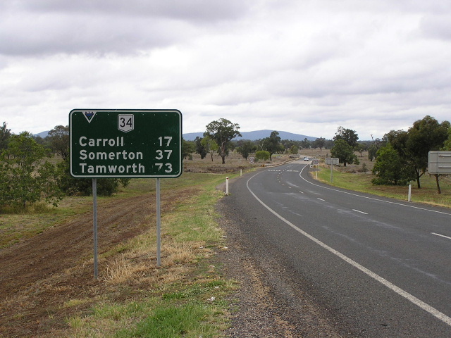
Distance sign heading west from Gunnedah. April 2006. |
 |
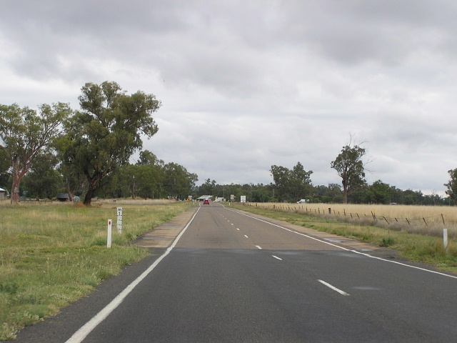
Looking west about 5km west of Gunnedah. April 2006. |
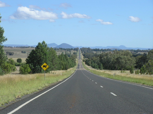 |
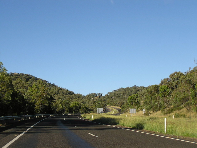
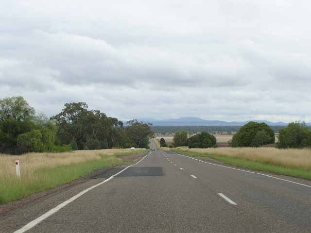
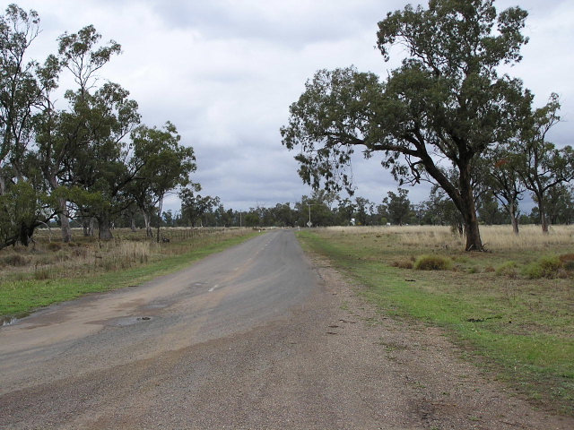
One of three picturesque westbound vistas on the Oxley Highway between Gunnedah and Mullaley. This photos typifies not only the road quality but the horizontal alignment of the Oxley Highway west of Gunnedah. April 2006. |
 |
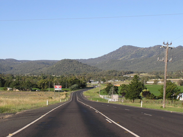
Looking west, about 25km west of Gunnedah, with Millie Ridge in the background. April 2006. |
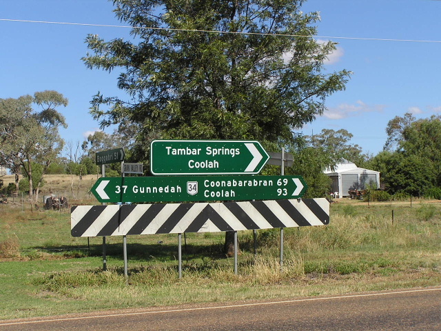 |
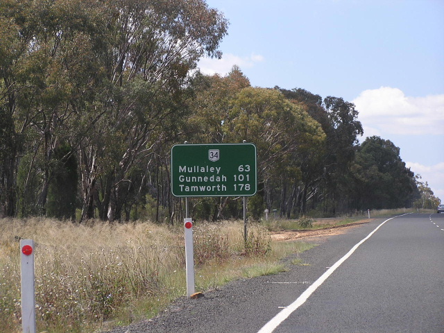
Sign assembly at the junction with Grain Valley Rd in Mullaley. April 2006. |
 |
Unusual style of distance sign, common to Queensland in the 1980s and early 1990s, heading east through Mullaley. April 2006. |
 |
Westbound AD sign approaching the junction with Black Stump Way at Mullaley. April 2006. |
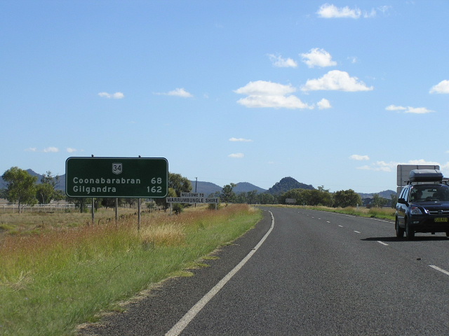 |
Distance sign heading west from Black Stump Way as you enter Warrumbungle Shire. April 2006. |
 |
Looking west between Mullaley and Rocky Glen. Oct 2004. |
 |
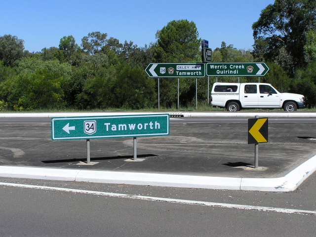
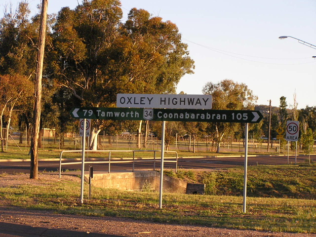
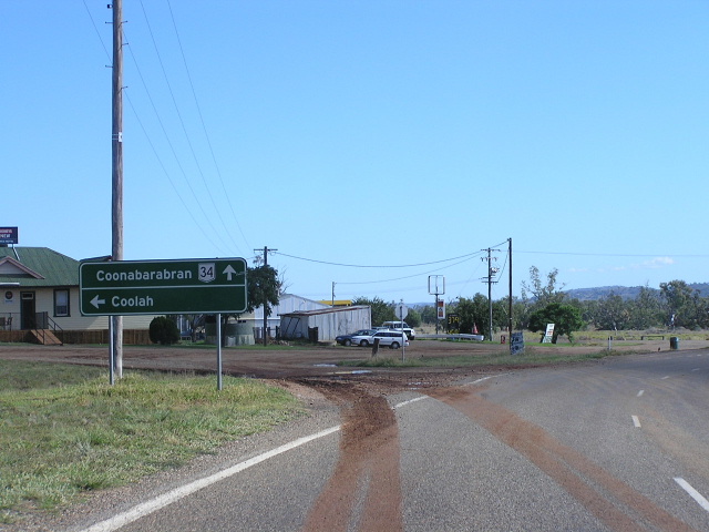
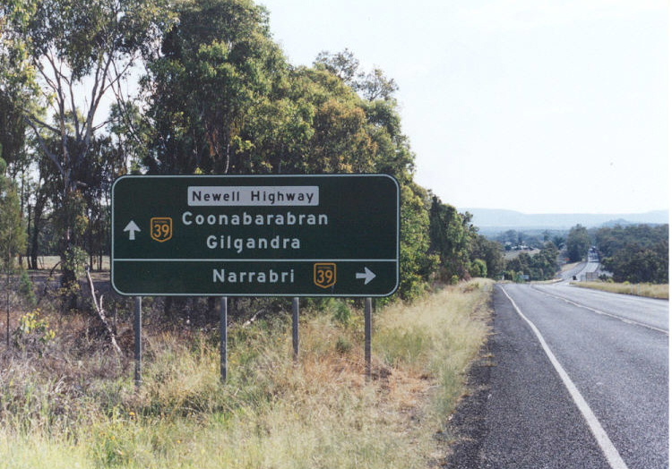
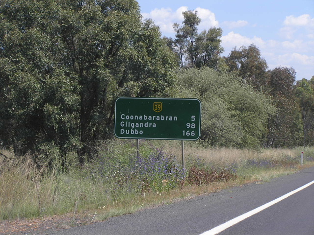
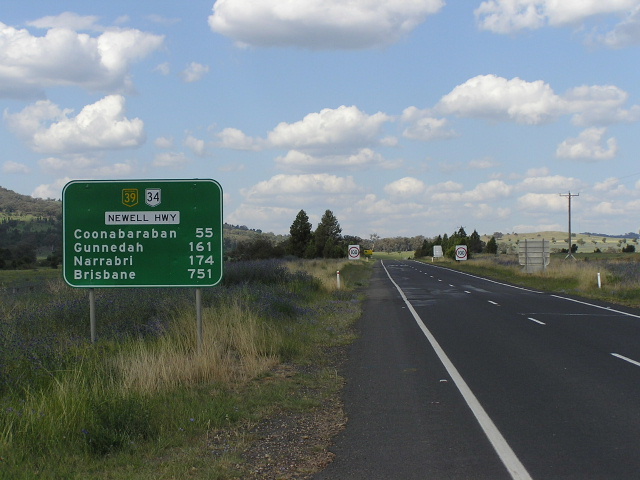
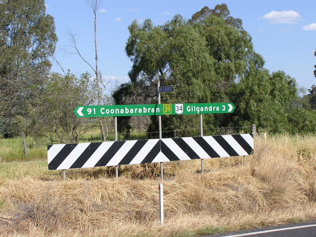
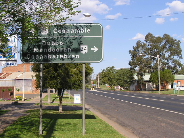
Distance sign heading east from the Newell Highway junction. Oct 2004. |
 |
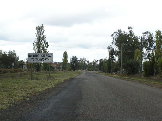
Westbound approaching the Newell Highway junction near Coonabarabran. Unlike what the sign says, NR34 continues straight along the Newell Hwy to Gilgandra. Jan 2003. |
 |
Unusual sign southbound on the Newell Highway approaching the Oxley Highway. From 1928 until 1993 the section of Newell Hwy between the two sections of Oxley Hwy was actually part of the Oxley Hwy - this may explain why this sign was installed. Oct 2004. |
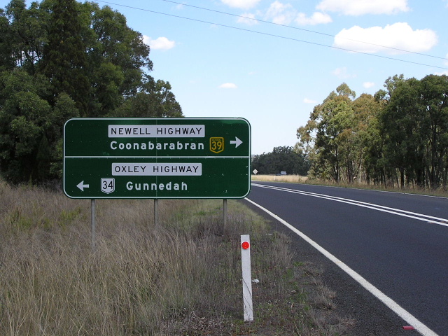 |
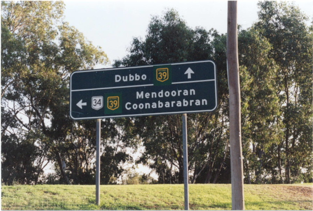
Newell Highway southbound approaching the Oxley Hwy junction and NR34/NH39 duplex. Oct 2004. |
 |
The first distance sign on the NR34/NH39 duplex and it doesnt include a bloody NR34 shield! Oct 2004. |
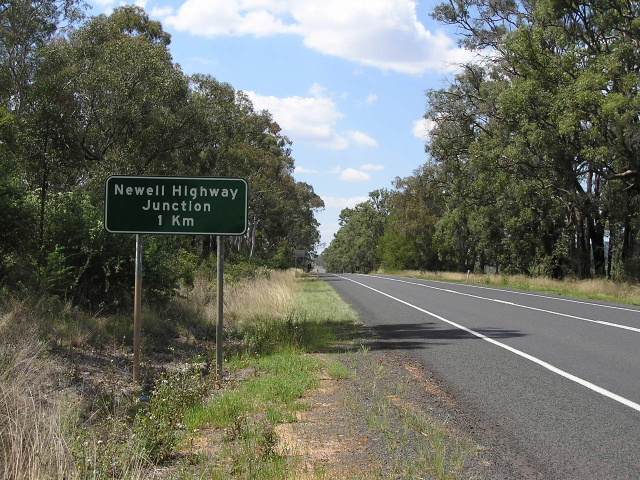 |
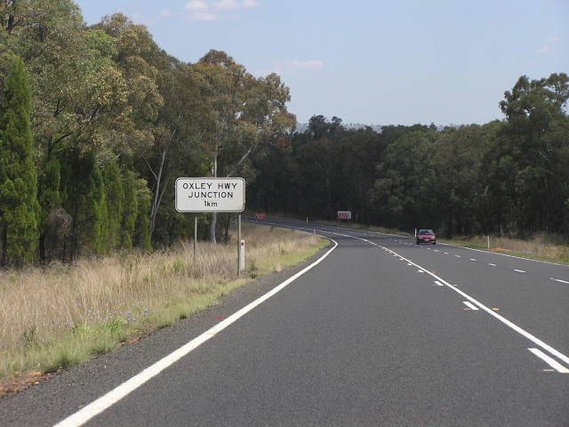
Another one of those unusual signs - this time reading "Newell Highway Junction 1km". This sign doesnt make much sense now that the piece of pavement it is located next to has been declared part of the Newell Hwy (in 1993). Oct 2004. |
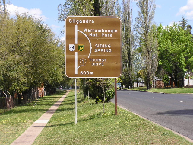 |
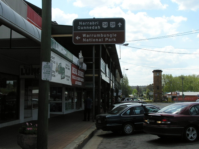
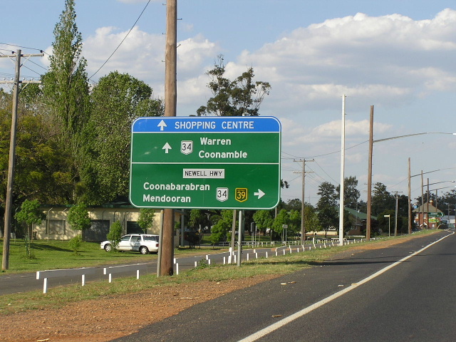
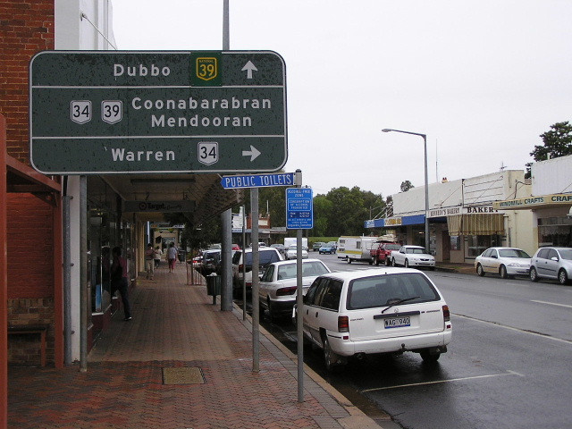
Tourist loop signage southbound on Newell Highway in Coonabarabran. Oct 2004. |
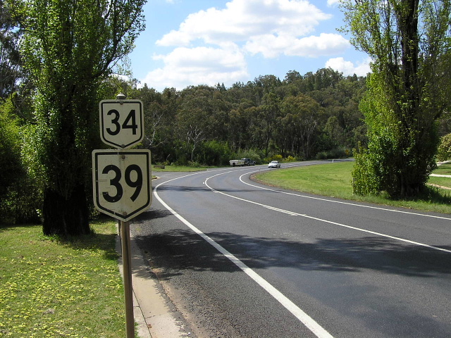 |
Very old NR34 and NR39 trailblazers on Chappell Ave northbound. Oct 2004. |
 |
More trailblazers just across the road, this time for southbound traffic. Oct 2004. |
 |
Very old black AD sign for northbound traffic at Baradine St. Oct 2004. |
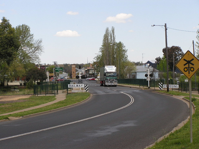 |
Looking south across the railway line and the Mary Jane Cain Bridge over the Castlereagh River at Coonabarabran. Oct 2004. |
 |
Painted black and brown AD sign northbound at Dalgarno St. Oct 2004. |
 |
More great old signage, this time on Edwards Street. Note the "Oxley Hwy" name - this is now the Newell Highway. Oct 2004. |
 |
Looking north along John Street (Newell Hwy - NR34/NH39) in Coonabarabran. Oct 2004. |
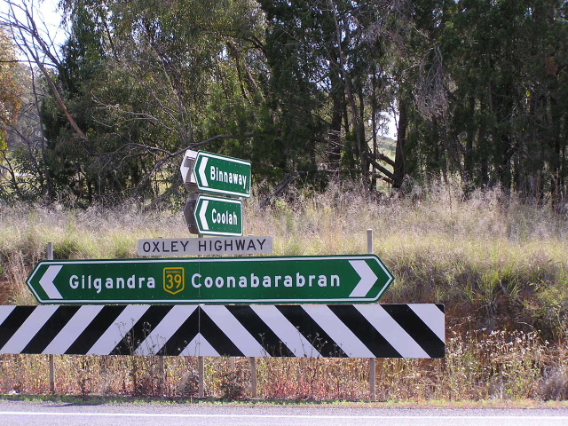 |
Unusual combination of name and number at the Binnaway turnoff just outside Coonabarabran. Oxley Hwy is the old name for this section of road and there is an absent NR34 shield. Oct 2004. |
 |
Another incorrect combination, this time heading north from the Mendooran turnoff. SR34 should say NR34. Oct 2004. |
 |
At last! A correct sign, heading south from the Mendooran turnoff. Oct 2004. |
 |
Looking south along the Newell Highway between Warkton and Gowang. Oct 2004. |
 |
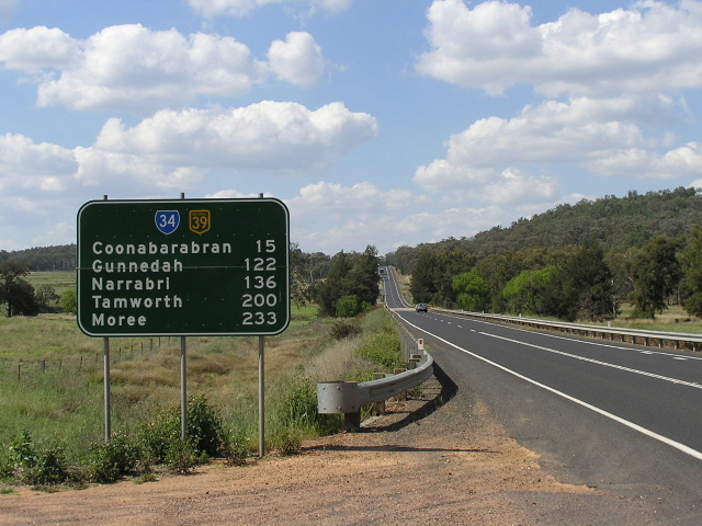
Distance sign heading north from Tooraweenah. Oct 2004. |
 |
Distance sign heading south from Tooraweenah. Oct 2004. |
 |
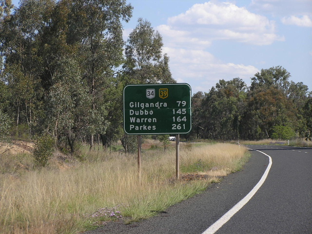
Fingerboard signage just north of Gilgandra. Oct 2004. |
 |
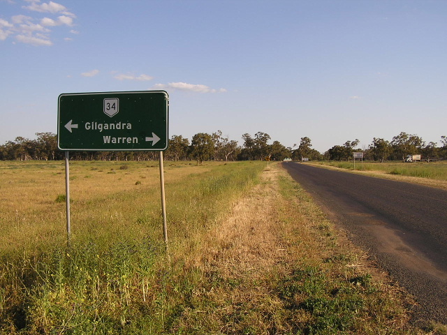
Newell Highway northbound approaching the western Oxley Hwy junction in Gilgandra. Oct 2004. |
 |
Signage on Oxley Hwy southbound approaching Newell Hwy. Note the reflective NH39 coverplates on the non-reflective sign. Jan 2003. |
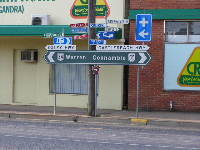 |
Black ID sign at the Oxley/Castlereagh Highways junction in Gilgandra. This is the southern terminus of NR55, which at one stage extended all the way north to Charters Towers in Queensland. Oct 2004. |
 |
ID sign at the Oxley/Castlereagh Highways junction. Oct 2004. |
 |
Black ID sign facing southbound Castlereagh Highway traffic in Gilgandra. Oct 2004. |
 |
Very old black AD sign on Castlereagh Hwy southbound approaching the Oxley Hwy in Gilgandra. Note that one NR39 shield was coverplated but not the other. April 2006. |
 |
Oxley Hwy eastbound approaching the Castlereagh Hwy in Gilgandra. Oct 2004. |
 |
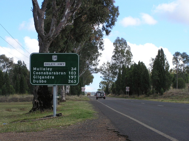
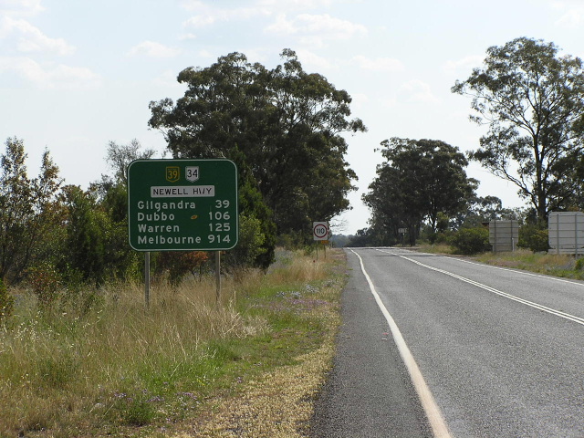
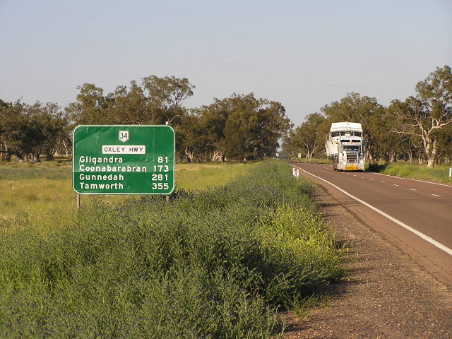
Distance sign heading west from Gilgandra. April 2006. |
 |
Black fingerboard signage at the Curban turnoff between Gilgandra and Collie. Oct 2004. |
 |
Non-standard fingerboard/ID sign at the junction with Berida Bullagreen Rd, 16km east of Collie. Oct 2004. |
 |
Distance sign heading west from Collie. Oct 2004. |
 |
Reconstruction of the highway underway between Collie and Warren. Oct 2004. |
 |
Standard NSW-style fingerboard sign, 23km east of Warren. Oct 2004. |
 |
Distance sign heading east from the Quambone turnoff, 4km east of Warren. Oct 2004. |
 |
Non-standard AD sign southbound on the Warren-Quambone road approaching Oxley Hwy, 4km east of Warren. Oct 2004. |
 |
Incorrect NR11 shield in Warren. The Oxley Highway is National Route 34 and State Highway No. 11. Oct 2004. |
 |
Unusual assembly of signs. Perhaps those west of the great divide don't associate the name Oxley Highway with Highway Traffic? :p Oct 2004. |
 |
Black roundabout AD sign in Warren. Oct 2004. |
 |
More black signage in Warren. Oct 2004. |
 |
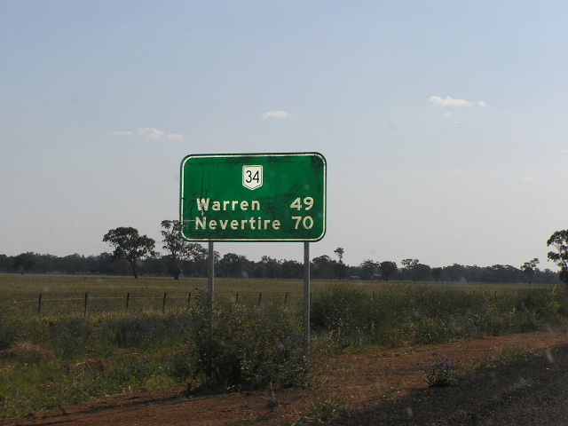
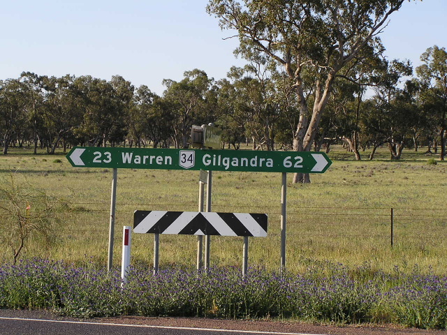
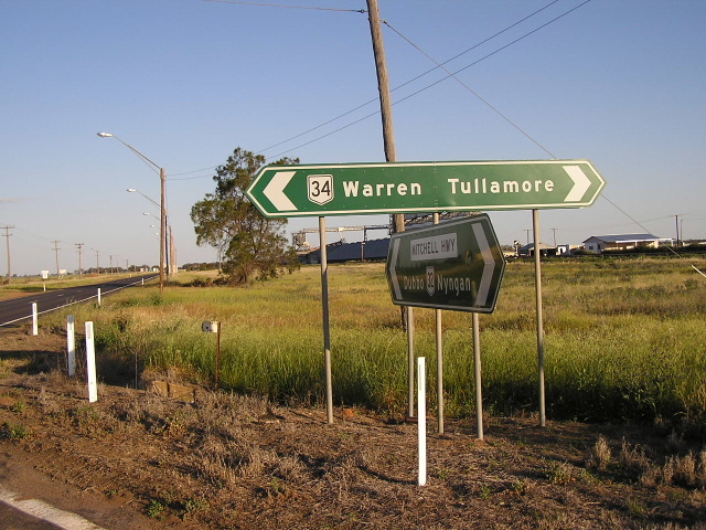
Distance sign heading west from Warren towards Nevertire. Oct 2004. |
 |
Very poorly designed signage just west of Warren. Oct 2004. |
 |
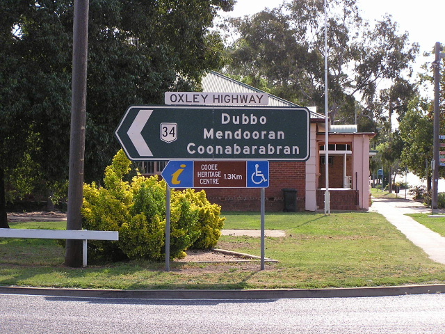
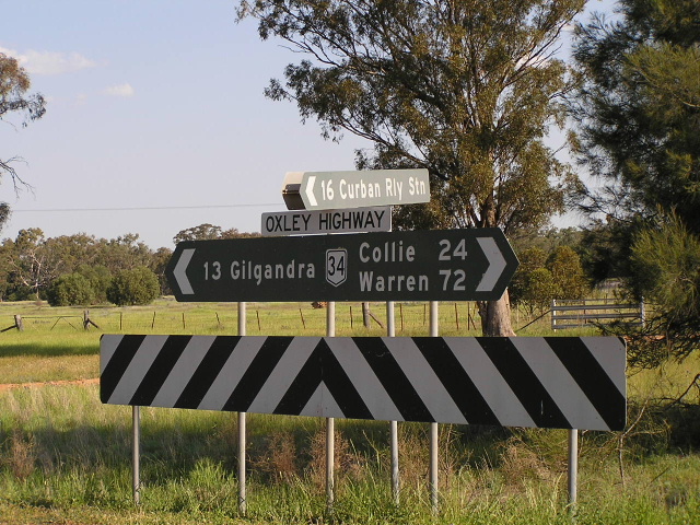
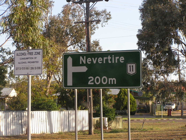
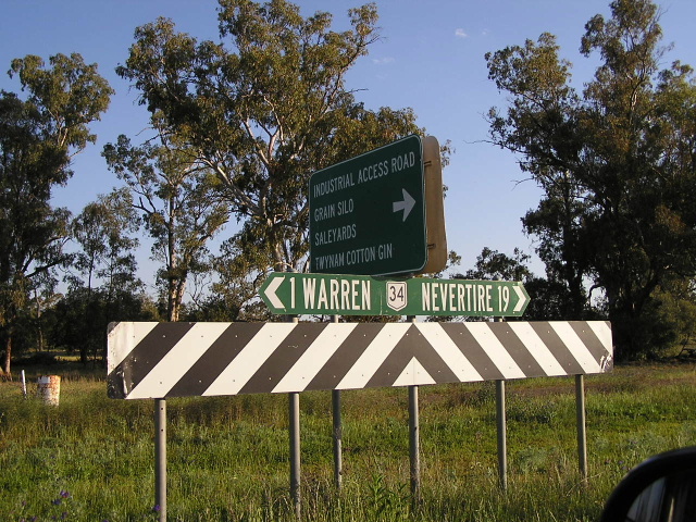
ID signage at the beginning of the Oxley Hwy in Nevertire. Oct 2004. |
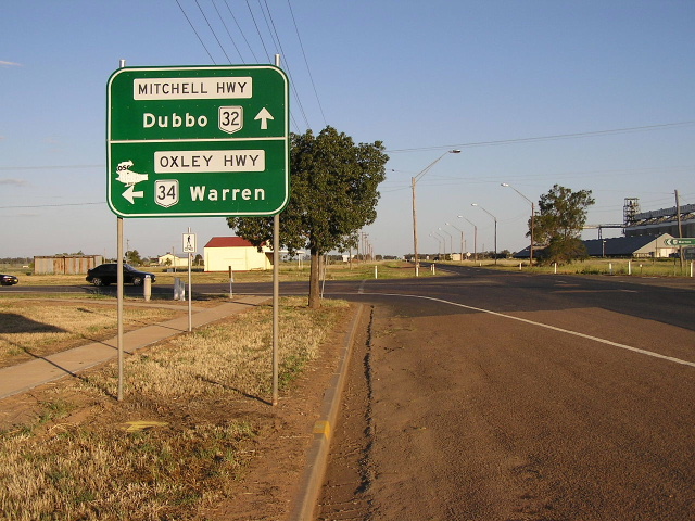 |
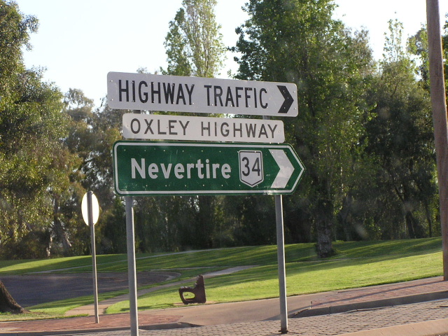
Mitchell Hwy eastbound approaching the beginning of the Oxley Hwy. Oct 2004. |
Oxley Highway former alignment: Gunnedah (bypassed 1995) |
|
 |
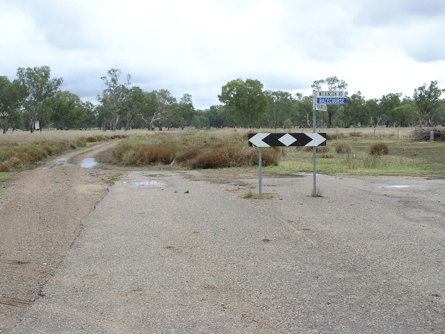
Signage on the eastern section of the old Oxley Highway (Tamworth Road) at Wilkinson Rd, pointing traffic to the new alignment of Oxley Highway as the old road is now closed at the Mooki River. April 2006. |
 |
Looking east along Tamworth Rd between Wilkinson Rd and the Oxley Highway. April 2006. |
 |
Looking west at the junction of Tamworth Rd and Wilkinson Rd. As you can see the old alignment of the Oxley Highway is no longer accessible between here and the western side of the Mooki River. Note the remains of yellow line-marking. April 2006. |
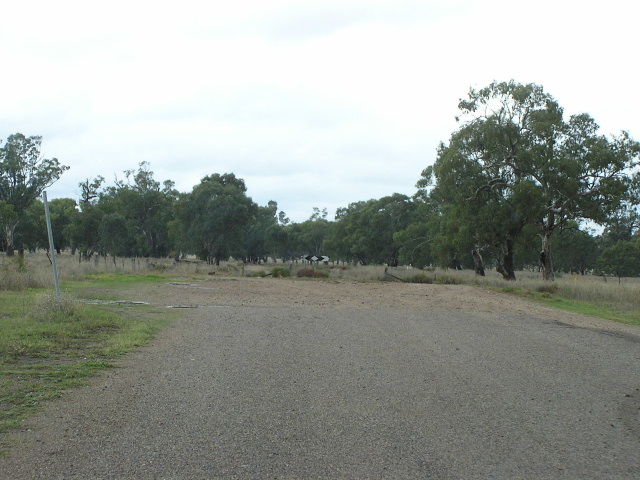 |
Looking east along Tamworth Road on the western side of Mooki River, showing where the old alignment is no longer accessible. April 2006. |
 |
Looking east along Tamworth Rd on the eastern outskirts of Gunnedah. This photo shows the narrow pavement that once was part of the Oxley Hwy. April 2006. |
 |
Looking north along Henry St (old Oxley Highway) in Gunnedah, with signage informing motorists that old alignment of Oxley Highway is no longer trafficable. April 2006. |
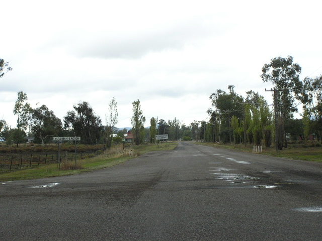 |
Looking north along Henry St in Gunnedah, showing one section of the old highway susceptible to flooding across Mullibah Lagoon. April 2006. |
Last updated 13 December 2012 © Ozroads 2003-2012. |