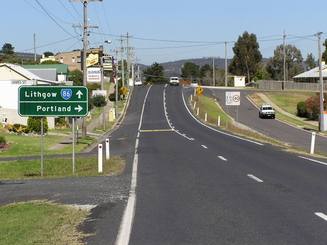
NSW State Route 86 Lithgow - Dunedoo - Gilgandra |
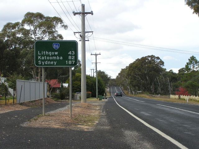
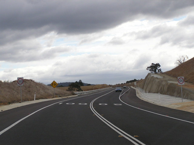
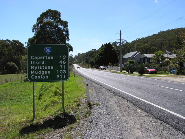
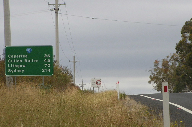
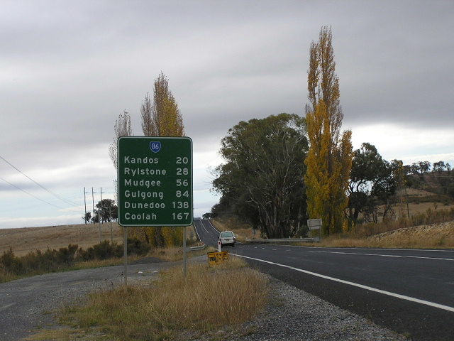
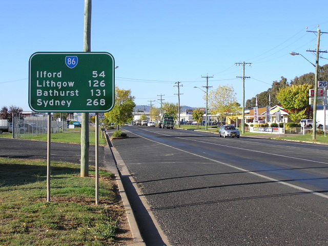
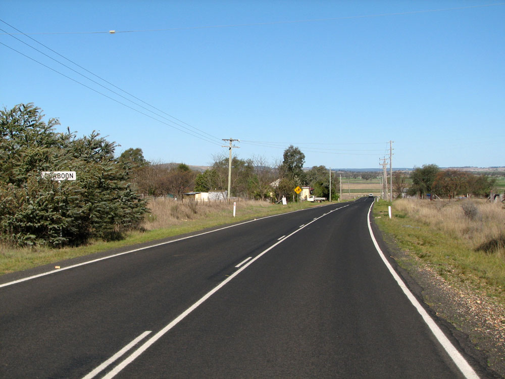
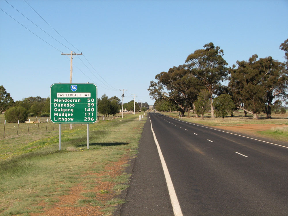
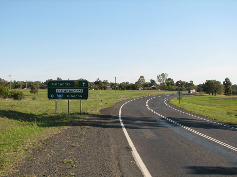
Distance sign heading south from Capertee. April 2006.
In 2013, RMS will be implementing a new alpha-numeric route numbering system. For more information, visit the RMS Website. |
|
Forthcoming alpha-numeric route number: |
|
Length: 300km
Northern Terminus: Newell Highway, 1km east of Gilgandra
Southern Terminus: Great Western Highway, Marrangaroo (7km W Lithgow)
Route Taken: Castlereagh Highway (Marangaroo-Craboon), Golden Highway (Craboon-Dunedoo), Castlereagh Highway (Dunedoo-Gilgandra)
Roads Act 1993 Classification: Highway No. 18 (Golden Highway section is part of Highway No. 27)
Focal Points: Lithgow, Mudgee, Gulgong, Dunedoo, Mendooran, Gilgandra
Route Overview:
State Route 86 is the southern portion of NSW's Castlereagh Highway, a major north-south route providing links from Sydney to the power stations at Lithgow, the vineyards near Mudgee and the north-west plains. The name descends from original section of Castlereagh Hwy, north of Gilgandra, which follows the Castlereagh River for most of its length. State Route 86 only follows the Castlereagh River for a small section between Mendooran and Gilgandra but the continuation of the name south to Lithgow provides consistency in navigation.
The route is entirely 2-lanes and sealed across flat country with ample overtaking opportunities, but south of Mudgee can be rather undulating. Overtaking lanes are provided south of Mudgee rather frequently.
The State Route 86 designation was allocated in 1974, along with the rest of the orginal NSW state routes. The route remained nameless for years until, in October 1997, the Castlereagh Hwy name was extended south from Gilgandra along State Route 86. As at 2010, many signs along the route pre-date this change and are yet to acknowledge the Castlereagh Hwy name.
State Route 86 has only one duplex, with State Route 84 (Golden Hwy), for 10km easterly from Dunedoo to Craboon.
Signposting on this particular route is generally terrible, and although the SR86 shield is present in MOST cases (a notable exception is Mudgee, which has an assortment of NR86 shields), the designing of the signs leaves a lot to be desired. The Castlereagh Hwy name is missing on 99% of signage, being that most signage is older than 1997. Disregarding the absence of the highway name, the older signposting seems to be more accurate than the newer signs. However, new signs erected after 2006 around Gilgandra and the SR84 duplex have produced more errors.
Listed below in chronological order are some of the major upgrdaes constructed on State Route 86:
January 1947 - Bridge over Coxs River at Lidsdale (now being widened)
1964 - Bridge over Coxs River at Lidsdale (replaced)
1973 - Grade-separation of the interchange with NR32 (Gt Western Hwy) at Marrangaroo. Also part of the project was dual carriageway on NR32 east towards Lithgow.
December 1982 - Windamere Dam Deviation south of Mudgee
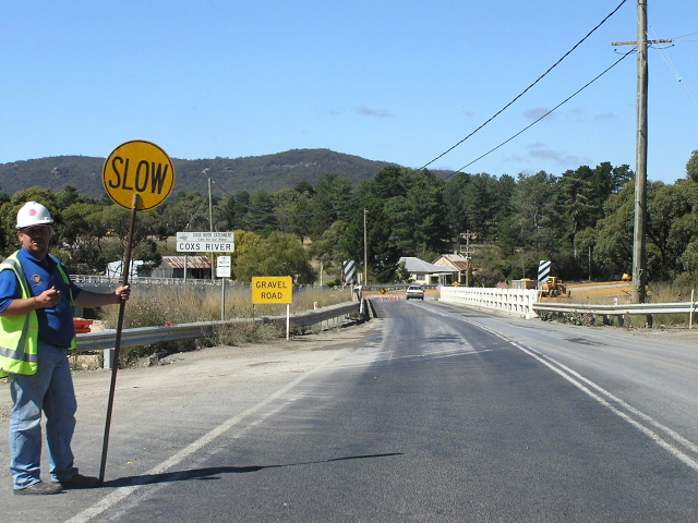
October 2005 - Lidsdale Deviation and new bridge across Coxs River
Further Reading: On Site
Further Reading: Off Site
Castlereagh Hwy - Michael Greenslade
|
Photos of State Route 86 |
|
 |
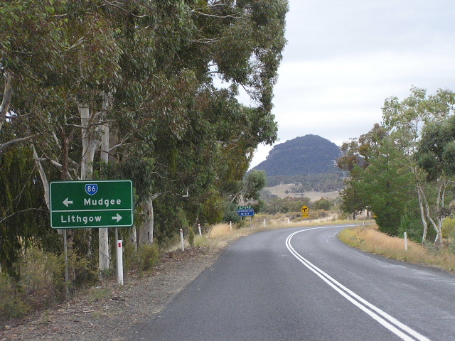
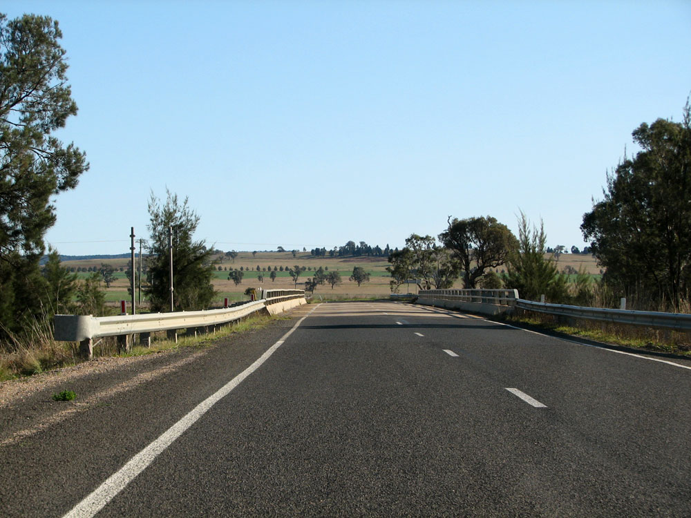
Westbound on the Great Western Highway approaching the beginning of the Castlereagh Highway and State Route 86 at Marrangaroo, 7km north of Lithgow. April 2006. |
 |
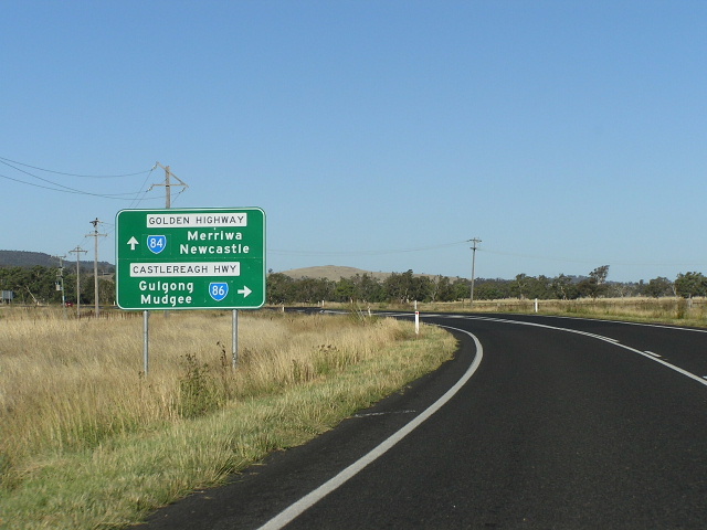
ID signs at the junction of Great Western Highway and Castlereagh Highway, signalling the beginning of State Route 86. The junction is a partial grade-separated interchange which allows westbound traffic to travel unimpeded to the Castlereagh Highway northbound. April 2006. |
 |
Looking west along Great Western Highway showing the Castlereagh Highway overpass and the southbound on-ramp. May 2004. |
 |
Great Western Highway eastbound approaching Castlereagh Highway. Oct 2005. |
 |
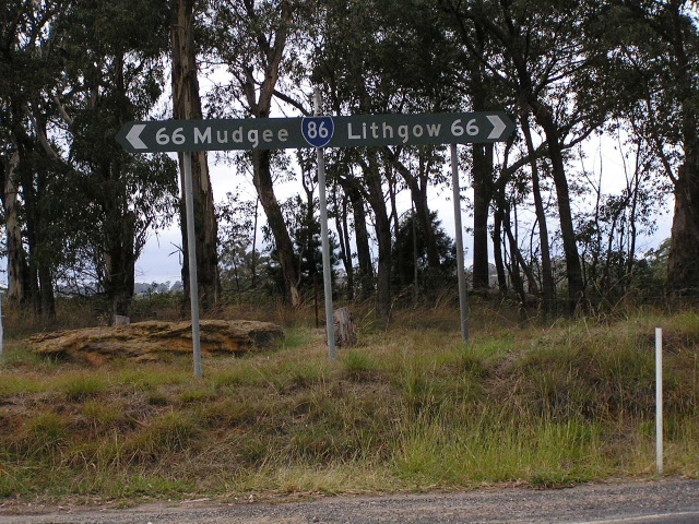
Southbound Castlereagh Highway approaching the Great Western Highway. This AD sign is very old and also incorrect as Lithgow/Sydney traffic continues straight ahead and onto the Gt Western Hwy, rather than having to turn left as the sign indicates. April 2005. |
 |
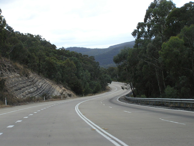
The first northbound distance sign on SR86, heading north from Great Western Highway. Note the concrete pavement which has deteriorated badly. April 2006. |
 |
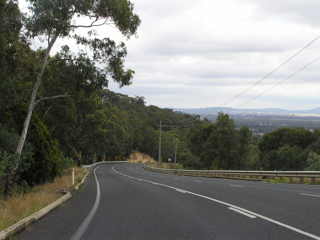
Another view of the deteriorating concrete pavement that makes up the southern-most 2km of SR86. April 2006. |
 |
Incorrect shield on an otherwise perfect fingerboard sign at Springvale Lane. The sign designer probably got confused between the Castlereagh Highway's internal classification of State Highway No. 18 and the route marker of State Route 86. Jan 2003. |
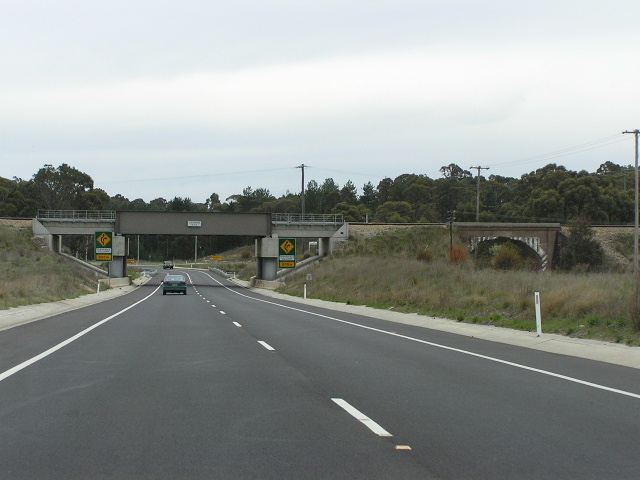 |
Looking north, approaching the entrance to Springvale Mine. This section was recently (late 1990s?) deviated to improve the alignment and clearance beneath the railway line - the old underpass can be seen on the right. April 2006. |
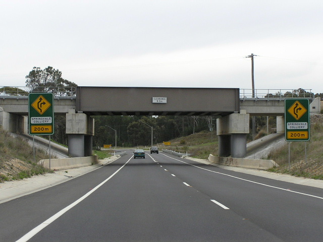 |
A closer view of the railway underpass and the unsual warning signs for the entrance to Springvale Mine. I believe there is a less-than-ideal sight distance for the intersection which has heavy vehicles turning frequently, hence the warning signs. April 2006. |
 |
Distance sign with a SR86 shield on a coverplate over an alpha-numeric route marker, heading south from Lidsdale. April 2006. |
 |
Brand-spanking new AD sign assmebly northbound approaching the junction with Main Street and old Castlereagh Highway at Lidsdale. Note the blank space above Lidsdale, its as if the RTA is prepared to later insert a road name for the old alignment of Castlereagh Hwy. Note: as of 26 May 2006, the old alignment of Castlereagh Hwy has been renamed "Wolgan Rd" as far north as the turnoff to Newnes. April 2006. |
 |
Looking north along the Lidsdale Deviation, which bypassed a badly deteriorated section of concrete pavement, a steep grade and section of poor horizontal alignment through the small village of Lidsdale in October 2005. April 2006. |
 |
Looking north along the former alignment of Castlereagh Highway at Lidsdale. Oct 2005. |
 |
AD sign assembly with SR86 shield on the old alignment of Castlereagh Highway in Lidsdale. April 2005. |
 |
Southbound approaching the northern entrance to Lidsdale. Note the "B55" shield being covered by gaffer tape, and the blank space awaiting a road name. Note: as of 26 May 2006, the old alignment of Castlereagh Hwy between Coxs River and the Newnes turnoff (Wolgan Rd) has been renamed Ian Holt Drive. Remnants of the old Castlereagh Highway can be seen on the left. April 2006. |
 |
Looking south at the same location in October 2005, showing the deviation about to open. |
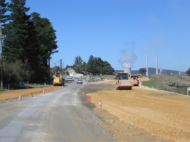 |
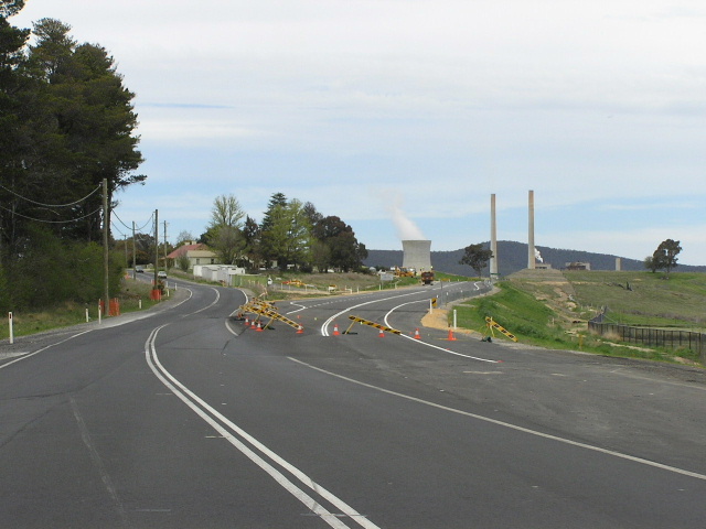
Heavy plant working away on the Lidsdale Deviation, just south of the Coxs River. April 2005. |
 |
A southbound view of the old bridge over the Coxs River at Lidsdale, which was also replaced as part of the deviation. April 2005. |
 |
The old and new Coxs River bridges, looking north at Lidsdale. Source: Derek Rogers, January 2005. |
 |
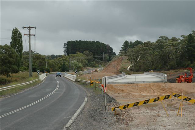
Looking north across the new bridge over the Coxs River. The old bridge was located just to the left of the current bridge but has been completely removed. April 2006. |
 |
Looking south towards Lidsdale showing the old (right) and new (left) bridges over the Coxs River. April 2005. |
 |
Distance sign heading north from Lidsdale. April 2006. |
 |
Very non-standard AD sign that replaced a dodgy black old one, northbound approaching Frankfort Rd. April 2005. |
 |
Looking south the junction with Frankfort Road, showing badly deteriorating surface and very early style channelised intersection. April 2005. |
 |
Looking north along a very nice concrete section of road as you descend from Frankfort Road towards Cullen Bullen. April 2006. |
 |
Looking south towards Carsons Siding Road in Cullen Bullen. April 2005. |
 |
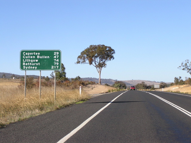
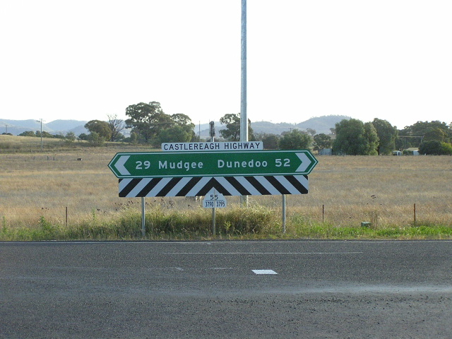
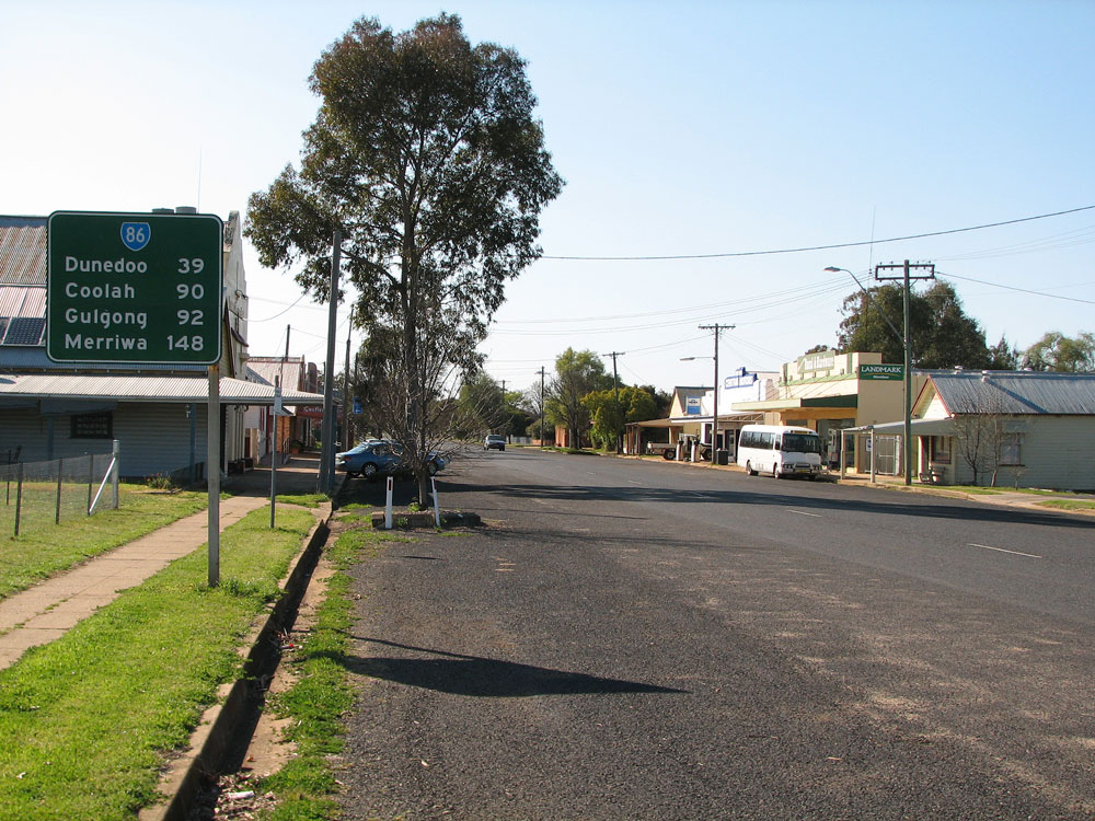
Distance sign heading north from Carsons Siding Road at Cullen Bullen. Note the inclusion of Coolah as the last focal point - Trunk Road No. 55 (which SR86 was part of prior to its gazettal as part of the Castlereagh Hwy in 1997) continues north from the Golden Highway to Coolah. Since the change in classification I would expect Gilgandra to be included as the final focal point, replacing Coolah. April 2005. |
 |
The old (left) and new (right) alignments of Castlereagh Highway at Baal Bone Colliery, north of Cullen Bullen. When the railway line serving the Colliery was constructed during the 1980s, a new bridge carrying Castlereagh Highway (then Mudgee Road) was built on a new alignment, slightly to the east of the original alignment. Source: Daniel Thornton, December 2007. |
 |
Looking north to a narrow 1950s bridge over Jews Creek, between Cullen Bullen and Ben Bullen. April 2006. |
 |
Looking north on the southern approach to Ben Bullen. The Castlereagh Highway takes a 90 degree bend to the left here, crosses the Wallerawang-Gwabegar rail line (now disused) at a level crossing, then turns north again. April 2006. |
 |
Looking north, just north of Ben Bullen. April 2006. |
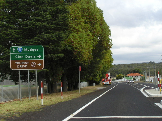 |
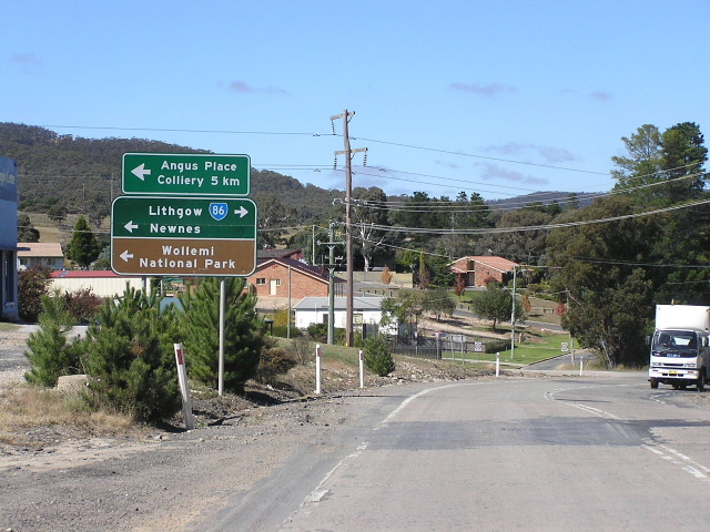
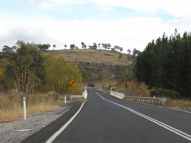
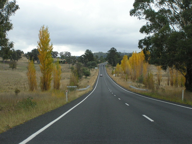
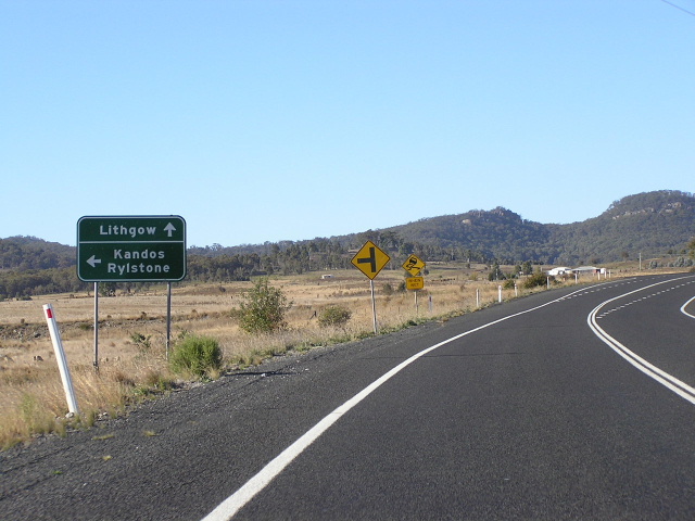
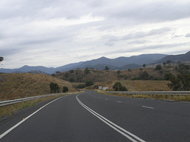
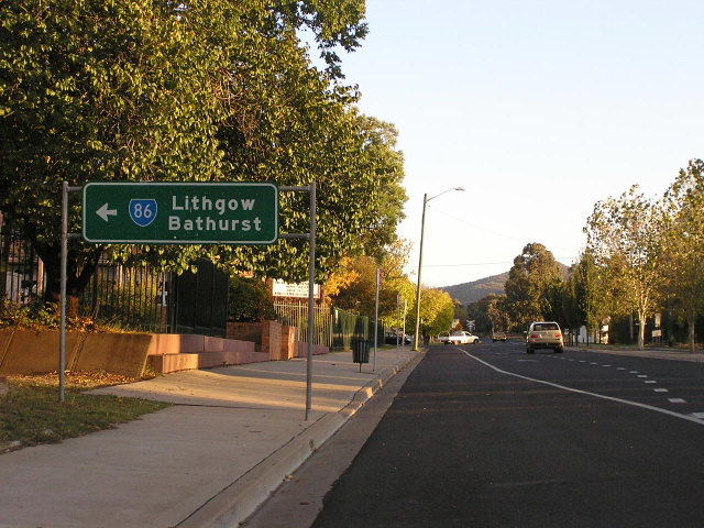
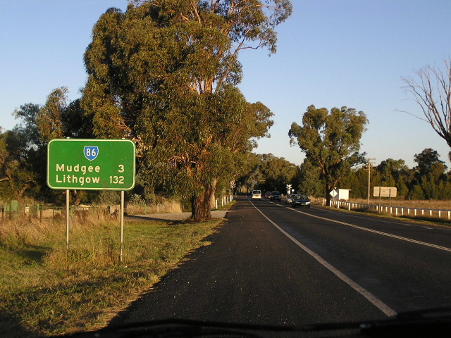
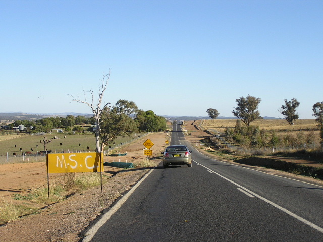
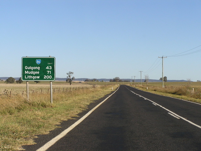
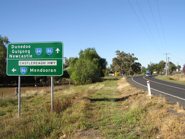
Looking north to the Glen Davis turnoff in the tiny village of Capertee. April 2006. |
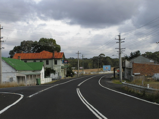 |
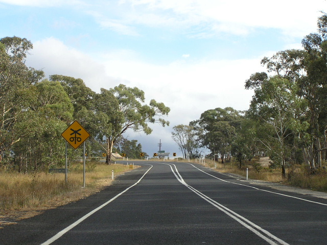
Looking north through Capertee, just north of the railway overpass. April 2006. |
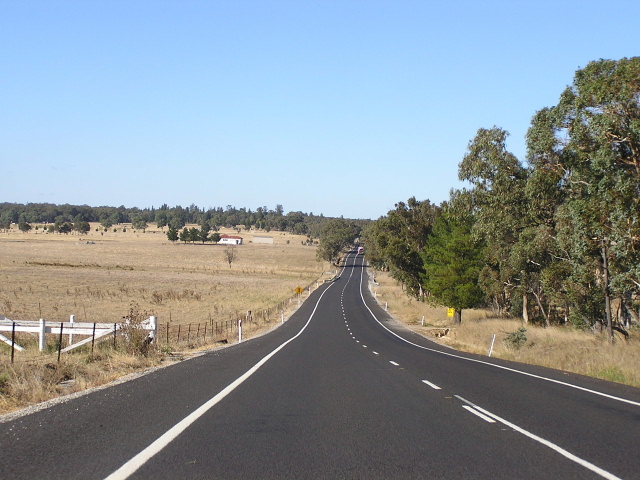 |
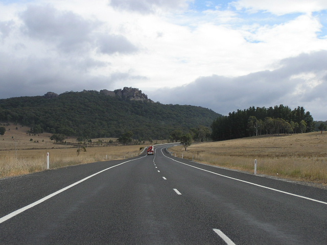
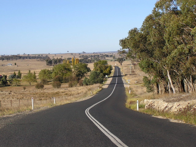
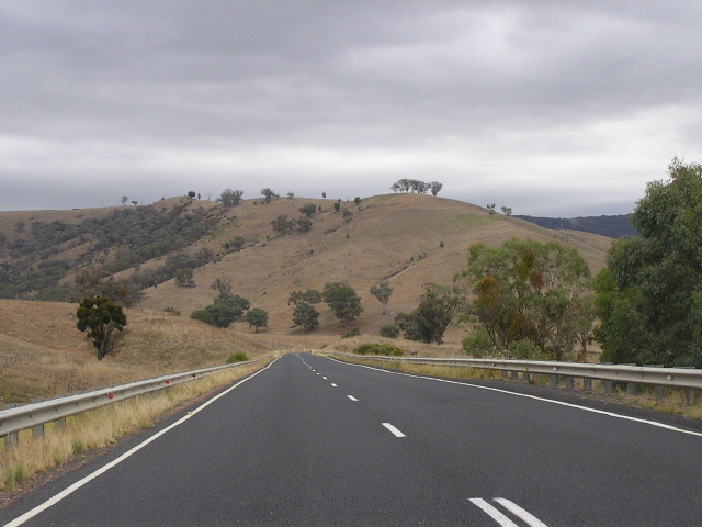
Looking south along an excellent section of the Castlereagh Highway near Greys Creek (in the distance). April 2006. |
 |
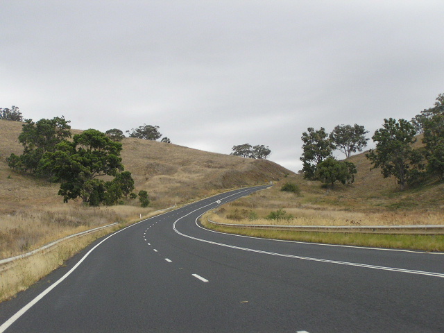
Looking south about 1km north of Greys Creek, showing an undulating and curving alignment. April 2006. |
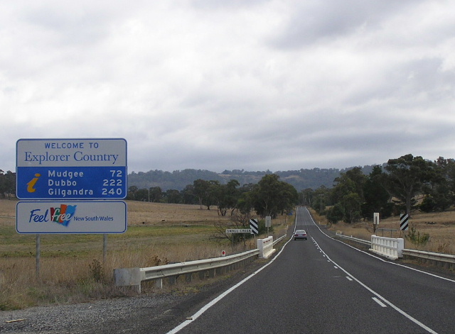 |
Tourism NSW sign welcoming travellers to "Explorer Country" at Smalls Creek, near Round Swamp. April 2006. |
 |
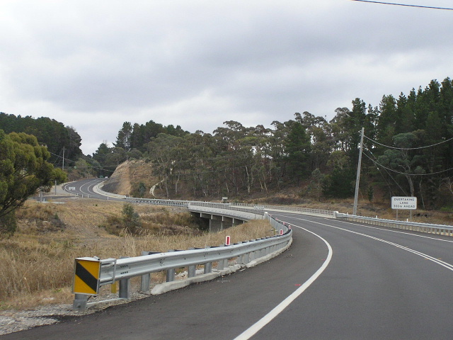
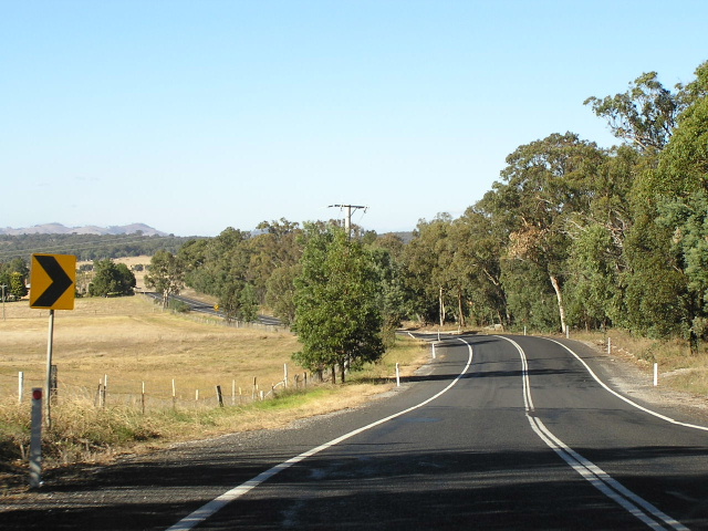
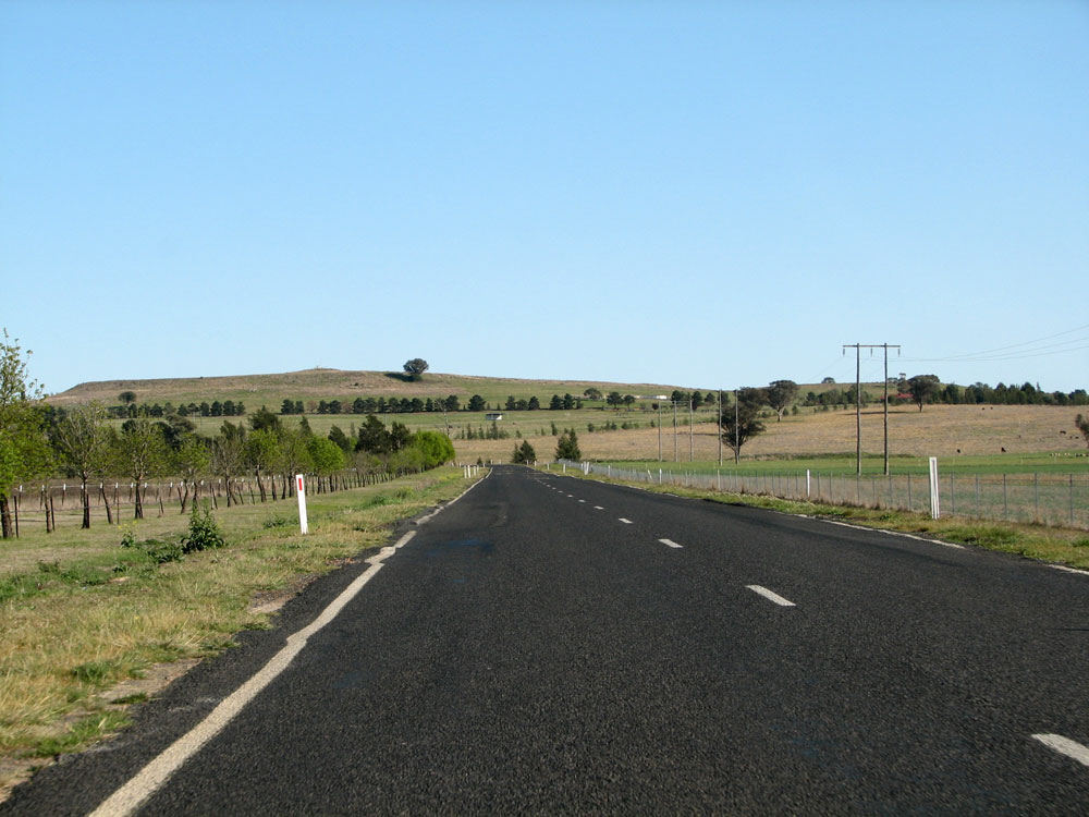
Looking north to Jack Hall's Creek, near Round Swamp. The Castlereagh Highway is very picturesque south of Mudgee, particularly during the Autumn and Winter months. April 2006. |
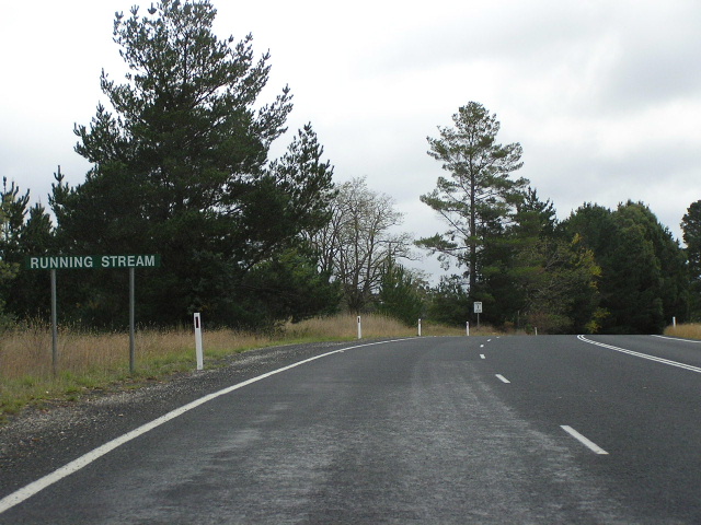 |
Unusual white-on-green information sign, welcoming travellers to the locality of Running Stream. April 2006. |
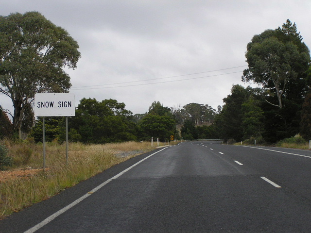 |
The section of Castlereagh Highway between Cullen Bullen and Aarons Pass is at pretty high altitude and subject to ice, frost and snow sometimes during the winter months. Ben Bullen Railway Station, adjacent to the Castlereagh Highway at Ben Bullen, was also the highest railway station in NSW above sea level. April 2006. |
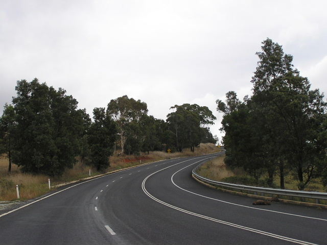 |
Looking north through the winding section approaching Cherry Tree High (1100m above sea level). Despite the winding nature of the road, many overtaking lanes are provided and one can maintain a speed of 80-90km/h without too much trouble. April 2006. |
 |
Very old black fingerboard sign at the junction with Razor Back Rd, right at the top of Cherry Tree Hill. April 2006. |
 |
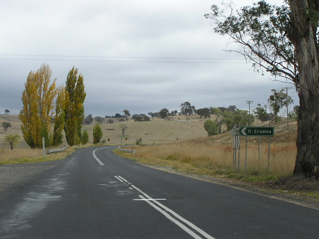
Looking north as you descend from Cherry Tree Hill into the Crudine River valley and the tiny village of Ilford. April 2006. |
 |
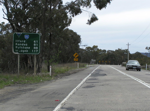
Non-standard distance sign with a very small SR86 shield, heading south from Ilford. April 2006. |
 |
Very poorly-designed AD sign northbound approaching Main Road No. 54 (Sofala Rd) at Ilford. Note the incorrect placement of the arrow and route shield. April 2006. |
 |
Another shockingly-designed AD sign, this time approaching Castlereagh Highway from Sofala Road. April 2006. |
 |
This AD sign, southbound approaching Sofala Rd, is much better designed but it is missing a SR86 shield! April 2006. |
 |
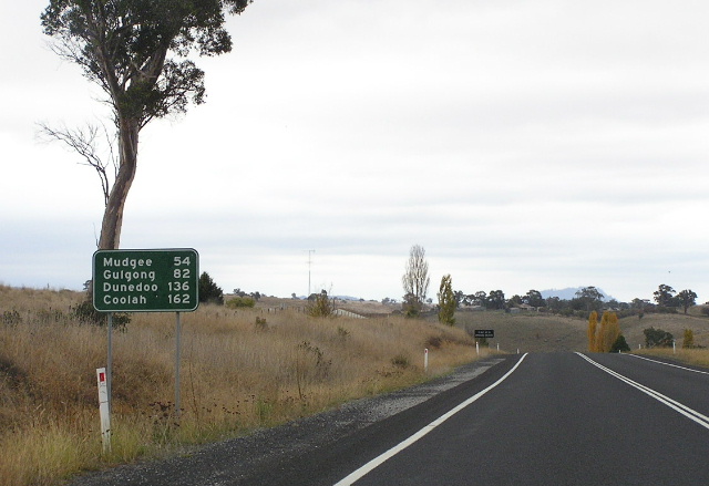
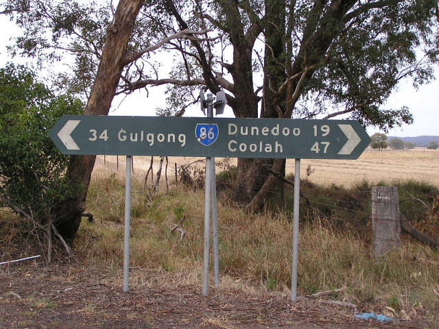
Very weird looking distance sign, heading north from Ilford. This just about covers every town on the Castlereagh Hwy south of the Golden Hwy, also note the inclusion of Coolah as a focal point again. April 2006. |
 |
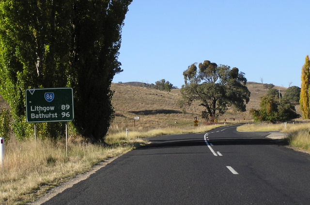
Well-designed distance sign heading south from the junction with Main Road No. 215 (Rylstone turnoff). Note the missing SR86 shield. April 2006. |
 |
Another well-designed sign, this time and AD sign southbound approaching the Rylstone turnoff. Again note the missing SR86 shield. April 2006. |
 |
Distance sign heading north from the Rylstone turnoff, again missing a SR86 shield. April 2006. |
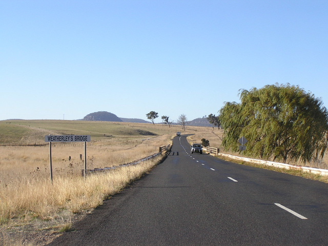 |
Looking south at Weatherley's Bridge, about 3km north of the Rylstone turnoff. April 2006. |
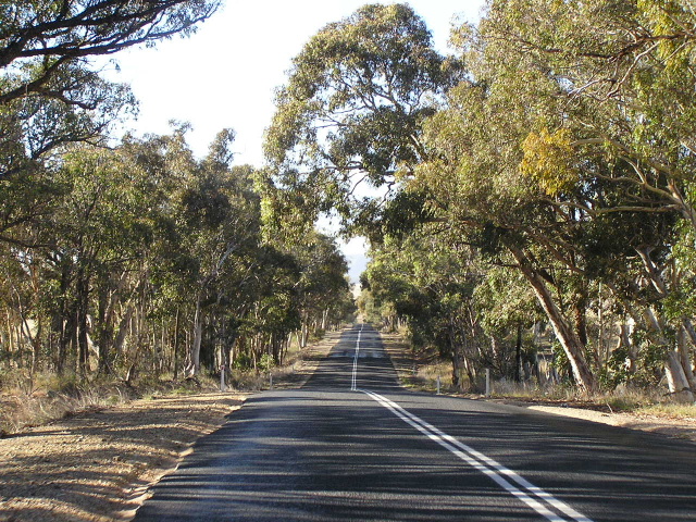 |
A particularly narrow and undulating section through a heavily-forested area between Ilford and Aaron's Pass. April 2006. |
 |
Looking north at the Crudine turnoff, 10km north of Ilford. Note the narrow, deteriorating pavement and the poor alignment. April 2006. |
 |
Looking south from Aarons Pass. April 2006. |
 |
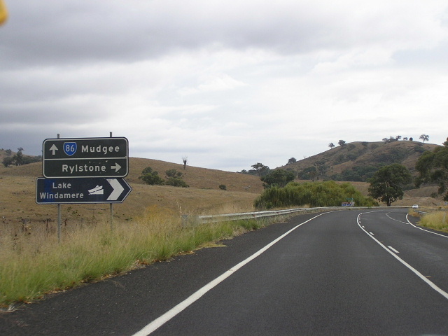
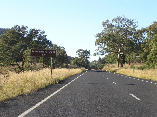
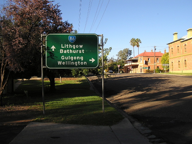
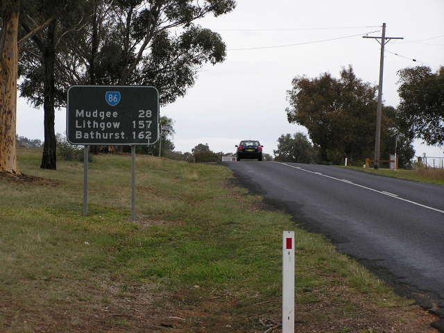
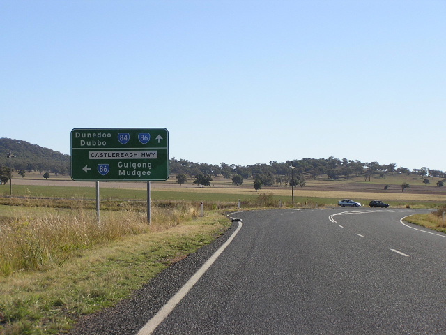
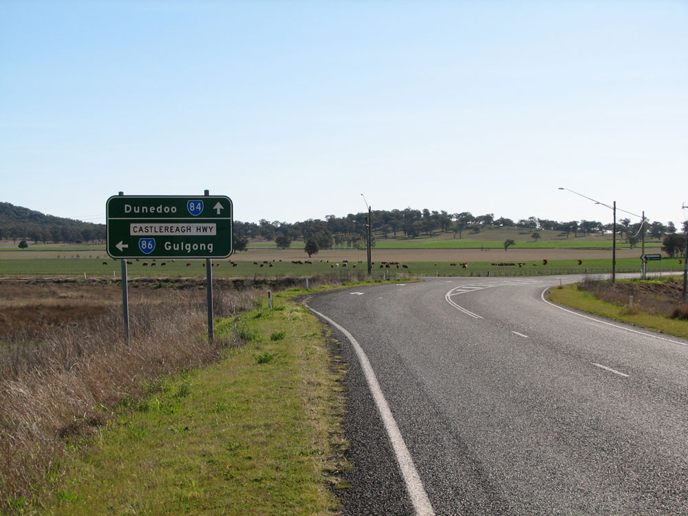
Dodgy-looking distance sign, heading south from the junction with Cudgegong Road near Lake Windamere. Note the inclusion of Bathurst as a focal point - this is done quite frequently heading south from Mudgee. April 2006. |
 |
Remnant black AD sign northbound approaching the junction with Cudgegong Road near Lake Windamere. April 2006. |
 |
Remnant black AD sign westbound on Cudgegong Road approaching Castlereagh Highway near Lake Windamere. April 2006. |
 |
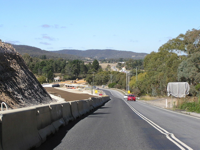
Looking north along the Windamere Dam Deviation. April 2006. |
 |
Another northbound view of the Windamere Dam Deviation, built in the early 1980s. April 2006. |
 |
Another northbound view of the Windamere Dam Deviation. April 2006. |
 |
Looking south approaching the northern end of the Windamere Dam Deviation. April 2006. |
 |
Brand-spanking new distance sign heading south from Mudgee. Note the Castlereagh Hwy name has not been included. April 2006. |
 |
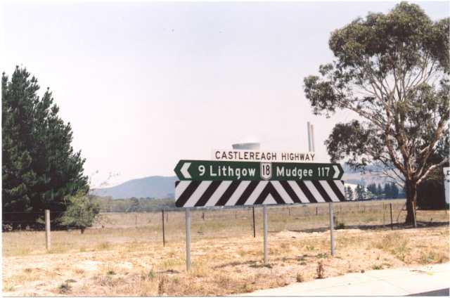
Very old black fingerboard sign, probably dating from the introduction of SR86 in 1974, at the intersection of Sydney Rd, Burrundulla Ave & Horatio St, Mudgee. Jan 2003. |
 |
Very old black ID sign with a ridiculously incorrect shield, at the same intersection. Jan 2003. |
 |
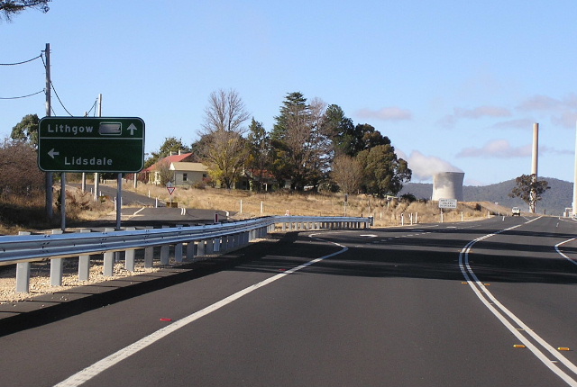
Castlereagh Highway (Horatio St) westbound approaching Church St, Mudgee. April 2006. |
Very old painted black ID sign at the intersection of Castlereagh Hwy (Horatio St) and Church St, Mudgee. Note the RTA reference marker (white sign), still showing the old Main Road No. 55 classification (instead of the current State Highway No. 18). The numbers on the white sign are chainages, measured either from Lithgow or the junction with Great Western Highway. April 2006. |
|
 |
Incorrect National Route 86 shield on a very old non-standard ID sign, at the junction of Castlereagh Hwy (Horatio St) and Church St, Mudgee. April 2006. |
 |
Another NR86 shield on a very old black sign, this time southbound on Church St approaching the Castlereagh Hwy (Horatio St). Note the inclusion of Bathurst as a focal point, which is accessed via Ilford and Sofala. Judging by this sign, it is also posisble that once upon a time SR86 passed along Church St through Mudgee's CBD. Indeed my 4th edition UBD Cities & Towns Street Directory shows the main route via Church St rather than Douro St. April 2006. |
 |
Unusual structure holding this AD sign above the footpath, southbound on Douro St approaching Horatio St. This route forms a bypass of Mudgee's CBD for Castlereagh Highway traffic. April 2006. |
 |
Another unusual sign structure, this time holding up the AD sign southbound on Douro St (Main Road No. 208 - Mudgee-Muswellbrook) approaching the Castlereagh Hwy (Market St). April 2006. |
 |
Very old council-issued black ID sign at the junction of Douro & Market Streets, Mudgee. April 2006. |
 |
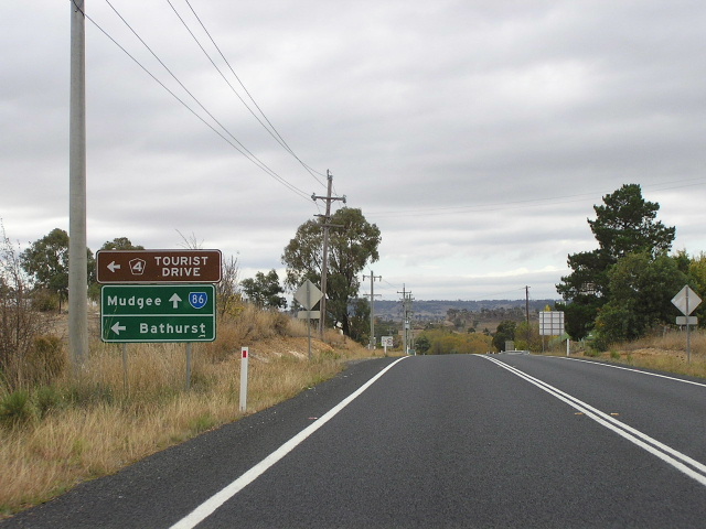
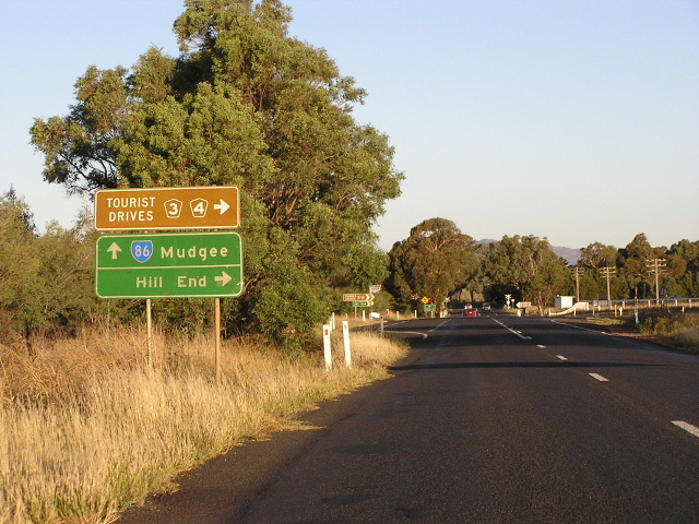
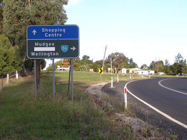
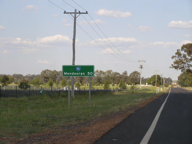
Distance sign heading north from Mudgee. It is interesting that Dunedoo and Coolah make way for Hill End and Wellington, neither of which are anywhere near the Castlereagh Hwy or SR86. April 2006. |
 |
Distance sign heading south from the junction with Windeyer Rd (Hill End turnoff), 3km north of Mudgee. April 2006. |
 |
Southbound AD sign assembly approaching the junction with Windeyer Rd. April 2006. |
 |
Distance sign heading north from Windeyer Rd, again omitting Dunedoo and Coolah. April 2006. |
 |
Very unusual looking and poorly-designed AD sign, northbound approaching the entrance to Mudgee Abbatoir and Saleyards. April 2006. |
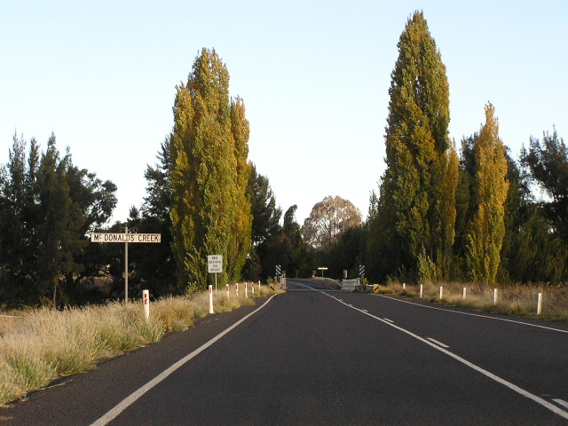 |
Looking south to the 1950s bridge over McDonalds Creek, about 6km north of Mudgee. April 2006. |
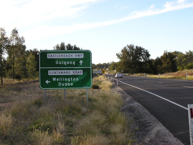 |
Northbound AD sign approaching the junction with Guntawang Rd. Note the missing SR86 shield - despite including the Castlereagh Hwy name. The bridge over the Cudgegong River is in the background. April 2006. |
 |
AD sign eastbound on Guntawang Rd approaching Castlereagh Hwy. April 2006. |
 |
A stray SR86 shield found on the AD sign eastbound on Main Road No. 233 (Parkes-Wellington-Gulgong) approaching Guntawang Rd at Guntawang. April 2006. |
 |
Another stray SR86 shield at the same intersection, showing Guntawang Road as SR86. April 2006. |
 |
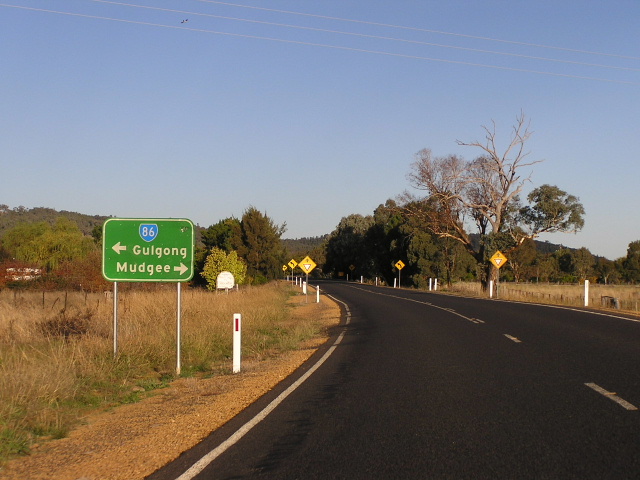
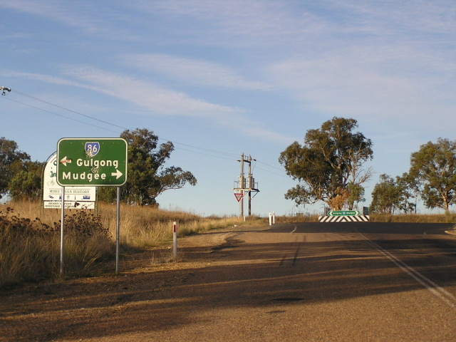
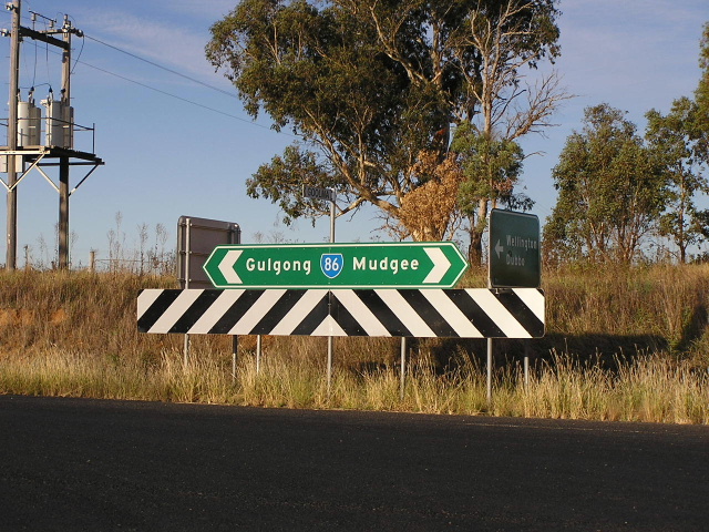
Remnant black RD sign, heading south from Gulgong. Again note the inclusion of Bathurst as a focal point. April 2006. |
 |
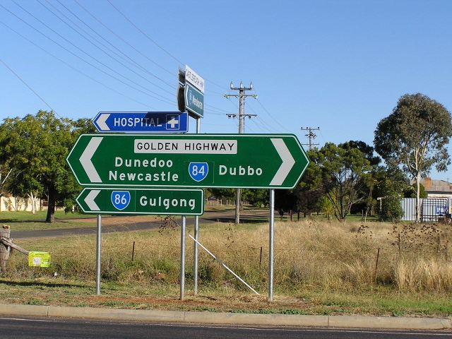
Another remnant black sign, this time an AD sign northbound on Castlereagh Hwy (Medley St) approaching Fisher St, which takes the Highway and SR86 around the south-western edge of Gulgong. Judging by the age of this sign, it is unlikely that SR86 ever passed through Gulgong's historic town centre, although Trunk Road NO. 55 probably did at one stage. April 2006. |
Remnant black sign assembly at the junction of Medley and Fisher Streets, Gulgong. Note the use of dual focal points for SR86 (Dunedoo & Coolah) - this eventuated from SR86 continuing to Dunedoo but Trunk Road No. 55 continuing to Coolah. Note the Wellington ID sign appears to be significantly older than the other sign. April 2006. |
|
 |
Black ID sign at the intersection of Medley St and Fisher St, Gulgong. April 2006. |
Very old and faded AD sign, hidden behind a tree (hence the poor angle of the photo) southbound on Medley St approaching the Castlereagh Hwy. Note there is no SR86 shield for the right-turn. Is this an error or a sign that SR86 actually went through Gulgong's town centre once upon a time? April 2006. |
|
 |
AD sign eastbound on Castlereagh Hwy (Fisher St) approaching Medley St, Gulgong. April 2006. |
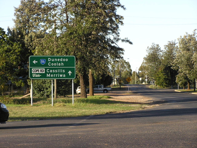 |
Stray SR86 shield found at the intersection of Cope Rd, Station St and Rouse St, Gulgong. April 2006. |
 |
AD sign westbound on Mayne St approaching Castlereagh Hwy (Fisher St), Gulgong. Note the late inclusion of Dubbo as a focal point. April 2006. |
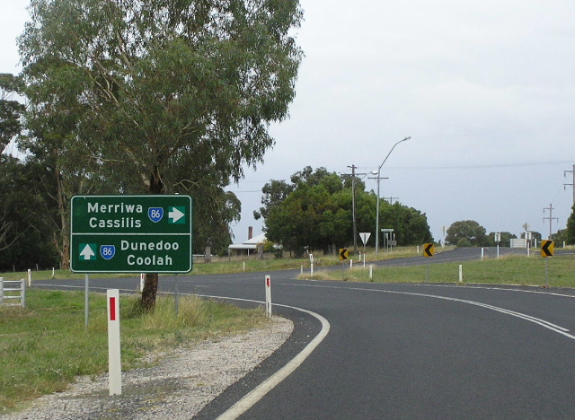 |
Interesting AD sign northbound on Castlereagh Hwy (Fisher St) approaching Caledonian & Tallawang Streets, Gulgong. Note the arrows are on coverplates and there is an incorrect SR86 pointing towards Cassilis/Merriwa. April 2006. |
 |
Non-standard AD sign southbound on Caledonian St approaching Castlereagh Hwy. Note the late inclusion of Dubbo as a focal point. April 2006. |
 |
Non-standard double-chevron ID sign acting as a fingerboard at the junction with Caledonian & Tallawang Streets. Note the missing SR86 shield and the old reference marker, despite the inclusion of the Castlereagh Hwy nameplate. April 2006. |
 |
Remnant painted black/blue AD sign southbound on Castlereagh Hwy approaching Caledonian & Tallawang Streets. Note the tape used in lieu of a coverplate to cover what I think says "Cassilis". April 2006. |
 |
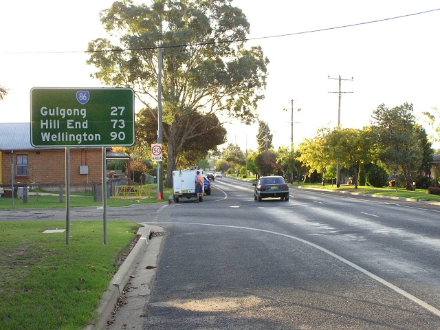
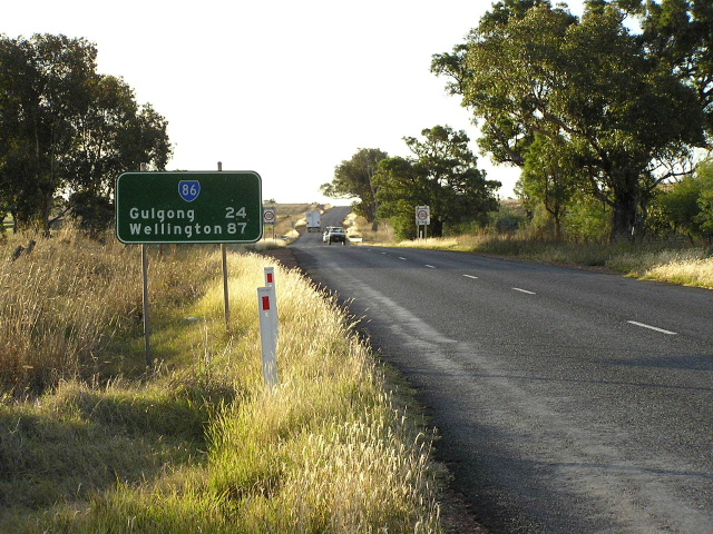
Distance sign heading north from Gulgong. April 2006. |
 |
Looking south on the northern approaches to Gulgong. April 2006. |
 |
Looking south to the bridge over Lambing Yard Creek, about 10km north of Gulgong. April 2006. |
 |
Remnant black "G25" kilometre plate, southbound 25km north of Gulgong. April 2006. |
 |
Looking south through some widening and reconstruction work at Black Bull Hill. April 2006. |
 |
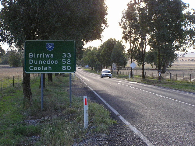
Looking south across the Wallerawang-Gwabegar railway line at Birriwa. April 2006. |
 |
Remnant black fingerboard sign - probably dating from 1974 - at the junction with Barneys Reef Rd in Birriwa. April 2006. |
 |
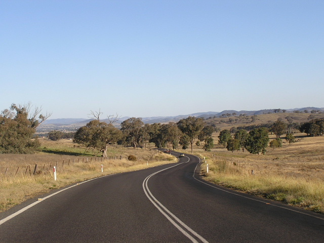
Looking north between Birriwa and Craboon. April 2006. |
 |
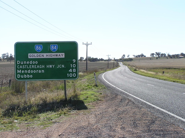
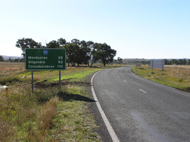
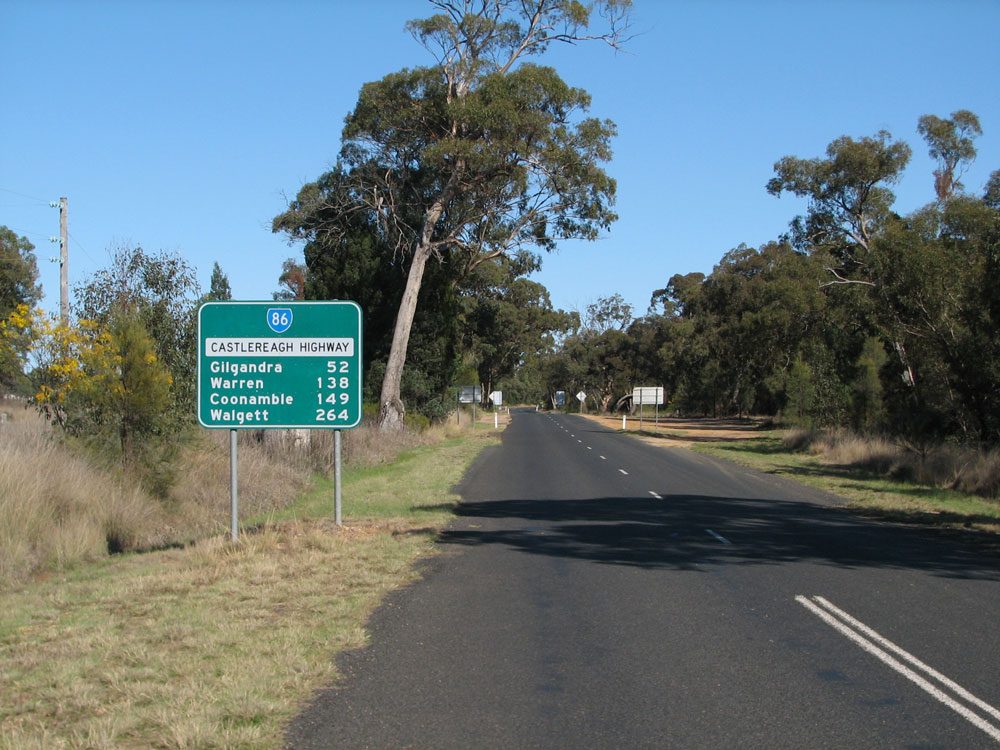
Distance sign heading south from the Golden Highway near Craboon. April 2006. |
 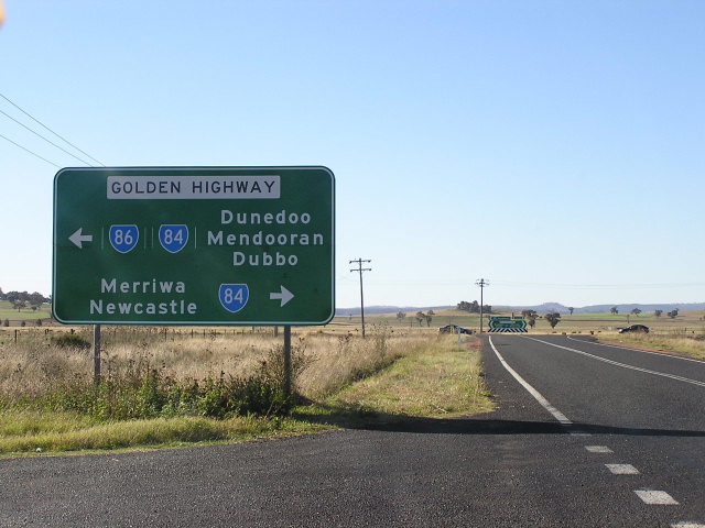  |
Three generations of AD signs northbound on Castlereagh Highway approaching the junction with Golden Highway at Craboon. The top photo shows a terrible, non-standard diagrammatic sign missing a SR84 shield for the left turn. The middle photo shows the sign which replaced it and which corrected the route marker situation but omitted Coolah! The bottom photo shows the most recent AD sign which now screws up the route marker situation again and still omits Coolah! I find it difficult to understand how the RTA keeps managing to screw this sign up - you wouldn't know that SR86 turns left here based on this sign. Top photo: January 2003. Middle photo: April 2006. Bottom photo: September 2011. |
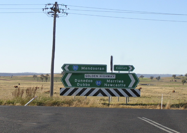 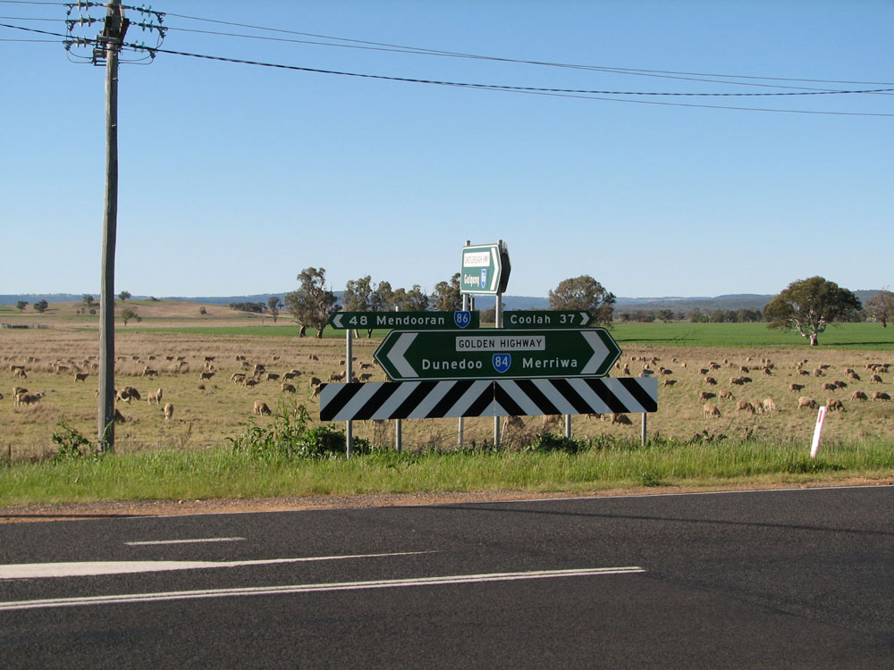 |
Older and new ID and fingerboard signs at the junction of Castlereagh Highway & Golden Highway, Craboon. On both occassions, Mendooran and Coolah appear on signs at this junction but not on the AD signs shown above. Top photo: April 2006. Bottom photo: September 2011. |
  |
Older and new AD signs westbound on Golden Highway approaching the junction with Castlereagh Highway at Craboon. The older sign had the correct route markers, correct focal points and was alpha-numeric-ready so I am not sure why it was replaced with the incorrect sign shown below! The new sign of course omits SR86 which should be shown for the through movement. Top photo: April 2006. Bottom photo: September 2011. |
  |
Older and new AD signs eastbound on Golden Highway approaching the junction with Castlereagh Highway at Craboon. Whilst the RTA haven't managed to screw up this new sign, I am still wondering why it was necessary or desirable to replace the sign and omit Newcastle and Mudgee as focal points. Top photo: April 2006. Bottom photo: September 2011. |
 |
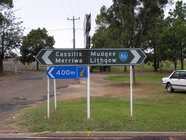
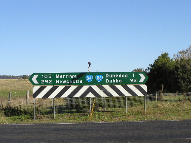
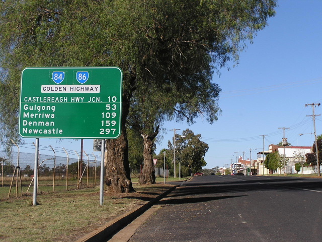
Distance sign heading west along Golden Highway from the Castlereagh Highway junction. Note the inclusion of "Castlereagh Hwy Jcn." as a focal point - the Castlereagh Hwy has a 10km gap in it where SR86 shares pavement with the Golden Highway. The SR84/SR86 duplex is correctly shown and surprisingly this sign is still there as of September 2011. Photo taken: April 2006. |
 |
Golden Highway (SR84/SR86) looking east from the tiny hamlet of Craboon towards the Castlereagh Highway junction and the bridges over the Talbragar River. Photo taken: September 2011. |
 |
Golden Highway (SR84/SR86) looking east through the tiny hamlet of Craboon which was once the junction for the branch railway to Coolah. Photo taken: September 2011. |
 |
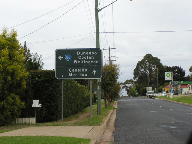
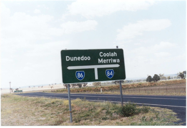
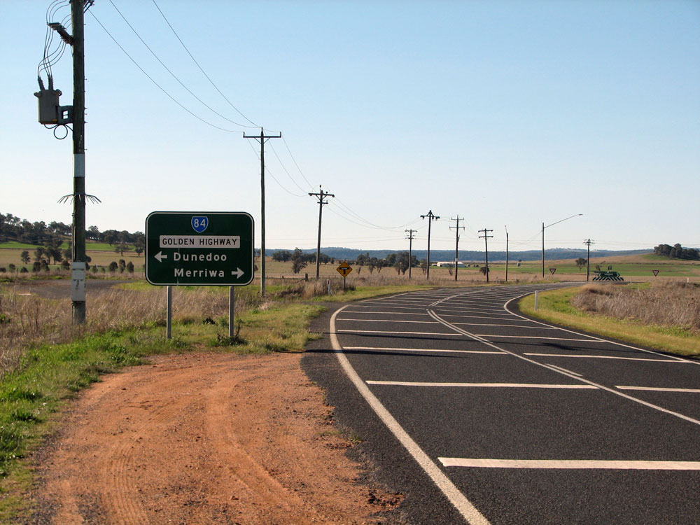
Fingerboard sign at Digilah Rd on the eastern outskirts of Dunedoo, correctly showing the SR84/SR86 duplex. However, note there is no mention of SR86's focal points. April 2006. |
 |
Distance sign heading east from Dunedoo. Note the missing SR86 shield - another new RTA sign with a new error! April 2006. |
 |
ID signs at the junction of Golden Highway (Bolaro Street) & Wargundy Street, Dunedoo. Note the older sign on top correctly shows the SR84/SR86 duplex but doesn't mention Mendooran. The newer, alpha-numeric-ready sign on the bottom correctly shows the two focal points but doesn't include the SR86 shield! Photo taken: September 2011. |
 |
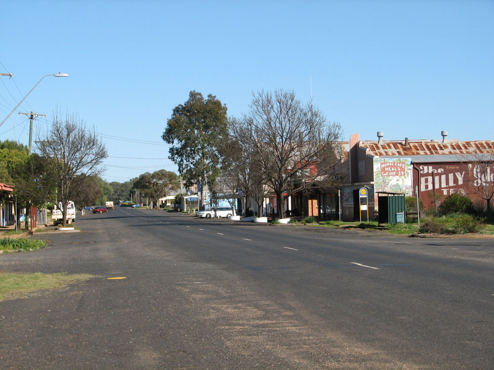
Looking west along Golden Highway (Bolaro Street) through Dunedoo town centre. Photo taken: September 2011. |
 |
Looking west along Golden Highway (Bolaro Street) through Dunedoo town centre. Photo taken: September 2011. |
 |
Distance sign heading east along Golden Highway (Bolaro St) from the Castlereagh Hwy junction on the western side of Dunedoo. April 2006. |
 |
AD sign westbound on Golden Highway (Bolaro St) approaching the Castlereagh Hwy junction. This is the western end of the SR84/86 duplex. April 2006. |
 |
Golden Highway eastbound approaching the Castlereagh Hwy junction, Dunedoo. April 2006. |
 |
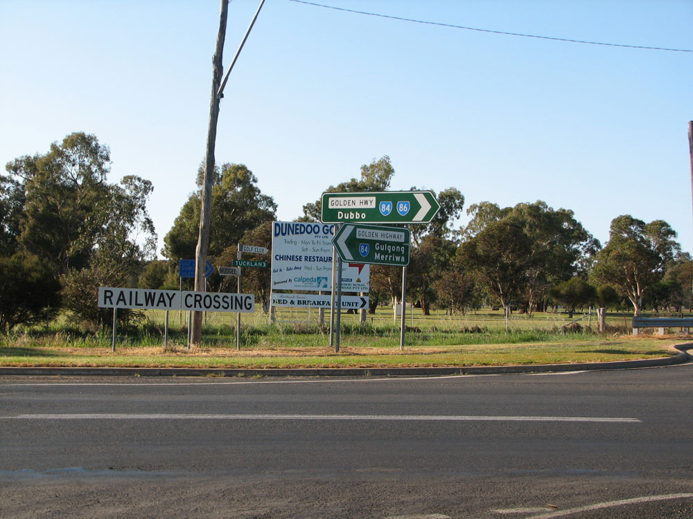
ID sign assembly at the Golden Hwy/Castlereagh Hwy junction, Dunedoo. April 2006. |
 |
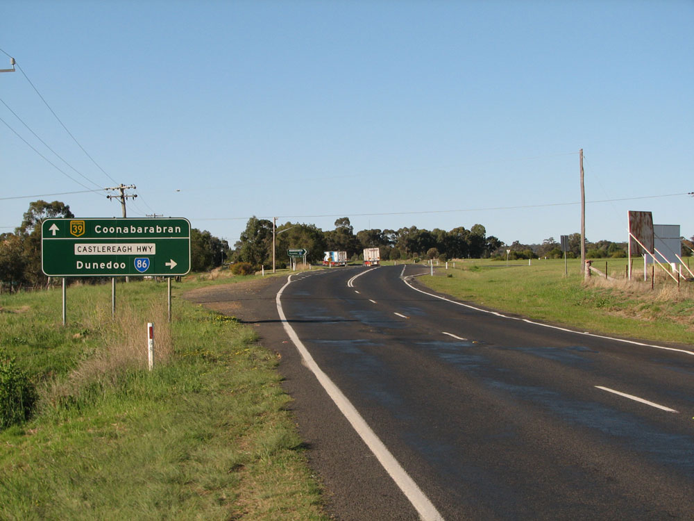
Distance sign heading north from Dunedoo along Castlereagh Hwy. Note that Coonabarabran is mentioned rather than Coonamble, which is actually on the Castlereagh Hwy. April 2006. |
 |
Castlereagh Highway looking north to the level crossing of the Gwabegar branch railway line, 1km north of Dunedoo. Photo taken: September 2011. |
 |
Looking north across the Talbragar River, 3km north of Dunedoo. Photo taken: September 2011. |
 |
Looking northwest, north of the Talbragar River, 4km north of Dunedoo. Photo taken: September 2011. |
 |
Looking northwest towards the Roger Nott Bridge over Mumbedah Creek, 6km north of Dunedoo. Photo taken: September 2011. |
 |
Castlereagh Highway looking northwest across another level crossing of the Gwabegar branch railway line, 8km north of Dunedoo. Photo taken: September 2011. |
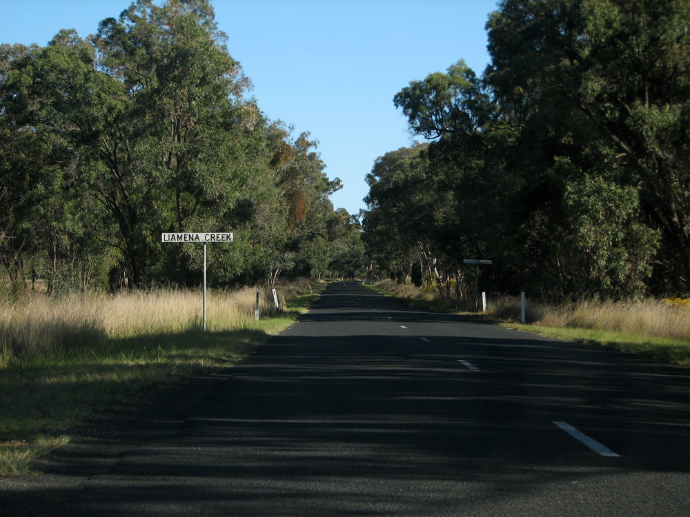 |
Looking northwest through the trees as you cross Liamena Creek, 9km north of Dunedoo. Photo taken: September 2011. |
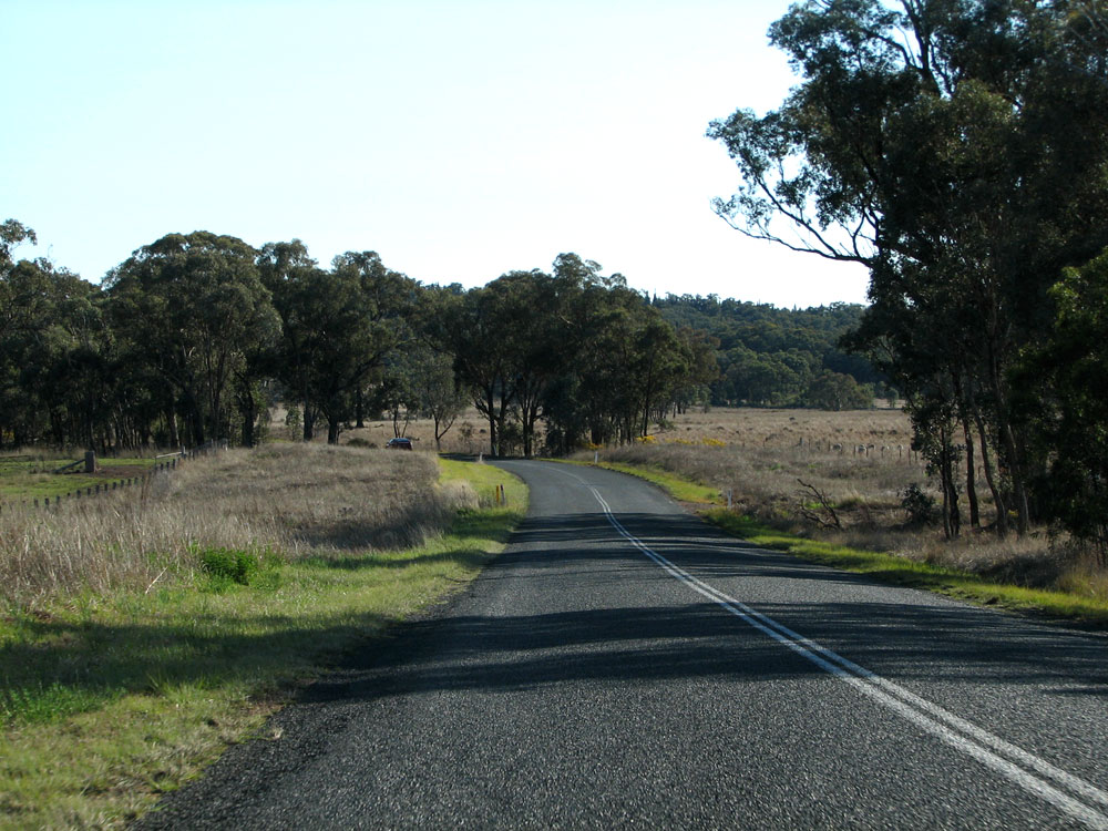 |
Looking northwest through a winding and undulating section, 12km north of Dunedoo. Photo taken: September 2011. |
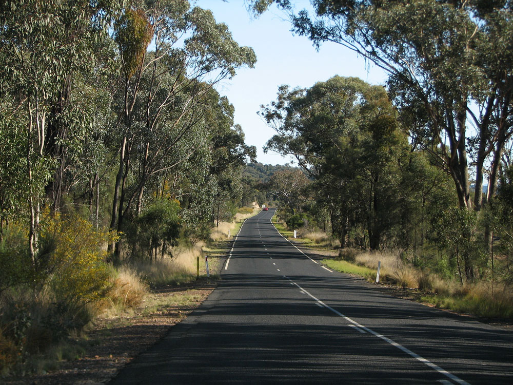 |
Looking northwest at the transition from the older, narrow pavement onto a newer, wider section approximately 16km north of Dunedoo. Photo taken: September 2011. |
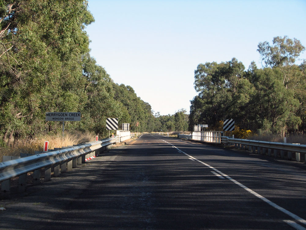 |
Looking northwest across the bridge over Merrygoen Creek at Wongoni, 21km north of Dunedoo. Photo taken: September 2011. |
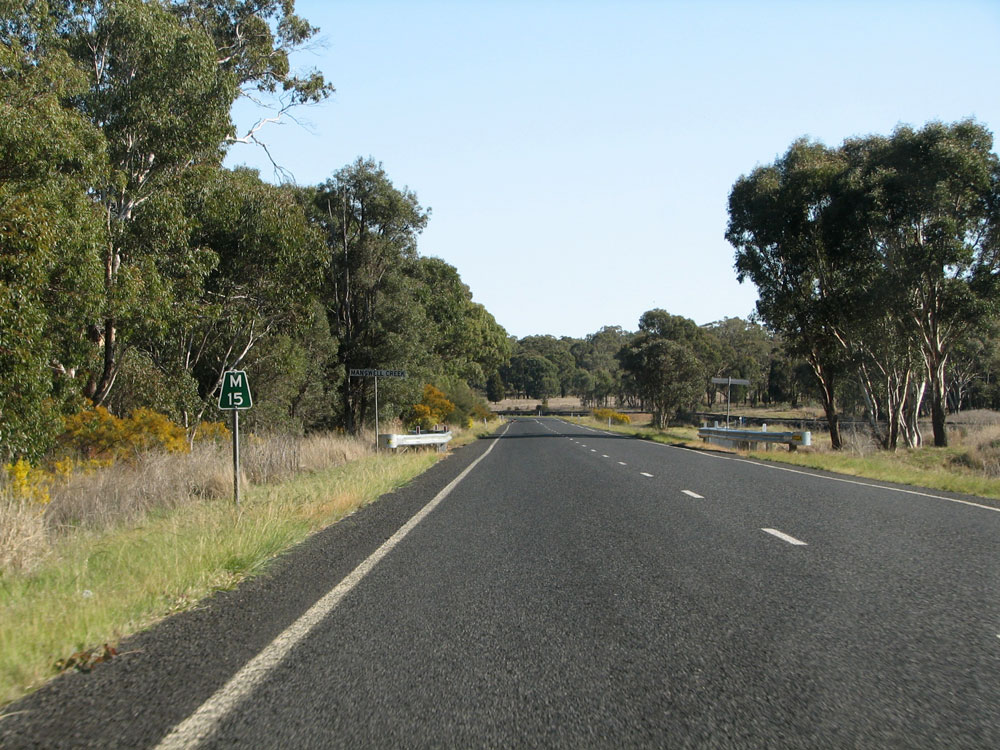 |
'M15' kilometre plate looking northwest at Mangwell Creek, 15km east of Mendooran/23km north of Dunedoo. Photo taken: September 2011. |
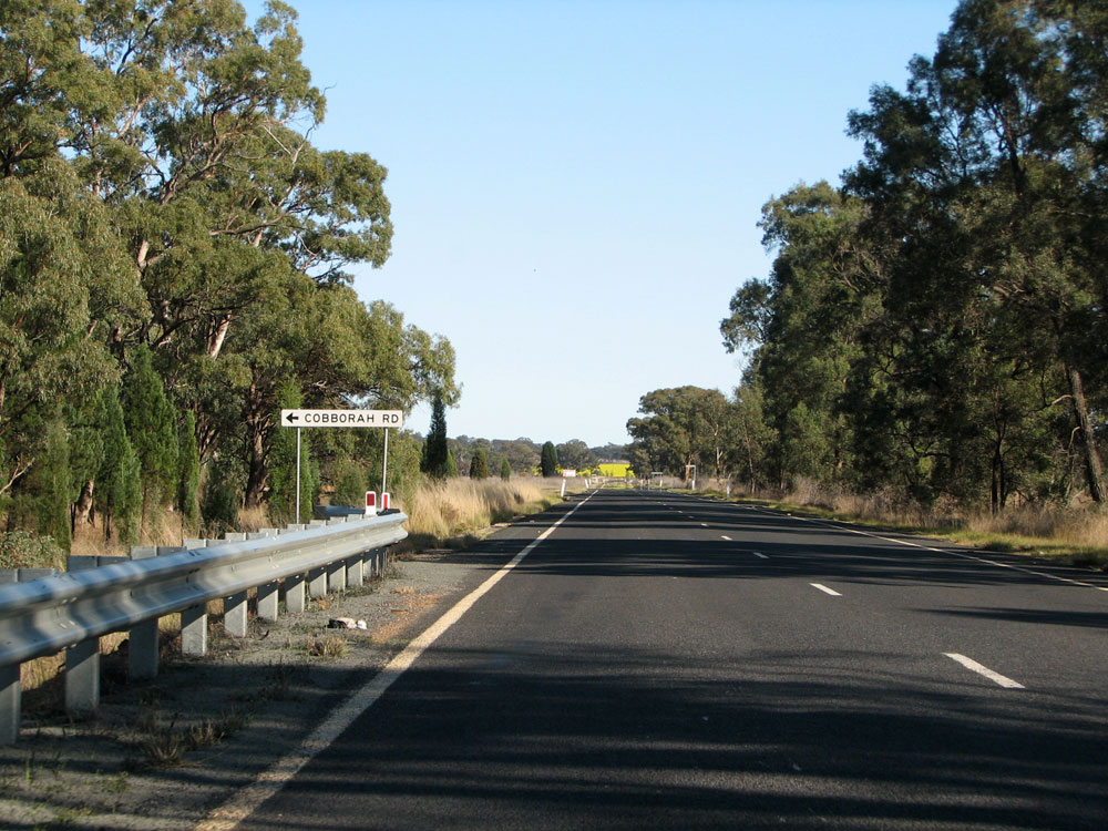 |
Castlereagh Highway looking west towards the junction with Cobborah Road, 10km east of Mendooran. Photo taken: September 2011. |
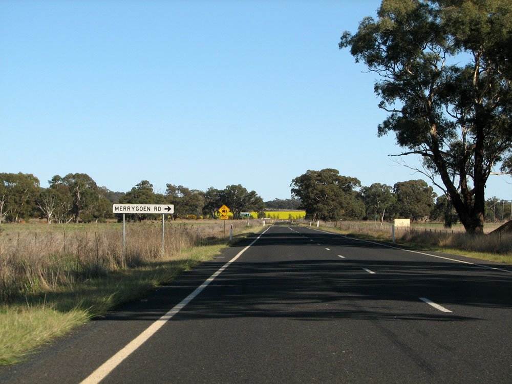 |
Castlereagh Highway looking west towards the junction with Merrygoen Road, 10km east of Mendooran. Photo taken: September 2011. |
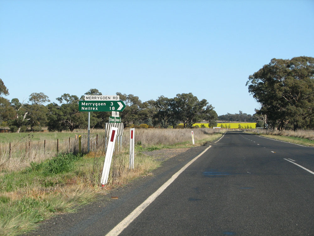  |
Fingerboard signs at the junction of Castlereagh Highway & Merrygoen Road, 10km east of Mendooran. Note the incorrect NR55 shield - it should, of course, be SR86. Photos taken: September 2011. |
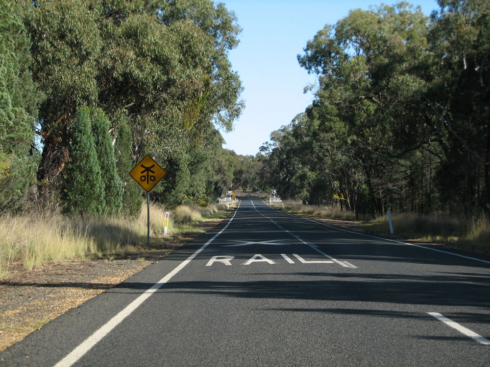 |
Castlereagh Highway looking west towards the level crossing of the Dubbo-Merryogen railway line, 6km east of Mendooran. Photo taken: September 2011. |
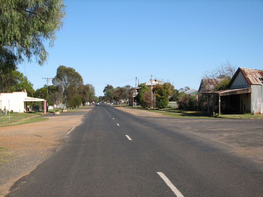 |
Castlereagh Highway (Bandulla Street) looking west through Mendooran. Photo taken: September 2011. |
 |
Another westerly view along Bandulla Street through Mendooran. Photo taken: September 2011. |
 |
Older RD sign eastbound on Bandulla Street, Mendooran. As of September 2011, no new alpha-numeric-ready signs had appeared in Mendooran. Photo taken: September 2011. |
 |
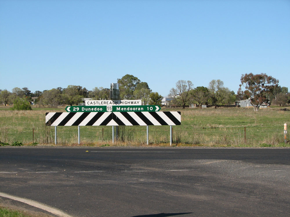
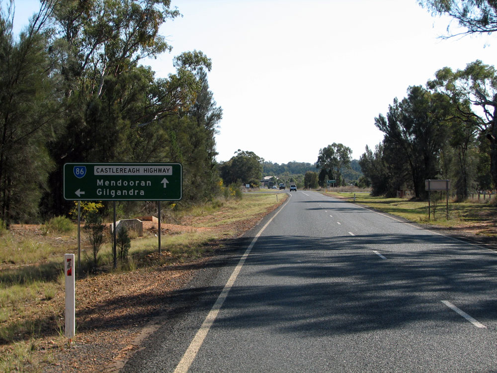
AD sign westbound on Bandulla Street approaching the junction with Yalcogran Street, Mendooran. Castlereagh Highway & State Route 86 make a left turn here towards Gilgandra. Photo taken: September 2011. |
 |
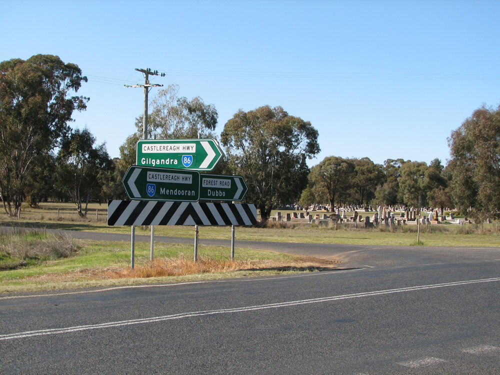
ID signs at the junction of Bandulla & Yalcogran Streets, Mendooran. Note the missing SR86 shield on the 'Dunedoo' ID sign - there is no AD sign facing northbound traffic so good luck trying to follow SR86. Also note that Coonabarabran appears to be on an old painted coverplate which is very unusual! Photo taken: September 2011. |
 |
Dodgy AD sign southbound on Yalcogran Street (Main Road No. 334) approaching the junction with Bandulla Street (Castlereagh Highway) at Mendooran. Note the missing SR86 shield for the left turn. Photo taken: September 2011. |
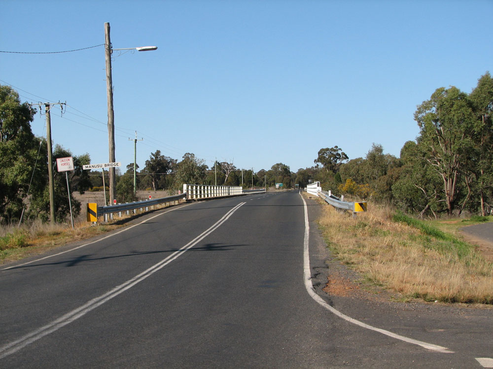 |
Castlereagh Highway looking south at Manusu Bridge over Merrygoen Creek, Mendooran. The highway heads south across the bridge then makes a right turn to head to Gilgandra - you can just see the signs for this turn in the distance. Photo taken: September 2011. |
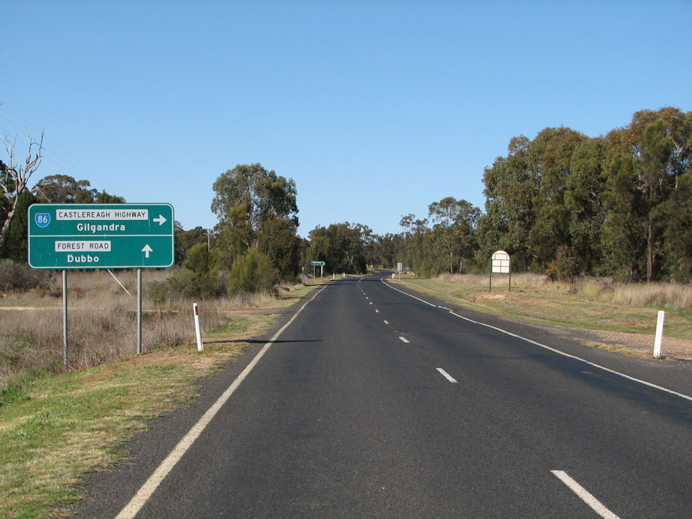 |
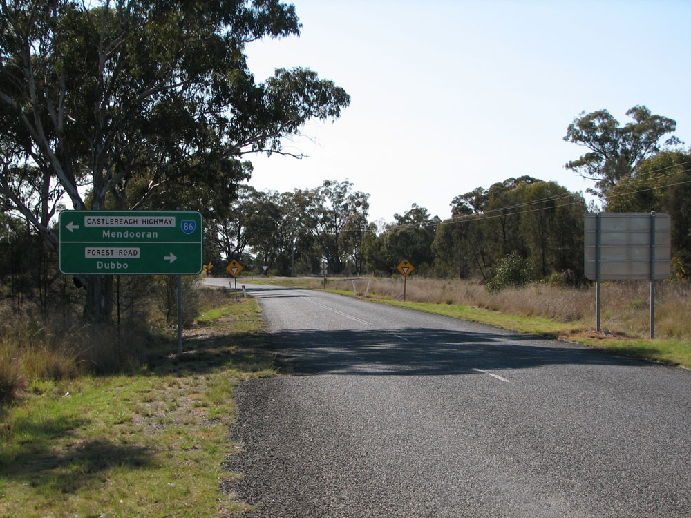
Very dodgy AD sign southbound on Castlereagh Highway approaching the junction with Forest Road, 1km south of Mendooran. Castlereagh Highway/State Route 86 turns right here to head west to Gilgandra. Photo taken: September 2011. |
 |
Dodgy AD sign northbound on Forest Road approaching Castlereagh Highway, 1km south of Mendooran. Even if these are non-standard, at least they have the correct route markers and focal points. Photo taken: September 2011. |
 |
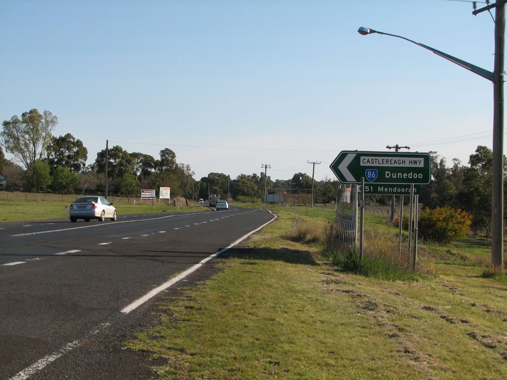
Alpha-numeric-ready ID signs at the junction of Castlereagh Highway & Forest Road, 1km south of Mendooran. Photo taken: September 2011. |
 |
Dodgy AD sign eastbound on Castlereagh Highway approaching the junction with Forest Road, 1km south of Mendooran. Photo taken: September 2011. |
 |
Dodgy RD sign westbound on Castlereagh Highway as you leave the junction with Forest Road near Mendooran. I'm not sure why the signs at this junction are all made of this non-standard green colour. Photo taken: September 2011. |
  |
Old and new, alpha-numeric-ready, RD signs eastbound on Castlereagh Highway near the junction with Newell Highway, 1km east of Gilgandra. Top photo: October 2004. Bottom photo: September 2011. |
  |
Old and new AD signs on Castlereagh Highway approaching the junction with Newell Highway, 1km east of Gilgandra. The new sign is a massive improvement on the horrid, non-standrd sign that it replaced, although it is missing the NR34 route shield which appears to have been largely phased out west of Coonabarabran. Unfortunately the new sign does not make any provision for the 'B55' route marker which will replace SR86 and duplex with A39 into Gilgandra. Top photo: October 2004. Bottom photo: September 2011. |
 |
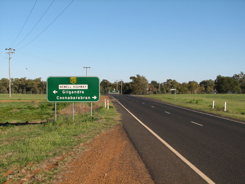
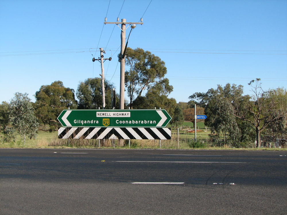
Old ID sign assembly at the junction of Newell & Castlereagh Highways, 1km east of Gilgandra. State Route 86 terminates here, however Castlereagh Highway recommences in Gilgandra and continues north into Queensland as National Route 55. Photo taken: October 2004. |
  |
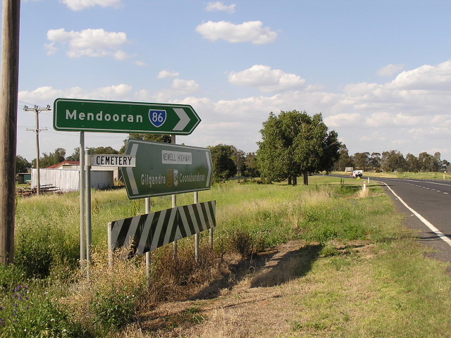
New ID signs at the junction of Newell & Castlereagh Highways, 1km east of Gilgandra. Note the use of a supplementary fingerboard sign for Mendooran - I am not sure why Dunedoo was substituted for Mendooran in the first place. Photos taken: September 2011. |
  |
Old and new AD signs southbound on Newell Highway approaching the junction with Castlereagh Highway near Gilgandra. Note the omission of NR34 in the new sign - this route is been phased out west of Coonabarabran as part of the transition to alpha-numeric route markers. Also note the lack of provision for including a 'B55' route marker once alpha-numeric route marking is introduced. Top photo: October 2004. Bottom photo: September 2011. |
 |
New AD sign northbound on Newell Highway approaching the junction with Castlereagh Highway, 1km east of Gilgandra. Photo taken: September 2011. |
Last updated 11 December 2012 © Ozroads 2003-2012. |