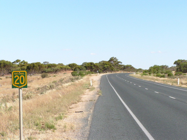
National Highway Route 20 Sturt Highway |
Rare NH20 trailblazer between Euston and Buronga, January 2004.
In 2013, RMS will be implementing a new alpha-numeric route numbering system. For more information, visit the RMS Website. |
|
Forthcoming alpha-numeric route number: |
|
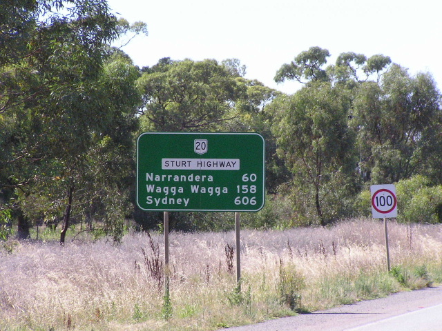
Length: 605km
Eastern Terminus: Hume Highway, 9km N Tarcutta
Western Terminus: George Chaffey Bridge over Murray River, Buronga (NSW/VIC Border)
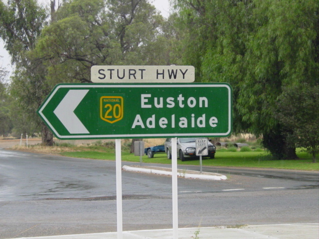
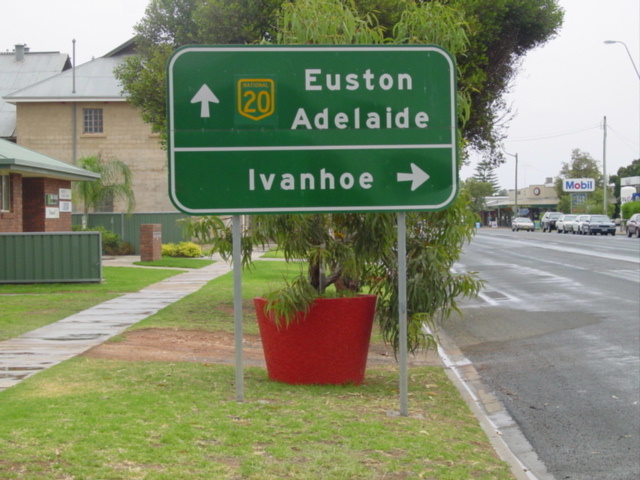
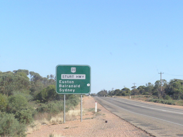
Interstate Continuation: Sturt Hwy continues west through VIC /SA to Adelaide as National Highway A20.
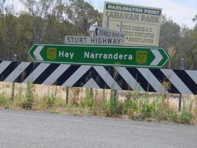
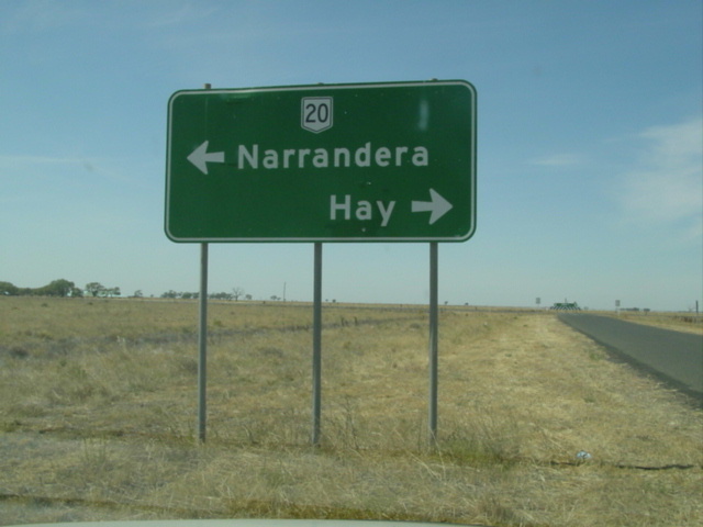
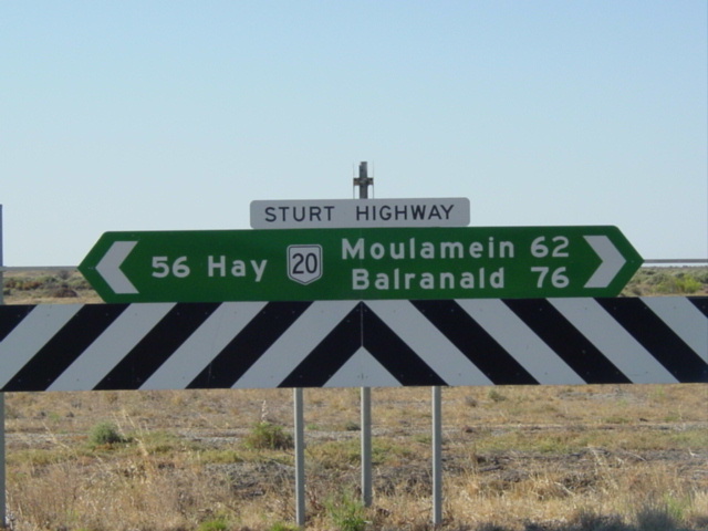
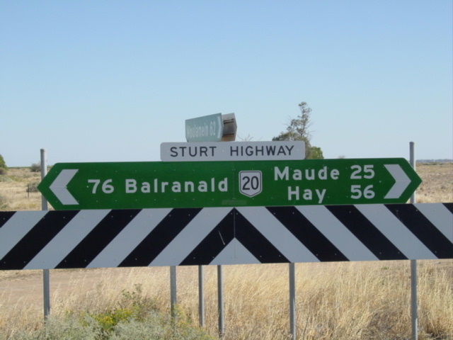
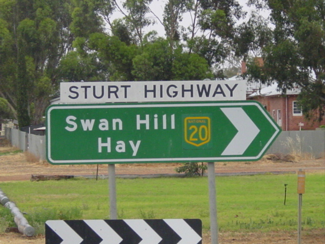
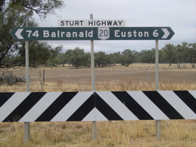
Focal Points: Gundagai, Wagga Wagga, Narrandera, Hay, Balranald, Euston, Mildura
RTA Internal Classification: State Highway 14
Proclaimed a state highway: August 1933
Named: August 1933 (named Sturt Trunk Rd in 1930)
Route Overview:
The Sturt Highway in NSW is a major east-west through the Murray-Riverina region. As a whole, the Sturt Hwy forms the Sydney-Adelaide National Highway link and carries the NH20 shield throughout NSW, while the Victorian and SA sections now carry the A20 designation. Before 1998, NH20 used to extend all the way from the Hume Hwy to Adelaide along the Sturt Hwy but the introduction of alpha-numeric numbering in Victoria and South Australia means that NH20 now only exists in NSW. Within NSW it remains largely unchanged from its original alignment.
Having travelled the length of the Sturt Hwy in NSW i can assure you that it is of the highest quality, with only a few narrow sections across the Hay Plains. 110km/h conditions are encountered west of Hay.
Im 1928, at the dawn of road classification in NSW, the Sturt Hwy as whole did not exist. Parts of the current route existed, the Hume Hwy to Wagga Wagga section was part of State Highway 4 (Snowy Mtns Hwy) and the Balranald to Buronga section was part of State Highway 6 (Mid Western Hwy) which extended west to the SA border near Renmark, a route which the Sturt Hwy would later traverse. In 1929, the Wagga Wagga to 58km W of Hay section was proclaimed Trunk Road 58 and named Sturt Trunk Road in 1930. The remaining section fo the current route from Hay to Balranald did not exist.
A major overhaul came in August 1933 when all these parts were proclaimed State Highway 14, from Hume Hwy to the SA Border near Renmark. This newly proclaimed highway was named Sturt Highway after Captain Charles Sturt who explored the area in 1829 and opened it up for agriculture. In 1939, the Sturt Hwy was truncated at Buronga and the Buronga-Wentworth section reclassified as Main Road 69 (later Silver City Hwy) and the Wentworth-SA section reclassified as MR68. This rationalisation took place so that the Sturt Highway name would apply to the shortest and highest standard route between Sydney and Adelaide.
In 1938, the Sturt Highway was completely reconstructed between the Hume Hwy and Balranald to bring it up to rural highway standards. In 1955, the Sturt Highway was rewarded with the National Route 20 shield as one of the first 5 National Routes to be signposted. Completion of a bitumen surface along its entire NSW length was achieved in 1962, following the completion of a major reconstruction programme. Since then, the only major upgrade has been the Guys Hill Deviation (22-29km W of Hume Hwy), which opened to traffic in November 1975.
In 1992, the Sturt Highway was proclaimed a National Highway, forming the Sydney-Adelaide Link. The black and white shield was subsequently replaced with the green & gold shield. NH20 only remained an interstate route for a few years, as in 1999 Victoria rebadged their section as the A20 with SA following suit in 2001. Remnants of the pre-alpha numeric shields can still be found, albeit in decreasing numbers.
Notable events in the history of NH20:
1882 - Old bridge over Murrimbidgee River, Blaranald
1924 - Old bridge over Murray River, Buronga
1928 - Hume Hwy to Wagga Wagga section proclaimed part of State Highway 4 (Snowy Mtns Hwy) and the Balranald to Buronga section proclaimed part of State Highway 6 (Mid Western Hwy).
1929 - Wagga Wagga to 58km W Hay section proclaimed Trunk Road 58
1930 - Wagga Wagga to 58km W Hay section named Sturt Trunk Road
August 1933 - Proclaimed State Highway 14 & named Sturt Highway from Hume Hwy to SA border near Renmark
1938 - Completely reconstructed between Hume Hwy and Balranald
1939 - Buronga to SA Border section of Sturt Hwy decomissioned, truncating the highway st Buronga
1955 - National Route 20 signage erected (Hume Hwy to Adelaide)
1962 - sealing and reconstruction completed
June 1973 - Murrumbidgee River Bridge, Balranald
November 1975 - Guys Hill Deviation (22-29km W of Hume Hwy)
1985 - George Chaffey Bridge over Murray River, Buronga
1985 - Hume Hwy intersection grade-separated
1992 - Proclaimed a National Highway for its entire length (Hume Hwy to Adelaide)
Jan 1993 - Newell Hwy duplex reclassified as State Highway 17 (Newell Hwy)
December 1999 - Euston Roundabout
1999 - Victorian section of NH20 re-badged as A20
2001 - South Australian section of NH20 re-badged as A20
Dec 2001 - Yarragundry realignment
2003 - Sandigo realignment
Further reading (on-site):
Sturt Highway (NSW)
NR20 former alignment: Sturt Hwy in Victoria (1955-1999)
NR20 former alignment: Sturt Hwy in South Australia (1955-2001)
Photos of National Route 20 remnants in NSW |
|
 |
Original 1950's NR20 trailblazer which I personally own. It was removed from Docker St, Wagga Wagga. Unfortunately the RTA officer didn't take a photo of the sign before he removed it like I asked him too :-( Photo taken December 2004. |
 |
NH20 shields on coverplates over NR20 shields at Donald Ross Dr near Waddi. Photo taken January 2004. |
 |
Distance sign eastbound from Waddi. This NR20 is an error rather than a remnant. Photo taken January 2004. |
 |
NR20 remnant shield at Carrathool turnoff between Narrandera and Hay. Photo taken January 2004. |
 |
NR20 remnant at Maude turnoff between Balranald and Hay. Photo taken January 2004. |
 |
NR20 remnant at Moulamein turnoff between Balranald and Hay. Photo taken January 2004. |
 |
NH20 on a coverplate over NR20 shield in Balranald. Photo taken January 2004. |
 |
NH20 on a coverplate over NR20 shield in Balranald. Photo taken January 2004. |
 |
NH20 on a coverplate over NR20 shield in Balranald. Photo taken January 2004. |
 |
Very old (1980's) fingerboard sign between Balranald and Euston with NR20 shield. Photo taken January 2004. |
 |
Distance sign leaving Gol Gol eastbound without any distances. Photo taken January 2004. |
Last updated 12 December 2012 © Ozroads 2003-2012. |