Metroad 6 |

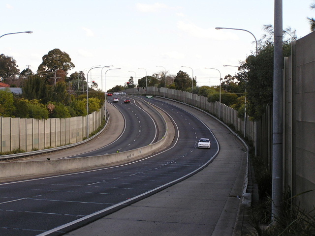
New Illawarra Road northbound from the Bangor Bypass at Menai. Feb 2005.
In 2013, RMS will be implementing a new alpha-numeric route numbering system. For more information, visit the RMS Website. |
|
Forthcoming alpha-numeric route number: |
|
Length: 34km
Northern Terminus: Pennant Hills Rd & Hills (M2) Motorway, Beecroft
Southern Terminus: Princes Hwy & Heathcote Rd, Heathcote
Route taken: Pennant Hills Rd, Marsden Rd, Stewart St, Kissing Pt Rd, Silverwater Rd, St Hilliers Rd, Rawson St, Olympic Drive, Joseph St, Rookwood Rd, Stacey St, Fairford Rd, Davies Rd, Alfords Point Rd, New Illawarra Rd, Heathcote Rd
Focal Points: Hornsby, Carlingford, Silverwater, Bankstown, Menai, Heathcote
RTA Internal Classification: State Highway No. 13 (Pennant Hills Rd) Main Road No. 158 (Marsden Rd), Main Road No. 574 (Stewart St/Kissing Pt Rd), Main Road No. 190 (Ermington-Lucas Heights), Main Road No. 512 (Heathcote Rd)
Following the opening of the Westlink M7 motorway on 17 December 2005, Metroad 6 appeared to have been extended north from its original terminus at Carlingford (Pennant Hills Rd & Marsden Rd) along Pennant Hills Road to meet Metroad 7 at the M2 Motorway junction in Beecroft. Several signs showing Metroad 6 were installed at the M2 interchange on the night of 21 December 2005, however the majority of signs between Marsden Rd and the M2 had their Metroad 7 shields covered with blank coverplates! The logic behind that move still evades me.
In March 2006 the blank coverplates were then covered with Metroad 6 shields, thus marking the official extension of Metroad 6 from Carlingford to Beecroft.
Metroad 6 is a major north south route, running close to the geographical heart of the metropolitan area. It is made up of a number of suburban streets and deviations that have over the years been widened and joined together to make one continuous through route, the last of which was opened to traffic in early 1999.
Much of the route from Bankstown to Silverwater is six lanes wide, the remainder of the route being at least four lanes wide - except for the Alfords Point Bridge and south of Barden Ridge. Unlike many other important through routes in Sydney, Metroad 6 is not unified under one name. This combined with a number of turns that need to be made to follow the route results in a situation where clear signage of the route number is very important.
The opening of the Bangor Bypass on 7 February 2005 created the first former alignment for Metroad 6 - Menai Rd and Old Illawarra Rd between Alfords Point Rd and Marsden Rd at Menai. Photos of Metroad 6 shields on the old route can be found in the picture table below.
History and Development
Decommissioned State Route 45: The route that Metroad 6 replaced
 |
AD sign southbound on Pennant Hills Rd approaching the beginning of Metroad 6 at Beecroft. Note how there is no mention of Canberra for through traffic at this key turn (right). March 2006. |
 |
Mention of Metroad 6's extension on a Metroad 2 distance sign, heading west from Lane Cove Rd at North Ryde. Jan 2006. |
 |
Eastbound AD sign on the M2 Motorway showing Metroad 6 for Pennant Hills Rd interchange. Jan 2006. |
ID signs on the eastbound offramp from the M2 Motorway showing Metroad 7 left and Metroad 6 right. March 2006. |
|
 |
Metroad 6 shield covering a Metroad 7 shield on this AD southbound on Pennant Hills Rd approaching North Rocks Rd at Carlingford. March 2006. |
 |
Dual ID signs at the Pennant Hills Rd/North Rocks Rd junction, Carlingford. The Metroad 7 shields were initially covered by blank coverplates in December 2005, then covered again with Metroad 6 coverplates in March 2006! March 2006. |
 |
Interesting use of an oversized Metroad 6 sticker for the left turn - North Rocks Rd eastbound approaching Pennant Hills Rd. March 2006. |
 |
Pennant Hills Road southbound at Carlingford approaching the old northern terminus of Metroad 6. Sep 2005. |
 |
Now an undersized Metroad 6 shield, this time on the distance sign heading north from Carlingford Rd. Note the unusual use of dual road names. March 2006. |
 |
Metroad 6 coverplates on ID signage at Carlingford Rd. March 2006. |
 |
AD sign northbound on Marsden Rd approaching Pennant Hills Rd at Carlingford. Note the blank coverplate and no mention that Metroad 6 now continues north along Pennant Hills Rd towards Hornsby. March 2006. |
 |
Northbound Pennant Hills Rd AD sign for the old beginning of Metroad 6. Note the remnant SR28 shield. Dec 2003. |
AD sign northbound on Pennant Hills Rd approaching Marsden Rd at Carlingford. Note no mention of Metroad 6 straight. March 2006. |
|
 |
ID sign marking the old beginning of Metroad 6 at Carlingford. Dec 2003. |
 |
Looking south on Marsden Rd at Carlingford. Jan 2004. |
 |
Southbound AD sign approaching the Marsden Rd/Stewart St/Rutledge St intersection at Brush Farm. July 2004. |
 |
AD sign for the same intersection, eastbound on Stewart Street. Not sure exactly what the coverplate beneath 'Rutledge St' is covering - my best guess would be an erroneous SR45 shield. July 2004. |
 |
Looking west down Stewart St from the above sign. March 2005. |
 |
AD sign for the Kissing Point Rd/Silverwater Rd intersection at Dundas. Note the missing Metroad 6 shields. Aug 2004. |
 |
Looking south along Silverwater Rd from Kissing Pt Rd towards Kingsford St. Note the hill that traffic has to climb to meet Kingsford St at an at-grade intersection - would have been perfect for an underpass. Aug 2004. |
 |
Victoria Rd looking east towards Silverwater Rd at Ermington. Aug 2004. |
 |
Looking south along Silverwater Rd from Victoria Rd towards Silverwater Bridge in the distance. Aug 2004. |
Looking north over the Silverwater Bridge following opening in 1962. (DMR). |
|
 |
Silverwater Rd southbound approaching Holker St, Silverwater. Note the Metroad 6 shield is on a coverplate over 'A6'. July 2004. |
 |
Distance sign northbound from the M4 Motorway at Silverwater. Jan 2004. |
 |
Lane allocation signs for southbound traffic on the M4 overpass at Silverwater. July 2004. |
 |
M4 distance sign near Homebush Bay Drive mentioning Silverwater Road exit. May 2004. |
 |
M4 westbound at Silverwater Rd exit. May 2004. |
 |
M4 eastbound at Silverwater Rd exit. June 2004. |
 |
Silverwater Rd southbounbd approaching Gt Western Hwy (Parramatta Rd) where Metroad 6 becomes St Hilliers Rd. July 2004. |
 |
Gt Western Hwy westbound approaching Metroad 6. June 2004. |
 |
St Hilliers Rd northbound approaching Gt Western Hwy. June 2005. |
 |
St Hilliers Rd looking south from Gt Western Hwy at Auburn. June 2004. |
 |
ID sign pointing the way as Metroad 6 turns from St Hilliers Rd onto Rawson St at Auburn. July 2004. |
 |
ID sign at the intersection of Olympic Drive and Boorea St, Lidcombe. June 2005. |
 |
Olympic Drive looking south approaching the railway underpass at Lidcombe. June 2005. |
 |
Unusual AD sign on Weeroona Rd approaching Metroad 6 at Regents Park. Dec 2004. |
 |
AD sign northbound on Joseph St approaching Amy St & Weeroona Rd. May 2005. |
 |
Opposite side of the above sign, heading south on Joseph St. Note the unusual 'To Rookwood Rd'. This is because Joseph St becomes Rookwood at the Auburn/Bankstown LGA boundary, only 100m or so up the road. July 2004. |
 |
Lane allocation AD sign southbound approaching the Stacey Street extension at Bankstown. Rookwood Rd is the former route of State Route 45, which became Metroad 6 when this deviation opened in early 1999. July 2004. |
 |
Stacey St looking north from Hume Hwy at Bankstown. Dec 2004. |
 |
Hume Hwy westbound approaching Stacey St at Bankstown. Jan 2004. |
 |
Hume Hwy eastbound approaching Stacey St at Bankstown. Aug 2005. |
 |
Stacey St looking south at Greenacre Rd, Bankstown. Note the land reserved for widening on the right hand side of the road. June 2005. |
 |
Newly installed ID signs at Stacey St & Rickard Rd, Bankstown. Note Metroad 6 is on a coverplate over 'A6'. June 2005. |
 |
Stacey St southbound approaching the railway overpass at Bankstown. June 2005. |
 |
Stacey St looking south from the railway overpass. Note the stormwater drain in the median in the distance. July 2004. |
 |
Very old, probably early 1970s, 'To Hume Hwy' ID sign at Stanley St, Bankstown. Jan 2004. |
 |
Fairford Rd looking south from Stacey St South towards the Canterbury Rd overpass at Bankstown. Aug 2004. |
 |
Fairford Rd northbound approaching Canterbury Rd interchange. Aug 2004. |
 |
Canterbury Rd westbound approaching Fairford Rd. April 2005. |
 |
Fairford Rd southbound approaching the M5 Motorway at Padstow. Aug 2004. |
 |
M5 westbound approaching Fairford Rd exit. Aug 2004. |
 |
M5 eastbound approaching Fairford Rd exit. June 2004. |
 |
Fairford Rd northbound approaching the M5 at Padstow. Dec 2004. |
 |
Looking south along Davies Rd from the railway overpass at Padstow. Dec 2004. |
 |
Distance sign northbound on Davies Road at Padstow. Feb 2005. |
 |
Signage on Clancy St westbound approaching the Metroad 6 junction. July 2004. |
 |
The crazy situation of a stop sign on an on-ramp to an 80km/h road. This ramp from Clancy St to Alfords Pt Rd southbound is a temporary measure until the road is duplicated. July 2004. |
 |
Metroad 6 northbound approaching Clancy St exit at Padstow Heights. Mar 2005. |
 |
Great photo showing distance sign and three-lane Georges River Bridge southbound. Feb 2005. |
1973 photo looking west on Henry Lawson Drive to the Alfords Point Rd overpass. (DMR). |
|
 |
Aerial view southbound over Henry Lawson Drive in 1972. (DMR). |
A shot of the newly-opened bridge in 1973, showing the piers constructed for future duplication of the bridge. (DMR). |
|
Looking south from the bridge showing the new three-lane approach road in 1973. (DMR). |
|
 |
Alfords Point Road, looking south across the Georges River, showing duplication of the bridge underway. Source: Daniel Thornton, October 2007. |
 |
Looking north on Alfords Point Rd where, depending on what time of day it is, either the 2nd northbound lane ends or the 2nd southbound lane begins. Mar 2005. |
 |
Alfords Point Rd looking north from the Brushwood Dr/Old Illawarra Rd interchange at Illawong. Mar 2005. |
 |
Southbound signage for the Old Illawarra Rd offramp at Illawong. Note that there is no name patch on the lower panel. July 2004. |
 |
Looking north at the Brushwood Dr overpass showing provision for future duplication. Mar 2005. |
 |
Alfords Point Rd southbound approaching New Illawarra Rd, Menai Rd and Old Illawarra Rd at Menai. Feb 2005. |
 |
Looking south on New Illawarra Rd from Menai Rd. Feb 2005. |
 |
New Illawarra Rd southbound approaching the Bangor Bypass at Menai. Feb 2005. |
 |
Bangor Bypass westbound approaching New Illawarra Rd. Feb 2005. |
 |
New Illawarra Rd northbound approaching Bangor Bypass. Feb 2005. |
 |
New Illawarra Road looking north at Lucas Heights. Mar 2005. |
 |
New Illawarra Rd southbound approaching Heathcote Rd at Lucas Heights. July 2004. |
 |
ID signs at the intersection of Heathcote Rd & New Illawarra Rd, Lucas Heights. July 2004. |
 |
Heathcote Rd looking east from New Illawarra Rd. July 2004. |
Woronora River bridge on Heathcote Rd. (DMR) |
|
 |
Looking north-west on Heathcote Rd approaching the Woronora River bridge. Mar 2005. |
 |
1km to go to the end of Metroad 6. Mar 2005. |
 |
Formerly the first northbound RD sign on Metroad 6, this sign has since been removed. Oct 2000. |
 |
Sign marking the beginning of Metroad 6 at Heathcote. Mar 2005. |
 |
Sign marking the end of Metroad 6 at the Princes Hwy. July 2004. |
 |
Princes Hwy southbound approaching Metroad 6 at Heathcote. July 2004. |
 |
Princes Hwy northbound approaching Metroad 6 at Heathcote. Mar 2005. |
Former Alignment: Menai |
|
 |
Alfords Point Rd southbound sign, pointing traffic onto a short section of Menai Rd. July 2004. |
 |
Menai Rd eastbound AD sign, pointing Metroad 6 traffic onto Old Illawarra Rd. July 2004. |
 |
ID signs at the Menai Rd/Old Illawarra Rd intersection. July 2004. |
 |
Looking south along the bypassed section of Old Illawarra Rd. July 2004. |
Last updated 12 December 2012 © Ozroads 2003-2012. |