NSW STATE ROUTE 45
Decomissioned
Lifespan: 1974-1999 (25 years)
Length: 39km
Northern Terminus: Pennant Hills Rd & Marsden Rd, Carlingford
Southern Terminus: Heathcote Rd & New Illawarra Rd, Lucas Heights
Route taken: Marsden Rd, Stewart St, Kissing Pt Rd, Silverwater Rd, St Hilliers Rd, Rawson St, Olympic Drive, Joseph St, Rookwood Rd, Hume Hwy, Stacey St, Fairford Rd, Davies Rd, Alfords Pt Rd, Old Illawarra Rd, New Illawarra Rd
Focal Points: Carlingford, Silverwater, Bankstown, Menai, Heathcote
RTA Internal Classification: Main Road 158 (Marsden Rd), Main Road 574 (Stewart St/Kissing Pt Rd), Main Road 190 (remainder of route)
Replaced by: Metroad 6
Route Overview:
State Route 45 was proclaimed in 1974 between Heathcote and Ermington as north-south route through central western Sydney. From Ermington, travellers wishing to head north could use Victoria Rd/Marsden Rd to reach Pennant Hills Rd at Carlingford. Oddly enough, at the time of proclamation, SR45 utilised many secondary (council-owned) and unclassified roads on its journey. The 1982 'Schedule of descriptions of State Routes' gives this description: "From the junction of Main Road Nos. 165 and 532 at Silverwater [Ermington], then via Main Road No.s 532 [Silverwater Rd], 190 [St Hilliers Rd/Olympic Dr/Joseph St/Rookwood Rd], Secondary Road No. 2094 (temporary link) [Brunker Rd], State Highway No. 2 (temporary link) [Hume Hwy], Stacey St North, Stacey St South, Main Road No. 167 (temporary link) [Canterbury Rd], Secondary Rd No. 2061 [Fairford Rd/Davies Rd], Alfords Pt Rd, Secondary Rd no. 2034 [Old Illawarra Rd], Old Illawarra Rd, New Illawarra Rd and Main Road No. 512 [Heathcote Rd] to the junction at State Highway No. 1 [Princes Hwy] at Heathcote, with a possible future extension." The amount of Secondary Roads and unclassified roads used in this route is quite puzzling, however it was rectified in July 1989 when the whole route from Ermington to Lucas Heights was reclassified Main Road No. 190 (excepting the shared pavement with Hume Hwy at Bankstown). State Route 45 was the last route to be replaced by a Metroad, M6 not being proclaimed until early 1999, when the Stacey St extension opened at Bankstown.
State Route 45 has a number of former alignments. Initially the route's northern extremity was Victoria Rd at Ermington. In January 1996, the Silverwater Rd extension was opened to traffic, meaning SR45 was extended north along the new road, Stewart St and Marsden Rd to Pennant Hills Rd at Carlingford.
At Lidcombe, the initial routing was via Olympic Drive (which then terminated at Bridge St), Bridge St and Joseph St. In 1982, the Lidcombe Bypass was completed, utilising the alignment of Bede St, and this bypass was named Olympic Drive.
North of Bankstown, initially the route used Brunker Rd/Hume Hwy as a temporary link between Rookwood Rd and Stacey St. In the early 1980's, SR45 was re-routed to use Rookwood Rd/Hume Hwy as this temporary connection. In 1999, the Stacey St extension was opened to traffic and SR45 finally abandoned these temporary routes, however at the same time SR45 was replaced by Metroad 6.
South of Bankstown, SR45 initially used Stacey St South and Canterbury Rd to connect to Fairford Rd. In 1985, the Fairford Rd extnsion was opened to traffic and SR45 could now connect directly from Stacey St to Fairford Rd.
At the southern extremity of Alfords Pt Rd, SR45 used Old Illawarra Rd between Illawong and Menai. This section of road was bypassed by the opening of the Alfords Pt Deviation, in July 1992.
From 1974 till 1993, SR45 stretched all the way south to the Princes Hwy at Heathcote. However, when Metroad 7 was signposted in 1993, SR45 was truncated at Luc Heights. Metroad 6 later regained the pavement that SR45 lost, by superseding Metroad 7 south to Heathcote in 1999.
Notable events in the history of SR45:
November 1962 - Silverwater Bridge
1968 - SIlverwater Rd 6-laning
October 1969 - Stacey St Rail overpass, Bansktown
September 1973 - Padstow to Illawong section opened (including Alfords Pt Br)
1974 - SR45 proclaimed (Ermington-Heathcote)
1982 - Lidcombe Bypass
1985 - Fairford Rd extension
Feb 1989 - Alfords Pt Bridge tidal-flow introduced
July 1989 - Reclassified as Main Road 190 from Lucas Hts to Ermington
July 1992 - Alfords Pt Deviation
1993 - SR45 truncated at Lucas Heights
Jan 1996 - Silverwater Rd extension, SR45 extended north to Carlingford
1999 - SR45 replaced by Metroad 6 upon opening of Stacey St Extension, Bankstown
Photos of State Route 45 |
|
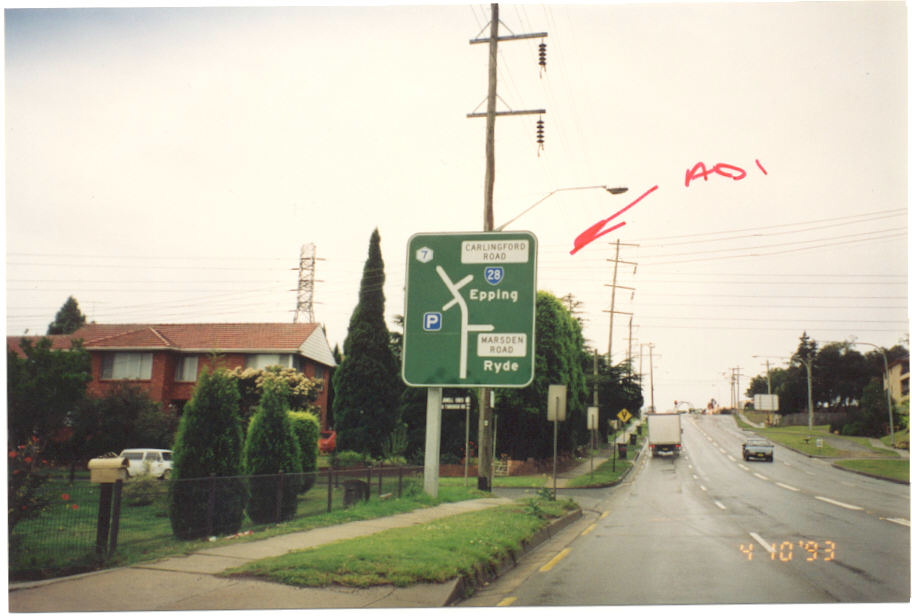 |
Pennant Hills Rd northbound approaching Marsden Rd, Carlingford, the northern terminus of SR45 from Jan 1996 till its decomissioning in 1999. This photo was taken before SR45 was comissioned along this section, in 1993. |
 |
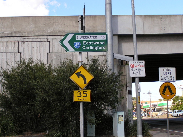
Marsden Rd ID sign in December 1998, showing SR45 shield only months before its decomissioning. |
 |
Marsden Rd ID sign southbound on Pennant Hills Rd, showing Marsden Rd before its proclamation as SR45. Photo taken 1993. |
 |
Marsden Rd AD sign northbound at Lawson St, taken in 1993 before its proclamation as SR45. |
 |
AD sign eastbound on Kissing Point Rd approaching Silverwater Rd Extension, Dundas. This is a relic from the days before SR45 and now Metroad 6 ran here. Photo taken September 2004. |
 |
The only SR45 relic still in existence today, this sign is at the Victoria Rd interchange, Ermington. Photo taken September 2004. |
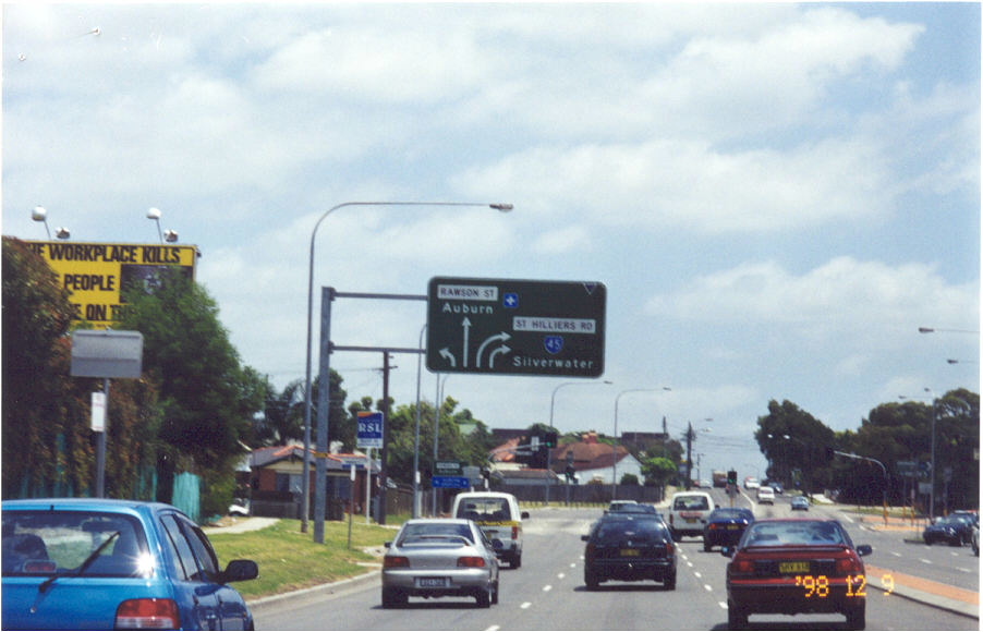 |
Rawson St at Auburn approaching St Hilliers Rd in December 1998. |
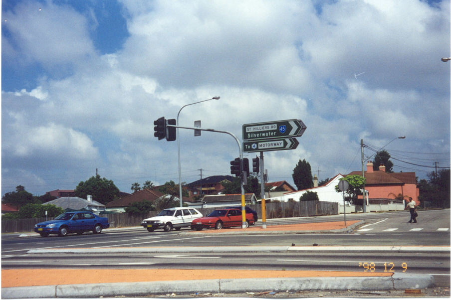 |
Rawson St & St Hilliers Rd, Auburn. Photo taken December 1998. |
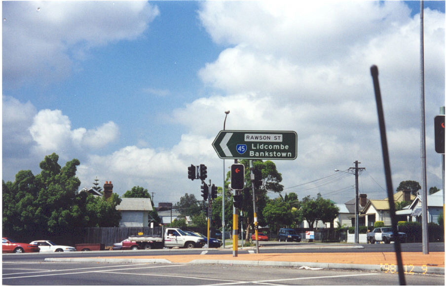 |
Same intersection, December 1998. |
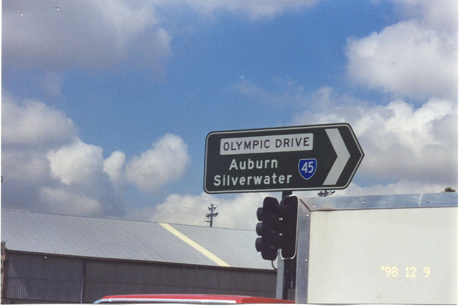 |
Olympic Dr & Boorea St, Lidcombe, Dec 1998. |
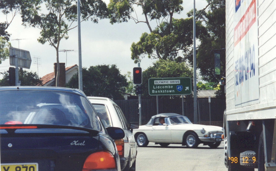 |
Same intersection, Dec 1998. |
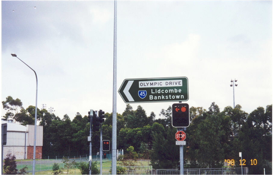 |
Same intersection, Dec 1998. |
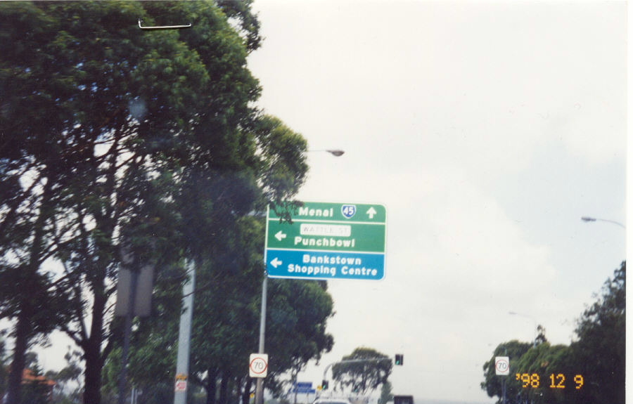 |
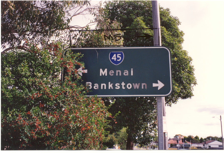
Stacey St southbound approaching Wattle St, Bankstown. Photo taken Dec 1998. |
 |
1992 photo on Clancy St approaching SR45 at Padstow Heights. |
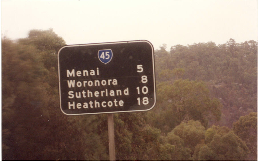 |
Black RD sign southbound on Alfords Point Rd near the Georges River. Photo taken c.1995. |
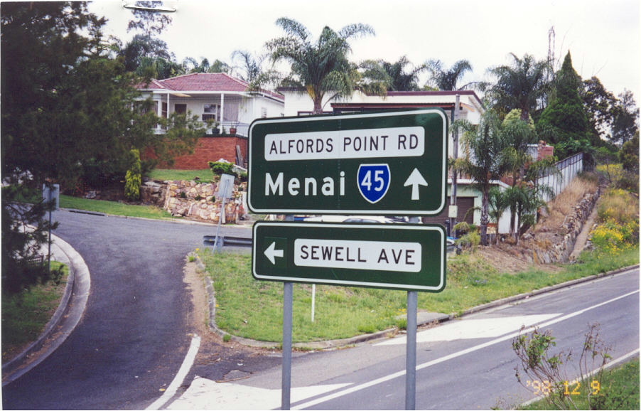 |
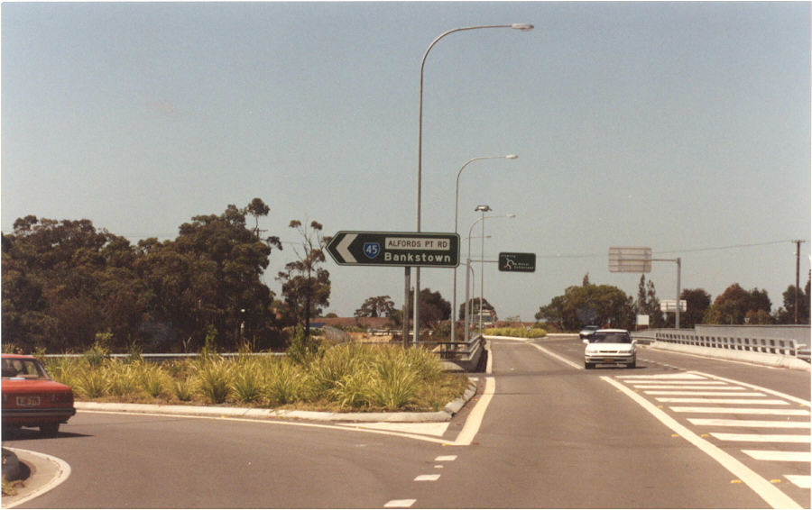
December 1998 photo of SR45 sign on the southbound on-ramp from Henry Lawson Dr, Padstow Hts. |
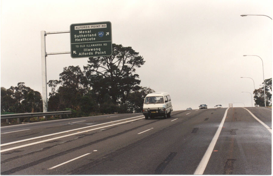 |
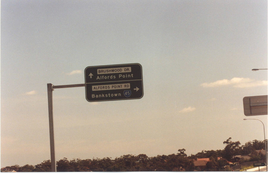
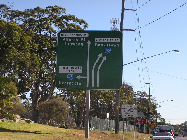
Alfords Point Rd southbound approaching Old Illawarra Rd & Brushwood Dr, Illawong. Photo taken c.1995. |
 |
AD sign on Brushwood Dr for Alfords Pt Rd, Illawong. Photo taken c.1995. |
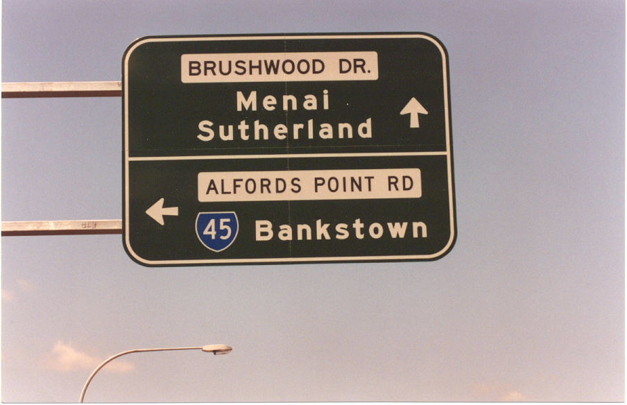 |
AD sign on Brushwood Dr for Alfords Pt Rd, Illawong. Photo taken c.1995. |
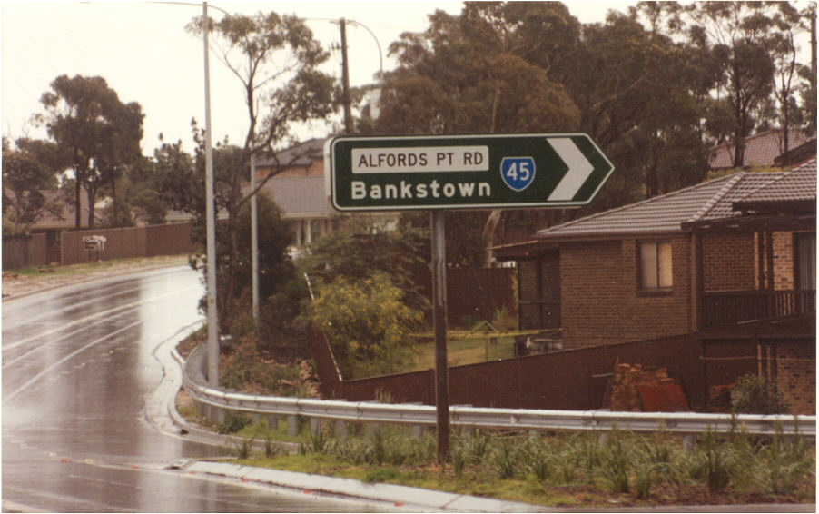 |
Alfords Pt Rd ID sign on Brushwood Dr, Illawong. Photo taken c.1995. |
 |
Alfords Pt Rd ID sign on Brushwood Dr, Illawong. Photo taken c.1995. |
 |
Menai Rd, Menai. This sign was replaced when the Bangor Bypass opened in Feburary 2005. Photo taken July 2004. |