Metroad 3 |

Metroad 3 trailblazer northbound on Homebush Bay Dr at Rhodes. June 2004.
In 2013, RMS will be implementing a new alpha-numeric route numbering system. For more information, visit the RMS Website. |
|
Forthcoming alpha-numeric route number: |
|
Length: 52km
Northern Terminus: Pittwater Rd & Mona Vale Rd, Mona Vale
Southern Terminus: Princes Hwy & King Georges Rd, Blakehurst
Route taken: King Georges Rd, Wiley Ave, Roberts Rd, Centenary Dr, Homebush Bay Dr, Concord Rd, Ryde Bridge, Church St, Devlin St, Lane Cove Rd, De Burghs Br, Ryde Rd, Mona Vale Rd
Focal Points: Mona Vale, Pymble, Ryde, Sydney Olympic Park (formerly Homebush Bay), Hurstville, Wollongong
RTA Internal Classification: Main Road No. 162 (Mona Vale-Ryde), Main Road No. 139 (Devlin St between Blaxland Rd, Ryde), Main Road No. 200 (Ryde-Blakehurst)
Metroad 3 is the inner-most circumferential route in Sydney's Metroad system, stretching from Mona Vale on Sydney's northern beaches to the Princes Highway at Blakehurst. From Mona Vale to Terrey Hills, Mona Vale Rd is a two-lane narrow winding road - except for a small section of four lane road near the Bahai Temple at Ingleside - before the land flattens out and becomes a long section of 90km/h dual carriageways. Once it reaches St Ives, the route becomes a typical urban 6-lane divided road with no access control - a design it retains until the beginning of Homebush Bay Drive at Rhodes. Homebush Bay Drive and Centenary Drive are both access controlled 80km/h roads with partial grade-separation but the route returns to its 6-lane undivided urban feel south of the Hume Highway. There is still two 2-3km sections of four lane undivided road near Hurstville.
The route was first formally recognised as a continuous circumferential route in 1964 when it was given the Ring Road 3 shield. The route of Ring Road 3 at the time is largely the same as Metroad 3's route today, with the exception that Ring Road 3 travelled via the former State Route 27 through Strathfield. In 1974, when the State Route system was introduced and the Ring Road system abandoned, Ring Road 3 was renumbered State Route 33. Then finally, in April 1993, State Route 33 was replaced by the Metroad 3 shield.
Metroad 3 came under increasing importance in 1990s as its Strathfield Bypass section passes right by the Sydney Olympic Park precinct (then called Homebush Bay). A number of upgrades were undertaken to improve its capacity as a through route prior to the Olympics and 'Homebush Bay' was added as a focal point. In mid-2003 a major sign replacement program was undertaken when Homebush Bay was changed to Sydney Olympic Park. It appears that Metroad 3 will be changed over to an alpha-numeric route sometime in the immediate future as a number of rectangular coverplates with the current route shield on them can be found along the route.
History and Development
Decommissioned State Route 33
Decommissioned Ring Road 3
 |
Pittwater Rd southbound approaching the beginning of Metroad 3 at Mona Vale. Sep 2005. |
 |
Looking east along Mona Vale Rd through Mona Vale. Sep 2005. |
 |
Looking west along Mona Vale Rd as it begins its climb from the coastal plain. Sep 2005. |
 |
Looking east through the narrow and winding section near Tumburra St, Ingleside. Sep 2004. |
 |
A sample of the view encountered when descending from Terrey Hills to Mona Vale. Sep 2005. |
Heading west near McCarrs Creek Rd, Terrey Hills. Sep 2005. |
|
 |
Looking east from Forest Way at Terrey Hills. Sep 2005. |
 |
AD sign northbound on Forest Way approaching Mona Vale Rd at Terrey Hills. March 2006. |
 |
Looking west from Forest Way at Terrey Hills. Sep 2005. |
 |
Looking east from Richmond Ave, St Ives, at the beginning of the 90km/h zone. Sep 2005. |
 |
Shocking mistake! Very, very dodgy attempt at a Metroad 3 shield, southbound approaching Kitchener St in St Ives. March 2006. |
 |
Looking south approaching Link Rd, St Ives. Sep 2005. |
Aerial view of completed widening through St Ives shopping centre in 1975. (DMR) |
|
Looking south over widening underway on Mona Vale Rd at Pymble, 1977. (DMR) |
|
 |
Southbound freeway-style AD sign for Pacific Highway near Telegraph Rd. Sep 2005. |
 |
Mona Vale Rd looking north from Church Ave, Pymble. Sep 2005. |
 |
Pacific Hwy eastbound approaching Metroad 3 at Pymble. June 2004. |
 |
Pacific Hwy westbound approaching Metroad 3 at Gordon. June 2004. |
 |
Distance sign heading south on Ryde Rd from Pacific Hwy. Sep 2005. |
Looking south of Ryde Rd following widening in West Pymble. 1969. (DMR) |
|
Looking south from West Pymble towards De Burghs Bridge. 1969. (DMR) |
|
 |
AD sign northbound on Ryde Rd approaching Yanko Rd, West Pymble. Yanko Rd becomes The Comenarra Parkway after passing through West Pymble and is an important regional link between Pennant Hills Rd and Ryde Rd. June 2006. |
 |
Ryde Rd looking south to Lady Game Dr at West Pymble. Note the truck speed limit of 40km/h - the approach to this intersection is on a curve and a steep-grade as Metroad 3 descends to cross the Lane Cove River. June 2006. |
 |
Very quaint AD sign westbound on Lady Game Drive, approaching Ryde Rd at West Pymble. June 2006. |
 |
Looking north across De Burghs Bridge to Lady Game Drive. Dec 2003. |
 |
Southerly aerial view of construction of the current De Burghs Bridge. The old bridge was destroyed by fire in January 1994. 1966. (DMR) |
 |
Opening of the old De Burghs Bridge, February 1901. (DMR) |
 |
Close up of birdge construction in 1967. (DMR) |
 |
The old and new bridges side-by-side after opening. 1967. (DMR) |
 |
Lane Cove Rd southbound approaching the M2 at North Ryde. May 2004. |
 |
Lane Cove Rd looking north towards Talavera Rd and the M2, North Ryde. Jan 2004. |
 |
Distance sign facing heavy northbound peak hour traffic on Lane Cove Rd at Epping Rd, North Ryde. Feb 2006. |
 |
Southerly aerial view of the Lane Cove Rd/Epping Rd interchange prior to construction. 1974. (DMR) |
 |
Various views of construction of the Lane Cove Rd/Epping Rd interchange. (DMR). |
 |
Typical afternoon traffic on Lane Cove Rd at North Ryde, looking north towards Epping Road. Jan 2006. |
 |
Looking south from Epping Rd at North Ryde. Sep 2005. |
 |
Looking south near Coxs Rd, North Ryde. Dec 2003. |
 |
Looking north at Quarry Rd/Goulding Rd junction. The clump of trees on the right marks the spot where "Lane Cove Rd" continued north along Goulding Rd pre-1960. Goulding Rd also has a strip of land on its west side reserved for future widening to six lanes. Sep 2005. |
 |
Victoria Rd westbound approaching Devlin St at Ryde. June 2004. |
 |
A rare traffic-free moment provides this view north along Church St from Ryde Bridge. June 2004. |
 |
Looking south over Ryde Bridge. The structure on the right is the original iron truss, bascule opening span bridge built in 1935 and the left structure was built in 1988. Sep 2005. |
 |
Looking south at the old Ryde Punt that took traffic across the Parramatta River between Bowden St and Blaxland Rd. 1929 (DMR). |
A 1935 view of the Ryde Bridge in its opened postion. The bridge was built with an opening span to allow ships to access the State Timber Yard at Homebush Bay, although it has not been opened for the best part of fifty years. (Ryde Council) |
|
 |
Toll collecting on the southern side of Ryde Bridge in 1949. (DMR). |
 |
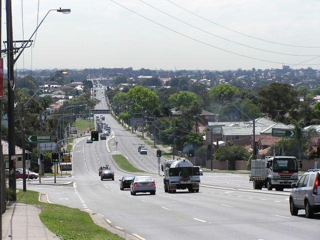
Concord Rd southbound approaching the beginning of Homebush Bay Drive at Rhodes. June 2004. |
 |
Homebush Bay Dr northbound approaching Concord Rd at Rhodes. April 2004. |
 |
Southerly aerial view of Homebush Bay Drive (unduplicated) in 1991. (RTA) |
 |
Looking south over the Australia Avenue intersection prior to construction of flyover. 1991. (RTA) |
 |
Looking south on Homebush Bay Dr near Liberty Grove. Sep 2005. |
 |
Looking north to Australia Ave. Aug 2004. |
 |
Western Motorway westbound approaching Homebush Bay Drive exit at Homebush Bay. July 2004. |
 |
Western Motorway eastbound at Homebush Bay Drive exit. July 2004. |
 |
Parramatta Rd eastbound approaching Marlborough Rd, which connects to Metroad 3 at Flemington. May 2005. |
 |
Centenary Drive southbound alongside Strathfield Golf Links. July 2004. |
 |
Centenary Dr southbound approaching the Hume Highway overpass and Roberts Rd. Sep 2005. |
 |
Hume Hwy eastbound approaching Centenary Dr/Roberts Rd at Greenacre. Sep 2005. |
 |
Looking north from Roberts Rd over the Hume Hwy at Greenacre. Sep 2005. |
 |
Roberts Rd northbound from Wiley Ave at Greenacre. Sep 2005. |
Painted black AD sign on Wiley Ave southbound approaching Punchbowl Rd. The sign formerly said SR33 but this Metroad 3 coverplate was hastily put on making the sign incorrect. Sep 1996. |
|
 |
The above sign, this time in 1999. Note the Metroad 5 shield which has since been made obsolete. |
 |
Punchbowl Rd AD sign for Metroad 3. This is another SR33 relic. The blank coverplate probably covers 'Milperra'. Nov 1996. |
 |
King Georges Rd northbound approaching Punchbowl Rd. Note the SR27 shield has since been removed. Also note the old Metroad 5 shield and old focal points. Photo taken 1996. |
 |
King Georges Rd looking south to Wiley Park. June 2004. |
 |
Looking north from Canterbury Rd. Sep 2005. |
 |
Northbound approaching Canterbury Rd. Sep 2005. |
 |
Looking south approaching the M5 Motorway at Beverly Hills. Note this was the motorway terminus until 2001. 1996. |
 |
Similar view, this time in July 2004. |
 |
Northbound approaching the M5 at Beverly Hills. Sep 2005. |
 |
M5 westbound approaching King Georges Rd. July 2004. |
 |
Looking south to Stoney Creek Rd in Beverly Hills. Sep 2005. |
 |
Looking north at Forest Rd, Hurstville. Note the road narrowing the four lanes between Stoney Creek Rd and Forest Rd. Oct 2004. |
 |
Looking south from Woniora Rd along another four-lane undivided section. Oct 2004. |
 |
No right turn at Hillcrest Ave to get to Oatley so this sign explains how southbound traffic can get to westbound Hillcrest Ave. May 2004. |
 |
Looking north to Connells Pt Rd at South Hurstville. Sep 2005. |
 |
Looking north from Walton St, Blakehurst. This RD has a coverplate over SR33 and still has the old focal points of Beverly Hills and Strathfield. Sep 2005. |
 |
Extremely rare "Start Metroad 3" sign northbound at Princes Hwy. July 2005. |
 |
END Metroad 3 sign southbound at Princes Hwy junction. July 2005. |
 |
Lane allocation AD sign for Metroad 3 on Princes Hwy southbound. July 2005. |
Last updated 12 December 2012 © Ozroads 2003-2012. |