Mitchell Highway (NSW) |
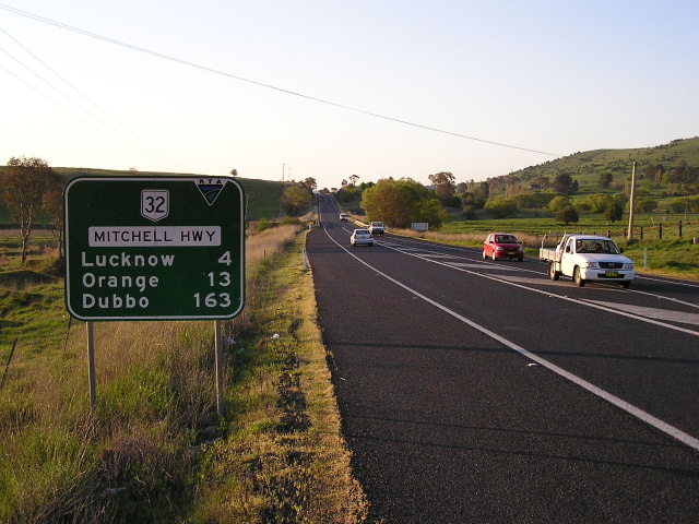
Distance sign heading west from the Blayney turnoff at Shadforth. Oct 2004.
Length: 713km
North-western Terminus: NSW/QLD border, Barringun
South-eastern Terminus: Great Western Hwy & Mid Western Hwy & Brilliant St, Bathurst
Intertsate Continuation: Mitchell Hwy continues north into Queensland, to the Landsborough Hwy near Augathella, via Cunnamulla and Charleville
Focal Points: Bathurst, Orange, Wellington, Dubbo, Nyngan, Bourke, Cunnamulla
RTA Internal Classification: State Highway No. 7
Proclaimed a State Highway: 7 August 1928
Named: 9 October 1936 (originally "North Western Hwy")
The Mitchell Highway , State Highway No. 7, is the north-western branch of the Great Western Highway , which runs from Sydney to Bathurst, taking travellers from Bathurst to Orange, Wellington, Dubbo, Narromine, Nyngan, Bourke and beyond. North of Bourke, the Mitchell Highway continues into Queensland, terminating at the Landsborough Highway near Augathella. The Queensland section of the Mitchell Highway is discussed elsewhere on this site.
The Mitchell Highway also forms part of the Highway 32 corridor, which stretches from Sydney to Adelaide via Dubbo and Broken Hill. North of Nyngan, the Mitchell Highway is part of National Route 71, which extends north into Queensland, terminating at the Warrego Highway in Charleville. The Mitchell Highway also forms part of the shortest route between Sydney and Darwin, via Bourke and Mt Isa.
The Mitchell Highway has carried the National Highway 32 shield between Bathurst and Nyngan since 1959 and the National Route 71 shield north of Nyngan since 1961. Photos of the National Route 32 section of the highway (Bathurst-Nyngan) can be found below, whilst photos of the National Route 71 section can be found HERE.
Photos of the National Route 32 section of the Mitchell Highway (Bathurst to Nyngan) |
|
 |
Gt Western Hwy westbound in Bathurst approaching the beginning of the Mitchell Hwy. May 2004. |
 |
Mid Western Hwy eastbound in Bathurst approaching the beginning of the Mitchell Hwy. May 2004. |
 |
ID sign pointing traffic onto the beginning of the Mitchell Hwy. May 2004. |
 |
Old black AD sign facing Mid Western Hwy traffic at the beginning of the Mitchell Hwy. May 2004. |
 |
Distance sign heading west from Bathurst. May 2004. |
 |
Looking west towards Bathurst. Oct 2004. |
 |
Looking west near Dunkeld. Oct 2004. |
 |
View of the countryside near sunset from the Mitchell Hwy as it winds it way from Vittoria to Bathurst. Oct 2004. |
 |
Resealing work underway along a 6km section at Vittoria. Jan 2006. |
 |
Typical country fingerboard set-up, at Vittoria. Oct 2004. |
 |
Now this is a rare sight! An old DMR black sign with an error! The route shield should say NR32 rather than 31, at Cashens Lane (Ophir turnoff), 28km west of Bathurst. Oct 2004. |
 |
A goodie, an old black DMR fingerboard a little further west, this time near East Guyong. Oct 2004. |
 |
Another great old black fingerboard sign, this time at the turnoff to Millthorpe from Guyong. Jan 2006. |
 |
Eastbound AD sign for the Blayney-Millthorpe-Shadforth road at Sahdforth. Oct 2004. |
 |
Another black fingerboard sign at the Huntley turnoff in Lucknow. Oct 2004. |
 |
Distance sign heading east from Orange. Note the unusal colouring of the sign background and the cracking of the paint. Jan 2006. |
 |
Looking east through Orange City Centre. Oct 2004. |
 |
Old black roundabout AD sign westbound on Summer St, approaching Woodward St and Coronation Dr. The route shield has badly lost its reflectivity, as is the case with the next sign. This suggests its age is somewhere between 30 and 40 years old. Jan 2006. |
Another example of the very old roundabout AD sign, southbound on Woodward St approaching Summer St and Coronation Dr. Jan 2006. |
|
 |
Another example, at the same intersection but this time northbound on Woodward Street. Jan 2006. |
 |
And while we are at it I may as well show you the fourth AD sign for this section, which is also of the same age. This one is heading east on Summer Street, approaching Mitchell Hwy & Woodward St. Jan 2006. |
 |
Disgracefully-designed sign, with incorrect route shield, at the same intersection. Whoever designed this travesty should be shot! Oct 2004. |
 |
Southbound AD sign approaching Escort Way (which is incorrectly signed as Forbes Rd, which was its unofficial name prior to 1987) in Orange. Oct 2004. |
 |
Distance sign heading north from Orange. Jan 2006. |
 |
Looking south about 10km north of Orange. You can see the original pavement crossing the highway at an acute angle in the middle distance - the Department of Main Roads extensively realigned this section of the Mitchell Hwy during the 1970s and many pavement remnants can be found. Jan 2006. |
 |
Another section of abandoned pavement, this time about 16km north of Orange. Jan 2006. |
 |
Very old and faded fingerboard paired with a shiny new one at Amaroo Rd, 29km northwest of Orange. Jan 2006. |
 |
Distance sign with incorrect SR32 shield heading east from Molong. Jan 2006. |
 |
Looking west across the railway overpass on the eastern approach to Molong. Straight ahead is Wellington St which leads to State Route 81 after a few blocks so I suppose the SR81 shield can be excused. However, SR90 is over 20km from this intersection via either Manildra or SR81 so I have no idea how SR90 managed to get itself on this sign. Jan 2006. |
 |
Old black painted double-chevron ID sign at Bank St in Molong. Jan 2006. |
 |
Looking east along the Mitchell Hwy (Hill St) towards the junction with Gidley St. Jan 2006. |
 |
Great old black AD sign westbound on Hill St approaching Edwards St, which is the northern terminus of State Route 81. Jan 2006. |
 |
Great old black AD sign eastbound on Hill St approaching Edwards St, which is the northern terminus of State Route 81. Jan 2006. |
 |
Northbound AD sign for the alternative route between Molong and Dubbo - via Yeoval. There was a proposal to name this alternative route "Banjo Paterson Way", however local government along the Mitchell Hwy strongly objected to it, citing a potential loss of tourist traffic. Jan 2006. |
 |
Looking south into Molong. The bridge in the foreground crosses Moss Hollow Creek, then the highway rises in the background to bridge the railway line. Jan 2006. |
 |
Distance sign heading east from Dubbo. Oct 2004. |
 |
Black ID sign on Wheelers Lane southbound approaching the Mitchell Hwy in Orana Heights (a suburb of Dubbo). Oct 2004. |
 |
Looking west along Cobra Street through Dubbo. Oct 2004. |
 |
Westbound AD sign on Cobra St for Darling St (old Newell Hwy), Dubbo. Oct 2004. |
 |
ID signs that are a direct replacement of some very very old black signs that I saw here in 1994. The NH39 shield is now erroneous, but prior to 1993 NH39 duplexed with NR32 between Darling and Whylandra Streets. Oct 2004. |
 |
Looking east across the L.H. Ford Bridge over the Macquarie River. Oct 2004. |
 |
A Department of Main Roads photo, showing the then newly-opened bridge in 1969. Note the heavy traffic, it carried both Newell and Mitchell highway traffic until 1993. |
 |
Westbound AD sign approaching the Newell Highway junction at West Dubbo. Oct 2004. |
 |
Sign assembly facing eastbound traffic at the Newell Hwy junction. Oct 2004. |
 |
Distance sign heading west from Dubbo. Oct 2004. |
 |
Fingerboard signs at The Falls Rd, midway between Dubbo and Narromine. Note that while the larger distance signs refer to Nyngan, the fingerboards refer to Narromine. Oct 2004. |
 |
Distance sign heading east from Narromine. Oct 2004. |
 |
Looking west along Burraway Street in Narromine. Oct 2004. |
 |
Black AD sign northbound on Dandaloo St, approaching Derribong St in Narromine. Oct 2004. |
 |
Black AD sign heading west on Derribong St approaching Dandaloo St, Narromine. Oct 2004. |
 |
Very old, black, faded AD sign, heading east approaching Culling St which forms part of an alternative route for heavy vehicles to bypass the town centre. Judging by the age of the sign, the alternative route has been in place a long, long time. Oct 2004. |
 |
Distance sign heading east from Trangie. Oct 2004. |
 |
Looking west through Trangie. Oct 2004. |
 |
Very old, faded black fingerboard sign for a homestead, 15km south eats of Nevertire. Oct 2004. |
 |
Distance sign heading east from the Oxley Hwy junction at Nevertire. Oct 2004. |
 |
Southbound AD sign for the Oxley Hwy at Nevertire. Oct 2004. |
 |
Distance sign heading northwest from Nevertire. Oct 2004. |
 |
Another black fingerboard assembly, this time at the road to Buddabadah. Oct 2004. |
 |
Sign heading southeast near Nyngan, showing an alternative route to Sydney via the "Scenic Rivers Byway". Oct 2004. |
 |
Distance sign heading southeast from Nyngan. Oct 2004. |
 |
Black ID sign at the railway level crossing adjacent to the railway station. This level crossing was the original route of the Mitchell Hwy bu the former truck bypass has now been declared part of the highway. Oct 2004. |
 |
Black ID sign outside the RSL Club (corner of Pangee St & rail level crossing approach), leftover from when the Mitchell Hwy went via Pangee St (the main street of Nyngan). Oct 2004. |
 |
Looking east along Pangee St (old Mitchell Hwy) in Nyngan town centre. Oct 2004. |
 |
This sign points towards Tottenham, via Moonagee St, and the Cairn which marks the geographical centre of NSW. Tourists be warned, the Cairn is on private property so you may not always be able to access it. Oct 2004. |
 |
Heading east towards the town centre, approaching Moonagee St. As the sign says, the Mitchell Hwy now avoids the town centre, via Moonagee and Nymagee Streets. Oct 2004. |
 |
Mitchell Highway (NR32) northwestbound approaching the junction with Barrier Highway (NR32) on the western outskirts of Nyngan. Mitchell Highway continues through the intersection and becomes National Route 71 en route to Bourke. Photo taken: December 2006. |
 |
AD sign eastbound on Barrier Highway (NR32) approaching the junction with Mitchell Highway (NR32/NR71) at Nyngan. Photo taken: October 2004. |
 |
ID sign at the intersection of Barrier Highway (NR32) & Mitchell Highway (NR71) incorrectly showing a duplex instead of NR71 to the left and NR32 to the right. Photo taken: October 2004. |
 |
Mitchell Highway (NR71) looking south towards the junction with Barrier Highway (NR32) at Nyngan. Mitchell Highway continues through the intersection as National Route 32, whilst NR71 terminates here. Photo taken: September 2006. |
  |
Top: RD sign on Mitchell Highway (NR71) heading north-west from Nyngan. Bottom: Replacement RD sign in preparation for alpha-numeric route marking. For continuation of Mitchell Hwy photos from Nyngan to QLD please see the National Route 71 page. |
Last updated 1 February 2011 © Ozroads 2004-2011. |