CUMBERLAND HIGHWAY
State Highway No. 13
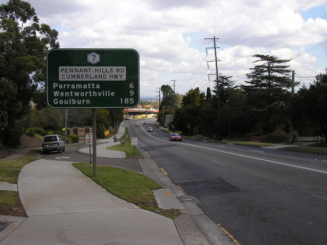
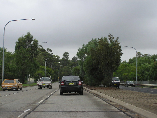
Dual Cumberland Highway/Pennant Hills Road signage, showing the now-defunct Metroad 7 shield, heading south from Marsden Rd at Carlingford.
Length: 35km
Northern Terminus: Pacific Highway, Pearces Corner (Wahroonga)
Southern Terminus: Hume Highway, Liverpool
Route Taken (local names): Pennant Hills Rd, James Ruse Dr, Briens Rd, Hart Drive, Freame St, Emert St, Jersey Rd, Betts Rd, Warren Rd, Smithfield Rd, Palmerston Rd, New Cambridge St, Cambridge St, Joseph St, Orange Grove Rd
RTA Internal Classification: State Highway No. 13
Proclaimed a State Highway: 7 August 1928
Named: August 1988
The Cumberland Highway, State Highway No. 13, is the State Highway linking the Pacific and Hume Highways, forming a bypass of central and eastern Sydney. It begins at the Pacific Highway, Pearces Corner, following Pennant Hills Road, James Ruse Drive and a number of other former local roads through Wentworthville, Smithfield and Cabramatta en route to meeting the Hume Highway at Liverpool.
A comprehensive history of the Cumberland Highway is available HERE.
Photos of the former route of Cumberland Highway are available HERE.
|
Photos of Cumberland Highway |
|
 |
Looking south along Pennant Hills Road towards the Normanhurst Rd/Osborn Rd junction at Normanhurst. Dec 2003. |
 |
Now-removed Metroad 7 trailblazer southbound on Pennant Hills Rd approaching Dartford Rd at Normanhurst. All Metroad 7 trailblazers were removed in early 2005 in preparation for Metroad 7's decommissioning south of the M2. Dec 2003. |
 |
Looking south towards Dartford Rd at Normanhurst. Long sections of Pennant Hills Rd have median fences to discourage pedestrians from crossing mid-block. One down side to this treatment is that it heightens the physical barrier that heavily-trafficked roads create between sections of suburbs. Aug 2004. |
 |
Very unusual to see one of these service signs in an urban area given the availability of petrol stations. This one was probably installed as this is the first southbound service station beyond the southern end of the F3. Aug 2004. |
 |
Double chevron ID sign at the intersection of Pennant Hills Rd & Duffy Ave, Thornleigh. The local name of "Pennant Hills Rd' is preferred on directional signs over Cumberland Highway, except on distance signs where both are included. This is probably because Pennant Hills Rd was an established part of the Pacific Hwy/Hume Hwy link well before the naming of Cumberland Hwy. Aug 2004. |
 |
Looking south at The Comenarra Parkway junction, Thornleigh. Dec 2003. |
 |
Following the naming of Cumberland Highway, a programme was launched by the RTA to provide better street name signage along Pennant Hills Road, including plenty of this type of AD sign. This particular one is northbound approaching George St at Pennant Hills. Aug 2004. |
 |
Looking north to the railway underpass and the pedestrian overpass at Pennant Hills Railway Station. Aug 2004. |
 |
AD sign southbound on Pennant Hills Rd approaching Trebor Rd & City View Rd. This sign is typical of a number of diagrammatic AD signs that were installed as part of an improved signage plan along Pennant Hills Rd during the late 1980s and early 1990s. Note the blank coverplates which cover "Trebor Rd" (bottom) Metroad 2 shield (above Beecroft Rd) and State Route 77 shield (Metroad 7 coverplate). Aug 2004. |
 |
Also installed as part of the original street-name signage plan were these name plates with a route marker included. This sign originally showed State Route 77 but was coverplated with Metroad 7 following its introduction. This sign is located in Trebor Rd, eastbound approaching Pennant Hills Rd at Pennant Hills. Dec 2003. |
 |
Oversized and undersized ID signs on Boundary Rd at the junction with Pennant Hills Rd. Epping and Sydney are reached via Beecroft Rd and the Metroad 7 shield (lower sign) is on a coverplate over the Metroad 2 & 7 duplex. March 2006. |
 |
Unusual lane allocation AD sign that refers to the centre lane of Boundary Rd, at its junction with Pennant Hills Rd. Note the blank coverplate just above the Metroad 7 shield which covers a Metroad 2 shield (Beecroft Rd was part of Metroad 2 from 1993 to 1997). March 2006. |
 |
Distance sign southbound on Pennant Hills Rd, between the two junctions with Beecroft Rd. Sep 2004. |
 |
Northbound lane allocation AD sign approaching the northern leg of Beecroft Rd. Dec 2005. |
 |
Unusual lane allocation AD sign, northbound on Beecroft Rd approaching Pennant Hills Rd. It is unusual because the two lanes go right, not straight ahead at the junction with Pennant Hills Rd. Note the Metroad 7 shield on a coverplate over the Metroad 2/7 duplex, which existed between Beecroft and Castle Hill Roads during 1993-1997. Sep 2004. |
 |
Unusual sign southbound on Beecroft Road at the split. Quite why the Beecroft Rd name is paired up with a Metroad 7 shield is beyond me. Dec 2005. |
 |
Typical afternoon traffic on Pennant Hills Rd, looking north from the southern leg of Beecroft Rd. Sep 2004. |
 |
Distance sign heading north from Cardinal Ave, West Pennant Hills. Oct 2005. |
 |
Southbound lane allocation AD sign approaching Castle Hill Rd at Thompsons Corner. March 2006. |
 |
Unusual gantry sign eastbound on Castle Hill Road at Thompsons Corner. I don't know why two mentions of Epping/Parramatta were needed but only one road name patch sufficed. Also note the use of dual road names, something only seen on distance signs elsewhere on Cumberland Hwy. March 2006. |
 |
Distance sign heading south from Thompsons Corner. March 2006. |
 |
Typical advance street-name signage, northbound approaching Copeland Rd. March 2006. |
 |
AD sign southbound on Pennant Hills Rd approaching the M2 Motorway - the southern terminus of Metroad 7 and the northern terminus of Metroad 6. Mar 2006. |
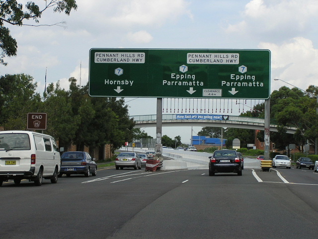
ID sign assembly at the Pennant Hills Rd/M2 Motorway interchange. March 2006. |
|
 |
Perfectly-designed AD sign southbound on Pennant Hills Rd approaching North Rocks Rd. This section of the Cumberland Highway is now part of Metroad 6. March 2006. |
 |
ID signage at the Pennant Hills Rd/North Rocks Rd intersection. Note the focal point does not match the route marker - Metroad 6 doesnt go anywhere near Parramatta. March 2006. |
 |
Distance sign heading north from Carlingford Rd at Carlingford. March 2006. |
 |
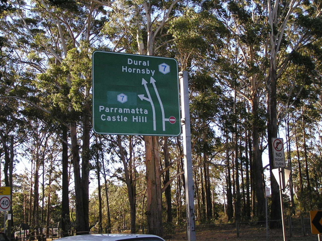
ID sign assembly at Carlingford Rd, Carlingford. Again note the southbound focal point no longer matches the route marker. March 2006. |
 |
AD sign northbound on Marsden Rd approaching Pennant Hills Rd at Carlingford. Note the incorrect coverplate - Metroad 6 goes right here. March 2006. |
 |
Looking southwest along Pennant Hills Rd near Baker St, Carlingford. Dec 2005. |
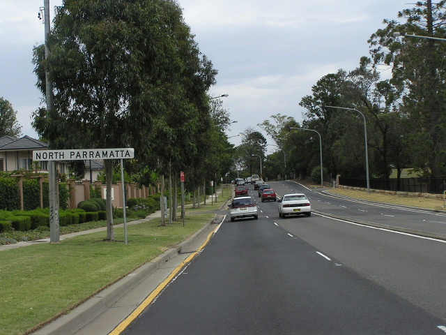 |
Looking southwest into North Parramatta on Pennant Hills Rd adjacent to The Kings School. Dec 2005. |
 |
Looking northeast along Pennant Hills Rd adjacent to The Kings School at North Parramatta. Dec 2005. |
 |
A tight corner with jersey barrier installation, adjacent to The Kings School at North Parramatta. The section of Pennant Hills Rd south of the M2 Motorway is very substandard as can be seen from the above photos. Dec 2005. |
 |
Looking east along James Ruse Drive at North Parramatta. Jan 2004. |
 |
Looking east along Briens Road at Northmead. May 2006. |
 |
Looking west at the Cumberland Hwy/Briens Rd split at Northmead. Sep 2005. |
 |
Looking northeast along Hart Drive at Wentworthville, showing the early 1980s concrete surface. Jan 2006. |
 |
Looking south to the railway overpass at Wentworthville. The signalised intersection with Wentworth Ave is just before the bridge. June 2004. |
 |
Looking north along Betts Rd between Bruce St and Merrylands Rd at Merrylands West. May 2005. |
 |
Looking south along Betts Rd with the Woodpark Rd intersection in the foreground and the bridge over the Liverpool-Parramatta Transitway and Sydney Water Supply Pipeline in the distance. June 2004. |
 |
Looking north along Smithfield Road towards Brenan St at Smithfield. Note the median fence which prevents pedestrians from attempting dangerous mid-block crossings of the busy Cumberland Hwy. May 2005. |
 |
Looking north at the overpass over the Polding St/Smithfield Rd roundabout, Fairfield West. May 2005. |
 |
Looking south along Palmerston Rd towards Hamilton Rd at Fairfield West. June 2004. |
 |
Looking north along Cambridge Street in Canley Heights. June 2004. |
 |
Looking south along Joseph St towards John St, Cabramatta. Aug 2004. |
 |
Looking north along Orange Grove Rd near Viscount Place, Warwick Farm. May 2004. |
 |
Cumberland Highway ID sign at the junction with Hume Highway, Liverpool. This is the southern terminus of State Highway No. 13. Apr 2006. |
 |
This is the northern-most stretch of the former route of State Highway No. 13 (the name Cumberland Highway was not gazetted until the route of the highway was moved in August 1988), looking southwest along Pennant Hills Rd from James Ruse Drive at North Parramatta. May 2004. |
 |
Looking northeast along Pennant Hills Road from Church St at North Parramatta. This view shows what Pennant Hills Road was like prior to the upgrading to six-lanes that was undertaken north of the M2 during the 1980s and 1990s. June 2006. |
 |
Church Street, Parramatta, looking north to the junction with Victoria Road. The only clue that this was once part of State Highway No. 13 is the reference to Hornsby on the AD sign. June 2006. |
 |
The 167-year-old Lennox Bridge which carries Curch Street (formerly State Highway No. 13) across the Parramatta River. This section of road can trace its origins back to construction of the 'new' Windsor Road in 1810-1812, however this bridge was not erected until 1836-1839. The bridge was strengthened in 1901-02 to carry the Parramatta-Castle Hill tramway, and a footway was added in 1912. In 1934, the Department of Main Roads widened the bridge by constructing a parallel concrete arch structure on the eastern side, giving it a sandstone facade to match the existing arch. June 2006. |
 |
Church St looking south between the Parramatta River and Phillip St. Note the extensive traffic calming measures that have been implemented following the construction of Church Street mall. June 2006. |
 |
Looking north in Church Street Mall, between George and Macquarie Streets at Parramatta. The mall was created in the late 1980s following the construction of the Parramatta Ring Road. I believe this section was closed to traffic prior to the regazettal of State Highway No. 13 had taken place. June 2006. |
 |
Church Street, looking south from Macquarie Street towards the railway underpass adjacent to Parramatta Railway Station. June 2006. |
 |
Church Street (Great Western Hw) looking north from Marion St at Parramatta. This section was technically always part of the Great Western Highway (State Highway No. 13 had a gap from the intersection of Church St & Parkes St to the intersection of Parramatta Rd & Woodville Rd) but was an important link for traffic passing between the Pacific and Hume Highways. June 2006. |
 |
Looking north along Woodville Road to the former Dog Trap Gates, which was the name given to the former railway level crossing on Woodville Road. Woodville Road was originally named Dog Trap Road from the mid 1830s until about the 1950s. This 1950s photo shows the line waiting to cross the old Main South Railway Line at Granville. (Department of Main Roads) |
 |
A southerly view of the newly-constructed subway beneath the old Main South Railway Line at Granville in 1968. Note the truck which is waiting to turn right onto Crescent St because it is too high to fit through the subway. (Department of Main Roads) |
 |
A modern-day view of the Granville subway. The much higher viaduct is the Harris Park-Merrylands Y-link, which was completed in 1996 allowing direct rail services between Blacktown, Parramatta, Liverpool and Campbelltown. May 2004. |
 |
The only southbound distance sign on Woodville Road, heading south from Merrylands Road at Merrylands. Note that the focal point of Liverpool is now in parenthesis, showing that Woodville Road is no longer part of State Highway No. 13 (which was focused on traffic passing from Hornsby to Liverpool). May 2004. |
 |
Woodville Road looking south at Guildford Rd, Guildford. Note the use of S-lanes to provide protected right-turn bays. May 2004. |
 |
Woodville Road looking south towards Fairfield Street at Old Guildford. Note another mention of Liverpool, which is just about the only clue that Woodville Road was once part of State Highway No. 13. May 2004. |
 |
Woodville Road looking north to Tangerine Street at Fairfield East. Note that only Parramatta (and not Hornsby) gets a mention on northbound signs. May 2004. |
 |
This ID sign, located on Christina Road at Villawood, shows only "To Hume Highway", pretty much summing up State Highway No. 13's role. May 2004. |
 |
Woodville Rd looking south at Llewellyn Ave, Villawood. Again note the use of S-lanes to provide protected right-turn bays. May 2004. |
 |
This 1973 photo shows the sight that a southbound traveller on State Highway No. 13 used to be confronted with then they reached the Hume Highway. Note the two right-turn lanes for traffic heading towards Liverpool. (Department of Main Roads) |
 |
A modern-day view of the Hume Hwy/Woodville Rd junction (Mecano Set) at Lansdowne. May 2004. |
 |
Formerly the first northbound distance sign on State Highway No. 13. Note how Hornsby and Newcastle are included on this distance sign despite the re-routing of the highway in August 1988. May 2004. |