BARTON HIGHWAY
Former Alignments
Former Alignment: Yass
As part of construction of the Yass Bypass project on the Hume Highway, a 9km dual carriageway deviation of Barton Highway was constructed to connect the Barton Highway with the new route of the Hume Highway, north of Yass. Construction of the new route of the Barton Highway was commenced in April 1993 (just prior to the opening of the Hume Hwy bypass of Yass) and opened to traffic in May 1995.
The new route of the highway leaves the old alignment approximately 7km south of Yass, crossing the Yass River and Yass River Road on twin bridges, junctioning with Yass Valley Way (old Hume Highway) at a grade separated interchange to the east of the historic Cooma Cottage before terminating at the Hume Highway about 3km northeast of Yass.
The old alignment of Barton Highway is still intact and trafficable, the northern 2km of it serving a local road named Dog Trap Road. The sold highway is now known as Kirketon Road.
 |
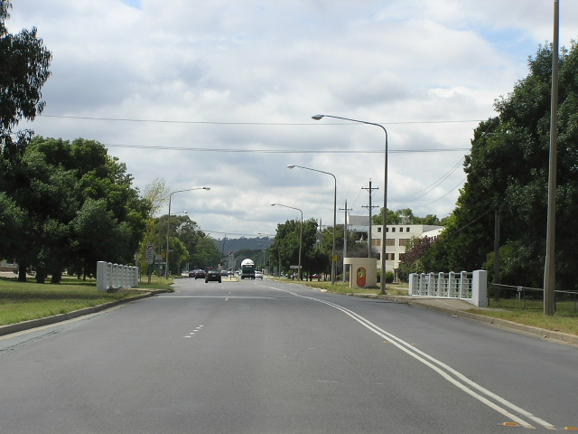
Looking north to what was formerly the Barton Hwy/Hume Hwy junction outside Cooma Cottage. Feb 2006. |
 |
Looking south along the old highway near the junction with Yass Valley Way (old Hume Highway). Feb 2006. |
 |
Looking south through a tree-lined section of the old highway, near Dog Trap Rd. Feb 2006. |
 |
Half of a National Highway 25 fingerboard, remaining at Dog Trap Rd. The right half of the sign ahs been chopped off (probably by council) since Canberra cannot be accessed via Kirketon Rd. Feb 2006. |
 |
A close-up of the badly degraded National Highway 25 shield on the above sign. Feb 2006. |
 |
Looking south from Dog Trap Rd showing typical pavement condition from prior its decommissioning as part of the Barton Hwy. Feb 2006. |
 |
Looking south to the crossing of Kurys Creek, south of Dog Trap Rd. Feb 2006. |
 |
Looking north to Kurys Creek. Just beyond the trees is a corner which appears to have been recently resealed - quite strange for a now dead-end road! Feb 2006. |
 |
Looking south at the dead-end where the former alignment ends. Just beyond the trees is the current route of Barton Highway, at the southern end of the dual carriageways. Feb 2006. |
Former Alignment: Hall
Originally, Barton Highway passed through the centre of the tiny border village of Hall along the narrow Victoria Street. Hall was bypassed in June 1980 and was the first section of the Barton Highway to be upgraded to dual carriageway standard. Today there is no evidence along Victoria St to suggest that it was once part of the highway.
 |
Looking southeast along Victoria Street through the tiny village of Hall. Feb 2006. |
 |
Looking southeast along Victoria St outside Hall Primary School. Feb 2006. |
 |
Looking southeast along Victoria St outside the shopping precinct. Feb 2006. |
 |
Looking south across an old concrete bridge over Halls Creek. Feb 2006. |
 |
Looking southeast approaching the junction with Barton Highway. The 25km/h corner was created to make a right-angle junction with Barton Highway, whereas prior to the bypass the highway went straight ahead. Feb 2006. |
Former Alignment: Lyneham
According to a NRMA map from 1938 (courtesy of Paul Rands), the original alignment of the Canberra-Yass road followed Ellenborough Street, thence keeping its south, southeasterly course until it met Northbourne Ave just south of where the Visitor Information Centre is located today. By the time the highway was officially named (1954) it had been realigned at Brigalow Street, turning directly east to meet Northbourne Ave at Antill Street (via today's Mouat St). This realignment included the construction of a concrete bridge over Sullivans Creek, the crossing of which appears to have been via a ford on the old route which passed through the current location of Lyneham High School.
The Barton Highway was relocated for a third time in the late 1970s with funding from the Federal Government under the National Highways programme, taking a south-easterly course from Ellenborough St at Kaleen to meet Northbourne Ave & Federal Highway adjacent to Panton Street. Today there is no evidence of the original (pre-1950s) alignment and, whilst the pre-1970s alignment still exists as Ellenborough St and Mouat St, there is no evidence to suggest it was once the Barton Highway.
 |
Looking south along Ellenborough St from Barton Highway. Feb 2006. |
 |
Perfectly-designed 1970s/80s black ID sign on Ellenborough St at Cossington Smith Dr, Lyneham. Feb 2006. |
 |
Looking south on Ellenborough St to the junction with Ginnindera Dr. Feb 2006. |
 |
Looking east along Mouat St across Sullivans Creek. Feb 2006. |