State Route 72 City Beach - Leederville - Perth |
SR72 trailblazer eastbound on Bulwer Street approaching William Street, Perth. Photo taken: February 2011.
Introduced: 1986
Length: 11km
Eastern Terminus: Lord Street & Bulwer Street, Perth
Western Terminus: West Coast Highway & The Boulevard, City Beach
Route taken: Bulwer Street, Vincent Street, Lake Monger Drive, Grantham Street, The Boulevard
Focal Points: City Beach, Leederville, (Mt Lawley)
Main Roads Act 1930 classification: unclassified
Notable Events:
April 1986 - State Route 72 introduced1
Description:
State Route 72 is an east-west route in inner northern Perth, extending from City Beach in the west to the northern part of the suburb of Perth in the east. The section west of the Mitchell Freeway generally acts a radial route linking City Beach, Floreat and Wembley to Leederville and Perth CBD, whilst the section east of the freeway acts a distributor route skirting the northern edge of central Perth.
Commencing at the junction of Lord Street & Bulwer Street in Perth, the route follows the undivided, two-lane Bulwer Street and the undivided, four-lane Vincent Street to Leederville. After passing through Leederville, the route follows Lake Monger Drive alongside Lake Monger and then the four-lane undivided Grantham Street through Wembley. The section of Grantham Street west of Selby Street takes on the characteristics of a suburban street. Upon reaching the western end of Grantham Street, the route turns west onto The Boulevard, which it follows to its terminus at West Coast Highway. The Boulevard is a partially controlled-access road, skirting the northern edge of Bold Park and serving the 1930s suburbs of Floreat and City Beach.
History:
Coming soon...
Signage:
Signage along the route, with the exception of the Mitchell Freeway interchange at Leederville, consists entirely of freestanding route markers (trailblazers). Unfortunately, the maintenance of trailblazer signs along this route has not been good and a significant number are now missing. The eastern terminus of the route, at Lord Street (State Route 51), does not have a single route marker sign on any approach to the junction, and the junction with Fitzgerald Street (State Route 56) is also missing any mention of State Route 56. Other significant junctions are also missing several signs. Key eastbound turns along the route (i.e. The Boulevard into Grantham Street, and Vincent Street into Bulwer Street) are not signed and therefore it is easy for motorists to get lost along this route if attempting to navigate by route number.
References:
1. Main Roads Department, Annual Report 1985/86, p. 16
|
Photos of State Route 72 - Perth to City Beach |
|
 |
Lord Street (State Route 51) looking south towards the junction with Bulwer Street (State Route 72), Perth. Note the absence of any mention of the approaching junction of two state routes. |
 |
Bulwer Street looking east towards the junction with Lord Street, Perth. There was previously a trailblazer assembly on this approach but it has been removed since 2008 - now there's no signage at all acknowledging the end of the route. |
 |
SR72 reassurance trailblazer sign westbound on Bulwer Street after the junction with Lord Street. Perth Oval (NIB Stadium) is to the left. Photo taken: February 2011. |
 |
SR72 trailblazer westbound on Bulwer Street approaching the junction with Brisbane Street, Perth. |
 |
Bulwer Street looking east from the junction with Beaufort Street, Perth. Unlike the junction with Lord Street, this intersection still has some of its trailblazers intact. Photo taken: February 2011. |
 |
Trailblazer assembly westbound on Bulwer Street approaching the junction with Beaufort Street, Perth. Photo taken: February 2011. |
 |
Trailblazer assembly northbound on Beaufort Street approaching the junction with Bulwer Street, Perth. The southbound and eastbound trailblazer assemblies are both missing. |
 |
SR72 reassurance trailblazer westbound on Bulwer Street after the junction with Beaufort Street, Perth. Photo taken: February 2011. |
SR72 reassurance trailblazer eastbound on Bulwer Street at the junction with Knebworth Avenue, Perth. Photo taken: February 2011. |
|
 |
Bulwer Street looking west towards the junction with William Street, Perth. The trailblazer on this approach is missing. Photo taken: February 2011. |
 |
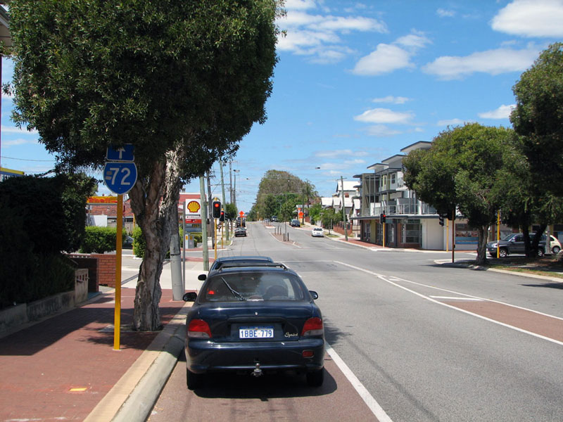
SR72 trailblazer eastbound on Bulwer Street approaching the junction with William Street, Perth. The westbound reassurance trailblazer is missing from this junction. Photo taken: February 2011. |
 |
Bulwer Street looking east near the junction with Fitzgerald Street, Perth. Photo taken: February 2011. |
 |
Bulwer Street looking west to the junction with Fitzgerald Street, Perth. This intersection is the southern terminus of State Route 56, not that you would know as the westbound trailblazer assembly approaching the junction is missing. Photo taken: February 2011. |
 |
Trailblazer assembly southbound on Fitzgerald Street approaching the junction with Bulwer Street. This is the only approach to the intersection with the correct signing on it. Photo taken: February 2011. |
 |
SR72 trailblazer eastbound on Bulwer Street approaching the junction with Fitzgerald Street. Note the SR56 trailblazer is missing - the sign should show a SR56 shield with a left-pointing arrow tab. Photo taken: February 2011. |
 |
Bulwer Street, looking east near Gallop Street, West Perth. Photo taken: February 2011. |
 |
Bulwer Street looking west towards the junction with Vincent Street, West Perth. SR72 turns left onto Vincent Street, however the trailblazer is missing. Photo taken: February 2011. |
 |
Vincent Street looking east towards the junction with Bulwer Street. SR72 makes a right turn here, not that you would know it as the trailblazer is missing. Photo taken: February 2011. |
 |
Vincent Street looking west towards the junction with Charles Street (State Route 60). Note the oversize arrow tabs which don't match the route shields. Photo taken: February 2011. |
 |
Trailblazer assembly southbound on Charles Street approaching the junction with Vincent Street, West Perth. The northbound and eastbound trailblazer assemblies are missing at this junction. Photo taken: February 2011. |
Vincent Street looking east towards the junction with Charles Street, West Perth. Note the missing trailblazers on this approach. Photo taken: February 2011. |
|
SR72 reassurance trailblazer westbound on Vincent Street after the junction with Charles Street, West Perth. Beatty Park Leisure Centre, one of the venues for the 1962 Empire Games, is located on the right. Photo taken: February 2011. |
|
 |
Trailblazer assembly westbound on Vincent Street approaching the junction with Loftus Street, Leederville. Photo taken: February 2011. |
 |
ID sign facing westbound traffic at the junction of Vincent Street & Loftus Street, Leederville. Note the absence of any reference to State Route 61 - this is typical of signage installed to direct motorists to the Graham Farmer Freeway. Photo taken: February 2011. |
  |
Dual trailblazer assemblies southbound on Loftus Street approaching the junction with Vincent Street, Leederville. This was the standard installation on divided carriageways; one on the left verge and one on the median. The fact there's so few of these left in Perth shows how many signs have gone missing and not been replaced since 1986! Speaking of which, the northbound and eastbound trailblazer assemblies approaching this junction are also missing. Photos taken: February 2011. |
 |
Vincent Street looking east towards the junction with Loftus Street, showing the missing trailblazer assembly. Photo taken: February 2011. |
 |
Vincent Street looking east from the junction at Oxford Street, Leederville. Note the trailblazer hidden behind the parking sign. Photo taken: February 2011. |
 |
Vincent Street looking west to the junction with Oxford Street, Leederville. You can see the freeway overpass in the background. Photo taken: February 2011. |
 |
AD sign westbound on Vincent Street approaching the junction with Leederville Parade & the Mitchell Freeway on-ramp, Leederville. Leederville Parade acts as a frontage road alongside the freeway between Vincent and Loftus Streets. Photo taken: February 2011. |
   |
ID signs at the junction of Vincent Street, Leederville Parade & Mitchell Freeway, Leederville. Note the 'Vincent Street' name plates - these are used at freeway ramp terminals where proper ID signs with focal points are not provided. Also note the use of 'Fwy SOUTH' and 'Fwy NORTH' as focal points - this is very common on older signs along State Route 2. Photos taken: February 2011. |
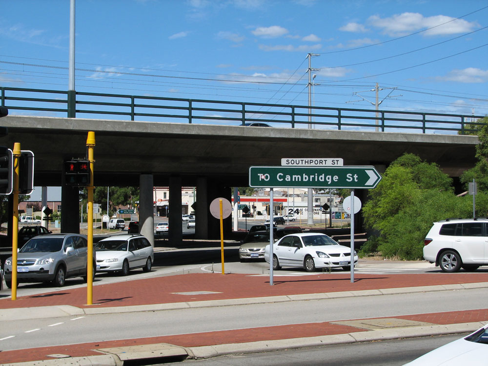
Southbound signage on Mitchell Freeway approaching the Vincent Street interchange at Leederville. Note there's no proper AD sign on the southbound off-ramp nor a trailblazer, just a sign advising traffic how to reach Southport Street. Top 4 photos: October 2010. Bottom photo: February 2011. |
|
Northbound signage on Mitchell Freeway approaching the Vincent Street interchange at Leederville. The northbound off-ramp terminates on Southport Street and traffic must turn right to reach Vincent Street, as shown in the bottom photo. Top 2 photos: October 2010. 3rd photo: December 2010. Bottom photo: February 2011. |
|
 |
AD sign westbound on Vincent Street approaching the junction with Southport Street & the Mitchell Freeway northbound on-ramp. Note the Principal Shared Path (PSP) overbridge in the foreground. Photo taken: February 2011. |
 |
AD sign eastbound on Vincent Street approaching the junction with Leederville Parade & Mitchell Freeway southbound on-ramp. Photo taken: February 2011. |
    |
ID signs and road name plate at the junction of Vincent Street, Southport Street & Mitchell Freeway northbound on-ramp, Leederville. Note no proper ID signs mentioning SR72. Photos taken: February 2011. |
 |
AD sign eastbound on Lake Monger Drive (Vincent Street becomes Lake Monger Drive just west of the freeway interchange) approaching the Mitchell Freeway. Photo taken: February 2011. |
 |
SR72 trailblazer eastbound on Lake Monger Drive at Kimberley Street, West Leederville. I am not sure why this particular trailblazer is there as the freeway interchange is only 300m ahead. Perhaps it should be facing westbound traffic. Photo taken: November 2011. |
 |
Lake Monger Drive looking east near St Vincents Avenue, Wembley, with Lake Monger to the left. Photo taken: June 2011. |
 |
SR72 trailblazer westbound on Grantham Street approaching the junction with Harborne Street, Wembley. Photo taken: June 2011. |
 |
AD sign and trailblazer southbound on Harborne Street approaching Grantham Street at Wembley. Photo taken: June 2011. |
 |
AD sign and trailblazer eastbound on Grantham Street approaching Harborne Street, Wembley. Photo taken: June 2011. |
 |
Grantham Street looking east near Jersey Street, Wembley. Photo taken: June 2011. |
 |
Grantham Street looking west towards the junction with Selby Street, Wembley. Note the missing trailblazer assembly on this approach. Photo taken: June 2011. |
 |
Trailblazer sign assembly northbound on Selby Street approaching the junction with Grantham Street, Wembley. Photo taken: June 2011. |
 |
Trailblazer sign assembly southbound on Selby Street approaching the junction with Grantham Street, Wembley. Photo taken: June 2011. |
 |
Grantham Street looking east towards the junction with Selby Street. West of Selby Street, Grantham Street takes on a much more residential character. Photo taken: June 2011. |
 |
Grantham Street looking west in Floreat with Seymour Avenue branching off to the left. Seymour Avenue was the connection to The Boulevard before Grantham Street was extended in 1951. Photo taken: June 2011. |
 |
Grantham Street looking east from the junction with The Boulevard, Floreat. Photo taken: June 2011. |
 |
Trailblazer westbound on Grantham Street at the junction with The Boulevard, Floreat. SR72 turns right here onto the The Boulevard. Photo taken: June 2011. |
 |
The Boulevard looking east towards the junction with Grantham Street, Floreat. There's no trailblazer approaching this junction so traffic has no indication that the route turns left. Photo taken: June 2011. |
 |
The Boulevard looking west towards the junction with Empire Avenue, Floreat. The footpath shows the original road alignment, prior to construction of the roundabout. Photo taken: June 2011. |
 |
SR72 reassurance trailblazer westbound on The Boulevard after the junction with Empire Avenue, Floreat. Photo taken: June 2011. |
 |
ID sign facing eastbound traffic on The Boulevard at the junction with Bold Park Drive, Floreat. Photo taken: June 2011.. |
 |
AD sign eastbound on The Boulevard approaching the junction with Bold Park Drive, Floreat. Photo taken: June 2011. |
 |
The Boulevard looking east from near the junction with Durston Road, City Beach, with the Perth CBD skyline in the background. Photo taken: June 2011. |
 |
SR72 trailblazer westbound approaching the junction with Durston Road, City Beach. This is the last westbound reference to SR72 before the route terminates at West Coast Highway. Photo taken: June 2011. |
 |
The Boulevard looking west towards Kalinda Drive, City Beach. Photo taken: June 2011. |
 |
The Boulevard looking west towards the junction with West Coast Highway at City Beach. The trailblazer assembly on this approach has gone missing so there is nothing to tell motorists they have reached SR71 and the end of SR72. Photos taken: June 2011. |
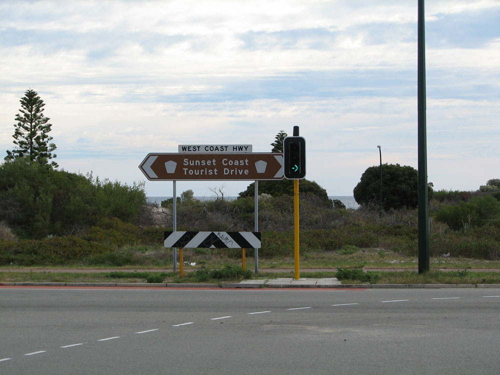 |
Tourist Drive 204 ID sign at the junction of West Coast Highway & The Boulevard, City Beach. The sign has seen better days - the faded route markers are TD204 route shields and this sort of fading is relatively common on tourist drive shields across the country. Photo taken: June 2011. |
 |
Trailblazer sign assemblies southbound on West Coast Highway approaching the junction with The Boulevard, City Beach. Note the bore water stain on the signs in the median. Photo taken: June 2011. |
 |
Trailblazer sign assembly northbound on West Coast Highway approaching The Boulevard. Unlike the southbound approach, the median signs are missing on this approach. Note the Scarborough skyline in the background. Photo taken: June 2011. |


Last updated 20 February 2012 © Ozroads 2003-2012. |