State Route 91 |

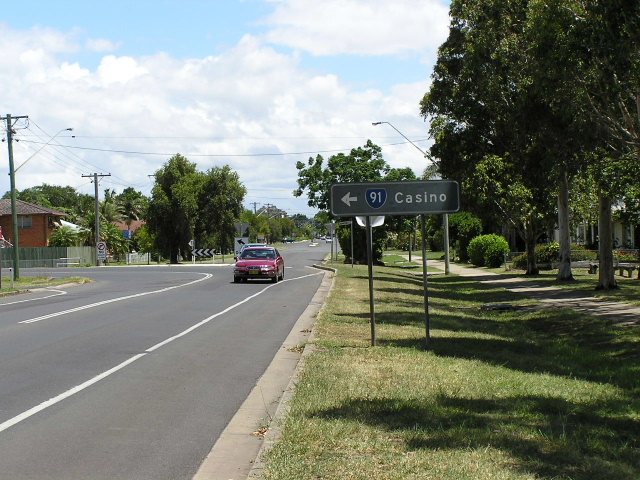
Summerland Way looking south on the southern outskirts of Casino. Photo taken: November 2005.
In 2013, RMS will be implementing a new alpha-numeric route numbering system. For more information, visit the RMS Website. |
||
Forthcoming alpha-numeric route number: |
(South Grafton to Mt Lindesay Rd section only) |
|
Length: 208km
Northern Terminus: Mt Lindesay Highway; NSW/QLD Border, Collins Gap
Southern Terminus: Pacific & Gwydir Highways, South Grafton
Interstate Continuation: State Route 91 continues north into Queensland. The Summerland Way changes its name to Mt Lindesay Hwy which becomes NR13 at Rathdowney and heads to Brisbane.
Focal Points: South Grafton, Grafton, Casino, Kyogle, Brisbane
RTA Internal Classification: Main Road 83
Route Overview:
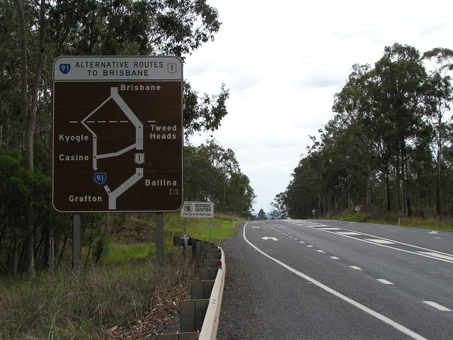
Summerland Way, NSW State Route 91, is a major north-south route through northern NSW. Beginning at the Pacific Hwy in South Grafton, the route is marketed as an alternative route to Brisbane (in conjunction with Queensland's Mt Lindesay Hwy).
The route was first constructed between Mt Lindesay and Casino in 1935 as a developmental road, opening up better road access to the farming and agricultural land near the border ranges. During World War 2 the section between Grafton and Casino was constructed as a flood-free defence route, providing a means of getting around the two ferries across the Clarence River on the Pacific Hwy.
Nowadays the road is of excellent quality for the most part thanks to its inclusion in the federal government's Roads of National Importance funding program, with $70 million of funding from state and federal government being spent on the road since 1998. Several overtaking lanes have been constructed between Kyogle and Grafton and a major deviation is under construction at Wiangaree, replacing the heritage-listed bridge across the Richmond River. The last substandard section within New South Wales was replaced during 2005 at Burnett's Creek, between Grevillia and Mount Lindesay Road.
A feature of the route is the bridge over the Clarence River at Grafton, built in 1932. It is a steel truss bridge with two decks - vehicular traffic operates on the upper deck while rail traffic operates on the lower deck - and an opening span which is now unused. The northern approaches to the bridge are comprised of two sandstone viaducts and are definitely worth a look.
Notable events in the history of the Summerland Way:
July 1932 - Bridge over Clarence River, Grafton
1935 - Casino to Mt Lindesay section constructed
1942 - Grafton to Casino section constructed
1974 - Proclaimed State Route 91
2005 - Wiangree Deviation
Photos of SR91 - Summerland Way |
|
 |
The first mention of SR91 northbound on the Pacific Highway about 5km from South Grafton. Nov 2005. |
 |
The next mention of SR91 on Pacific Hwy, this time in South Grafton. Not sure what the tourist drive shield stands for. Nov 2005. |
 |
AD sign for Summerland Way and Gwydir Hwy northbound on Pacific Hwy. Nov 2005. |
 |
Heading west on the Gwydir Hwy approaching the beginning of the Summerland Way. Note the very unusualy Tourist Drive 22 sub-sign. Also note how Armidale is signed via Glen Innes rather than the more direct, but poorer quality, route via Nymboida and Ebor. Nov 2005. |
 |
Heading east on the Gwydir Hwy approaching the beginning of the Summerland Way. Note the very unusualy Tourist Drive 22 sub-sign. Also note how Armidale is signed via Glen Innes rather than the more direct, but poorer quality, route via Nymboida and Ebor. Nov 2005. |
 |
Looking north from the Gwydir Highway at South Grafton. Nov 2005. |
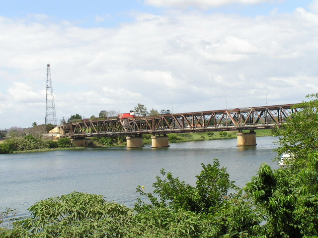 |
The double-decked bridge over the Clarence River at Grafton. The opening span (between the two most closely-spaced piers) is no longer used. Nov 2005. |
 |
Looking south along Prince St in Grafton CBD. Nov 2005. |
 |
Looking east along Dobie St in Grafton. Nov 2005. |
 |
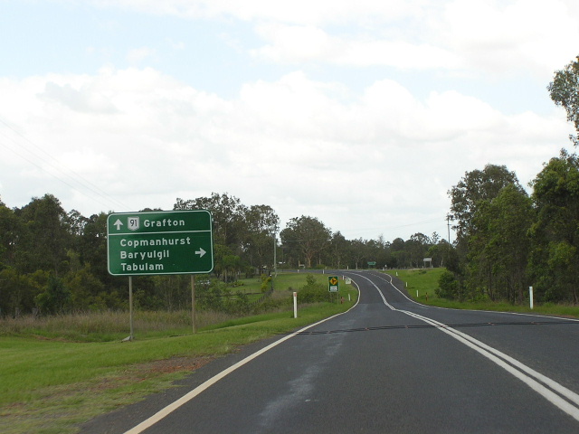
Distance sign heading north from Grafton. Nov 2005. |
 |
Heading south towards the Clarence Way junction near Junction Hill. Note the incorrect NR91 shield. Nov 2005. |
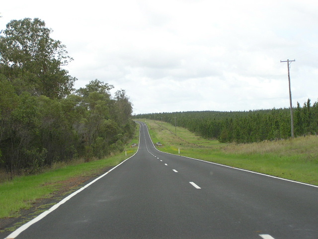 |
Looking south between Whiporie and Lawrence Road, clearly showing the wide road reserve amongst the forests. Nov 2005. |
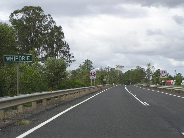 |
Unusual white-on-green sign for Whiporie, heading south. Nov 2005. |
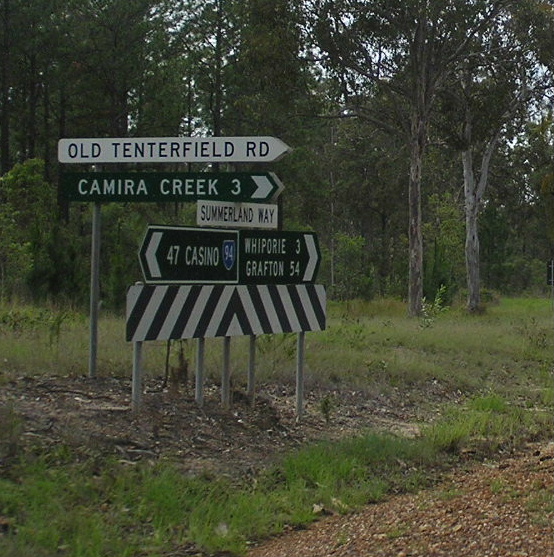 |
Rather unusual fingerboard signage at Old Tenterfield Rd just north of Whiporie. Note the incorrect SR94 shield, no shield for southbound Summerland Way and the destinations are in capitals. Not happy Jan! Nov 2005. |
|
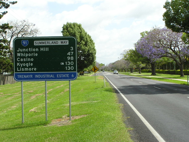
Distance sign heading south from Casino towards Grafton. Photo taken January 2005. |
 |
Northbound in Casino approaching the Bruxner Highway duplex. Photo taken January 2005. |
 |
Looking north to the Richmond River birdge in Casino. SR91 shares pavement with NR44 - Bruxner Hwy for 1km in Casino. Photo taken January 2005. |
 |
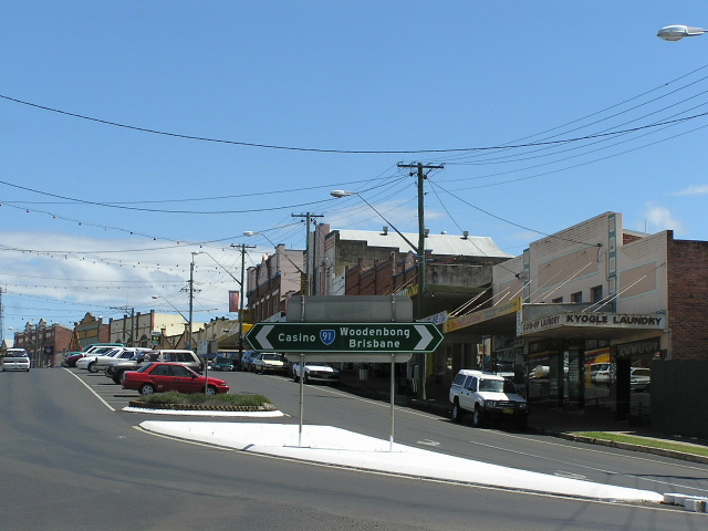
Southbound in Casino approaching the Bruxner Hwy. There should be a SR91 shield on this sign pointing right. Photo taken January 2005. |
 |
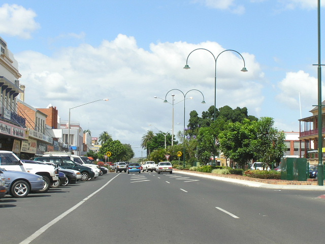
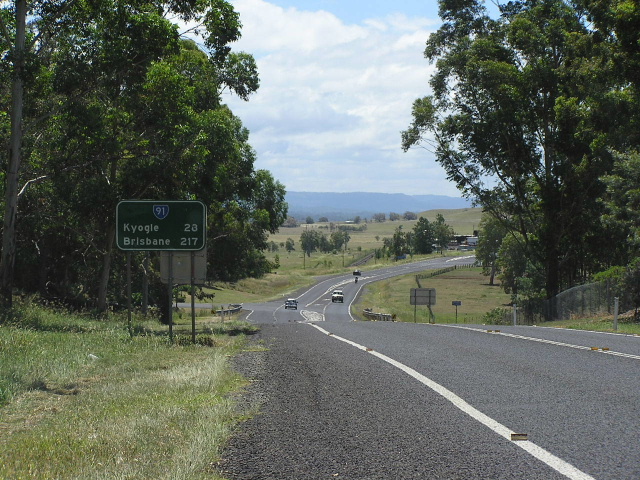
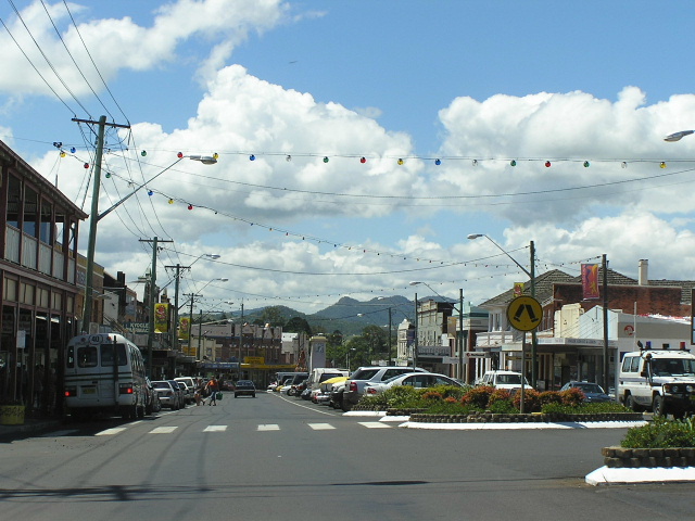
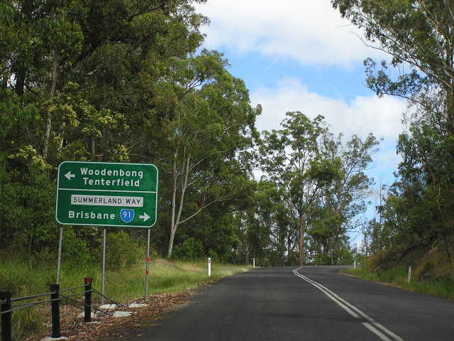
One of two non-reflective signs remaining on the Summerland Way north of Casino. This is one is looking south on the northern outskirts of Casino. Photo taken January 2005. |
 |
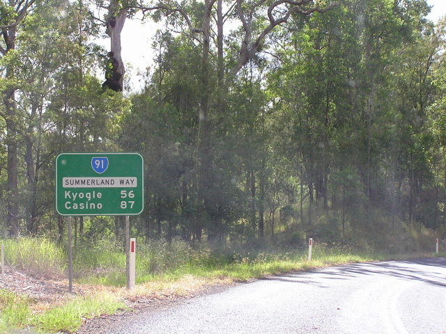
Distance sign leaving Casino. Photo taken January 2005. |
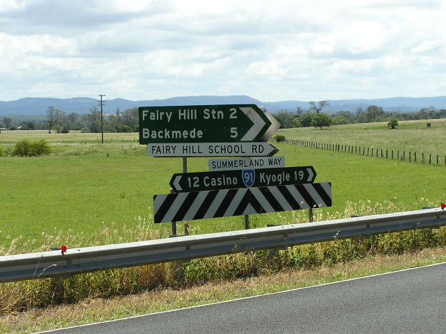 |
Typical rural fingerboard signage; a rarity on the Summerland Way. Photo taken January 2005. |
 |
Incorrect National Route 91 shield at Kyogle Rd in Cedar Point. Photo taken January 2005. |
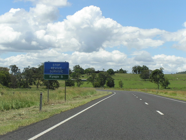 |
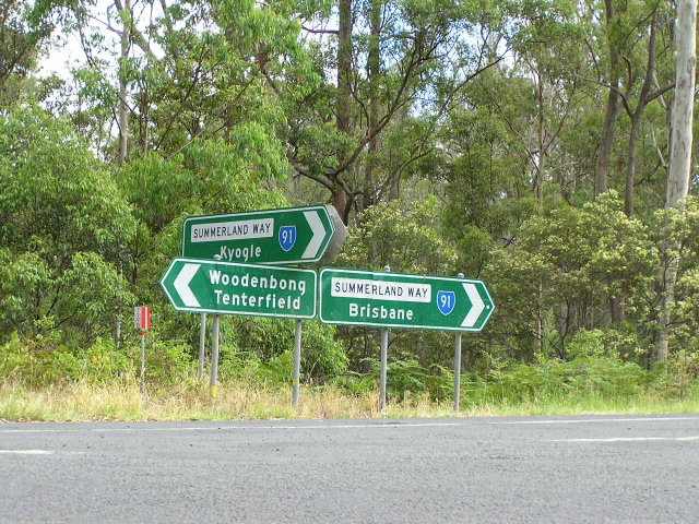
Looking north, 5km south of Kyogle :p Photo taken January 2005. |
 |
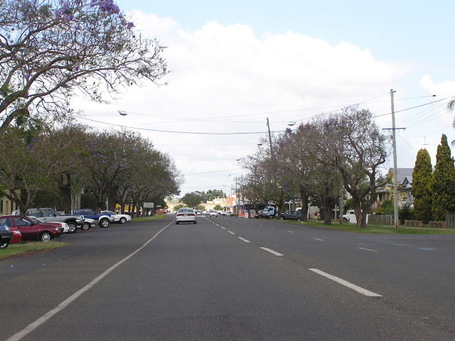
Northbound in the main street of Kyogle. Photo taken January 2005. |
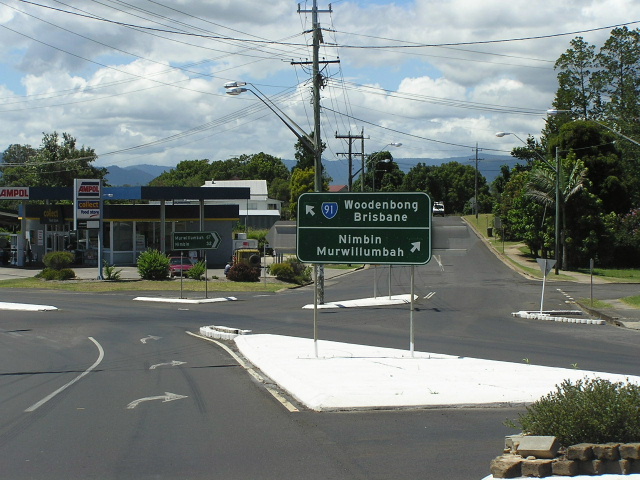 |
The Murwillumbah turnoff (Kyogle Rd) in Kyogle. Photo taken January 2005. |
 |
Rejoining the Summerland Way from Murwillumbah. Photo taken January 2005. |
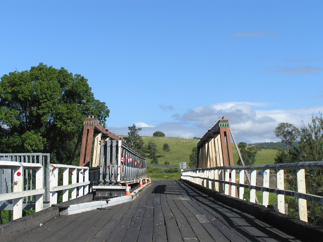 |
Heritage-listed wooden truss bridge across the Richmond River at Wiangaree. A deviation is under construction to bypass this bridge and should be completed late 2005. Photo taken January 2005. |
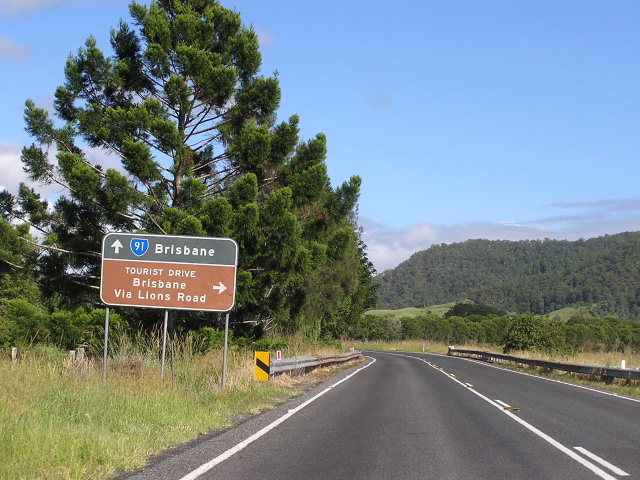 |
1980's non-reflective AD sign in good condition approaching the Lions Rd - a shorter (but unsealed) route to Brisbane. Photo taken January 2005. |
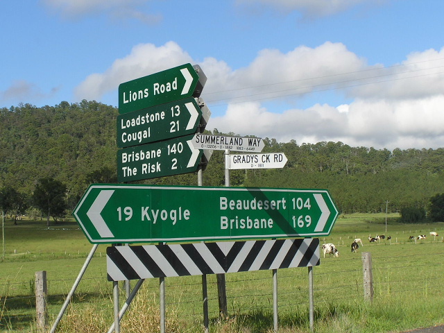 |
Fingerboard signage at Lions Rd. Note the lack of a SR91 shield, bit of a pissweak effort if you ask me. Photo taken January 2005. |
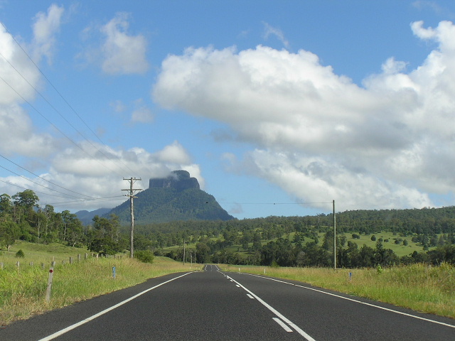 |
Looking north-west past Grevillia with the imposing Mt Lindesay as a backdrop. Photo taken January 2005. |
 |
Substandard section of road at Burnetts Creek, 8km east of the Mt Lindesay Rd. Reconstruction of this section is slowly moving further north. Photo taken January 2005. |
 |
Northbound approaching the former Mt Lindesay Hwy (now road). Photo taken January 2005. |
 |
Southbound distance sign from Mt Lindesay Rd. Photo taken January 2005. |
 |
ID sign assembly at Mt Lindesay Rd. Photo taken January 2005. |
 |
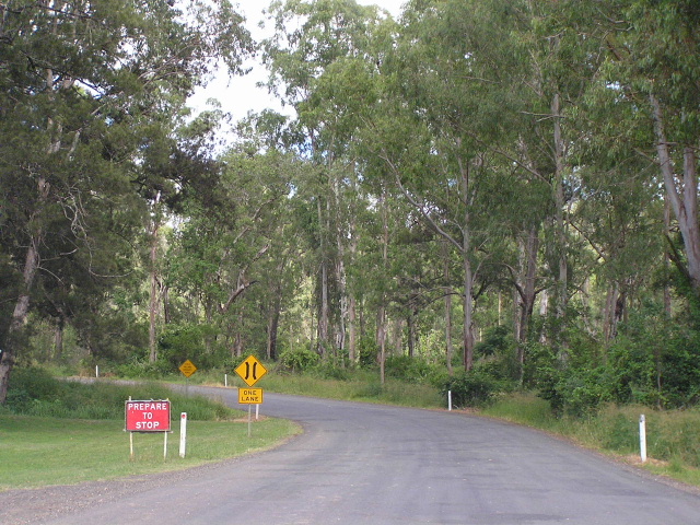
Northbound from Mt Lindesay Rd. This section passes through some densely forested areas. Photo taken January 2005. |
 |
Old school NSW welcome sign at the QLD border, Collins Gap. Photo taken January 2005. |
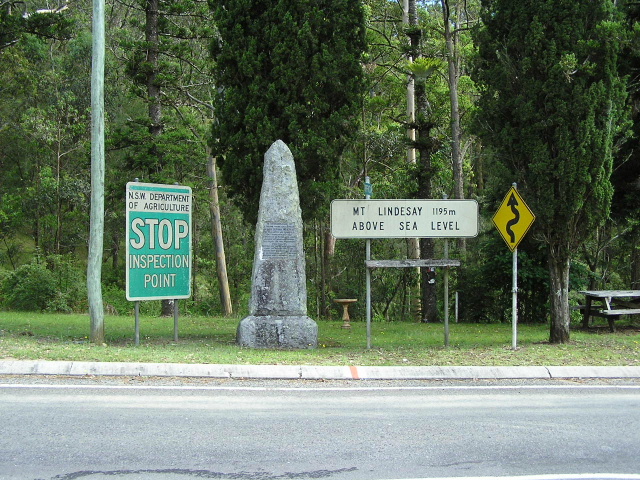 |
Assorted signs and explorers monument at the border. Photo taken January 2005. |
 |
Looking south across the border. Note the QMR sign which has snuck into NSW's territory since the RTA havent installed a distance sign for southbound traffic. Photo taken January 2005. |
Last updated 11 December 2012 © Ozroads 2003-2012. |