State Route 90 |
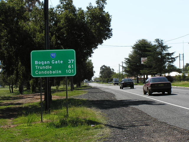
Distance sign heading east from Peabody Rd (SR81) near Cheesemans Creek. Oct 2004.
In 2013, RMS will be implementing a new alpha-numeric route numbering system. For more information, visit the RMS Website. |
RMS have advised that this route will be decommissioned and not replaced by an alpha-numeric route number. |
Length: 198km
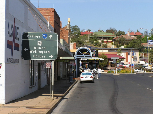
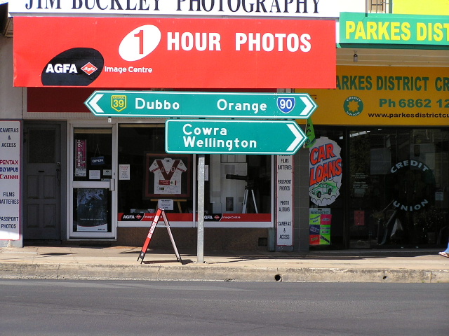
Eastern Terminus: Mitchell Hwy, Orange
Western Terminus: William St & Bathurst St, Condobolin
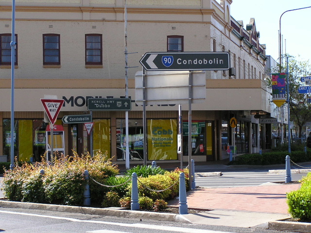
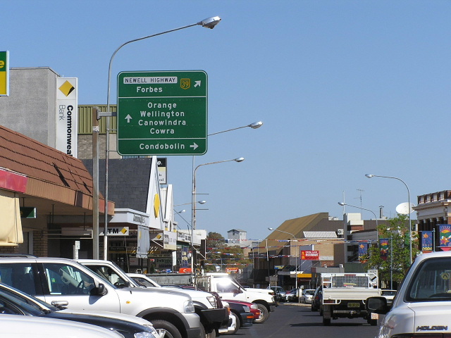
Route names: Escort Way (east of westernmost junction with SR81), Clarinda St East/Clarinda St, Dalton St (through Parkes), Station St/Denison St/Bathurst St (through Condobolin) - the remaining sections between towns do not have official names
Focal Points: Orange, Parkes, Condobolin
RTA Internal Classification: Main Road No. 61
State Route 90 is an east-west route in central New South Wales, stretching nearly 200km from Orange to Parkes and Condobolin. It was introduced in 1973 as one of three signed State Routes - the successful trial of state route signposting which the Department of Main Roads undertook prior to the intorduction of the comprehensive system.
Following the former Trunk Road No. 61 for its entire length, State Route 90 provides an important link in the state's road system. However, rural traffic volumes peak at 3661 vpd (2002) about 7km west of Orange and in towns the traffic peaks at about 5,000 vpd (2002) in Parkes. State Route 90 also follows the standard gauge railway line from Sydney to Perthj via Broken Hill, crossing it nine times in 200km.
Having never been west of Parkes on State Route 90, I could not comment on the standard of the road. However, the road is of excellent quality between Parkes and Orange with the only let down being a few sections with fraying edges. Across Crokers Range, between Parkes and Manildra, the route was comprehensively reconstructed as part of the Australian Bicentennial Road Development programme in the late 1980s.
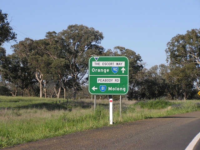
The easternmost portion of the route, from the westernmost junction with State Route 81 near Boree to the Mitchell Highway at Orange, was named "Escort Way" on 29 June 1987, however some signage still shows "Forbes Rd" as it was formerly known. The remainder of the route has no officialy declared name and thus signage does not include any road name plates, even through towns where local road names are prominent.
State Route 90 is unusual in that its western ends in the middle of nowhere! Well, not quite, it ends at Condobolin - a town with a population of about 3,000 and a major grain terminal on the Sydney-Broken Hill railway. However, it is the fact it does not end at another numbered route that is the strange thing. The Department of Main Roads' Schedule of Descriptions of State Routes (June 1982) makes no mention of a possible future extension so this one remains a mystery. One theory I had was that it could be extended along the Lachlan Valley Way to meet State Route 87 (Kidman Way), via Lake Cargelligo. However, I have seen no evidence that this was ever a proposal.
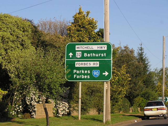 |
AD sign southbound on Mitchell Hwy, approaching SR90 at Orange. Note the incorrect use of "Forbes Rd" - it should say "Escort Way". Oct 2004. |
 |
Very old black ID sign at the Mitchell Hwy junction in Orange. It quite puzzles me as to why this sign is here - according to the DMR they signed SR90 in 1973 but this sign does not look that old, let alone older. Must be an error... Oct 2004. |
 |
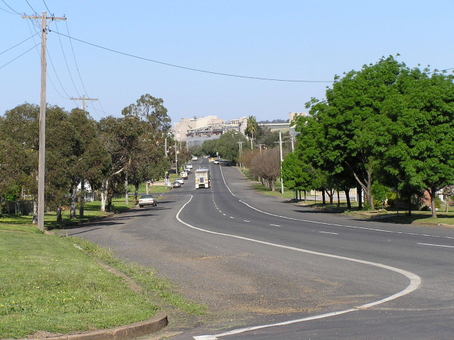
Looking east into Orange, showing increasing urbanisation of Orange's rural fringe. Oct 2004. |
 |
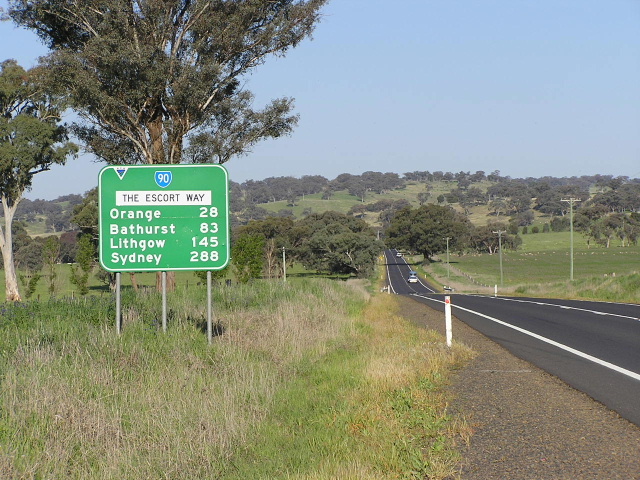
Distance sign heading west from Orange. Note the use of the name "The Escort Way" - which, to be fair, is consistent along the route - when the declared name is just "Escort Way" (according to personal communication with the RTA in 2003). Jan 2006. |
 |
Lovely view, looking east between Borenore and Orange. Oct 2004. |
 |
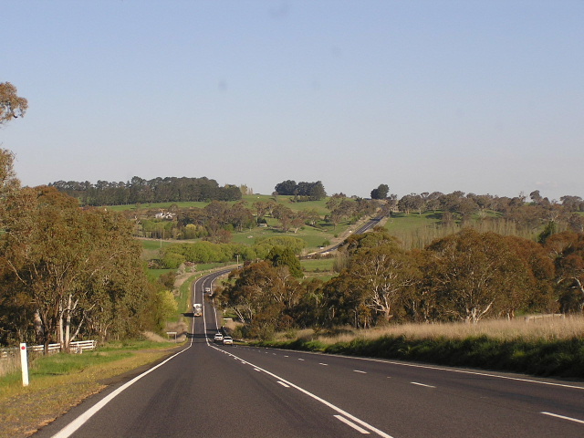
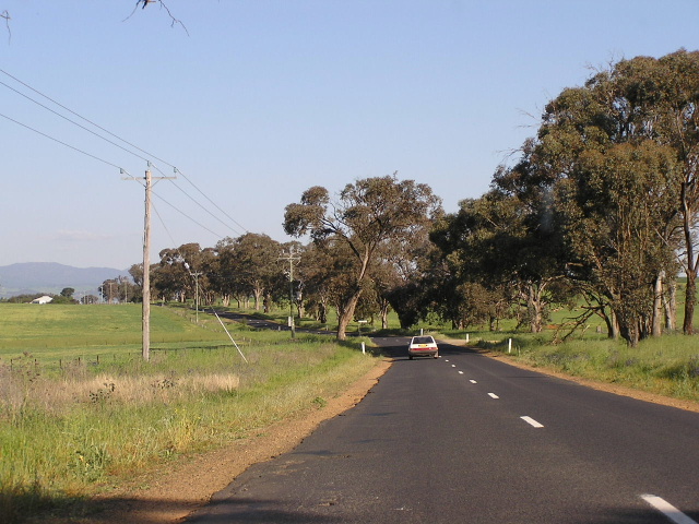
Looking east through increasingly undulating countryside near Boree Creek. Oct 2004. |
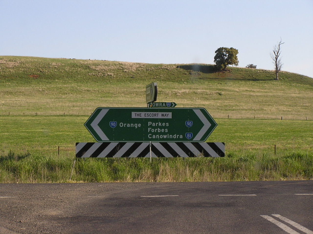 |
Poorly-designed double-chevron ID sign at the junction of SR91 and SR81 (Peabody Rd). Note the afterthought - a tiny fingerboard style sign mentioning Cowra for SR81 - probably added by the Council. Oct 2004. |
 |
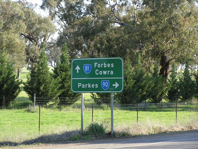
Eastbound AD sign on the SR81/90 duplex, approaching the eastern split (Peabody Rd). Oct 2004. |
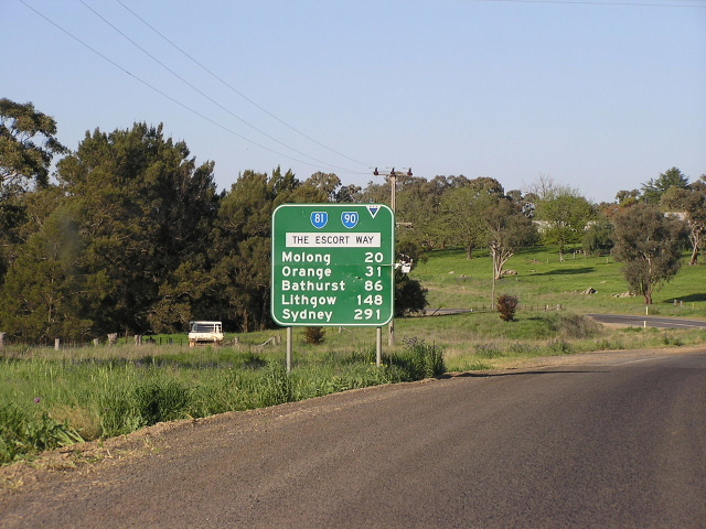 |
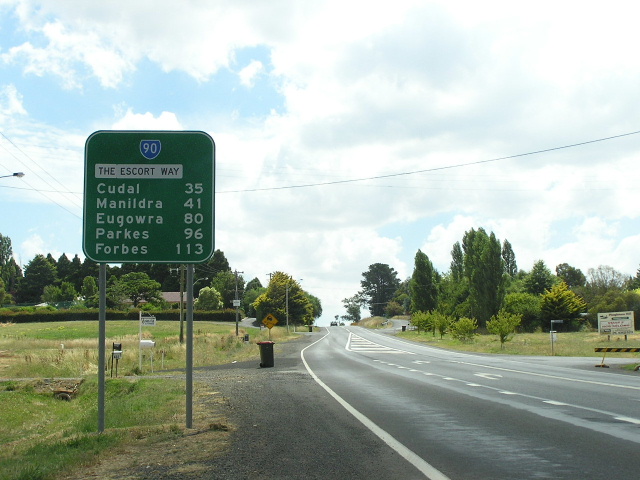
SR81/90 distance sign heading east from the westernmost junction with SR81 near Boree. Oct 2004. |
 |
Older style AD sign heading west approaching the westernmost junction with SR81 at Boree. Oct 2004. |
 |
Distance sign heading west from SR81 at Boree. Not sure whether I was just lazy or the sun caused me to take this less-than-perfect angled photo. Oct 2004. |
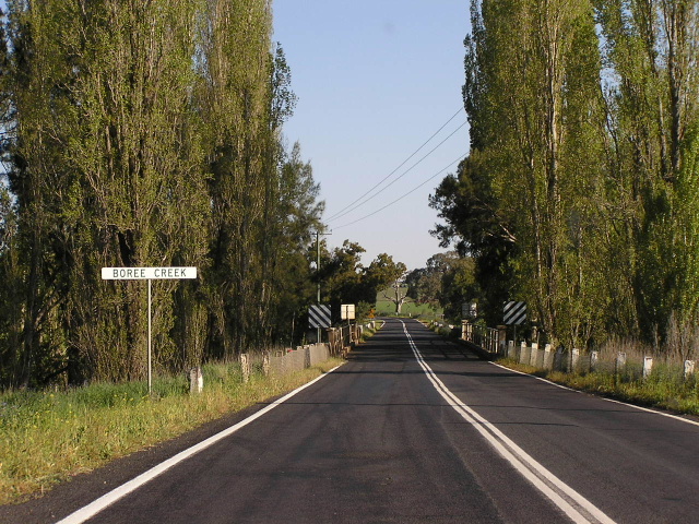 |
Typicla view of a rural trunk road from the 1950s (except this was taken in 2004!), looking east across Boree Creek. Love the wire mesh fencing, the old bridge rails and the large trees planted in the road reserve. Oct 2004. |
 |
Lower standard section of pavement with fraying edges, looking east between Manildra and the SR81 duplex. Oct 2004. |
 |
Looking east through the town of Manildra. The grain silos in the background say it all - this town is (or perhaps once was?) a major grain-loading point on the railway line to Sydney. The B-double truck in the background reflects the shift from rail freight to road freight. Oct 2004. |
 |
Old black fingerboard sign in Manildra, at the turnoff to Cudal. The flash accentuates how signs used to be made, with only the legend and route shields reflectorised. Oct 2004. |
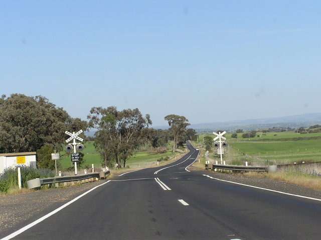 |
One of the nine level crossings of the Sydney-Brken Hill railway line along State Route 90. Oct 2004. |
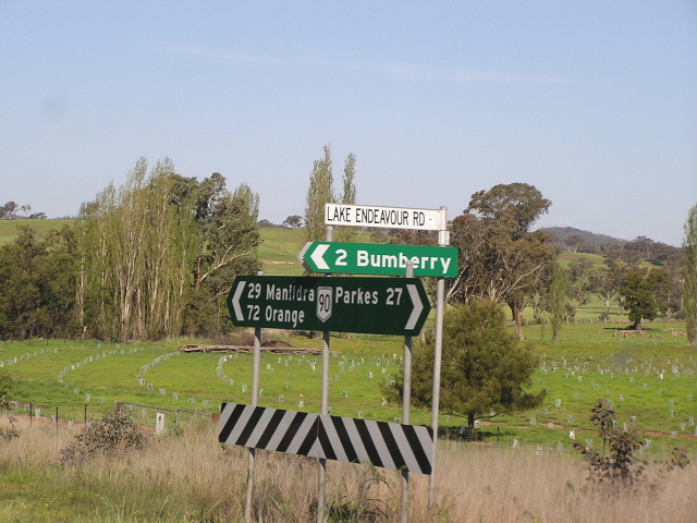 |
Erroneous National Route 90 shield on this fingerboard sign at Lake Endeavour Rd, 27km east of Parkes. Oct 2004. |
 |
Another erroneous National Route 90 shield - this time on the distance sign heading east from Parkes. Oct 2004. |
 |
Black double-chevron ID sign at the junction with Eugowra Rd in Parkes. Oct 2004. |
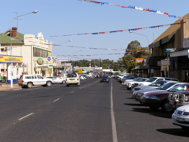 |
Looking south along Clarinda St in Parkes. This is the main shopping strip of the thriving regional/transport hub. Oct 2004. |
 |
Black ID sign (a species which is very plentiful in Parkes) at the junction of Clarinda St, Welcome St and Dalton St. Oct 2004. |
 |
Black AD sign heading west on Dalton St, approaching the junction with Clarinda St and Welcome St. As the sign suggests, Clarinda St and Welcome St was the original route of the Newell Highway. Oct 2004. |
 |
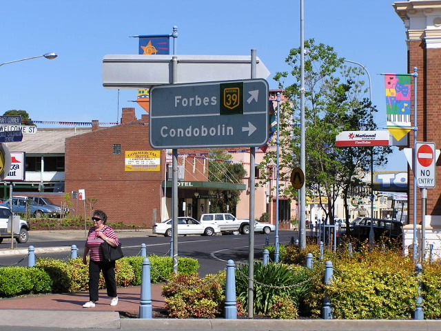
Looking south on Clarinda St approaching the junction with SR90. The AD sign is horribly incorrect, showing NH39 (which was re-routed onto Bogan St in August 2001) and not mentioning SR90! At least the destinations are correct. Oct 2004. |
 |
Horribly ugly ID sign assembly at the same intersection. Oct 2004. |
 |
Very old AD sign showing NH39 (obsolete) but not SR90! It is possible that this AD sign outdates the signposting of SR90 in 1973. Oct 2004. |
 |
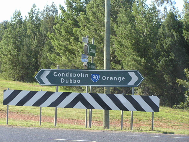
ID sign on Dalton St at the junction with Newell Hwy (Bogan St), showing incorrect NR90 shield. Interestingly now there are no AD signs on any approach to this intersection - motorists would be hard pressed to know they were crossing the Newell Hwy (or SR90). Oct 2004. |
 |
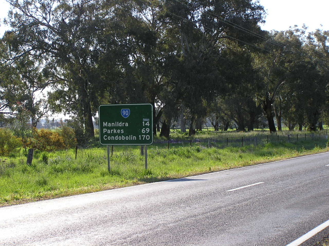
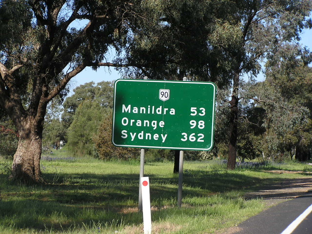
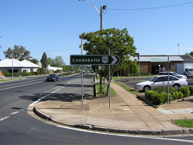
Distance sign heading west from Parkes. Oct 2004. |
Last updated 11 December 2012 © Ozroads 2003-2012. |