State Route 128 |
Looking west along Main Road at Glendale on one of the many remaining 2-lane sections of SR128 within Newcastle City Council. Nov 2004.
In 2013, RMS will be implementing a new alpha-numeric route numbering system. For more information, visit the RMS Website. |
||
Forthcoming alpha-numeric route number: |
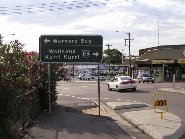
(West Wallsend to Cardiff section only) |
|
Length: 38km
Eastern Terminus: Pacific Highway (Hunter St) & Tudor St, Newcastle West
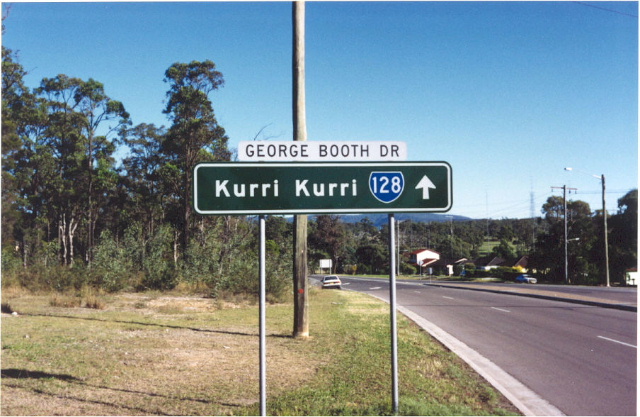
Western Terminus: John Renshaw Dr & George Booth Dr, Buchanan
Route taken: Tudor St, Belford St, Lambton Rd, Alma Rd, Rugby Rd, Russell Rd, Lookout Rd, Cardiff Rd, Main Rd, George Booth Dr
Focal Points: Newcastle, Broadmeadow, New Lambton, Cardiff, Kurri Kurri
RTA Internal Classification: Main Road 604 (Tudor/Belford), Main Road 223 (Lambton/Alma/Rugby/Russell/Cardiff/Main - as far as Cardiff), State Highway 23 (duplex with SR123 along Lookout Rd), Main Road 527 (Cardiff to Buchanan)
Ownership Status: SR128 is rare in that it traverses council-owned Regional Roads for most of its length. It is only owned by the RTA west of Cardiff and along the duplex with SR123.
Route Overview:
State Route 128 was introduced in 1974 as part of the Newcastle Region's 3-digit State Route system. At that stage it was the major route to the west of the city, and the coalfields of Kurri Kurri and Cessnock. Since then it has lost its importance to the point that not only is it no longer recognised as a through route but east of Cardiff the majority of the route has reverted to council ownership - as a Regional Road.
The first major improvements to the route were construction of the divided carriageway through Hamilton and Broadmeadown in the 60's and a bypass of the old mining town of West Wallsend which opened to traffic in April 1964. New construction on this road was rather stagnant until the late 1980's when a section of divided carriageway was constructed at Glendale. More followed in the early 1990's to compliment the F3 extension to Minmi, the dual carriageway being extended through Edgeworth to Northville Drive - with the original alignment preserved as a service road in some locations; construction on an improved alignment between Edgeworth and Withers St; and the widening of the West Wallsend Bypass.
Through Cardiff, the previously narrow rail overpass was widened to provide for 4-lanes along with divided carriageways from Glendale Dr to Macquarie Rd. This work was completed in 2000.
During 2003 three narrow bridges along George Booth Drive, which had proved to be a danger for the coal trucks that sometimes frequent the road, were replaced with wider structures; namely those across Blue Gum, Sugarloaf and Surveyors Creeks. George Booth Drive will also get three new passing lanes towards its western end in the next 2 years as part of planning approval for the new Tasman Coal Mine.
Notable events in the history of SR128:
Apr 1964 - West Wallsend Bypass
Late 1980s - Glendale divided carriageways
Early 1990s - Edgeworth dual carriageways & widening from Edgeworth to the F3
Dec 1993 - F3 Interchange
2000 - Cardiff Rail Bridge widening and divided carriageways from Glendale Dr to Macquarie Rd
June 2003 - Bridge replacements between the F3 and John Renshaw Drive; Blue Gum, Sugarloaf and Surveyors Creeks
Photos of State Route 128 |
|
 |
Looking west on the Pacific Highway approaching the beginning of SR128 at Newcastle West. This sign has been replaced. Dec 2003. |
 |
Looking east on Pacific Hwy approaching the eastern terminus of SR128. April 2005. |
1988 photo of an original SR128 ID sign at its western terminus, the intersection of Tudor St & Pacific Highway, Newcastle West. |
|
 |
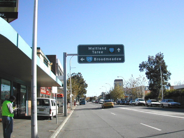
Westbound on SR128 approaching Parry St, Newcastle West. Note the coverplate covering an alpha-numeric route marker and the greened-out legend at the bottom. April 2005. |
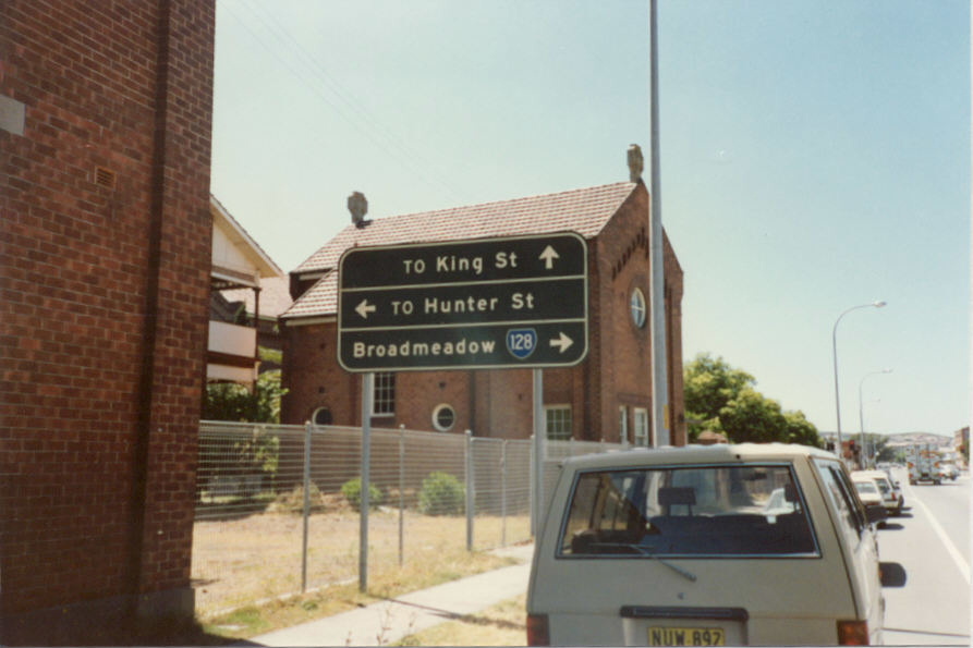 |
1988 photo of another original SR128 sign, this time heading east on Parry St approaching Tudor St, Newcastle West. |
 |
Another original SR128 sign at the intersection of Tudor and Parry Streets, Newcastle West. 1988. |
 |
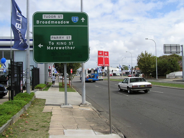
Looking east on Tudor St approaching Parry St, Newcastle West. Oct 2004. |
 |
First westbound RD sign on SR128 - Tudor Street, Hamilton East. Dec 2003. |
 |
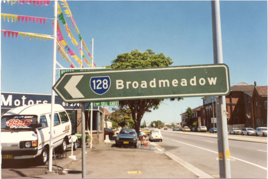
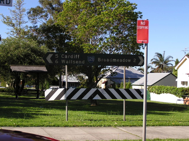
Looking west from the intersection with Brunker Rd - known as Broadmeadow Nineways. Oct 2004. |
 |
Non-reflective painted fingerboard sign at the intersection of Lambton Rd & Royal Place, New Lambton. Oct 2004. |
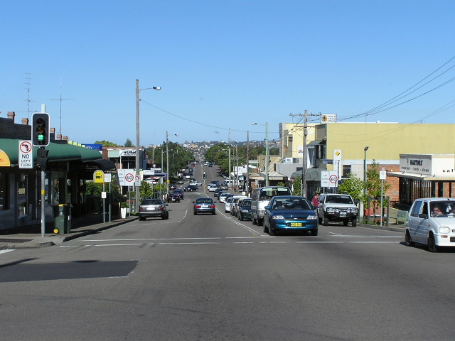 |
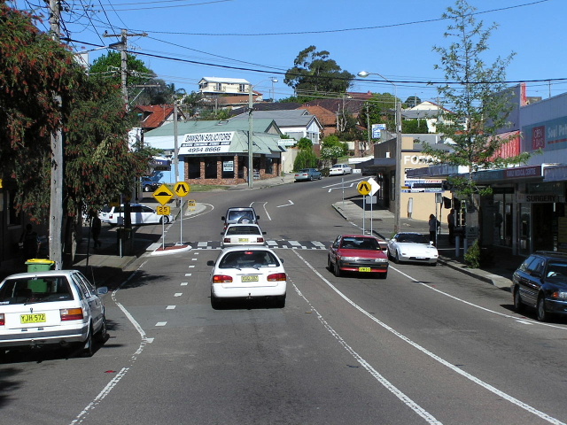
Looking east through New Lambton CBD. Oct 2004. |
 |
Very old non-reflective painted RD sign on Russell Rd, New Lambton. Rare occassion that an old sign like this has the wrong shield, generally the DMR sign designers were very accurate. Oct 2004. |
 |
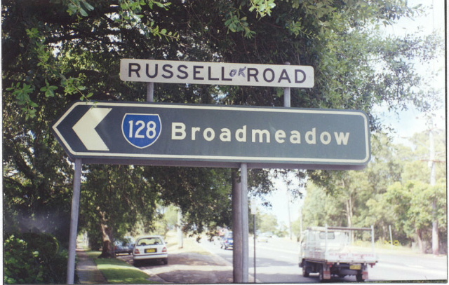
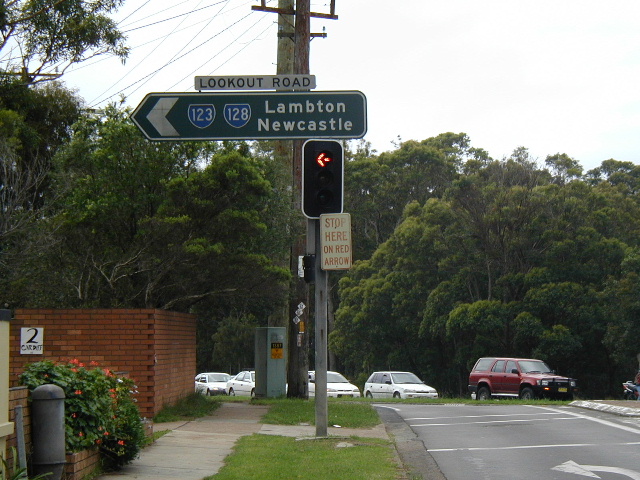
Westbound on Russell Rd approaching the duplex with SR123 along Lookout Road. Oct 2004. |
 |
1999 photo showing the older, faded version of the above sign. |
 |
Non-reflective ID sign at the intersection of Russell Rd with Croudace St & Lookout Rd (SR123), New Lambton. 1999. |
 |
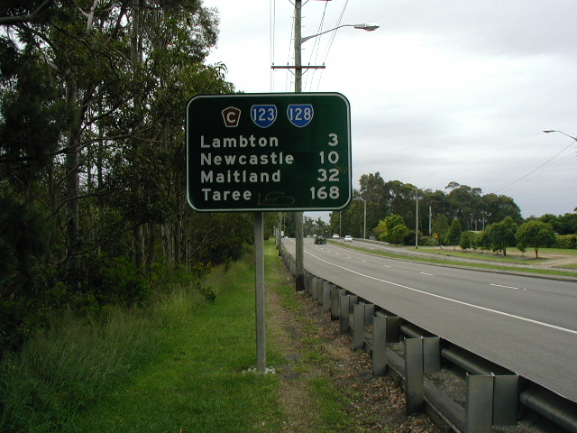
Looking south on Lookout Rd, New Lambton Heights. Oct 2004. |
 |
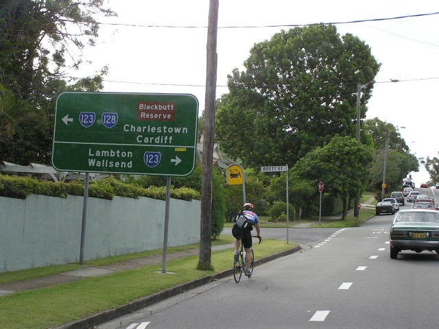
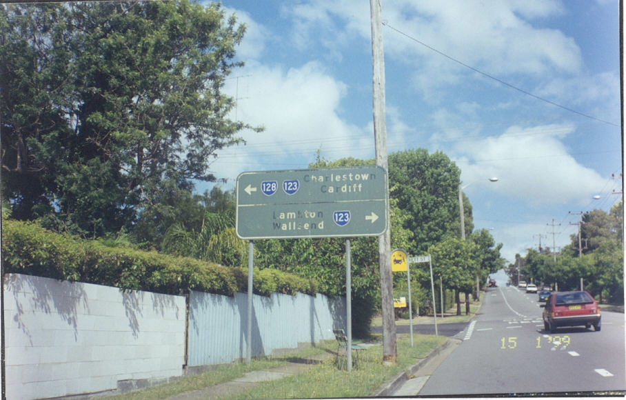
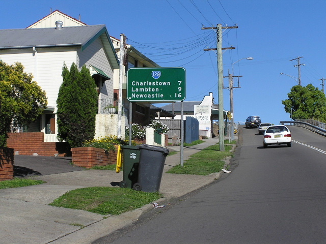
AD sign warning of the route split at the intersection of Lookout Rd, Charlestown Rd (SR123) and Cardiff Rd (SR128), New Lambton Hts. Dec 2003. |
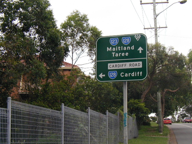 |
Interestingly designed AD sign approaching the same intersection, this time from the south. Dec 2003. |
 |
Non-reflective painted ID sign at the same intersection, this has since been replaced. Dec 2003. |
 |
Looking north from the same intersection, a rare triiplex sign still showing the now decommissioned Hunter Tourist Circuit shield. Dec 2003. |
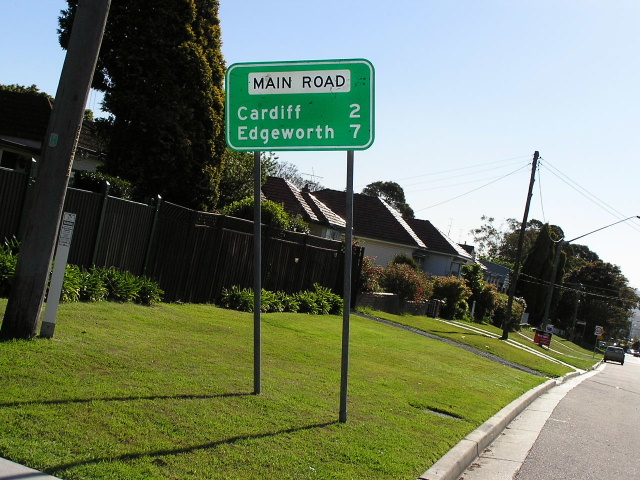 |
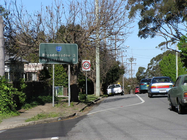
Newcastle Council installed RD sign along Main Road in Cardiff Heights. SR128 has been council-owned between Cardiff and SR123 and between SR123 and the Pacific Hwy since about 1996. Oct 2004. |
 |
RTA designed RD sign heading east on SR128 just before Cardiff Railway Station. Oct 2004. |
 |
Looking east through Cardiff CBD. Oct 2004. |
 |
Old black AD sign on SR128 approaching the intersection with Macquarie Rd, Cardiff. This intersection is seriously devoid of signage, this sign is one of only two signs for the whole intersection and there is no warning that SR128 follows Main Road if you are heading east towards Newcastle. Prior to the widening of the railway underpass and associated divided carriageways there was an black AD sign but it disappeared and was never replaced. Oct 2004. |
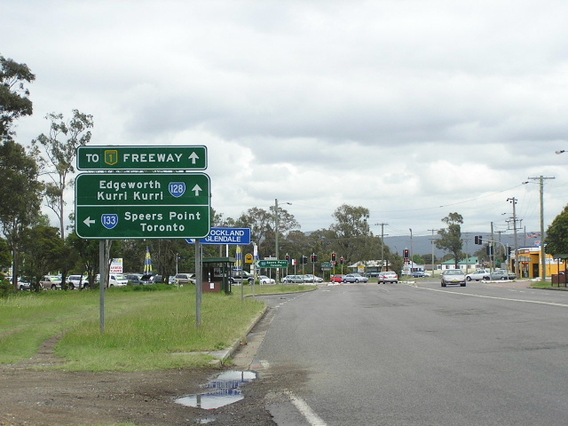 |
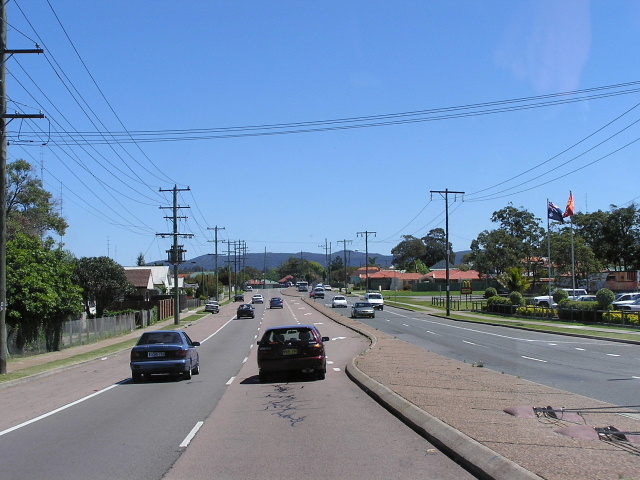
Looking west approaching Lake Rd (SR133) at Glendale. Note that the topknots begin appearing from here onwards, directing motorists to the freeway at West Wallsend. Nov 2004. |
 |
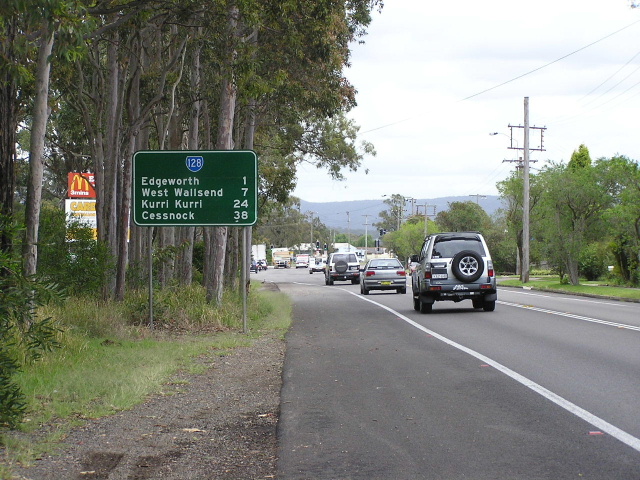
Looking west near Edgeworth McDonalds (Impala Street). Oct 2004. |
 |
Looking east near Garth Street, Edgeworth. Through this area the original carriageway is a service road on the north side of the current divided carriageway. Oct 2004. |
 |
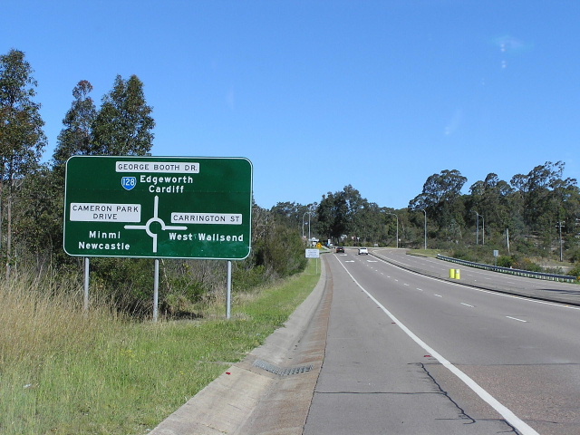
The beginning of George Booth Dr and rurality for SR128 at the roundabout with Northville Dr, Edgeworth. This sign has since been removed along with another ID whcih also went missing from this intersection. Thanks to Shayne Kerr for this 1998 pic. |
 |
Heading west towards the beginning of the West Wallsend Bypass. The original carriageway of George Booth Dr remains on the north side of the current roadway, which was constructed on an improved alignment to compliment the F3 Extension which opened in Dec 1993. Oct 2004. |
 |
Looking east approaching the West Wallsend Bypass from the Seahampton end. The bypass was opened in April 1964 and was widened and repaved to compliment the freeway extension to Minmi which opened in Dec 1993. Oct 2004. |
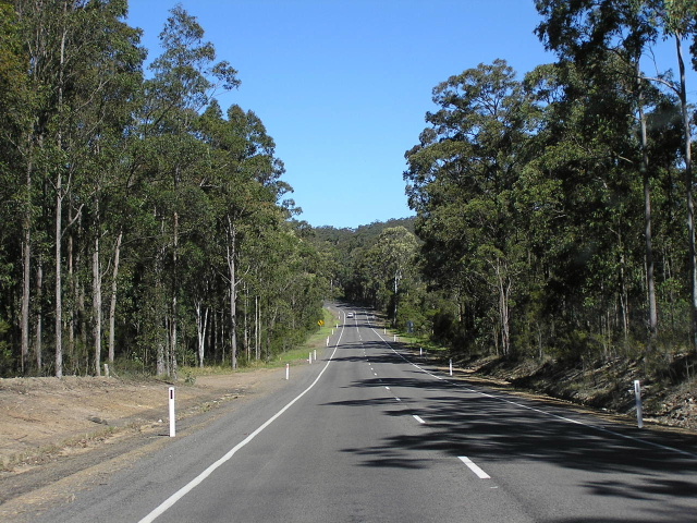 |
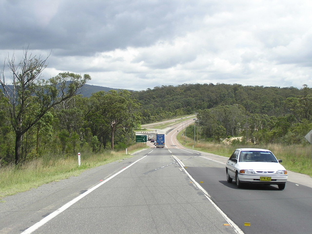
Looking east through the flatter section of the Sugarloaf Ranges. Unfortunately I wasnt able to get a decent pic of the steeper and windier section due to a lack of pulling over opportunities. Oct 2004. |
 |
Very old, possibly original, SR128 AD sign approaching Richmond Vale Rd. This sign has been replaced. Dec 2003. |
 |
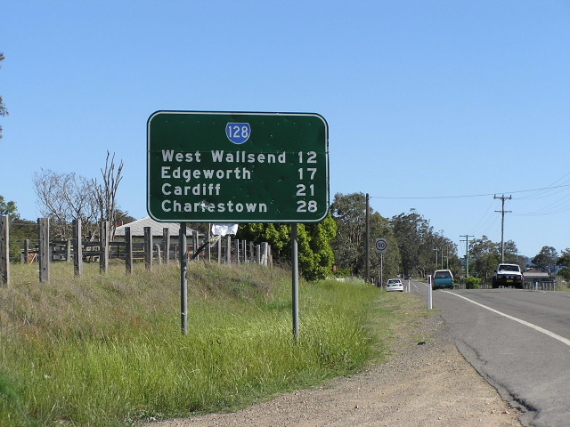
Once plentiful, now increasingly rare, black AD sign approaching John Renshaw Dr (SR132) which is the end of SR128 in the rural locality of Buchanan. Locals refer to this location as "Surveyors Creek" as it passes very close to the intersection and both routes cross it. Oct 2004. |
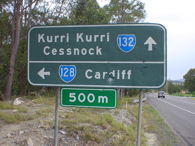 |
Another black AD sign, this time westbound on SR132, warning about the start of SR128 500m ahead. Dec 2003. |
 |
The first eastbound RD sign on SR128, which at this point is heading directly south from John Renshaw Dr, Buchanan. Oct 2004. |
Last updated 12 December 2012 © Ozroads 2003-2012. |