State Route 124 |
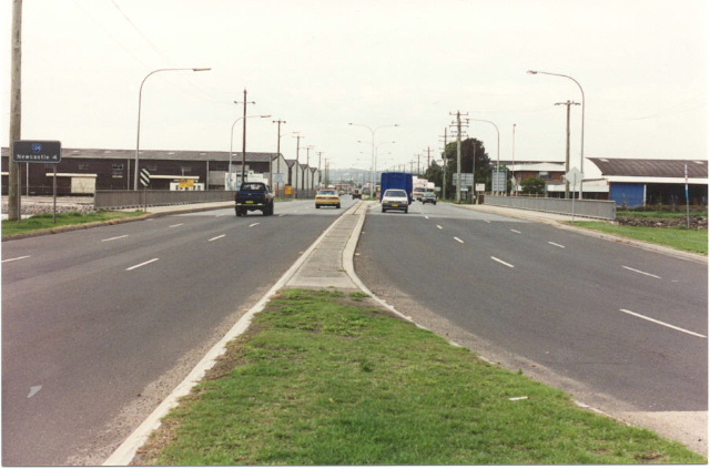
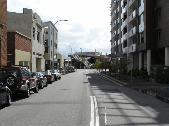
Looking east to Werribi St, Mayfield West. Oct 2004.
In 2013, RMS will be implementing a new alpha-numeric route numbering system. For more information, visit the RMS Website. |
|
Forthcoming alpha-numeric route number: |
|
Length: 8km
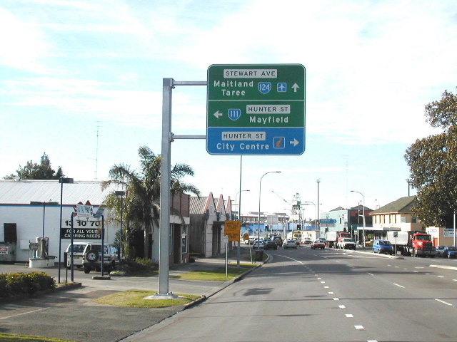
Eastern Terminus: Pacific Hwy & Hunter St & Stewart Ave, Newcastle West
Western Terminus: Pacific Hwy & Industrial Dr, Mayfield West
Route taken: Stewart Ave, Hannell St, Industrial Dr
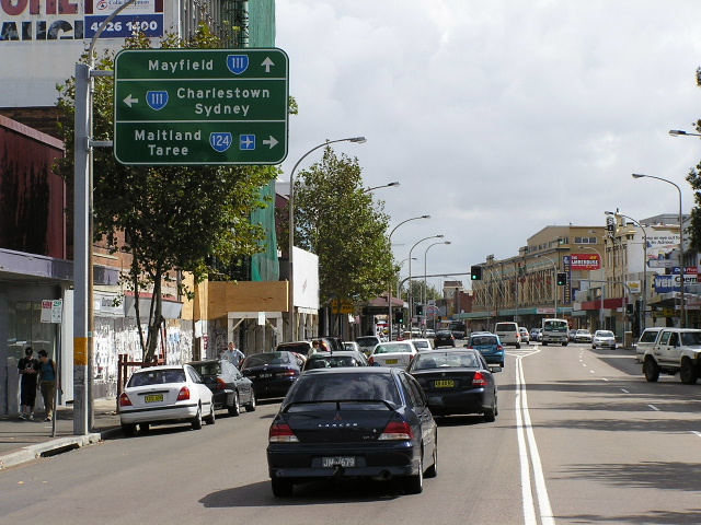
Focal Points: Newcastle, Maitland/Taree
RTA Internal Classification: Main Road 316
Route Overview:
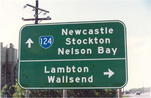
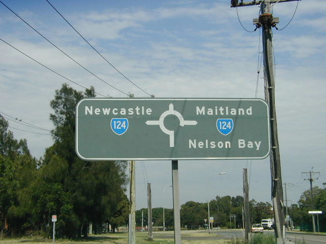
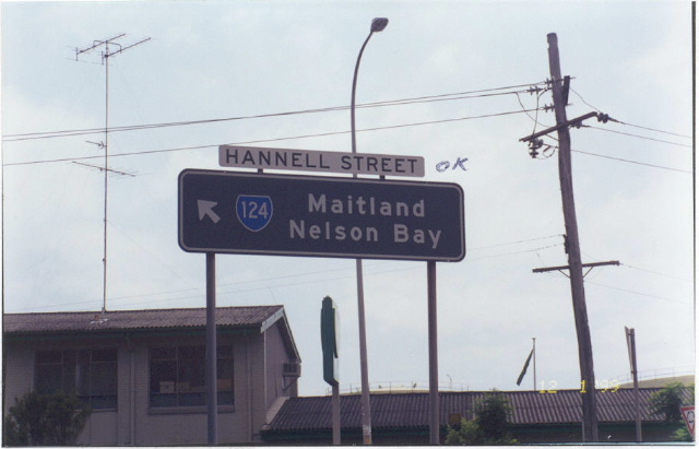
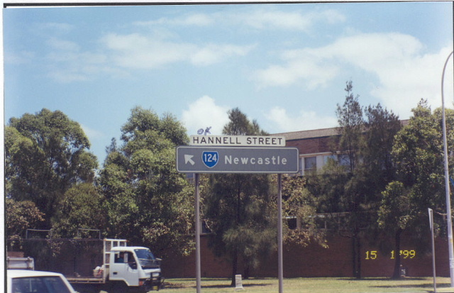
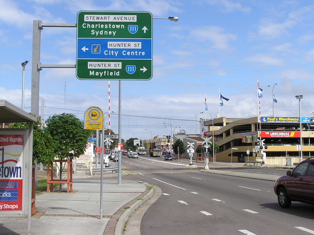
State Route 124 is a short (8km) route on the northern side of Newcastle, providing an alternative to the Pacific Hwy between Newcastle West and Mayfield West as well as access to the industrial areas of Port Waratah, Mayfield North and Kooragang Island. Upon opening of the Stewart Ave Extension in December 2000, the route took the Pacific Highway's focal points of Maitland and Taree, encouraging use of SR124 as the through route to Sandgate and beyond. Previously, the route had been signposted from northbound Pacific Hwy for "City Centre" - accessed via Hunter St which, until December 2000, was part of the route - the focals of "Stockton/Nelson Bay" appeared further up the route at the Hunter St/Hannell St intersection.
It has proved difficult to conclude exactly when this route was introduced. Most of the NSW state routes were introduced in 1974, including every other Newcastle region route, however, some internal DMR maps I have - dated January 1977 - omit SR124. The next, official, DMR map I have - dated 1980 - shows SR124. I had suspicions that the Industrial Drive route may have not been constructed until the late 1970's, however, another DMR map - dated 1974 - shows the route fully constructed. All these factors combined, I have decided that the omission of SR124 on the internal maps may have been accidental and that SR124 was in fact introduced during 1974.
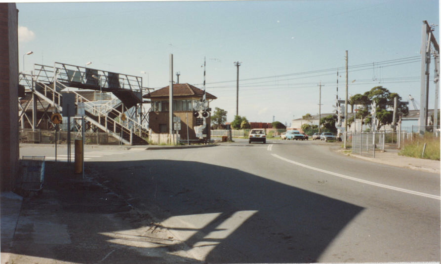
So, with all that somewhat resolved we can focus on the rest of the history of SR124. The route today follows much the same alignment as it did way back in '74, except at its eastern end, where the Stewart Avenue Extension replaced that original alignment in December 2000. Prior to this, Hannell Street continued south-east to cross the railway line on the east side of Wickham Railway Station and then SR124 would turn west onto Hunter St to terminate at the same intersection it does today. The Hannell Street railway crossing was closed upon opening of the Stewart Ave Extension.Initially the route was single carriageway east of Ingall St, Mayfield and the upgrade to dual carriageways through Tighes Hill, Maryville and Wickham was completed in November 1988.
The history of planning and constructing the Industrial Drive section of the route is covered in this comprehensive article (PDF File, 3.91MB).
Today the route seems have overtaken the Pacific Hwy as the major route to the north-west of the Newcastle CBD and with the RTA wishing to decomission the Pacific Hwy through Mayfield we may well see SR124 take on even more importance in the future.
Photos of State Route 124 |
|
 |
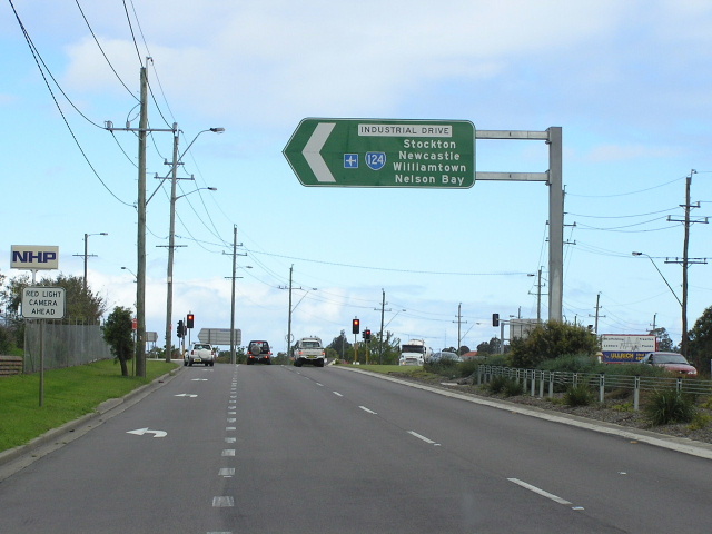
Approaching the start of SR124 at Mayfield West, south-east bound on the Pacific Highway. A whole bunch of these HUGE AD and ID signs were installed at the western end of SR124 during 2002. Oct 2004. |
 |
Huge cantilevered ID sign marking the start of SR124 on the Pacific Highway at Mayfield West. Oct 2004. |
 |
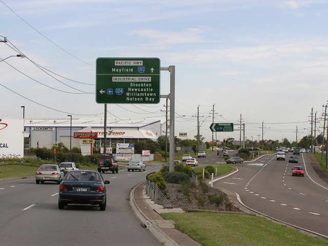
Heading west on SR124 approaching its western terminus at the Pacific Highway, Mayfield West. Oct 2004. |
 |
The first eastbound RD sign on SR124. Dec 2003. |
 |
The older style of AD sign, typical across the whole Newcastle region, installed in the early 1990's. This sign has since been replaced with the main pic above. Tahnks to Shayne Kerr for this 2000 pic. |
 |
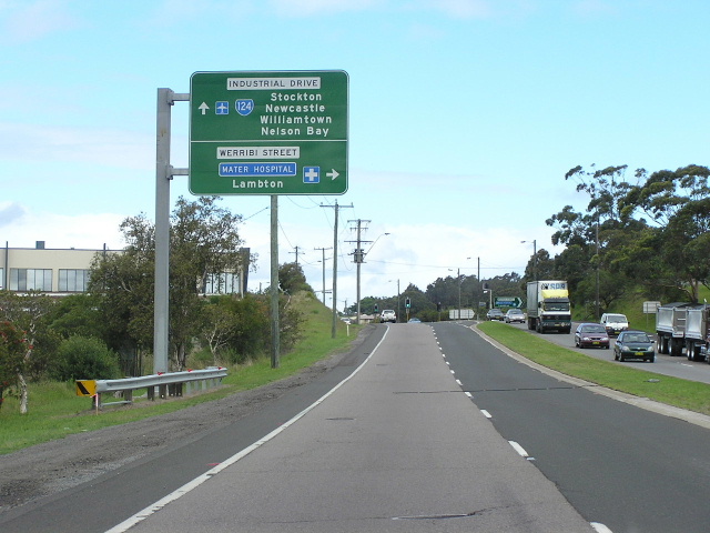
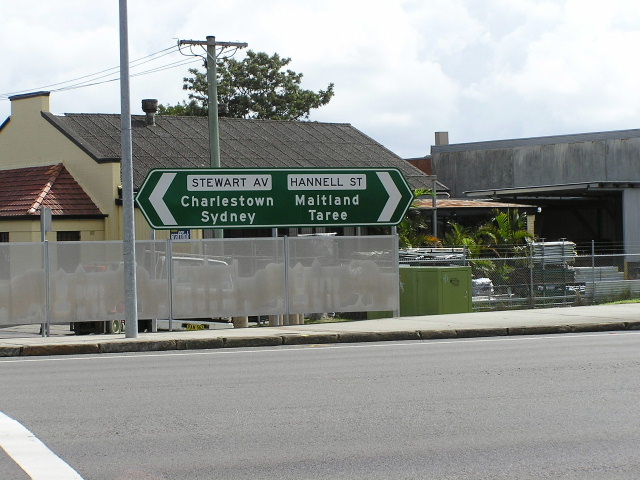
Westbound AD sign for Werribi St, Mayfield West. Oct 2004. |
 |
Looking east to Tourle St (SR121) and the start of the 1km long duplex with SR121. Oct 2004. |
 |
This 1998 photo, taken by Shayne Kerr, is looking south along Tourle St to Industrial Dr. Note that "Wallsend/Maitland" is on a coverplate. I'm not sure what would have been underneath, possibly "Maitland/Taree". |
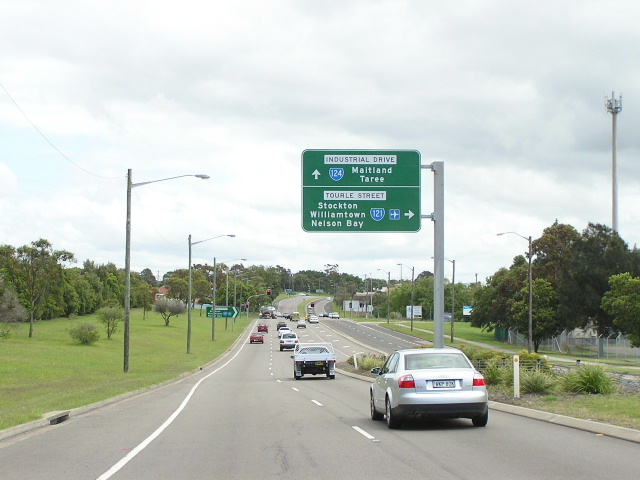 |
Looking west to Tourle St. Oct 2004. |
 |
Another typical, still existing, AD sign on Industrial Dr approaching the eastern split of the SR121/124 duplex, Vine Street, Mayfield. Thanks to Shayne Kerr for this 2000 pic. |
 |
Eastbound RD sign from Vine St, Mayfield. Dec 2003. |
 |
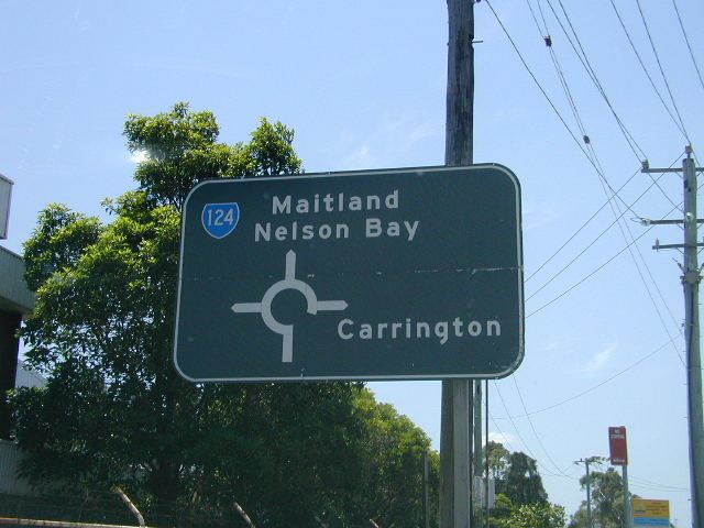
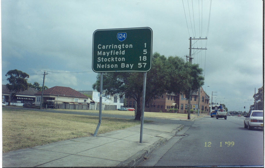
ID sign southbound on Ingall St at Mayfield with unusual focal point of "Carrington". I guess the rationale was that traffic would use Ingall St and SR111 (Pacific Highway) to reach Newcastle from here rather than SR124. |
 |
Black AD sign westbound on Elizabeth St, Carrington, approaching SR124. Dec 2003. |
 |
Black ID sign, since been removed, at the Elizabeth St roundabout, Carrington. Jan 1999. |
 |
Black ID sign, since been removed, at the Elizabth St roundabout, Carrington. Jan 1999. |
 |
Northbound AD sign approaching Elizabeth St, Carrington. Dec 2003. |
 |
Looking south across Throsby Creek into Maryville. Jan 1999. |
 |
ID sign at Honeysuckle Drive with no SR124 shield. April 2005. |
 |
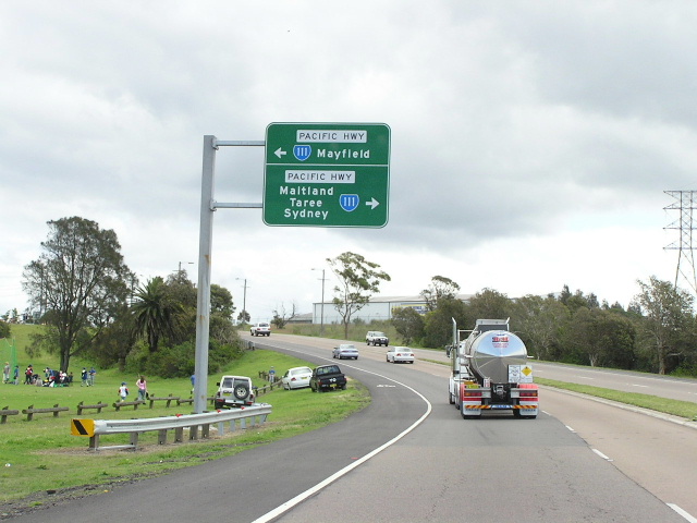
Looking south on the Stewart Ave Extension to SR124's southern terminus at the Pacific Hwy. Interestingly, on this sign the local road names are used rather than the declared name "Pacific Hwy". Dec 2003. |
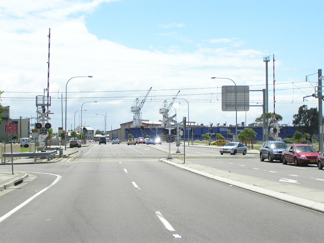 |
Looking north across the new railway crossing on the Stewart Ave Extension. Oct 2004. |
 |
Looking north on Pacific Hwy approaching the start of SR124. Oct 2004. |
Photos of SR124 former alignment - Hannell St, Wickham (1974-2000) |
|
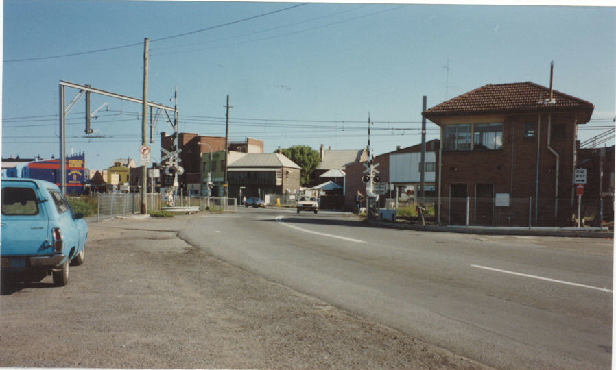 |
Looking south along Hannell St towards the old railway crossing. 1990. |
 |
Looking north along Hannell St towards the old railway crossing. 1990. |
 |
Looking north on Hannell St, this was the first RD sign westbound on SR124 but was removed and not replaced when the Stewart Ave Extension was opened to traffic. Note the vacant land on the left, this is the reservation the Northumberland County Planning Scheme of 1946 allocated for the Stewart Ave Extension, finally constructed 54 years later. Jan 1999. |
 |
Looking north from Hunter St along Hannell St. April 2005. |
 |
Remnant sign structures at the intersection of Hunter St & Hannell St. April 2005. |
 |
Looking west along Hunter St to SR124's terminus. This used to be the direction that SR124 approached the intersection from. April 2005. |
Last updated 12 December 2012 © Ozroads 2003-2012. |