PACIFIC HIGHWAY
Section: Yelgun to Chinderah
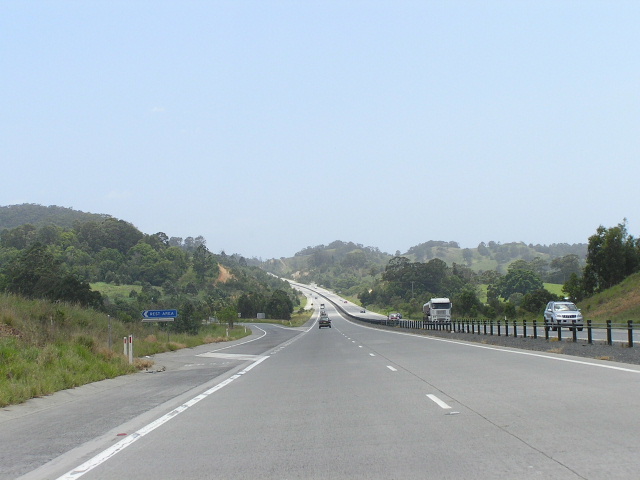
Looking north at Sleepy Hollow Rest Area, between Cudgera Creek Rd and Clothiers Creek Rd interchanges. Nov 2005.
This 29km section of the Pacific Highway stretches from just north of Yelgun Road at Yelgun, where it adjoins the Brunswick Heads to Yelgun section, to south of Oak Avenue at Chinderah, where it adjoins the Chinderah Bypass. The highway, for the length of this section, is of 110km/h freeway standard construction, with no at-grade intersections and on a completely new alignment. The previous route, following the opening of the Yelgun-Chinderah Freeway project, has been renamed Tweed Valley Way however a number of other, older alignments exist off Tweed Valley Way . But lets start from the beginning.
State Highway No. 10 was proclaimed on 7 August 1928 and named North Coast Highway . This name was changed to Pacific Highway on 29 May 1931 , after pressure from the Queensland Government who had named their section of the main coastal Sydney-Brisbane route Pacific Highway .
The Main Roads Board and, from 1932, the Department of Main Roads had a large job ahead of them to improve the roads that made up Pacific Highway to a condition that would suit the traffic of the day. Commencing prior to the highway’s proclamation in 1928, the Main Roads Board reconstructed the highway between Murwillumbah and Chinderah. Prior to the Board’s existence, Main Roads No. 142 and 303 had shared, with the Pacific Hwy, the burden of carrying traffic between Murwillumbah and Tweed Heads, which were important rail heads for the sugar industry. Following completion of the reconstruction of the Pacific Highway between Murwillumbah and Chinderah in June 1931, Main Roads No. 142 and 303 had their declarations revoked (No. 142 was truncated at Murwillumbah as it extend, and still does to this day, south west to Kyogle) as traffic was now concentrated on the new highway. Bridges over the Tweed River at Barneys Point and Terranora Creek at Tweed Heads were constructed during the Depression to further improve the highway between Murwillumbah and Tweed Heads – more information on these in the Chinderah to Tweed Heads section.
South of Murwillumbah is the notorious Burringbar Range , where the Pacific Highway twisted and turned its way for 8km on a tortuous alignment across the coastal escarpment, 1152m above sea level. The condition of the road in 1928 was no more than a goat track so in 1933 the Department of Main Roads began a massive reconstruction programme to improve the highway between Mullumbimby and Murwillumbah. Much of the highway was reconstructed on a new alignment, particularly at Billinudgel and several sections across the Burringbar Range , while the remainder was widened and curves and grades were improved. At Burringbar township, a short deviation to the west of the Burringbar Hall was constructed in conjunction with the provision of a new bridge over the Casino-Murwillumbah railway line (which was later replaced by a modern concrete structure in 1982). The Department of Main Roads’ Annual Report from 1939 mentions that the reconstruction and deviation of the highway across and in the vicinity of the Burringbar Range was completed in December 1938.
North of the Burringbar Range , the Pacific Highway passed along what is now Stokers Road and Mistral Road , via Stokers Siding and Dunbible. The Department of Main Roads’ December 1955 issue of Main Roads continues the story:
“A 4.3 mile deviation, largely constructed before the war, has been opened to traffic. This work required a bridge to be constructed at each end of the deviation. One of these, that over Dunbible Creek, had been completed prior to 1950 but strengthening of the pavement on the approaches then remained to be undertaken. This has now been done. The bridge over the [Casino-Murwillumbah] railway at the other end of the deviation has now been completed, the approaches strengthened and the full length of the deviation surfaced with bitumen, [as of December 1955]. The deviation was actually opened to traffic during late 1954, so that motorists could make most use of it as soon as possible. This work completed the reconstruction of the Pacific Highway between Yelgun and Chinderah.
Focus turned to this section of the highway again in 1971 when a start was made on a deviation of the highway at Condong, 3-6km north of Murwillumbah. The original alignment of the Pacific Highway at Condong was via McLeod Street (as well as a short section called Old Pacific Highway on the eastern side of Tweed Valley Way), which closely flanks the Tweed River and passes by Condong sugar refinery and primary school. It is therefore obvious why the preferred upgrade option was to relocate the highway around the eastern side of the village. As mentioned earlier, a start was made in 1971 but I could find no mention of the work in DMR publications until their 1979 Annual Report in which it was noted that construction of a deviation at Condong was commenced. Quite why this project was delayed for eight years is not known to me (yet!), but there was no false start the second time and work was completed and the deviation opened to traffic in 1980.
Four kilometres north, at the tiny village of Tumbulgum , work was put in hand in 1972 on a 1km deviation to relocate the highway to the east of the village. At this location, Riverside Drive , the original route of the Pacific Highway , follows a bend in the Tweed River and is swallowed by ribbon development for much of its length. At its southern end, Riverside Drive was turned into a cul-de-sac, with Government Road providing access to Tumbulgum from the south and, in the north, Riverside Dr connects with the deviation nears the Terranora Road bridge over the Tweed River . The Tumbulgum deviation was opened to traffic in 1973.
Further north, between Cudgen Road and the southern end of Chinderah Bypass, dual carriageways were constructed to provide overtaking opportunities for increasing volumes of traffic. The duplication work was carried out in two stages and completed in 1978.
For many years, I believe, the Department of Main Roads had known it would one day have to relocate the highway a fair distance to the east to bring it up to motorway standard. Despite the excellent alignment between Chinderah and Murwillumbah, the Burringbar Range and Fernvale Deviations posed major engineering problems. The Burringbar Range quickly developed into a black spot as motorists either drove too fast or just plain could not handle the tortuous bends. While the Department knew it would eventually have to build a major deviation it continued to make the Range safer – the construction of several overtaking lanes, the installation of improved warning signage and extensive resealing were all undertaken in the name of road safety during the 1980s and 1990s.
Official planning for a bypass of the area culminated in the 1994 release of an Environmental Impact Statement for a “Proposed Motorway – Billinudgel to Chinderah.” The selected route left the existing highway at Dirty Flat Rd , Yelgun, passing to the east of the Burringbar Range across the coastal plain, following almost a direct north-south line to Chinderah. However, construction would not commence straight away as community feedback caused the RTA to review its design for the project, replacing a 50m deep cutting at Cudgen Road with twin 134m long tunnels to protect prime cane-growing land and avoid flood-prone areas. An Environmental Impact Statement for the modified design was exhibited in 1998 and planning approval granted the next year. Construction commenced in May 2000 and involved the following key features:
- Three grade-separated interchanges at Cudgera Creek Rd , Clothiers Creek Rd and Tweed Valley Way (north) – a grade-separated interchange with Tweed Valley Way at the southern end of the project will be constructed as part of the Brunswick Heads to Yelgun Upgrade
- 11 overpasses, all with magnificent architecture (see photos) to blend in with the natural environment
- 39 highway bridges
- 36 cuts and fills, including several 40m+ deep cuttings
- two major rest areas at Sleepy Hollow
Also included in the project were three fauna overpasses which provide for almost unrestricted koala movements across the freeway corridor. The most demanding aspect of the design and construction was the 5.8km of the freeway which passes over low-lying, flood-prone areas. To overcome the problem of soft soil foundations and poor drainage, more than 1 million metres of wick drains were installed with 700,000 square metres of geotextile placed over the drainage layer to support the embankments. To speed up the settlement process (which would have otherwise taken up to 24 months) 800,000 cubic metres of earthworks were added on top of the embankments and later removed before the new road was built. After nearly 2.5 years of construction, the Yelgun to Chinderah Freeway, as the project was named, was officially opened on 4 August 2002 . Completed at a cost of $348 million, jointly funded by the State and Federal Governments, it was the single largest section of freeway to be opened in one stage in New South Wales at 28.5km and shortened the route of the Pacific Highway by 14.5km.
Following the opening of the Yelgun-Chinderah Freeway, the old highway route was renamed Tweed Valley Way and redeclared as Main Road No. 679. It has also been bestowed with the Tourist Drive 40 shield and re-signing due to this route marker change has removed any trace of National Route 1 from the signs.
|
Current route of Pacific Highway (Yelgun-Chinderah Freeway project) |
|
 |
Heading north approaching the beginning of the Yelgun-Chinderah Freeway at Yelgun. The Tweed Valley Way is the bypassed route of the Pacific Highway. Nov 2005. |
 |
Northbound AD sign for Tweed Valley Way. Wonder why Mooball was a later addition to the sign when the next AD sign includes it? Nov 2005. |
 |
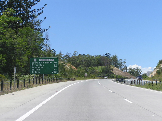
Supplementary AD sign placed at either end of the Yelgun-Chinderah freeway to inform motorists of the smaller bypassed towns that can be accessed via the old highway. Nov 2005. |
 |
Distance sign heading north from Yelgun. Note the fauna overpass. Nov 2005. |
 |
Looking south to the Tweed Coast Rd overpass. Jan 2005. |
 |
Looking south to the Pottsville Rd (Tweed Coast Way) overpass. Jan 2005. |
 |
Distance sign heading south from Cudgera Creek Rd, which is to be upgraded as a condition of approval of the Yelgun-Chinderah project. Nov Jan 2005. |
 |
Looking north to Cudgera Creek Rd. Nov 2005. |
 |
Looking south to the twin bridges over Cudgera Creek at the Cudgera Creek Rd interchange. This road now serves as the major access point from Pacific Hwy to the Tweed Coast. Jan 2005. |
 |
Southbound AD sign for Cudgera Creek Rd. Note the incorrect location of the NR1 shield and the TD38 is too small. Jan 2005. |
 |
Looking south to the Reserve Creek Rd overpass. Jan 2005. |
 |
Northbound 1km AD sign for Clothiers Creek Rd. Nov 2005. |
 |
AD sign on Clothiers Creek Rd eastbound approaching Pacific Hwy. Jan 2005. |
 |
Looking north to the tunnels under Cudgen Rd. Nov 2005. |
 |
Northbound 1km AD sign for Tweed Valley Way. Again note the small shields (should be double letter height) and the incorrect placing of the NR1 shield. Nov 2005. |
 |
Eerily well-designed signage (such a rarity on this project) on Tweed Valley Way at the Oak Ave interchange (at the northern end of the project). Jan 2005. |
 |
Southbound supplementary AD sign for the Tweed Valley Way interchange. Signage showing tourist attractions and services is mandatory for bypassed towns according to the RTA's signposting guidelines. Jan 2005. |
 |
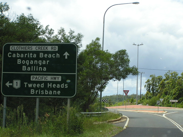
The first southbound mention of the Tweed Valley Way interchange, just south of the Chinderah Rd overpass on the Chinderah Bypass. Jan 2005. |
|
Old Pacific Highway, Yelgun to Chinderah (Tweed Valley Way) Also includes photographs of earlier alignments that were bypassed by sections of Tweed Valley Way |
|
 |
Looking south along the old highway that is currently a dead-end, just south of where the Tweed Valley Way has a temporary at-grade connection with the Pacific Hwy pending construction of the Brunswick Heads-Yelgun Upgrade. Nov 2005. |
 |
Looking south on Tweed Valley Way approaching the temporary at-grade connection with Pacific Hwy. Nov 2005. |
 |
The overpass that carries Tweed Valley Way across the Pacific Highway at Yelgun. Nov 2005. |
 |
Looking south to the rail subway on a poor alignment just north of Yelgun. Nov 2005. |
 |
Looking south through the town of Mooball, where most things are painted with cow spots! Nov 2005. |
 |
Southbound AD sign on Tweed Valley Way for Tweed Coast Way (Pottsville Rd) at Mooball. Nov 2005. |
 |
Northbound AD sign at Burringbar Rd. Nov 2005. |
 |
Looking south at Burringbar. This section of the highway is a deviation, probably constructed in the 1930s by the looks over the overpass and cutting. Nov 2005. |
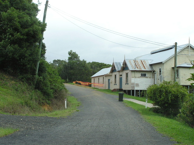 |
Old Pacific Highway alongside Burringbar Hall, bypassed in the 1930s by the deviation depicted in the above photo. Nov 2005. |
 |
Looking south through Burringbar, on the north side of the railway line. Nov 2005. |
 |
Looking south at the southern end of the notorious Burringbar Range. Nov 2005. |
 |
One of the many tortuous bends on the Burringbar Range. Nov 2005. |
 |
One of the easier sections of the road across the Burringbar Range. Nov 2005. |
 |
Oh dear, bad news for southbound travellers who have to deal with 8km of tortuous, winding road across the Burringbar Range. This sign is located just south of the intersection with Stokers Rd (Pacific Hwy from 1928 to 1954). Nov 2005. |
 |
Fingerboard sign pointing traffic down Stokers Rd, which was Pacific Hwy until the opening of the Fernvale Deviation in late 1954. Nov 2005. |
 |
Looking north across Dunbible Creek from the intersection with Stokers Rd. This section of the Tweed Valley Way was constructed as the Fernvale Deviation from 1930s-1955 and became part of the Pacific Hwy from opening until the completion of the Yelgun-Chinderah Freeway in October 2002. Nov 2005. |
 |
Looking south along the Fernvale Deviation towards Woodlands Creek. If this is standard of the new road, I wonder what the old road (Mistral Rd/Stokers Rd) is like! Nov 2005. |
 |
Looking south near Fernvale Rd. Nov 2005. |
 |
Looking south across the Casino-Murwillumbah railway line at the northern end of the Fernvale Deviation. Note the kilomtre plate which remains from the Tweed Valley Way's days as the Pacific Hwy. Nov 2005. |
 |
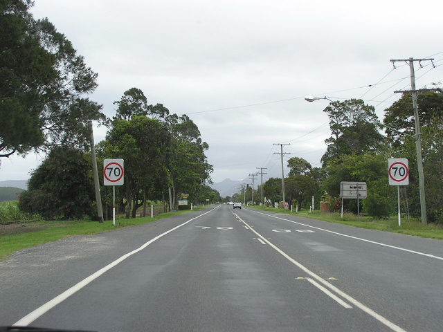
This distance sign, heading south from Mistral Rd at South Murwillumbah, has been coverplated - it used to say NR1/Pacific Hwy. Nov 2005. |
 |
Looking south through South Murwillumbah. Nov 2005. |
 |
Shockingly-designed sig southbound on Tweed Valley Way approaching Wollumbin St - the bridge across the Tweed River into Murwillumbah town centre. Nov 2005. |
 |
Tweed Valley Way distance sign heading north from Wollumbin St. Jan 2005. |
 |
Combination of new, council-designed signs and 1990s RTA-designed, coverplated signage looking north approaching Reserve Creek Rd. Jan 2005. |
 |
Looking south into the outskirts of Murwillumbah from Condong. Nov 2005. |
Southerly aerial view over the Tweed Valley Way from Cane Rd at Condong to Murwillumbah. You can see where McLeod St once was the highway in the bottom right corner of the photo. (DMR) |
|
Another southerly aerial view, this time of Condong. The original route of the highway (McLeod St) is clearly visible. (DMR) |
|
 |
Looking south along McLeod St at Cane Rd, Condong. McLeod Street is the original route of the Pacific Highway, bypassed by the current route of the Tweed Valley Way in 1980. |
 |
Looking south along McLeod St outside the Condong sugar refinery. Nov 2005. |
 |
Looking south along McLeod Street in Condong. Nov 2005. |
 |
Sigh, more dodgy signage northbound approaching Clothiers Creek Rd at Condong. Jan 2005. |
 |
Southbound AD (well designed, thank god!) sign for Clothiers Creek Rd at Condong. Nov 2005. |
 |
Heavy traffic looking south between Condong and Tumbulgum, with the Tweed River to the right. Ribbon development, the close proximity of the Tweed River and the difficult terrain south of Murwillumbah meant that upgrading the existing highway to dual carriageway standard was unfeasible. Nov 2005. |
 |
Looking south, at the southern end of the Tumbulgum deviation. Nov 2005. |
 |
Looking south along Riverside Dr (original route of Pacific Hwy) at Tumbulgum. Note the close proximity of the Tweed River to the original alignment of the Pacific Hwy. Nov 2005. |
 |
Looking south along Riverside Dr through Tumbulgum. Nov 2005. |
 |
Looking south between Tumbulgum and Cudgen Rd. Nov 2005. |
 |
Well-designed fingerboard sign at the rest area near Cudgen Rd. Jan 2005. |
 |
Coverplated NR1 AD sign at Cudgen Rd. Jan 2005. |
 |
Dual carriageways between Cudgen Rd and the Pacific Hwy. Jan 2005. |
 |
Distance sign for Tweed Valley Way heading south from Pacific Highway near Chinderah. Nov 2005. |