PACIFIC HIGHWAY
Section: Woolgoolga
Looking north approaching River Street at Woolgoolga. Nov 2005.
This 4km section of the Pacific Highway stretches from south of Bosworth Rd on the southern outskirts of Woolgoolga to south of the Safety Beach turnoff on the northern outskirts of Woolgoolga. Currently the highway along this section is a poor-quality single carriageway and carries in excess of 18,500 vpd.
On the north side of Woolgoolga, the Pacific Highway crosses Woolgoolga and Pound yard Creeks. The present bridges across these two creeks were completed by the Department of Main Roads in 1958 and 1959 and the 1956 Department of Main Roads Annual Report notes that “construction…has…commenced…of a deviation north of Woolgoolga to improve alignment in association with the construction of two new bridges.” I am not sure whether this is referring to bridges over Poundyard & Woolgoolga Creeks or to a deviation a little further north near the Safety Beach turnoff.
Originally, the Pacific Highway passed right through the commercial centre of Woolgoolga along River Street and Clarence Street . During the 1960s a short deviation involving a large cutting was constructed to shorten the length of the highway and avoid the centre of Woolgoolga. This deviation was gazetted as part of the highway on 7 May 1965 .
As part of the Pacific Highway Upgrading Programme, planning for an upgrade of the highway at Woolgoolga was commenced in September 2001. After investigating four different broad corridors, including upgrading the existing highway, a bypass of Woolgoolga was chosen as part of the preferred option in December 2004. The proposed bypass would leave the existing highway between Graham Drive and Bosworth Rd on the southern outskirts of Woolgoolga, passing to the west of Woolgoolga urban area and rejoin the existing highway at Arrawarra Creek, 5km north of Woolgoolga. Other options had included a shorter bypass of Woolgoolga, rejoining the highway at Bark Hut Rd near Safety Beach ; however this was rejected in favour of a longer bypass. According to the “What happens next” section of the Community Update No. 61 a concept design and Environmental Impact Statement should be in the process of being prepared now (December 2005).
|
Current route of Pacific Highway |
|
 |
Looking north into Woolgoolga. The original highway pavement (bypassed 1965) can be seen to the right of the current highway. Nov 2005. |
 |
Looking south from River St, showing the old highway pavement on the left of the highway. Nov 2005. |
 |
New northbound AD sign for Clarence St/Pullen St junction with a NR1 shield on a coverplate over an alpha-numeric route marker. Nov 2005. |
 |
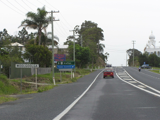
Distance sign heading north from Woolgoolga. Nov 2005. |
 |
Looking south near Woolgoolga High School, the original highway pavement can be seen on the left. I believe the realignment of this section of the highway was completed during the mid-to-late 1950s. Nov 2005. |
|
Old Pacific Hwy (River St & Clarence St) |
|
 |
Looking south along River St towards the Pacific Hwy. Nov 2005. |
 |
Looking south along River St in the commercial centre of Woolgoolga. Nov 2005. |
 |
Signage at the intersection of Clarence St, Beach St & River St. Nov 2005. |
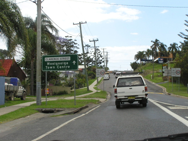 |
Looking along Clarence St into the town centre from the Pacific Hwy. Nov 2005. |
1. http://www.conwag.com/external/sapphire/pdfs/comm-update-nov04.pdf