PACIFIC HIGHWAY
Section: Ulmarra
Looking north into Ulmarra. Note the incorrect National Highway shield. Nov 2005.
This 11km section of the Pacific Highway stretches from the northern end of the Swan Creek deviation at Wyatt Straight, through Ulmarra to the southern end of the Cowper Deviation. It is currently single carriageway with no overtaking lanes and passes through the town centre of Ulmarra.
Upon gazettal in August 1928, State Highway No. 10 passed through Ulmarra along River Street . In 1929 the Main Roads Board decided that, as part of the construction of the highway in cement concrete, the highway would be relocated one block to the east through Ulmarra for a number of reasons. These included improved flood immunity, freeing up of the waterfront land for other uses and more room to widen the highway in the future. The relocation at Ulmarra was completed in 1933 but it wasn’t until 1939 that construction of the highway in cement concrete through Ulmarra Shire was completed.
For many years the Pacific Highway remained at its original width, with the original cement concrete surface through and around Ulmarra. During 2001 the State Government funded a $3.5 million project to upgrade the rough surface of the existing concrete pavement and make minor improvements to the Coldstream Street intersection as an interim measure until a bypass could be built.
A $29 million, 4.8km single-carriageway bypass of Ulmarra was to be constructed towards the end of the ten-year Pacific Highway Upgrading Programme (2006) but this was put on hold in November 2004 when planning commenced for a more comprehensive upgrade of the highway between Wells Crossing and Mororo. The bypass will be constructed (ultimately to dual carriageway standard) if the westernmost route option is selected, however it is more likely that a central or eastern route will be chosen, in which case a bypass of Ulmarra will no longer be required. A decision on the preferred route is expected in December 2005.
 |
Looking north, 4km south of Ulmarra town centre. The Clarence River can be seen to the left of the highway. Nov 2005. |
 |
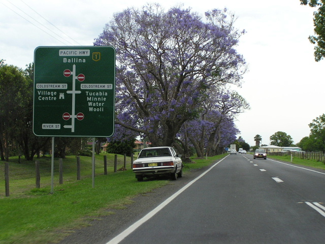
Looking north into Ulmarra - a historic river port (according to the sign). To the left is River Street - the original alignment of State Highway No. 10 (it predates the Pacific Highway naming). The current alignment through Ulmarra was constructed between 1929 and 1933. Nov 2005. |
 |
Looking north through Ulmarra. Nov 2005. |
 |
Looking north just north of Ulmarra. Note how the highway is sandwiched between the river extensive ribbon development. Nov 2005. |