PACIFIC HIGHWAY
Section: Telegraph Point
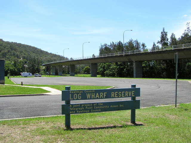
The bridge over the Wilson River and North Coast Railway, as viewed from Log Wharf Reserve on the southern side of the river. Nov 2005.
This section of the Pacific Highway is approximately 6km long, stretching from Pembrooke Road to Cooperabung Drive at Telegraph Point.
Since gazettal in 1928 the Pacific Highway has always passed through the small village of Telegraph Point, located on the banks of the Wilson River . However, the current alignment is different to that gazetted in 1928.
The first bridge over the Wilson River was a combination iron truss, timber truss and timber beam structure with a lift span and a carriageway width of only 4.3m. It had been constructed by the Department of Public Works between September 1900 and April 1902, opening to traffic on the 9 th day of that month. The highway passed through the area via what is now Moonee Street (a parallel service road on the western side of the existing highway, south of the river), a railway level crossing on the northern bank of the river, and via portions of what is now Rollands Plains Road and Cooperabung Drive . The bridge was located on a poor alignment and congestion caused by the single-lane bridge was compounded by the need for traffic to queue on the northern side of the bridge to allow numerous trains to cross the highway. Furthermore, while the bridge itself was above flood level, the southern approach was subject to regular flooding.
Partially aided by funds from the Joint Level Crossings Elimination Fund, the Department of Main Roads began construction on a 6km deviation, which included a 555m long, high-level bridge over the Wilson River and North Coast Railway line, in the early 1970s. The new alignment for the highway was 400m shorter than the original highway and would provide a flood-free bypass of Telegraph Point as well as eliminating the railway crossing. Constructed to motorway standards, the single carriageway deviation was opened to traffic on 17 April 1974 . The old bridge over the Wilson River was subsequently demolished as it was nearing the end of its useful life.
Since then, the alignment of the highway has remained static at Telegraph Point. However, as part of the Oxley Highway to Kempsey Upgrade project, the existing single carriageway highway is set to be either duplicated through Telegraph Point or relocated to the east of town. The project is currently in the route development phase and a preferred route has not yet been established. No construction timeframe has been set, but it is likely to have a long construction period to allow the soft soils of the Wilson River floodplain to settle before the road base can be laid.
Current route of Pacific Highway |
|
 |
Distance sign heading south from Pembrooke Rd. Nov 2005. |
 |
Looking south approaching Pembrooke Rd. Until the opening of Dennis Bridge over the Hastings River, Pembrooke Rd was a popular route for through traffic to bypass the Blackmans Pt Ferry and the Port Macquarie urban area. Nov 2005. |
 |
Looking south over the old single-lane bridge over the Wilson River with construction of the current bridge underway in 1973. (DMR) |
 |
Signage at the access road into Telegraph Point from the Pacific Highway. Nov 2005. |
 |
Looking south into Telegraph Point. The overpass in the foreground carries the current route of the highway over the original route of the highway - Cooperabung Drive. Aug 2004. |
|
Moonee Street (Pacific Hwy on south side of river from 1928 to 1974) |
|
 |
Moonee St looking south from Pembrooke Rd. Just by looking at the road you get the feeling it would be subject to flooding. Nov 2005. |
 |
Moonee St a little further south. Note the dual carriageway (or is it a single carriageway with service road?) setup. Nov 2005. |
 |
Looking north from Pembrooke Rd. You can see the current (flood-free) route of the highway built up on the right of the old, flood-prone route. Nov 2005. |
|
Cooperabung Dr & Rollands Plains Rd (Pacific Hwy on north side of river from 1928 to 1974) |
|
 |
Looking south along Cooperabung Drive towards the connection with Pacific Hwy. Nov 2005. |
 |
Looking south along what is now Rollands Plains Rd past the general store and pub on the north side of the river. The current Pacifc Hwy bridge is in the background. Nov 2005. |
 |
Looking south along Cooperabung Dr under the current route of the Pacific Hwy. Nov 2005. |