PACIFIC HIGHWAY
Section: Taree to Coopernook
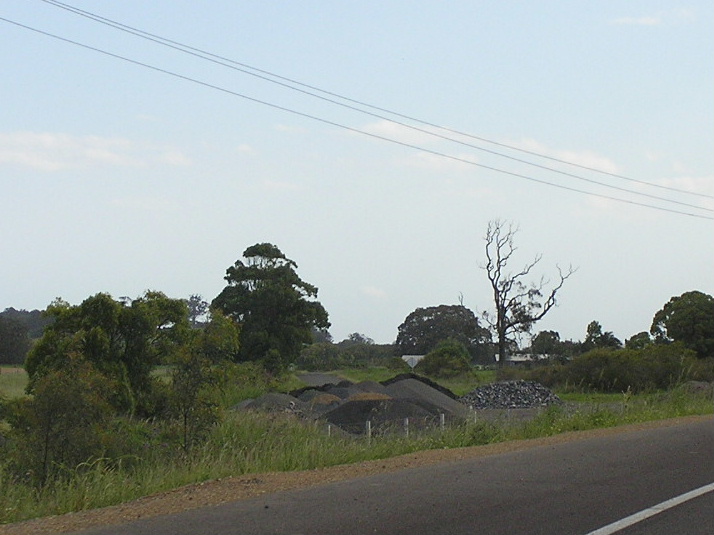
Looking north on Jones Island, north of Croki.
This section of Pacific Highway stretches from the northern end of the Taree Bypass at Cundletown to the southern end of the future Coopernook Bypass near Lansdowne River. A large portion of this section of the highway is located upon Jones Island , which is surrounded by Ghinni Ghinni Creek, Lansdowne River and the Manning River. Originally, a large number of right-angle bends had confronted motorists along this section as the highway followed the boundaries of agricultural properties on the floodplain. These corners have since been smoothed and thus there are small sections of abandoned highway pavement scattered across the island.
The first major work on this section of the highway came in 1957 when the Department of Main Roads noted in its Annual Report that “reconstruction of one major and several minor deviations on a length of 3 miles between Gill’s Lane, 10 miles north of Taree, and the Lansdowne River at Coopernook, was in hand.” This work involved the 1km deviation at the locality of Croki and was completed in 1958.
Five years later, in 1963, a new bridge over Ghinni Ghinni Creek was constructed on a new alignment to the north of the existing highway. This work also involved the smoothing out of a right-angle bend just west of the bridge as part of a 700m realignment.
As part of the broader Pacific Highway Upgrading Programme that was commenced in September 1996, this section of the highway was upgraded to dual carriageway standards. Work commenced in November 2001 on the earthworks and drainage, which are the most important part of the project - the land over which the highway passes is extremely swampy and must be stabilized before construction of the road base could begin. It was decided that the existing alignment of the highway would be maintained as far as possible, with the elimination of dips and curves, to ensure minimal disturbance to local dairying properties. Included as part of the project were two stock underpasses, two new bridges over Ghinni Ghinni Creek, and a number of culvert openings, which will ensure “at least one lane remains open in each direction during a 1 in 20 flood event.”1 After an extensive stablisation period, the Taree to Coopernook upgrade was opened to traffic on 4 August 2005 . The steel truss bridge over Ghinni Ghinni Creek was demolished following completion of the new road.
 |
Looking north at the northern end of the Taree Bypass, showing traffic merging to one lane due to construction of the Taree-Coopernook Upgrade. Aug 2004. |
 |
Traffic experiencing a "short delay" as advised by the sign during construction of the Taree-Coopernook Upgrade. Aug 2004. |
 |
Looking north to the bridge over Ghinni Ghinni Creek - on the left is a section of remnant pavement left over from the realignment and duplication of the highway in 2005. Source: Patrick McKendry, August 2006. |
 |
Looking northeast towards the bridge over Ghinni Ghinni Creek - built in 1963. This bridge has been demolished following the construction of two new bridges just to the north of the old bridge (as shown in pic) in 2005. Aug 2004. |
 |
The old bridge over Ghinni Ghinni Creek, built in 1963. Aug 2004 |
 |
Looking south to Ghinni Ghinni Creek bridge, showing construction of the 2 new bridges just to the north of the old bridge. Aug 2004. |
 |
Looking south to the new (2005) twin bridges over Ghinni Ghinni Creek. The crane in the background is removing the piers of the old bridge from the creek bed. Nov 2005. |
 |
Looking north between Ghinni Ghinni Creek and Croki, showing road formation settling and awaiting surfacing. Aug 2004. |
 |
Looking north between Ghinni Ghinni Creek and Croki, showing completed realignment and duplication works. Source: Patrick McKendry, August 2006. |
 |
Looking south from Croki showing road formation settling and awaiting surfacing. Aug 2004. |
 |
Northbound AD signs for Croki Rd (Pacific Hwy from 1928 to 1958). Aug 2004. |
 |
The equivalent sign, installed upon opening of the Taree-Coopernook Upgrade in June 2005. Note the black coverplate over an alphanumeric route marker - quite why the coverplate doesnt have a NR1 shield is beyond me. Nov 2005. |
 |
New (2005) fingerboard signage at the intersection with Croki Rd. Note the blank coverplate over an alpha-numeric route marker. Nov 2005. |
 |
A view of the narrow pavement along Croki Rd (Pacific Hwy 1928-1958). Further ahead is a right-angle bend which was bypassed by a short deviation during 1957-58. Nov 2005. |
 |
Another view of the old highway alignment Croki. Nov 2005. |
 |
View of the old highway alignment at Croki, looking south. There is no access to the current highway from the old highway at this end. Nov 2005. |
 |
Looking north from Croki, showing the highway as it was before the upgrade was commenced in mid 2002. Oct 2001. |
 |
Looking south to Croki Road, showing completed duplication and realignment work. Source: Patrick McKendry, August 2006. |
 |
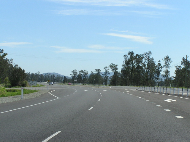
Looking north from Croki. Note the wire rope fencing which is becoming increasingly common on dual carriageways in NSW. Also note the low-lying terrain - the road has been constructed to ensure that at least one lane in each direction remains open to traffic during a 1 in 20 year flood event. Nov 2005. |
 |
The temporary end of the dual carriageways at the southern end of the Coopernook Bypass, which is due for completion in mid 2006. Nov 2005. |
1. Department of Transport and Regional Services; Roads of National Importance - Pacific Highway Upgrading Projects in New South Wales [Online]; Accessed: 5 November 2005 ; Available from: http://www.dotrs.gov.au/transprog/road/pac_hwy/nsw_proj.aspx
Last updated 26 January 2009 © Ozroads 2004-2009. |