PACIFIC HIGHWAY
Section: Sapphire to Woolgoolga
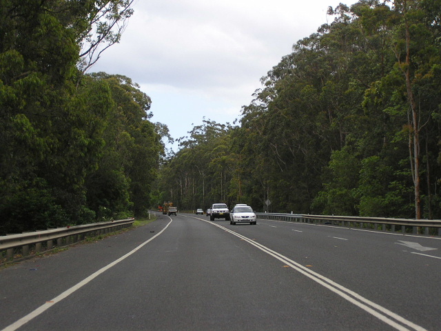
Looking south between Sapphire Beach and Moonee Beach. Nov 2005.
This 16km section of the Pacific Highway stretches from Pine Brush Creek at the northern end of Korora Deviation to the Bosworth Road on the southern outskirts of Woolgoolga. The present highway is currently single carriageway (except for a short section at the southern end), constructed to motorway standards and declared a motorway. Extensive reconstruction and realignment through the 1960s and 1970s has meant that the current route is of a high-standard but nearing its capacity as a two-lane, undivided road, carrying in excess of 20,000 vpd between Sapphire and Moonee.
The original (1928) gazetted route of the highway was greatly different to today’s alignment. In 1929, almost immediately after the declaration of State Highway No. 10 and prior to its naming as the Pacific Highway, the Main Roads Board commenced construction of a 2.9 mile long deviation, known as the “Korora Deviation” (although this name is now used to refer to the deviation at Korora Hill, constructed 1969-71) which would bypass what is now “Old Coast Rd”. Constructed in water-bound macadam (a style of unsealed construction pioneered by John Macadam in the 1800s) with two timber bridges, the deviation was opened to traffic in 1932. Prior to World War 2 the deviation was provided with a dust-free surface, as part of the progressive sealing of the highway.
During 1970 the length of the highway between Coffs Harbour and Grafton was proclaimed a motorway under section 27b of the Main Roads Act. Basically what this entails is that the land is now under the control of the Commissioner of Main Roads (now the Chief Executive Officer of the RTA) and access to the motorway is limited to specific points. In 1970 these specific points were generally limited to one access per lot or portion of land.
A reconstruction programme followed, stretching from Korora Hill to the junction of the highway and Bucca Road, north of Moonee Beach . A new bridge over Cunningham’s Creek near the Moonee Beach turnoff (old alignment now Hoys Rd) was completed in 1966, followed by a bridge over Skinners Creek, just north of Bucca Road, in 1969. The remainder of the work south of Bucca Road was completed to single carriageway motorway-standard road by the end of 1971. Sufficient land was acquired to permit the construction of a duplicate carriageway for southbound traffic on the eastern side of the highway in the future.
At Sandy Beach, a 2km deviation was constructed to the east of the existing highway ( Graham Drive ) and an overpass provided to link the east and west sides of Sandy Beach. According to the plate on the bridge, the bridge was completed in 1976. However, Department of Main Roads’ Annual Reports also mention a “Double Crossing Creek Deviation” which is located 19-24km north of Coffs Harbour , constructed between 1978 and 1980. This refers to the actual deviation, so it appears the bridge was completed some time before construction of the actual deviation was commenced.
Since the completion of the motorway-standard single carriageway road it has performed well under increasing traffic volumes, however it is nearing capacity. Planning for an upgrade of the highway between Coffs Harbour and Woolgoolga commenced in September 2001 with four broad corridors selected for further investigation - three western bypasses and one option of upgrading the existing highway. Since then, Coffs Harbour City Council requested the RTA to consider options along its preferred corridor, passing to the west of the coastal range between Coffs Harbour and Arrawarra. The proposal, known as Coastal Ridge Way , was rejected on economic and environmental grounds in June 2004. A preferred route was released for public comment in December 2004 and since then little public progress has been made. The preferred option will upgrade the existing highway - to eight lanes in some sections - between Sapphire and Woolgoolga, with grade-separated interchanges at the major turnoffs. Most other intersections will be restricted to left-in-left-out movements with some seagull intersections included. These will be upgraded to interchanges when the need arises. According to the “What happens next” section of the Community Update No. 61 a concept design and Environmental Impact Statement should be in the process of being prepared now (December 2005).
Update (November 2010): The upgrade between Sapphire and Woolgoolga has commenced. Completion is due in 2014.
Current route of Pacific Highway |
|
 |
Looking south outside Aqualina Resort towards the Korora Deviation and Coffs Harbour. Nov 2005. |
 |
Looking north at the same location. Nov 2005. |
 |
Looking south at the beginning of the dual carriageways at Sapphire. Nov 2005. |
 |
Northbound AD sign for Headland Rd, which is the turnoff for Sapphire Beach. Nov 2005. |
 |
Looking south approaching Split Solitary Rd. Nov 2005. |
 |
Looking south across Cunninghams Creek to the Moonee Beach turnoff. Nov 2005. |
 |
Looking south approaching Cunninghams Creek. To the right is the old alignment of the highway across Cunninghams Creek - Hoys Rd. Nov 2005. |
 |
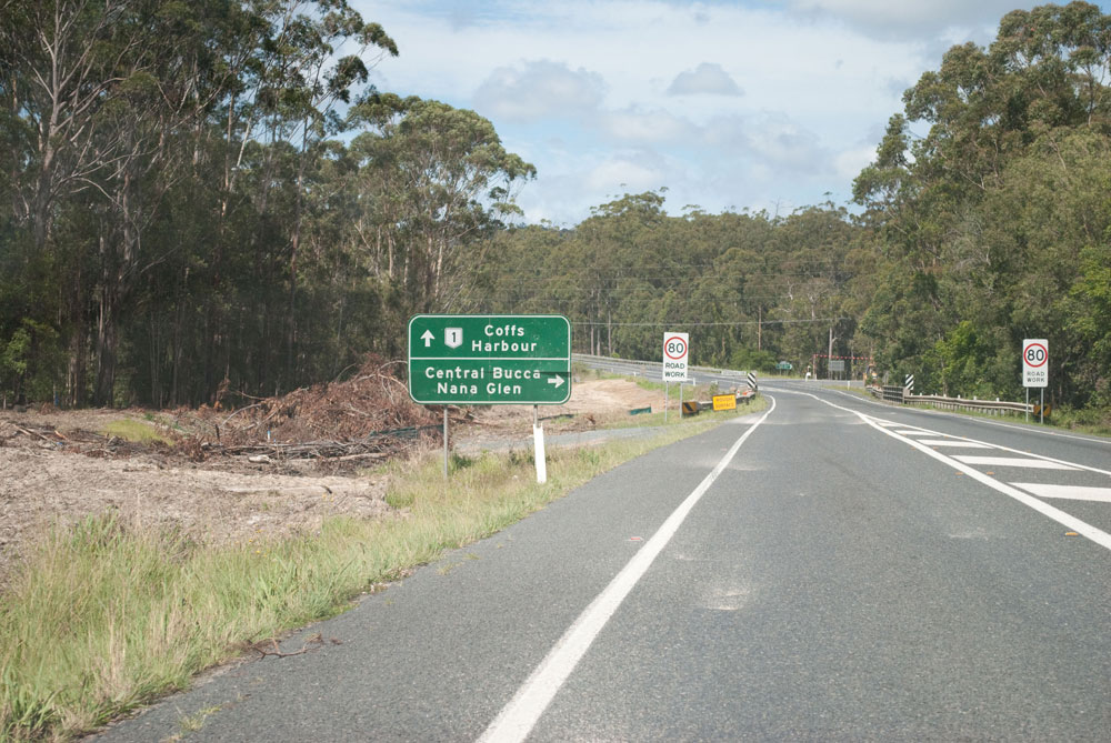
Northbound AD sign for Bucca Rd. Nov 2005. |
 |
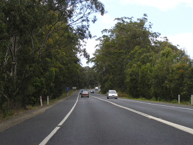
Looking north between Bucca Rd and Emerald Beach. Nov 2005. |
 |
Northbound AD approaching Fiddaman Rd. Nov 2005. |
 |
Looking south between Emerald Beach and Sandy Beach. Nov 2005. |
 |
Fingerboad sign at the junction with Graham Dr (south). Nov 2005. |
 |
Looking north along the Double Crossing Creek deviation. Nov 2005. |
 |
Looking south from the Diamond Head Dr overpass at Sandy Beach. Nov 2005. |
 |
Another northbound view, this time approaching the northern end of the deviation at Double Crossing Creek. Nov 2005. |
 |
Looking south between Graham Dr (north) and Bosworth Rd (Woolgoolga). Nov 2005. |
|
Old Pacific Highway (Graham Dr) |
|
 |
Fingerboard sign indicating Graham Dr was once the Pacific Hwy. At the intersection with Diamond Head Rd, Sandy Beach. Nov 2005. |
 |
Looking south along Graham Dr, south of Diamond Head Dr. Nov 2005. |
 |
Looking south along Graham Drive at Sandy Beach Public School. Nov 2005. |
 |
Looking south along Graham Dr near Double Crossing Creek. Nov 2005. |
Construction photos of the Sapphire to Woolgoolga Upgrade |
|
November 2010 (photos taken in the southbound direction) |
|
 |
Looking south approximately 600m north of Smiths Road, Emerald Beach. Source: Pete Ianetta, November 2010. |
 |
Looking south at Smiths Road, Emerald Beach. Source: Pete Ianetta, November 2010. |
 |
Looking south between Smiths Road and Bucca Road, Emerald Beach. Source: Pete Ianetta, November 2010. |
 |
Clearning underway for construction of the new southbound carriageway between Smiths Road and Bucca Road, Emerald Beach. Source: Pete Ianetta, November 2010. |
 |
Looking south approaching the Bucca Road intersection and bridge over Skinners Creek. Source: Pete Ianetta, November 2010. |
 |
Looking south to the bridge over Cunninghams Creek, Moonee Beach. Source: Pete Ianetta, November 2010. |
 |
Looking south, showing clearing works, near Gaudrons Road, Sapphire. Source: Pete Ianetta, November 2010. |
1.http://www.conwag.com/external/sapphire/pdfs/comm-update-nov04.pdf
Last updated 27 November 2010 © Ozroads 2004-2010. |