PACIFIC HIGHWAY
Section: Raymond Terrace to Karuah

Raymond Terrace-Karuah Duplication project sign, heading north near Grahamstown Dam. Dec 2003.
This 18.2km section of the Pacific Highway stretches from the northern end of the Raymond Terrace Bypass at Rees James Road to the southern end of the Karuah Bypass at Swan Bay Road. It has been constructed to dual carriageway standard with at-grade intersections.
The alignment of the highway as proclaimed on 7 August 1928, headed north from Raymond Terrace along what is now Rangers Road. From the current terminus of Rangers Road, the original alignment headed approximately due north – just east of the current alignment but following lower ground, rejoining the current highway alignment just south of Seven Mile Creek. At Twelve Mile Creek, the 1928 route of the highway left the existing highway, following what is now Bucketts Way via Booral, Stroud, Gloucester and Krambach to Purfleet, just south of Taree.
The first significant alignment change came on 22 August 1952 when the Pacific Highway was redeclared on a new alignment between Twelve Mile Creek and Purfleet. This new alignment took the highway through Karuah, Bulahdelah and Nabiac, serving areas distant from the North Coast rail line. However, due to the need to bridge the Karuah River and the poor quality of existing roads between Karuah and Bulahdelah the Department of Main Roads decided to seal the Booral-Bulahdelah road (then Main Road No. 110), allowing highway traffic to use the Bulahdelah-Purfleet section of the new highway alignment sooner. By 1960 the Department of Main Roads had completed reconstruction of the highway between Twelve Mile Creek and Bulahdelah; however it was not until 24 December 1963 that this portion of the highway was officially opened to traffic. The old alignment of Bucketts Way is still trafficable, although today there are no obvious clues that this was once part of the Pacific Highway.
The expansion of Grahamstown Dam by the Hunter District Water Board in the late 1960s necessitated the relocation of the Pacific Highway onto higher ground. Thus, in July 1968 a deviation approximately 4km long was opened to traffic, providing a flood-free alignment less than 100m west of the original route. Part of the old highway is now Rangers Road – trafficable for less than 1km northwards from Raymond Terrace before it ends abruptly at the boundary of Hunter Water land surrounding Grahamstown Dam. There is a track leading north from the boundary fence, however in times of good rain the highway is inundated by the waters of the dam. Reconstruction of the spillway during 2005-06 obliterated any trace of the old highway pavement at this location.
Between 1973 and 1973 a 5.5km realignment of the highway was carried out from Balickera Channel to Twelve Mile Creek. This is covered in more depth in the highway archaeology section below.
Duplication of the highway between Raymond Terrace and Karuah was commenced in August 1998 and involved a straight-forward duplication of the highway along the existing alignment. A new northbound carriageway was constructed on the western side of the existing highway which was reconstructed in cement concrete to form the southbound carriageway. The duplication project was completed in December 2000.
For a more in depth look at the history of this section of Pacific Highway follow the links below.
Highway Archaeology:
Raymond Terrace to Grahamstown Dam
Grahamstown Dam deviation
Grahamstown Dam deviation to Balickera Channel
Balickera Channel to Twelve Mile Creek
Twelve Mile Creek bridge and approaches
|
Photos of Pacific Highway - Raymond Terrace to Karuah |
|
 |
Looking south 3km north of Richardson Rd. Behind the road is Grahamstown Dam. Dec 2003. |
A view of the Grahamstown Dam deviation prior to its duplication in about 1988. (DMR) |
|
 |
The only remaining trafficable section of the former route of the Pacific Highway which is now largely submerged under Grahamstown Dam - Rangers Rd. Oct 2005. |
 |
Looking north along what, until 1968, was the Pacific Hwy and is now a track leading into Hunter Water land at the end of Rangers Road. Oct 2005. |
 |
Looking north at Italia Rd on a very wet day. Aug 2004. |
 |
Looking south this time. Aug 2004. |
 |
Northbound AD sign for Medowie Road (former SR121). Oct 2004. |
 |
Southbound AD sign for Medowie Rd (former SR121). Oct 2004. |
 |
Distance sign heading north from Medowie Road with the Twelve Mile Hill rest area and heavy vehicle checking station in the background. Oct 2004. |
 |
Twelve Mill Hill before the Raymond Terrace-Karuah Upgrade. (Shayne Kerr) |
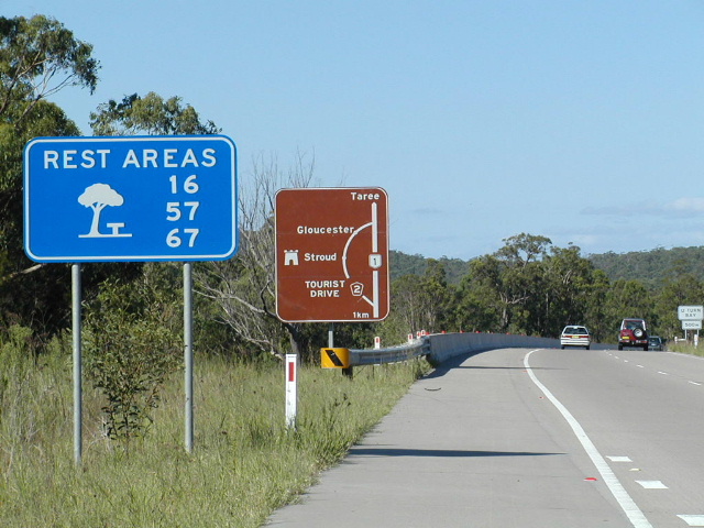 |
Signage northbound approaching Bucketts Way - the route of the Pacific Hwy until 1952. Oct 2004. |
 |
Distance sign heading south from Bucketts Way junction. Aug 2004. |
 |
Northbound AD signs for Bucketts Way. Oct 2004. |
 |
Looking west at the Bucketts Way intersection prior to upgrading. (Shayne Kerr) |
 |
Looking east between Bucketts Way and Swan Bay Rd (west end of Karuah Bypass). Aug 2004. |
Last updated 24 December 2012 © Ozroads 2003-2012. |