PACIFIC HIGHWAY
Section: Raleigh/Repton
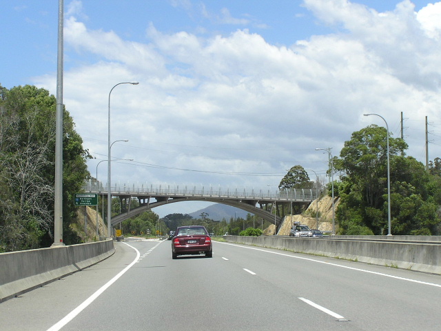
Looking south at the interchange with Waterfall Way. Nov 2005.
This section of the Pacific Highway is 6km long, stretching from the southern end of the Raleigh Deviation at Short Cut Rd to the northern end of the same deviation near Perrys Rd. Constructed during the period 1995-1998, the Raleigh Deviation is mostly dual carriageway, however short sections near either end of the deviation are only single carriageway. These short sections of single carriageway are likely to be replaced or significantly altered during construction of the Macksville-Urunga and Bonville Upgrades.
On 7 August 1928 , when State Highway No. 10 ( Pacific Hwy ) was declared a state highway, its route passed through the small villages of Raleigh and Repton.
Beginning at Short Cut Rd , the highway followed what is now “ Old Pacific Highway ” on the eastern side of the current highway, crossing the Bellinger River by punt between the villages of Raleigh and Repton. Bridging the Bellinger River was considered a priority for unemployment relief works during the Depression, and construction of a two-lane steel truss bridge was commenced in 1933. A site was selected about 1km upstream from the punt crossing, where the river was narrowest and flood-free approaches could be constructed as well as eliminating two crossings of the North Coast Railway. The steel box-girder bridge was built by the Department of Main Roads and opened to traffic in November 1935. Thus, the Pacific Highway was re-routed from its original route through Raleigh of Queen Street and Old Ferry Rd , to a route hugging the western bank of the Bellinger River (Old Pacific Hwy & Mylestom Drive).
Following World War 2, the Department of Main Roads immediately began an extensive upgrade of the Pacific Highway between Raleigh and Coffs Harbour , including several deviations and the provision of a bitumen surface. Included in this work was a deviation around the village of Repton , which would shorten the length of the highway by 1km and improve its flood immunity. This deviation was opened in June 1950 and replaced the route of the highway, along what is now Mylestom Drive , Repton Rd , Old Coast Rd and Overhead Bridge Rd , which had poor alignment and steep grades, especially on the climb from the banks of the Bellinger River into Repton.
For forty-five years the alignment of the highway in this area remained unchanged, however increasing traffic volumes and the increasing size of heavy vehicles took its toll on the section through Raleigh . As well as being subject to flooding along the western bank of the Bellinger River , the Raleigh Bridge had become too narrow for two heavy vehicles to pass each other. This had resulted in traffic delays as trucks had no option but to stop and wait for other trucks to pass across the bridge, holding up traffic. This problem was exacerbated by right-angle bends on both approaches.
The Department of Main Roads, and subsequently the Roads and Traffic Authority, had been investigating options for a new bridge over the Bellinger River and relocation of the highway for some time but it wasn’t until the launch of the Greiner Government’s five-year Pacific Highway upgrading programme in the early 1990s that the project really got off the ground. A line to the west of the existing highway was selected, which would involve 2 large cuttings and an extensive length of embankment to provide a satisfactory alignment and ensure the highway would be immune from floods. As part of the project a graceful 52m long arch bridge was constructed to carry Waterfall Way (SR78) across the relocated highway, just south of Raleigh .
Work commenced on the 8.1km deviation (including duplication of the highway between Short Cut Rd and the Kalang River ) in January 1995 and the injection of Federal Government funds in September 1996 allowed the project to be expanded from two to four lanes, including an additional 280m bridge over the Bellinger River . At a cost of $73.5 million, the Raleigh Deviation was opened to traffic in September 1998.
Current route of Pacific Highway |
|
 |
Looking north at the beginning of the Raleigh Deviation - the original route of the highway can be seen branching off the right. Aug 2004. |
 |
Looking south to the end of the Raleigh Deviation - the divided carriageway in the photo was constructed as part of the deviation project, but did not involve and relocation of the highway. Aug 2004. |
 |
Distance sign heading south from Waterfall Way. There is a short (~500m) section of single carriageway just south of Waterfall Way which I believe was not duplicated as it is the likely interchange point for a bypass of Urunga as part of the Macksville-Urunga Upgrade. Aug 2004. |
 |
Unusual design for this AD sign westbound on Waterfall Way approaching the Pacific Hwy. Aug 2004. |
 |
Signage pointing to the Pacific Hwy from Old Pacific Hwy at Waterfall Way. Aug 2004. |
 |
Distance sign heading north from Waterfall Way. Nov 2005. |
 |
Heading south approaching Waterfall Way. Nov 2005. |
 |
Looking north across Man Arm Creek. Nov 2005. |
 |
Looking south at the northern end of the Raleigh Deviation. Aug 2004. |
 |
Heading south approaching the northern end of the Raleigh Deviation. Nov 2005. |
|
Old Pacific Highway (includes Mylestom Dr, Repton Rd, Old Coast Rd & Overhead Bridge Rd) |
|
 |
Old Pacific Highway signage at the junction with Waterfall Way. Aug 2004. |
 |
Looking north approaching the turn for the bridge over the Bellinger River. Note the remnant Pacific Hwy/NR1 sign. Aug 2004. |
 |
Remnant Pacific Hwy/NR1 sign at the same intersection. Aug 2004. |
 |
Looking east (south) across the Raleigh Bridge over the Bellinger River. Should have got a side-on picture of the bridge, but I didn't :-( Aug 2004. |
 |
National Route 1 fingerboard sign still remaining at Valery Rd. Aug 2004. |
 |
Looking south alongside the Bellinger River. Aug 2004. |
 |
Looking south approaching Valery Rd. Note the "subject to flooding" signs. Aug 2004. |
 |
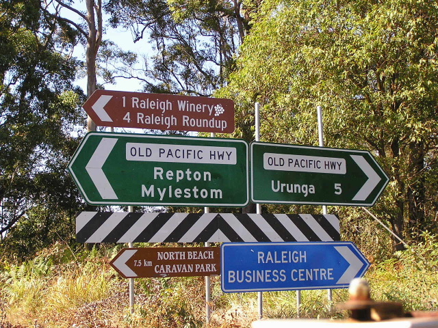
Fingerboard signs at the junction with Mylestom Dr. Between 1935 and 1950, the highway went along Mylestom Dr. Thence from 1950 to 1998 the highway went along what is called "Old Pacific Hwy". Aug 2004. |
 |
NR1 AD sign southbound approaching Mylestom Dr. Aug 2004. |