PACIFIC HIGHWAY
National Route 1 Section: Hexham to Tugun
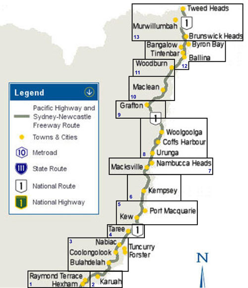 |
Welcome to the interactive map for the Pacific Highway - from Hexham to Tugun. Click on an area of the map to the left of screen to go to a detailed map of the Pacific Highway, showing current route, former alignments as well as construction information. From the more detailed maps, you can progress to photos and information on each section of the Pacific Highway. Also, clicking on each section of roadway in the maps leads to an information page. Enjoy!
NOTES FOR VIEWING DETAILED MAPS OTT: Open To Traffic Some of the maps may take a few minutes to load (note: some flash maps are around 500 KB). It may appear nothing has loaded, but please be patient. |
Base map supplied courtesy of Paul Rands. Changes courtesy of Viseth Uch. |