PACIFIC HIGHWAY
Section: Macksville
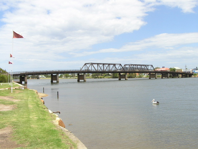
View of the Macksville bridge over the Nambucca River from Ferry St. Nov 2005.
This section of the highway stretches from the junction of Pacific Highway and Wallace Street, approximately 2.5km south of Macksville town centre to the junction of the highway and Nursery Rd (east), approximately 4km east of Macksville town centre, covering the highway through the town of Macksville.
The original gazetted route of the highway was via what is now Wallace Street , Princess Street , ferry over the Nambucca River , thence along Bellevue Dr and Nursery Rd to rejoin the current alignment of the highway. This route was made official in the Government Gazette of 7 August 1928 .
The first alignment change came soon afterwards when it was decided that construction of a bridge over the Nambucca River would proceed as a unemployment relief work. The present ferry crossing was located at the northern end of Princess Street and was the scene of considerable congestion, even in the 1920s.
Several possible bridge sites were investigated, with those adjacent to the railway bridge rejected because of the need to also bridge Tilly Willy Creek and the relatively circuitous route needed to reach the bridge. By agreeing with a local businessman to demolish and existing wharf at the end of Cooper Street , a suitable, central location was found for the bridge and it would have a southern approach via Wallace, Bent (now part of Wallace St ) and Cooper Streets. On the northern side, a T-junction would allow travelers to either head left to Bowraville and Bellingen or turn right and remain on the highway for the trip to Nambucca Heads and Coffs Harbour . Construction of the bridge was commenced in 1929 and it was officially opened on 12 December 1931 .
For many years after opening of the bridge, the highway took a circuitous 3.3km route via Wallace Street southerly towards the bridge over Warrell Creek - a further 3km south. This alignment of the highway was characterized by steep grades, numerous curves and conflict with local traffic caused by the highway passing through the centre of town. Thus, in 1965 the Department of Main Roads completed construction of a 2 mile deviation which extended Cooper Street southerly on an almost straight alignment towards Warrell Creek. The deviation was constructed to motorway standards and it was proposed that one day it would be duplicated, to provide a four-lane motorway standard approach to Macksville. However, it is unlikely this will ever eventuate.
On the north side of the river, the sharp turn to enter and exit the bridge on the Pacific Highway was a notable trouble spot, as was an old single-lane timber bridge over Newee Creek, located approximately 2km east of Macksville, which had been in service since 1911. Replacement of the bridge, located along the line of today’s Bellevue Drive and Nursery Rd , had been delayed by numerous proposals over the years to dam Newee Creek and relocate the highway on top of the dam wall. When these proposals fell through, the Department of Main Roads commenced investigations on the most suitable line for a new bridge. Keeping in mind the future requirements for dual carriageway construction, it was anticipated that a future crossing of the Nambucca River would most-likely be located midway between the existing highway bridge and Newee Creek. Thus, the bridge site was selected 300m upstream on a deviation of a the highway that would be likely to serve future plans. To avoid a repeat of ribbon development that littered the old route of the highway, the new 3.2km route was declared a motorway. The bridge and deviation were officially opened on 25 June 1974 and the old bridge was demolished soon afterwards - to be replaced with a pedestrian suspension bridge some years later.
As part of the Pacific Highway Upgrading Programme, planning commenced in June 2003 for a new route of the highway between Warrell Creek and Urunga, including through or around Macksville. After initially only considering potential locations for an eastern bypass of Macksville, the study area was expanded to include possible western bypasses of Macksville. In December 2005 the preferred route was announced, bypassing Macksville to the east before following Old Coast Rd along the ridgeline to north of Nambucca Heads. It is on public exhibition until the end of January 2006 when the design of the project will be refined and an Environmental Impact Assessment is likely to begin by mid-2006.
Current route of Pacific Highway |
|
 |
The motorway-standard southern approach to Macksville. Nov 2005. |
 |
Southbound distance sign leaving Macksville. Nov 2005. |
 |
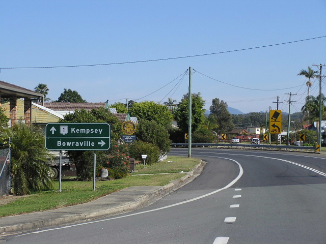
Looking south at Boundary St. Nov 2005. |
 |
Looking south at a rare traffic-free moment in Macksville town centre. Nov 2005. |
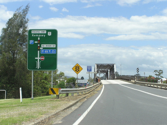 |
Unusual diagrammatic AD sign southbound approaching the Nambucca River bridge. Nov 2005. |
 |
Looking west towards Ferry St. Note the 45km/h curve where highway traffic turn south onto the bridge over the Nambucca River - this was improved from an even tighter curve in the 1970s. Nov 2005. |
 |
Distance sign leaving Macksville northbound. Nov 2005. |
 |
The bridge over Newee Creek as viewed from the site of the old single-lane timber bridge. Nov 2005. |
Opening day of the Newee Creek Deviation - 25 June 1971. (DMR) |
|
|
Old Pacific Highway (Wallace St, Bellevue Dr & Nursery Rd) |
|
 |
Wallace St looking west between Pacific Hwy and Princess St. Nov 2005. |
 |
Wallace St looking east to Princess St. From 1928 to December 1931 the Pacific Hwy turned north here onto Princess St. Thence until 1965 the Pacific Hwy continued east along Wallace St (formerly Bent St), then turned north into Cooper St. Nov 2005. |
Typical view of the old highway (Nursery Rd) east of Newee Creek. Nov 2005. |
|