PACIFIC HIGHWAY
Section: Herons Creek
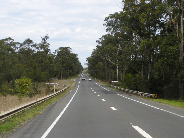
Looking south to Walkers Creek. Aug 2004.
The Pacific Highway currently bypasses the tiny hamlet of Herons Creek, located about 5km north of Kew . However, the original route of the highway saw it traversing what is now Herons Creek Rd , crossing the North Coast Railway in two locations - one via a timber bridge 3km south of Herons Creek and another via a subway on the northern side of the village which is susceptible to flooding and located on a 90° angle to highway. After crossing the railway line a second time, the highway turned north onto what is now Banks Rd to cross Herons Creek and its flood channel on timber bridges.
Construction of a deviation to eliminate these two was any early project and the Department of Main Roads’ 1939 Annual Report notes “between Kew and Herons Creek, a distance of about 4.5 miles, a deviation has been constructed which eliminates a railway overbridge, a subway, and a considerable length of old road with bad alignment. The new section which has excellent alignment and grading will shortly be opened to traffic with the exception of a short length on the northern end where two concrete bridges have yet to be constructed.” The deviation was opened to traffic in the latter half of 1939 and provided with a bitumen surface not long afterwards but it was not until 1963 that two steel and concrete bridges were constructed across Herons Creek and its flood channel, thus completing the deviation.
Apart from the construction of an overtaking lane for southbound traffic at the northern end of the project, the highway has remained in largely the same condition for nearly half a century.
As part of the broader Pacific Highway Upgrading Programme, planning for the duplication of the highway at Herons Creek began in October 2000. A preferred route, which would see a duplicate carriageway constructed on the east side of the existing highway at Herons Creek, was established by March 2002. An Environmental Impact Statement for the broader Moorland-Herons Creek project was exhibited during July and August 2005. The RTA is now considering community response to the EIS. No timeframe for construction has been released.
 |
Looking north at the junction with Herons Creek Rd (original route of Pacific Hwy). A good indication of how the original route branches off from the current route. Nov 2005. |
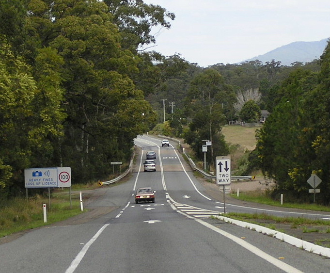 |
Looking south to the bridge over Herons Creek at the southern end of the dual carriageways that stretch for 19km northwards to the Oxley Highway junction. Aug 2004. |
 |
The ricketty old timber bridge over the North Coast Railway on the old route of the Pacific Highway. Not sure if this bridge is the same one that was bypassed in 1939. Nov 2005. |
 |
Typical section of the southern half of Herons Ck Rd (old Pacific Hwy). Note the former "open speed limit" signs that now mean the speed limit is 100km/h. Nov 2005. |
 |
Sign indicating Herons Ck Rd was once the Pacific Highway. Note the high standard bitumen construction, which lasts for only about 1km on the south side of Herons Creek township. Nov 2005. |
 |
Looking north along the old Pacific Hwy from the small cluster of houses that is Herons Ck township towards the rail subway that was bypassed in 1939. Nov 2005. |
 |
The rail subway, susceptible to flooding, which was bypassed by the 1939 deviation. The gravel road entering view from the right was also part of the Pacific Hwy, so you can see how the railway was crossed on a ninety-degree angle. Nov 2005. |