PACIFIC HIGHWAY
Section: Ewingsdale to Brunswick Heads
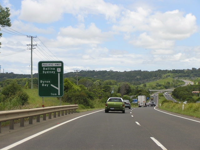
Looking south approaching the Ewingsdale Interchange. Jan 2005.
This 8km section of the highway stretches from the beginning of the dual carriageways just south of the Ewingsdale Interchange to the southern end of the Brunswick Heads Bypass. It incorporates the Pacific Highway Upgrading Programme projects: Ewinsgdale Interchange, Ewingsdale to Tyagarah and Tandy’s Lane.
Starting from the beginning - the original alignment of State Highway No. 10 (then known as North Coast Highway) as gazetted in 1928 headed east from Bangalow to Byron Bay, thence west via Ewingsdale Rd to Ewingsdale where it rejoined its northerly course to Tyagarah and beyond. On 29 May 1931 the definition of State Highway No. 10 was changed so that it took the direct road between Bangalow and Ewingsdale - via St Helena Hill. On this day the highway was also named Pacific Highway .
Between Ewingsdale and The Heath (a locality marked on my NRMA maps at the location of today’s southern Gulgan Road interchange) the route of the highway has remained largely unaltered, however there have been various realignments and minor deviations.
From The Heath, the Pacific Highway followed what is now Gulgan Road and Mullumbimby Road into Mullumbimby, crossing the Brunswick River via a timber bridge thence following Coolamon Scenic Drive to rejoin the current route of the Pacific Hwy near Billinudgel. On 9 March 1945 the route of the Pacific Highway was again altered, this time relocate the highway through Brunswick Heads rather than Mullumbimby. More information on the original route of the highway between Bangalow and Billinudgel can be found on the “Byron Bay/Mullumbimby” former alignment page.
Since the route change in 1931, the Pacific Highway has met Ewingsdale Rd at a four-way intersection near Ewingsdale Hall. With the growth of Byron Bay as a tourist destination - particularly for those from South East Queensland - the intersection soon became congested. With heavy through traffic in both directions, turning from Ewingsdale Rd into the Pacific Highway northbound could often take a very long time and impatient drivers would cause a number of minor and major crashes here over the years. From Ewingsdale to the Tyagarah, the highway alignment was across undulating terrain with many unnecessary curves and dips. At Tyagarah, the highway turned northwest to follow the railway for approximately 300m before crossing the railway line on a ninety-degree angle between Tyagarah Rd and Grays Lane . From there, the Pacific Highway headed due north to the heath, thence following today’s Gulgan Road to the northern end of the Tandy’s Lane project at the southern end of the Brunswick Heads Bypass. The alignment between The Heath and Brunswick Heads was particularly winding but escaped upgrading for many years because of its easy grades.
The first of the negatives of the aforementioned route to be eliminated was the railway level crossing at Tyagarah. The Department of Main Roads constructed an overpass on a much improved alignment during 1982 to replace the last level crossing on the Pacific Highway . Under the Pacific Highway Upgrading Programme, work commenced to upgrade the highway between Ewingsdale and Brunswick Heads. First to start was the Ewingsdale to Tyagarah Realignment, on which work began in late 1996. This project stretched from just north of the then proposed Ewingsdale Interchange to just north of the junction with Grays Lane at Tyagarah, and involved the construction of new twin bridges over Tyagarah Swamp and the duplication of existing bridges over the Casino-Murwillumbah railway line and Tyagarah Creek. The existing highway was retained as a local service road to the east of the new dual carriageways between Ewingsdale and Kennedys Lane . The project was opened to traffic on 10 October 1998 , except for the northernmost 1km of dual carriageway (including the bridges over Tyagarah Swamp and the railway line) which was opened later on as part of the Tandy’s Lane project.
The Ewingsdale Interchange project, construction of which was originally to have been commenced much later, was fast-tracked after a fatal crash occurred at the intersection in August 1997. Construction commenced in February 1999, involving the relocation of the highway to the west of its existing alignment to preserve several fig trees, Ewingsdale Hall and Ewingsdale Church. The interchange was opened to traffic on 4 September 2000 , however it wasn’t until December 2000 that traffic was able to the use the southernmost 1km of dual carriageway. The old highway has been retained north of Ewingsdale Rd as a service road known as Woodford Lane and south of Ewingsdale Rd as a local road with a cul-de-sac.
North from Tyagarah to the southern end of the Brunswick Heads Bypass is the Tandy’s Lane project. Consisting of 5.3km of dual carriageways on a new alignment, the project bypassed a winding section of the Pacific Highway which has since been renamed Gulgan Road . Grade-separated interchanges were constructed where Gulgan Rd meets the new highway at either end, the northernmost interchange replacing a roundabout that was constructed as part of the Brunswick Heads Bypass a few years earlier. Tandy’s Lane project was opened to traffic on 19 December 2001 , completed at a cost of $48 million.
|
Current route of Pacific Highway |
|
 |
Distance sign heading south from Ewingsdale Interchange. Jan 2005. |
 |
Distance sign heading north from Ewingsdale Interchange. Nov 2005. |
 |
Looking south towards the Ewingsdale Interchange. The old highway can be seen on the left. Nov 2005. |
 |
Unusually designed AD sign southbound approaching Tyagarah Creek. Nov 2005. |
 |
Looking south approaching the above sign, showing the old highway alignment on the left. Nov 2005. |
 |
Looking south at Kennedys Lane, showing old highway alignment on the left. Nov 2005. |
 |
Looking south from the railway overpass at Tyagarah. Nov 2005. |
 |
Looking south at Grays Lane. Jan 2005. |
 |
Looking north between Tyagarah and The Heath. Nov 2005. |
 |
Northbound AD sign for Gulgan Rd. Nov 2005. |
 |
Distance sign heading south from Gulgan Rd. Nov 2005. |
 |
Distance sign heading north from Gulgan Rd on the Tandy's Lane section. Nov 2005. |
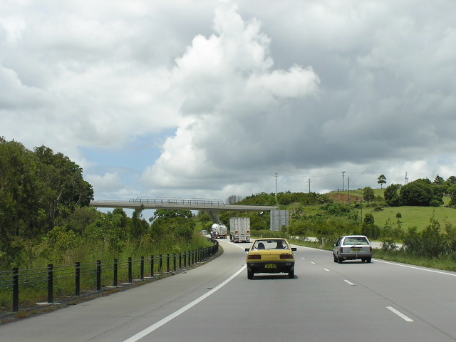 |
Looking south to the Tandy's Lane overpass. Jan 2005. |
 |
Northbound AD sign for Gulgan Rd - the southern end of the Brunswick Heads Bypass. Nov 2005. |
 |
Distance sign heading south from Brunswick Heads. Jan 2005. |
 |
Southbound AD sign on Brunswick Heads Bypass for Gulgan Rd. Jan 2005. |
|
Old Pacific Hwy (Gulgan Rd) |
|
 |
Looking south on the southbound on-ramp from Gulgan Rd at The Heath. Due to the poor light its a bit hard to make out, but you can see the old highway alignment to the left of the new dual carriageways. Nov 2005. |
 |
Remnant NR1 RD sign southbound on Gulgan Rd between The Heath and Mullumbimby Rd. Nov 2005. |
 |
Remnant NR1 AD sign northbound on Gulgan Rd approaching Mullumbimby Rd. Nov 2005. |
 |
Remnant double-chevron NR1 ID sign on Gulgan Rd at Mullumbimby Rd. Note how a Gulgan Rd plate has been added but the NR1 shield has not bee removed. Nov 2005. |
 |
Remnant Pacific Hwy AD sign eastbound on Mullumbimby Rd approaching Gulgan Rd. Nov 2005. |
 |
Remnant NR1 distance sign on Gulgan Rd heading north from Mullumbimby Rd. Nov 2005. |
 |
Remnant NR1 AD sign southbound on Gulgan Rd approaching Mullumbimby Rd. Nov 2005. |